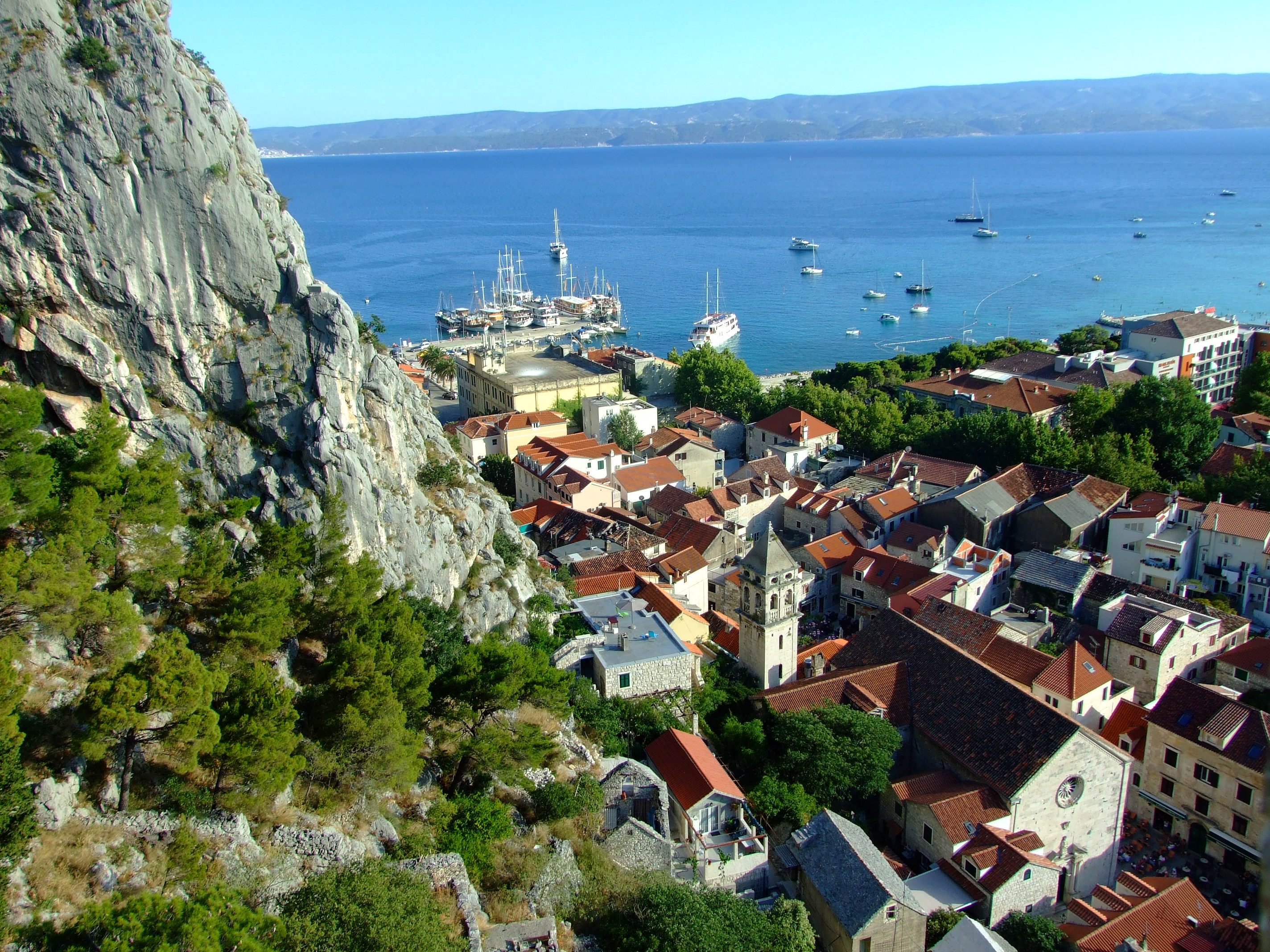
Two views over Omiš – Mila Gojsalić and the Mirabella

In the heat of a Croatian summer it pays to get up and head out as early as possible, which is why, at 07:20AM, we found ourselves in front of the gate of the Utvrda Peovica (Mirabela Fortress) in the Dalmatian Adriatic coastal town of Omiš.  Here we discovered that the locals didn’t share our ideas.

You can get to the entrance of the Mirabela Fortress by following the signs up a short 10-15 min. walk from the square where St. Michael’s Church (Crkva Sv. Mihovila) is located on Knezova Kačića in Omiš old town.]
You can get to the entrance of the Mirabela Fortress by following the signs up a short 10-15 min. walk from the square where St. Michael’s Church (Crkva Sv. Mihovila) is located on Knezova Kačića in Omiš old town.

We briefly returned to our nearby accommodation at Villa Mama before heading out again, this time to where our car was conveniently parked on the western bank of the Cetina River.  At 07:44 AM it was already 27°C (80.6°F), but we didn’t have long with the air conditioning.

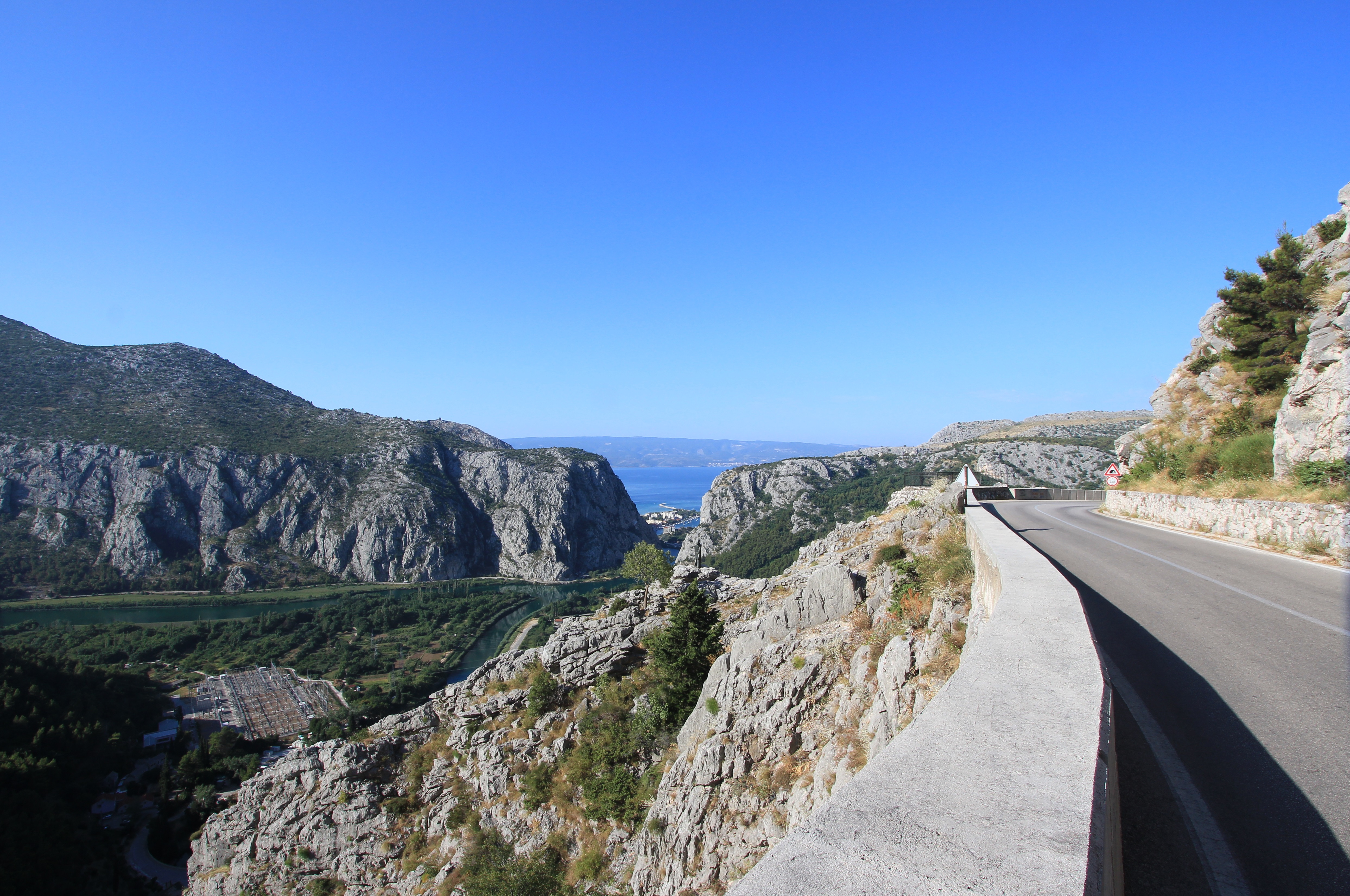
Taking Mosorska cesta north out of Omiš along the right bank of the Cetina and up the hairpin bends of the D70 for 4.1 km (2.5 mi.)/about 7 minutes, we then turned right onto the Z6165.  Continuing along this road for a further 1.1 km (0.7 mi.) we passed through a short narrow tunnel (with priority to oncoming traffic) and reached our destination which was marked by a raised viewpoint with an iron fence.
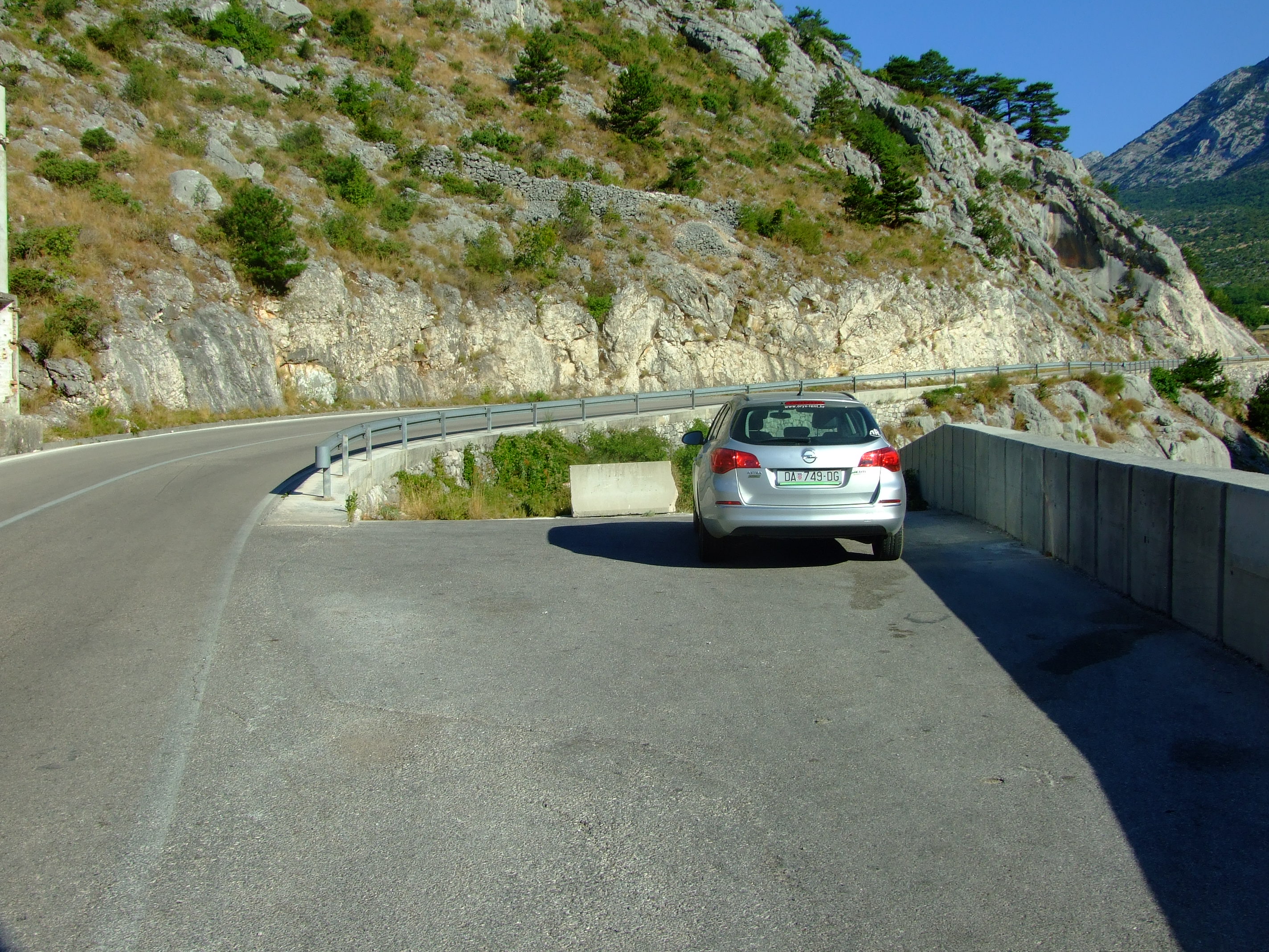
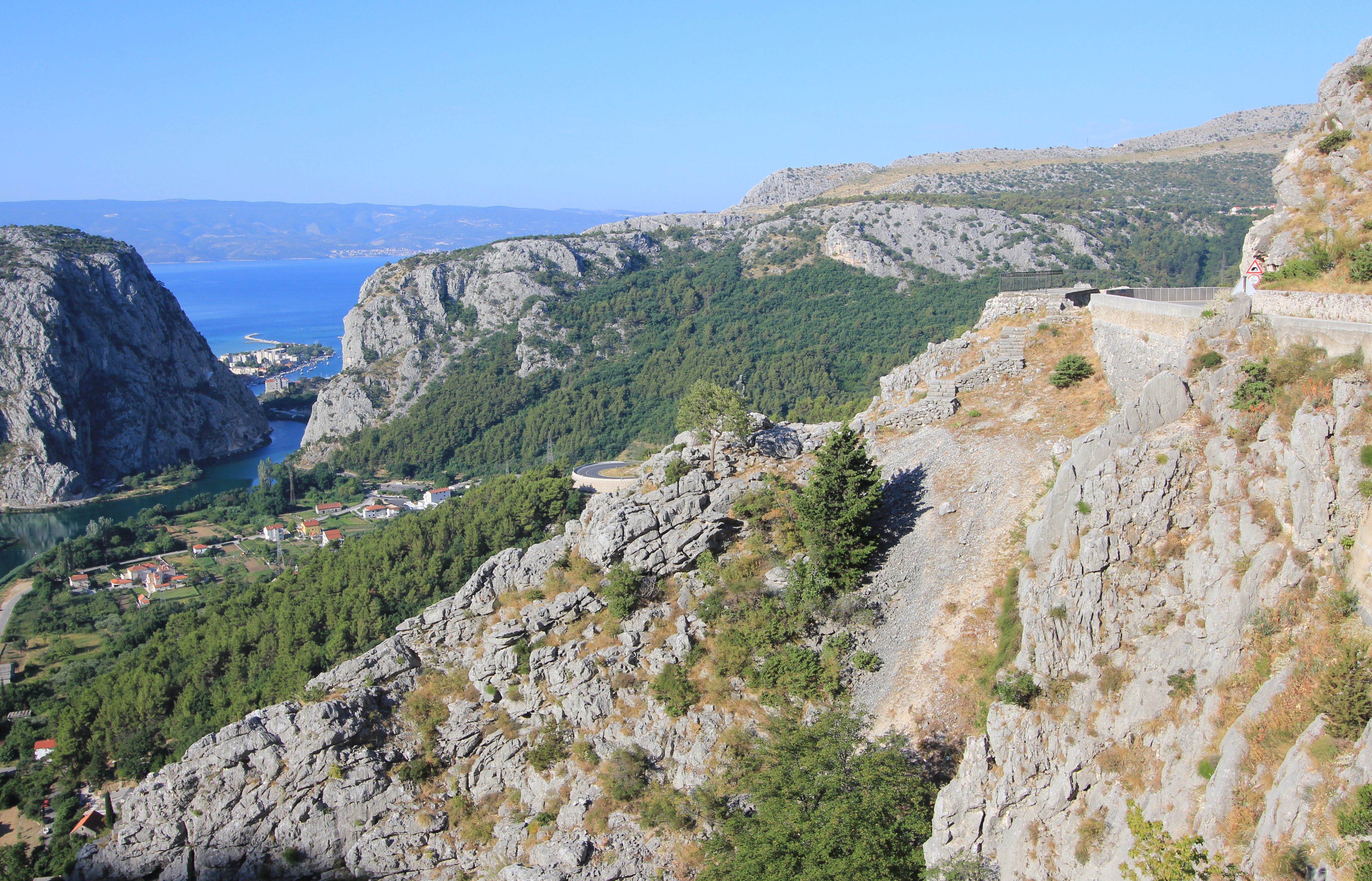
We couldn’t park by the viewpoint (take a look at Google Streetview in warning of the potential consequences of doing so), so we drove another 130m to a point where there’s a blocked off turning to an unfinished road, and plenty of space to pull over and park.
The view over the end of the Cetina valley with a glimpse of Omiš, and beyond to the Brač Channel and the northern edge of the island of Brač. The viewpoint is visible by the road to the right, a couple of bends away.
With little space between the road and the edge barrier we walked carefully, keeping one eye on the view and one eye on the traffic, as we heeded back to the viewpoint.
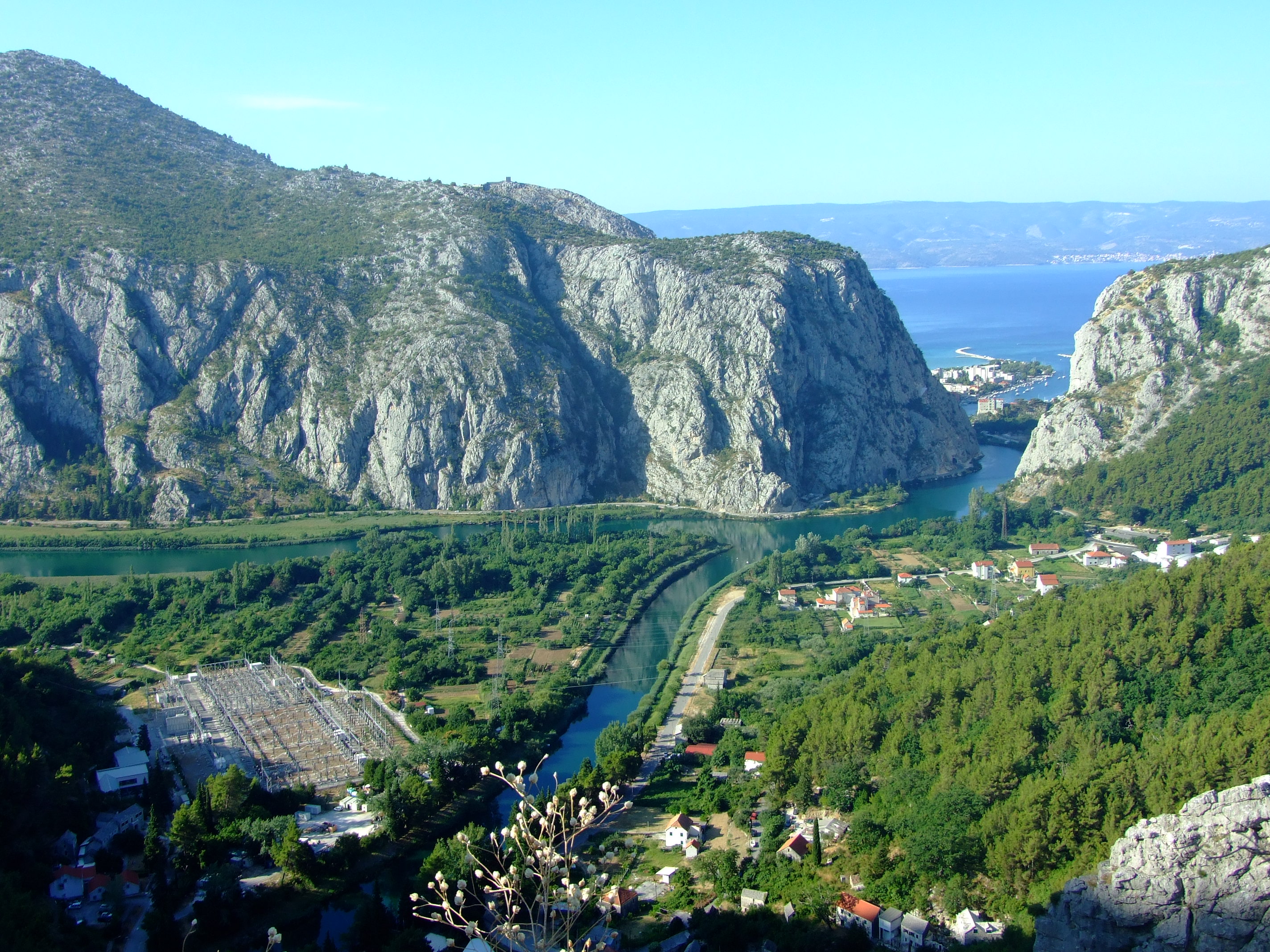
The Cetina River and the Zakučac Hydroelectric Power Plant (HPP) - the largest HPP in Croatia by capacity - are clearly visible from above.
The Cetina River and the Zakučac Hydroelectric Power Plant (HPP) – the largest HPP in Croatia by capacity – are clearly visible from above.
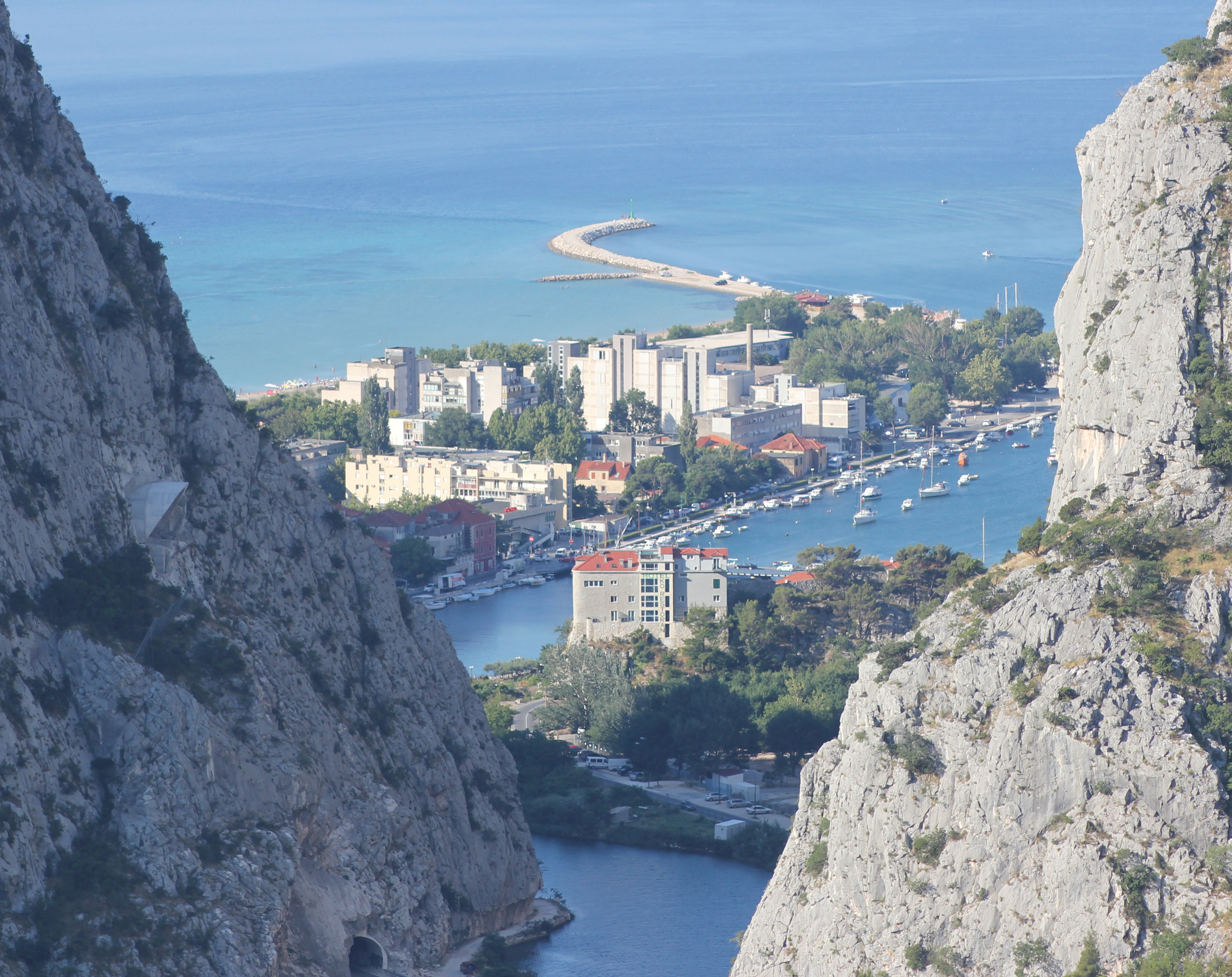
A close up of part of Omiš divided by the Cetina. In the still-shaded rock face to the left you can see the hooded entrance to the tunnel at the Omiš end of the proposed Omiš-Dugi Rat bypass. If it’s ever finished a bridge will have to span this view in future.
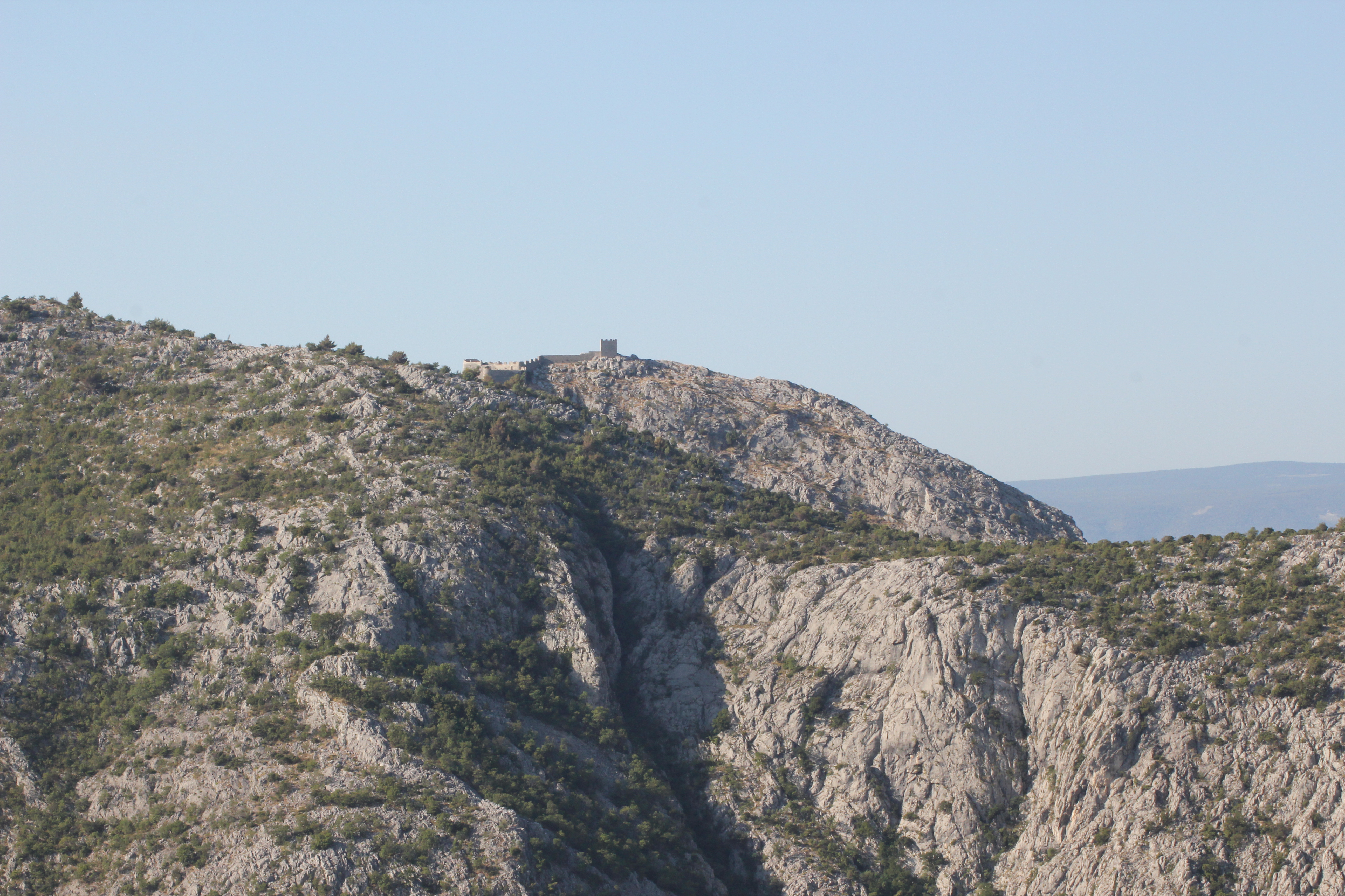
Visible on a ridge of the Omiška Dinara mountain on the other side of the valley is the 15th century Starigrad Fortress (Fortica), but this telephoto view was as close as we would be getting that day…
We’ll save this walk for another time, and not in the height of summer.
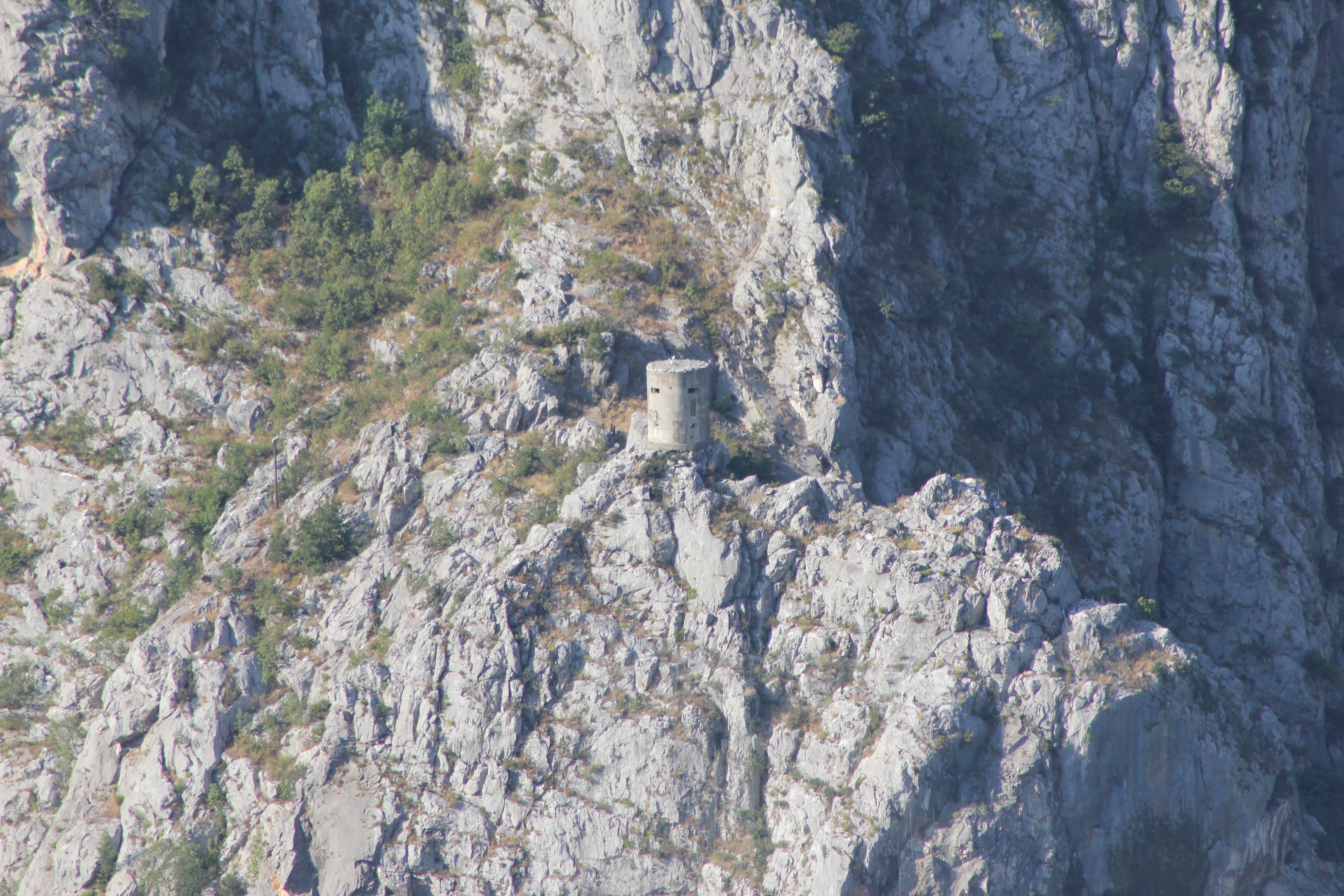
A long way below the Starigrad Fortress and just above the Z6166 as it leaves Omiš and turns east along the left bank of the Cetina is another small defensive tower. It’s just about visible from the road below if you know when to look up, but there is no established footpath to reach it.

Our new destination that morning was very specific, and this video from Crodrone captures the setting of the Mila Gojsalić memorial statue perfectly:

The story of Mila Gojsalić (also spelled “Mile Gojsalića”) is nearly 500 years old, and is set in the context of the tiny semi-autonomous ‘republic’ of Poljica standing against the might of the Ottoman Empire at the height of its power.
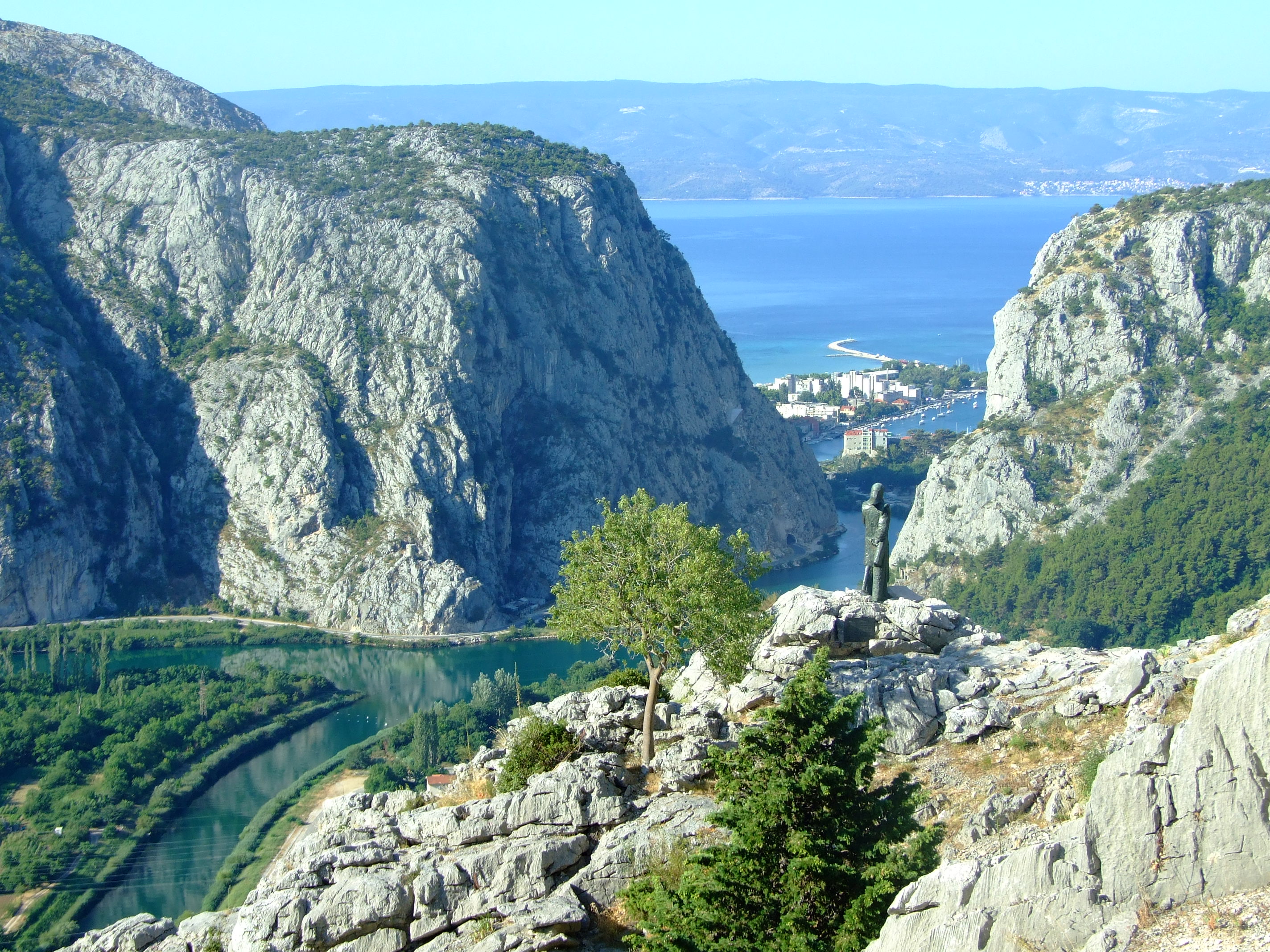
In 1530 the spirit of Poljica burned so brightly in one of its daughters that she is still remembered by name to this day. The statue of Mila Gojsalić by Ivan Meštrović was erected at this point (Lat.-Long: 43.460489, 16.700175. GPS: 43° 27' 37.7604'', N16° 42' 0.6300'' E) in 1967. You can also spot the tower from the previous image in this photo.
In 1530 the spirit of Poljica burned so brightly in one of its daughters that she is still remembered by name to this day. The statue of Mila Gojsalić by Ivan Meštrović was erected at this point (Lat.-Long: 43.460489, 16.700175. GPS: 43° 27′ 37.7604”, N16° 42′ 0.6300” E) in 1967. You can also spot the tower from the previous image in this photo.

The history of Poljica is fascinating in its own right (see the links at the bottom of this post).  For a people to successfully cultivate a viable, ordered living from this harsh landscape is no small feat.  For such a small community to then continuously develop, define (with a series of formal statutes), and effectively defend (both by the political expediency of token suzerainty and armed resistance) a unique form of rural democracy largely on their own terms, for hundreds of years, is nothing less than remarkable.
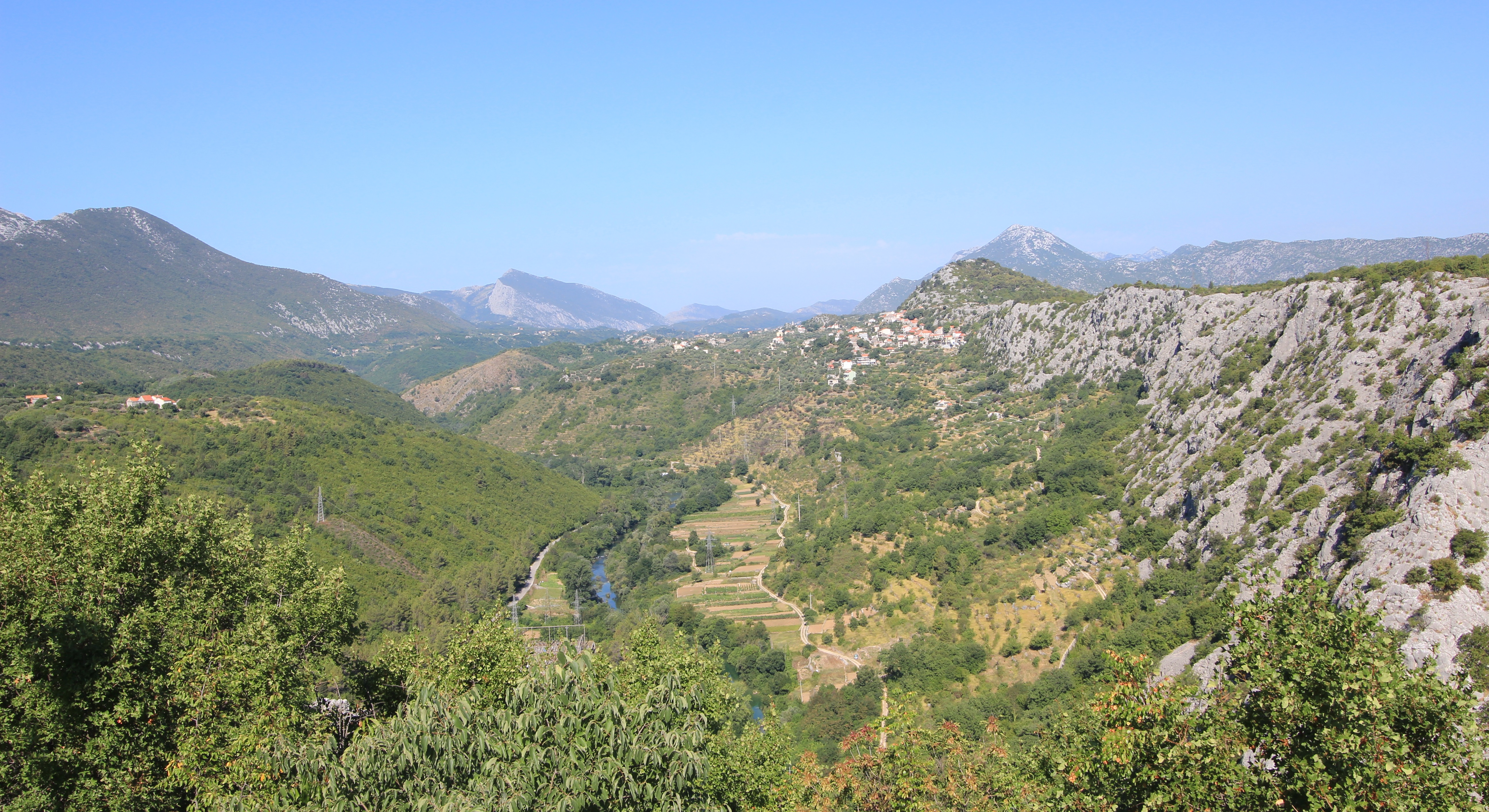
A view of Poljica (pronounced ‘Pol-yee-tsa’) looking NW from Zadvarje. This is the south eastern section of Sredjna (Middle) Poljica along the line of the Cetina Valley as it flows away towards Omiš.

However, in 1530 the future looked bleak.  During the previous century the Ottoman Empire had expanded rapidly into Europe.  In 1463 the Bosnian Kingdom had fallen to the army of Mehmed II in a matter of just a few weeks following the capture and execution of King Tomašević at Jajce, only 105 km (65.2 mi.) NNE of the Poljica village of Kostanje (named for its plentiful Chestnut trees) where Mila is said to have come from.  The Ottomans created the sanjak of Bosnia, their westernmost province, from the central part of the conquered areas of Bosnia, and enlarged it further in 1482 when they took the Duchy of Herzegovina from the House of Kosača.

In 1493 the Ottomans had taken the Imotski fortress, 30 km (18.6 mi.) ENE of Poljica. Raiding further to the west, and less than 150 km (93.2 mi.) NW of Poljica, the Ottoman forces decisively defeated the combined troops of several Croatian nobles at Krbava Field, near Udbina, on the 9th September 1493, but for Poljica the threat of Ottoman expansion became reality when a “major Turkish detachment crossed the river Cetina into Poljica for the first time in 1500, taking one hundred and fifty people prisoner.” [See article by Edo Pivčević linked below]. Given that the population of Poljica at the time was only in the low thousands this would have been an almost unimaginable shock to the community.  By 1502 Venice had ceded the Tvrđave Duare castle at Zadvarje at the south-eastern end of Poljica to the Ottomans and the threat, if not the reality of conflict, was a daily fact of life.
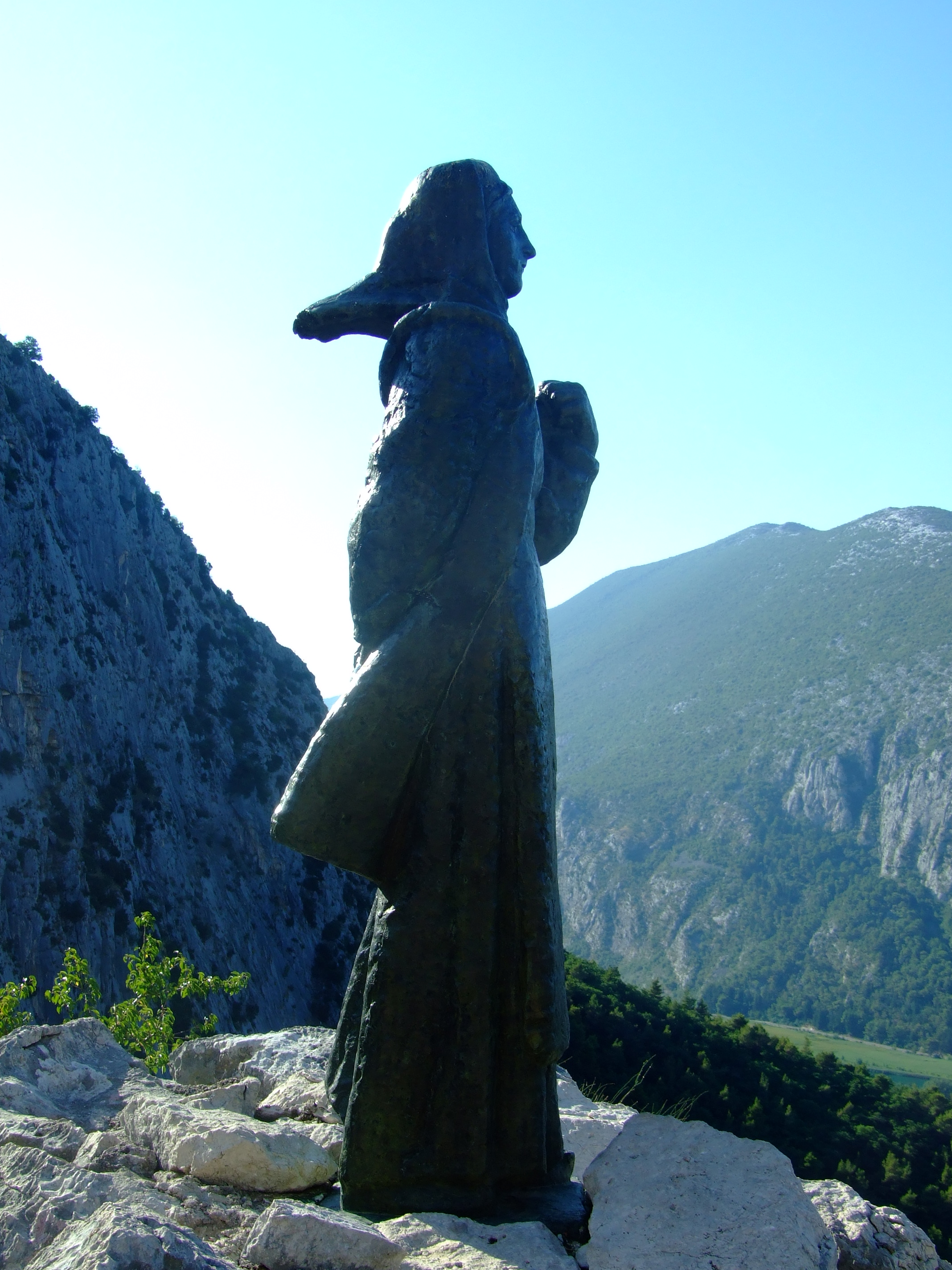
The morning sun rises over the Mila Gojsalić statue.

Ottoman forces finally seized the then political centre of Croatia at Knin in May 1522, with the downstream town of Skradin at the mouth of the Krka River (around 60 km (37.3 mi.) from the northern borders of Poljica) quickly following, but the inhabitants of Poljica had been on the receiving end of Ottoman ambitions for several years by then.  By 1514 they had realised that the political strength of the coastal Venetian Empire would avail them little in defending their lands, and had already transferred their suzerainty to the Ottomans.  It made little difference.

In 1526, and 313 km (195 mi.) NE from Kostanje, the Ottoman Empire, now under the leadership of Suleiman the Magnificent, had continued its northwards advance into Europe and inflicted a significant defeat over the Hungarians and their allies at the Battle of Mohács.  Continuing north the Ottomans took Buda in 1529 before turning NW to lay siege to Vienna.  This might sound to be a fair distance from Poljica but after Mohács the Ottomans started limiting the privileges given to Christians in captured territories unless they were to convert to Islam. With increasing dominance both regionally and locally, Mila would have been all too aware of threat to her community’s way of life from the Ottomans.

In the 1526 Poljica declined to pay the Ottoman tribute on the basis that the Turks had attacked the fortress at Klis, less than 5 km (3.1 mi.) NNE of Poljica, and a strategic gateway to Venetian Split.  Led by Petar Kružić, men from Poljica had joined his Uskok defenders against the Ottoman attempt to seize Klis, but in 1530 the Ottomans turned their attention to Poljica more directly and invaded with an army of 10,000 soldiers. They are said to have burnt and looted their way through the villages of Srinjine, Tugare and Gata, before encamping near the latter settlement.  This would have had particular symbolic significance as it was at the hill of Gradac, near Gata, that the people of Poljica would meet on St. George’s Day each year to choose their own leaders.  The intention to subjugate Poljica could not have been clearer.

The Ottoman force was reportedly led by Herzegovinian Sanjak Ahmed Bey (more usually reported as ‘Ahmed-pasha’ or sometimes ‘Osman-pasha’), but he would meet his match in Mila Gojsalić.

Remembered in popular memory as a notably attractive young lady of the district, accounts vary as to whether Mila Gojsalić was seized by her enemy and taken to Ahmed-pasha’s tent where she was raped (the most oft repeated story), ‘sold’ alongside other women of the district to the invaders and then raped, or whether she used her charms to ‘infiltrate’ the emplacement and seduce the leader of the Turkish forces.

Whatever the circumstances, she is said to have waited until the Ottoman leader was asleep and crept out from his tent, before setting fire to the encampment.  The blast from the ignited powder store is said to have killed him together with many other officers and soldiers.  In some versions of the story the explosion is said to have also claimed Mila, whilst in others she is said to have leapt from a cliff to avoid being captured by her enemies.

The disarray among the Ottoman invaders was such that the people of Poljica were able to strike with decisive force in the darkness and overrun their erstwhile oppressors, many of whom, the story tells, were forced over the edge of the precipice where the Mila Gojsalić memorial statue is located today.
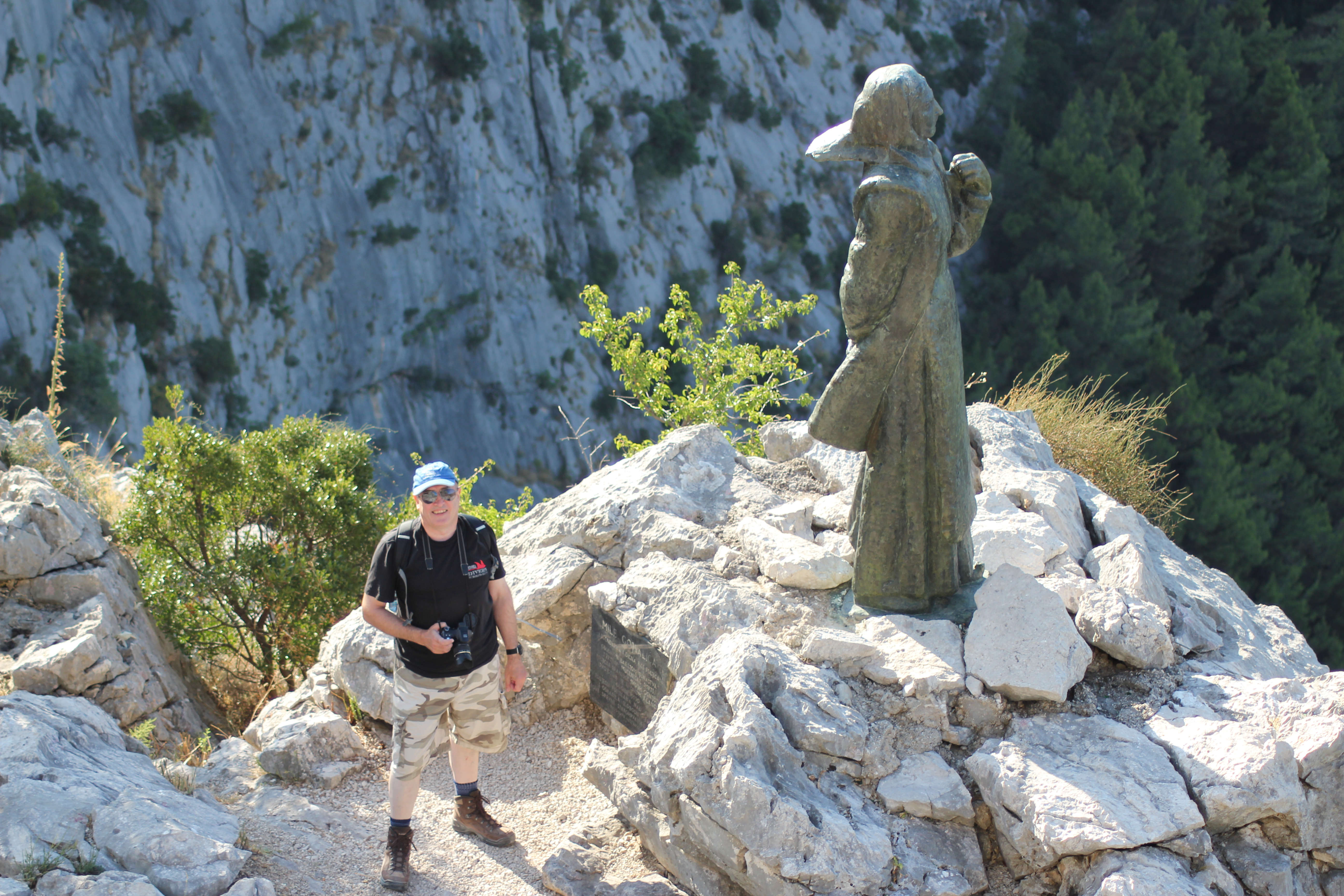
Meeting Mila Gojsalić. There’s no reason not to walk carefully down the steps from the fenced viewpoint, but this is as close as you need to get to the statue. A slip and the drop from the direction of her feet to the right is not survivable.

This was not the end of the fight for Poljica, but Mila was not forgotten by her people, and, in time, she became recognised as a Croatian national folk hero.  In recent years her home village of Kostanje has hosted the “Dani Mile Gojsalić” (Mile Gojsalić Days).  2016 will be the 13th edition and will run from the 14th – 17th July.  You can follow the event (in Croatian) on the organisers’ Facebook page.

Our day continued with a drive on through Kostanje, crossing the valley over the Cetina on the old Pavica Most, and on to Zadvarje.  From here we headed inland to visit the famous sinkholes at Imotski, and returned via a stop at the stecći near Lovrec.

By the early evening we were back in Omiš where we retraced our steps through the now much busier streets to the Utvrda Peovica (Mirabela Fortress).  This time it was open to visitors.
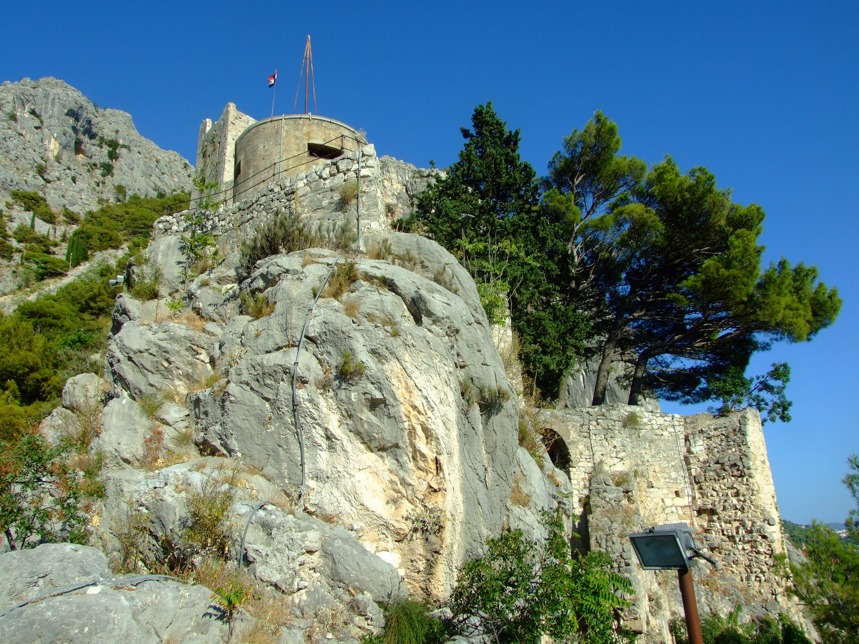
Looking up at the Utvrda Peovica/Mirabela Fortress from its lower levels.

It is believed that work on this redoubt was started early in the 13th century during the period when Omiš was ruled by the Kačić family who are perhaps best known for their tenure during the period when the famed Omiš pirates used the tower as a lookout for passing prey.  Built on six tumbling tiers, the Venetians expanded and refortified the structures after taking over in 1444.
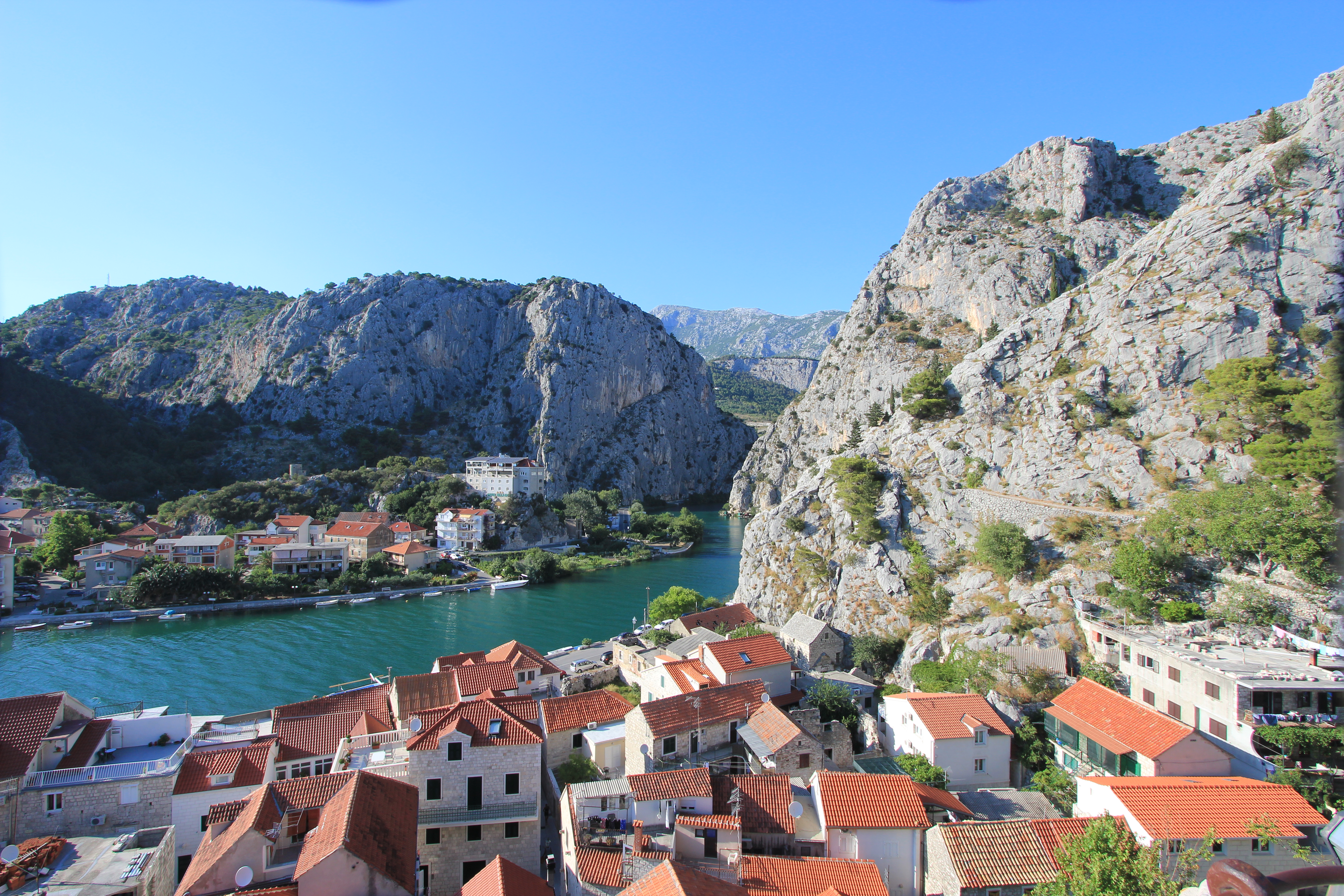
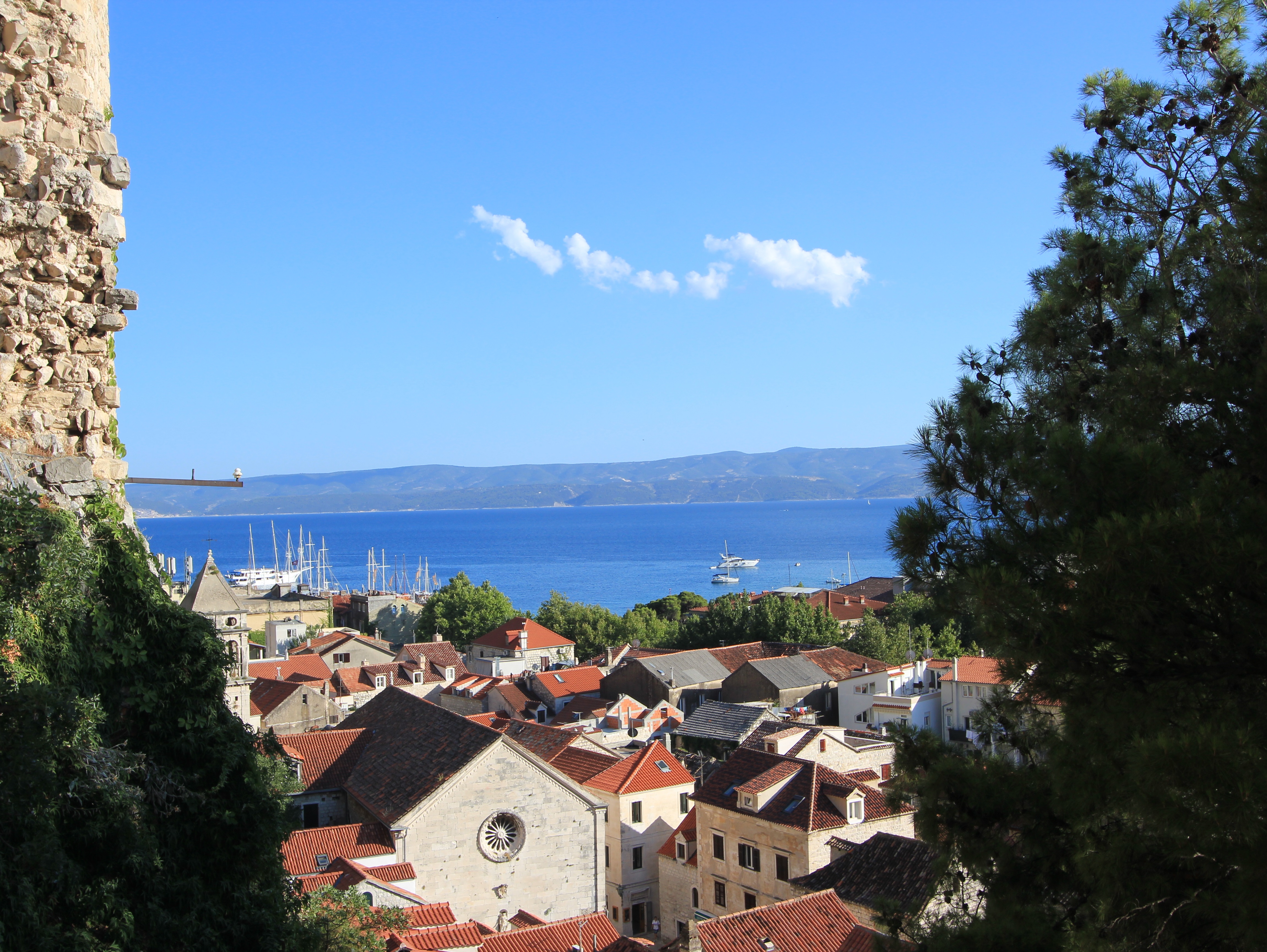
The view looking north-west over the Cetina River from the lower levels of the Utvrda Peovica/Mirabela Fortress.
The view looking south over Omiš old town from the lower levels of the Utvrda Peovica/Mirabela Fortress.
Still looking south over Omiš old town from slightly higher levels of the Utvrda PeovicaMirabela Fortress.

Because of the acoustic dynamics of the Mirabella’s location sound can be amplified without being directionally attributable.  This strange feature was used to advantage by defenders facing an Ottoman attack in 1537.  Shouting loudly, a relatively small number of soldiers were able to convince the invaders that the town contained a large force in wait for them, and, according to legend, the Ottoman troops promptly retreated.
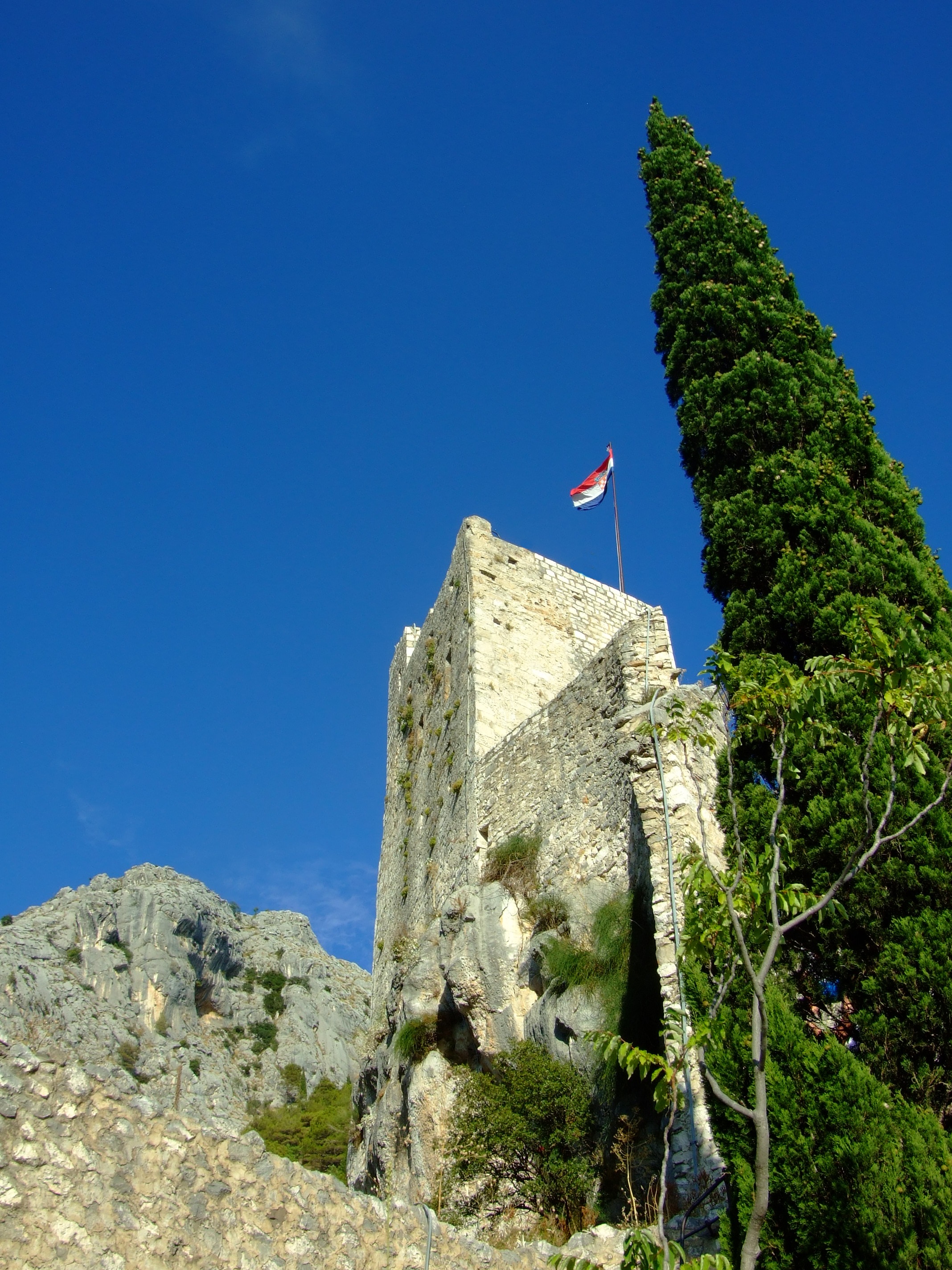
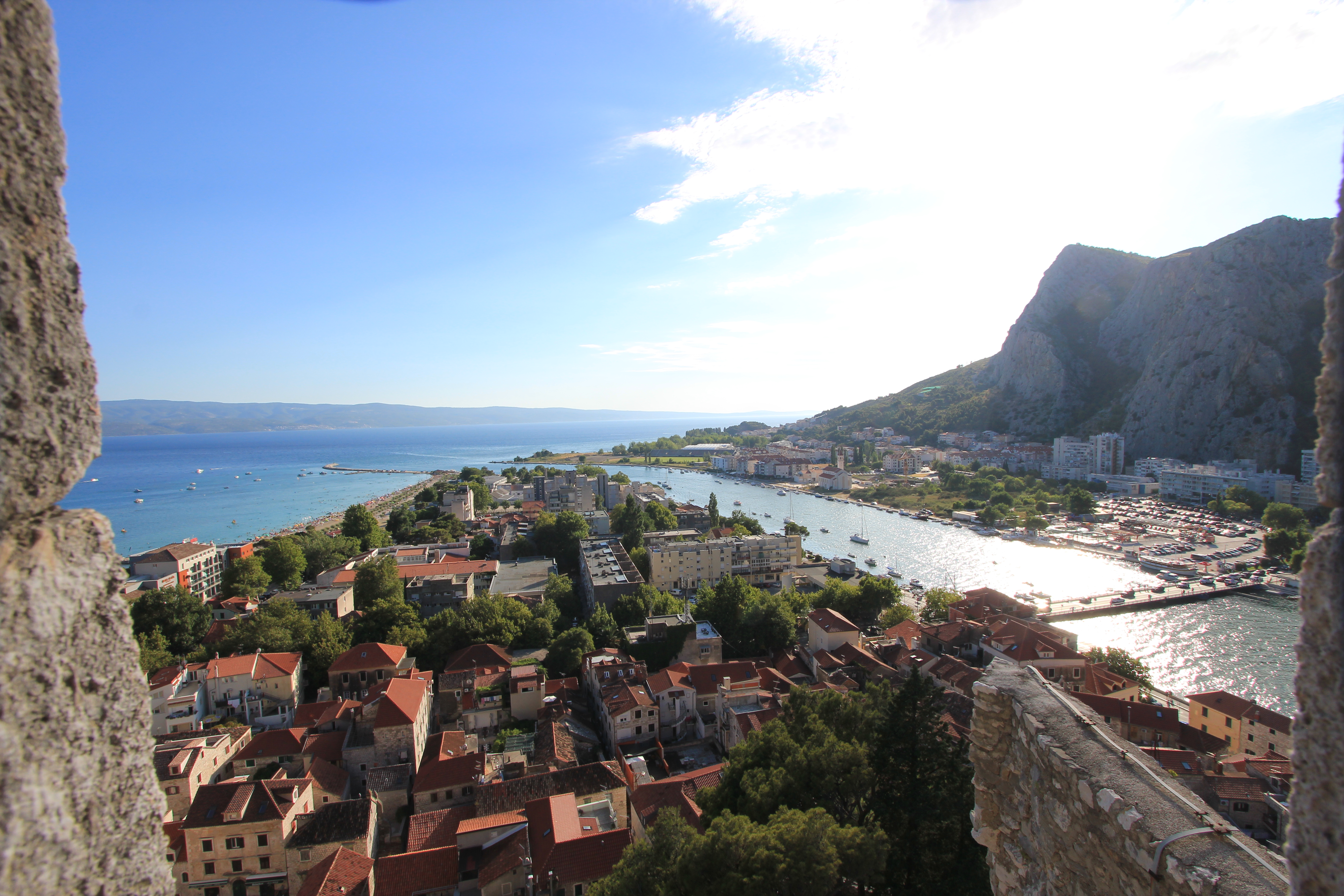
The Romanesque upper castle consists of four floors reached by an internal staircases with a final exit achieved by climbing a short ladder to the open top some 245m (804 ft) above the town. The castle tower you can see today is a comparatively recent restoration, albeit crafted in its original form with its original stones by the local population after it was destroyed by a lightning strike in 1988.
The view looking south-west from the upper levels of the Utvrda Peovica/Mirabela Fortress. To the right is the outflow of the Cetina River and the main road bridge. To the left is the 700m south-east facing stretch of sand called Velika Plaza (Big Beach).

As we were on a road trip vacation tour we only spent a couple of nights and one full day in the Omiš area.  The mid-summer heat was, to say the least, a limiting factor on our exploration of the town and wider region, but I don’t regret that we made the small effort to visit the Mila Gojsalić memorial statue and the Mirabela.  If I were to return with anyone who hadn’t seen these views I wouldn’t hesitate to take them there, and I think that, with more appropriate weather conditions, I would easily be able to spend a minimum of a couple more days exploring the area out on foot.

There is one final consideration that would almost certainly get me to spend a night in Omiš if travelling down the Dalmatian coast.  Its name is the Konoba Joskan.  On the night of our arrival in Omiš we quickly confirmed that many of the choices for eating out in the centre of the old town, and the vicinity of our accommodation, involved a ‘public dining’ experience.

The Konoba Joskan is located up an opening on the north side of Knezova Kačića, and if at first you manage to miss the entrance to this restaurant just keep looking (or asking) until you find it.  Previous vacation research and the idea of a small enclosed and more intimate konoba courtyard had already caught our attention, but we were unprepared for just how good this place would be.

Given that it was the height of the tourist season, we were lucky enough to be reasonably early and get a table in the courtyard (there’s also an inside air conditioned dining area), but that said, we noticed that the lovely staff bent over backwards to fit in later arrivals without a reservation.

The simple two-page menu suggested ‘fresh daily’ (which was confirmed when the day’s fish options were explained), and my wife and I both opted for a fillet steak with sliced fried potatoes and a shared tomato salad in oil and balsamic vinegar, with a couple of beers. It was the best meal we had eaten in Croatia to date.  In fact, it was so good that we went back the next night, after our sight-seeing tour, when we ordered exactly the same meal. It was just as good the second time round, and therefore qualified it as one of the two best meals we had in Croatia.

More online information.
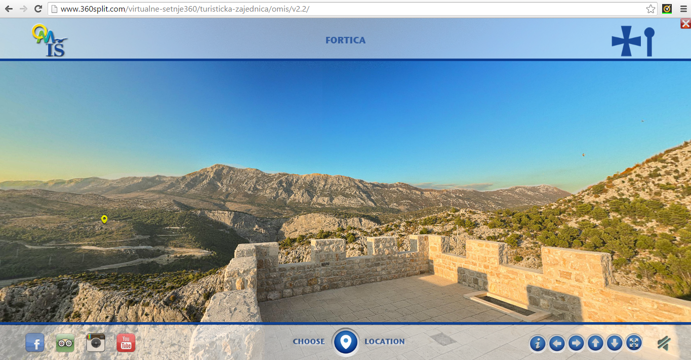
To get a first visual impression of the area from a number of different locations there is an excellent 360° interactive viewer on the Visit Omiš website (available in Croatian, Czech, English, German, Polish and Slovenian).

For the history of Poljica take a look at “The Principality of Poljica From its Medieval Inception to its Fall in 1807” by Edo Pivčević.

The history page from the village of Sitno website provides another brief introduction, as does cuvalo.net which adds a legal commentary and translation of the Poljica Statutes.

There’s also “Split and Poljica – relations through history” by Prof. Mate Kuvačić.  It is in Croatian, but Google translate works reasonably and is worth a read.

Later additions.

Take a look at these views from a beautiful January walk by BBQboy in January 2017.
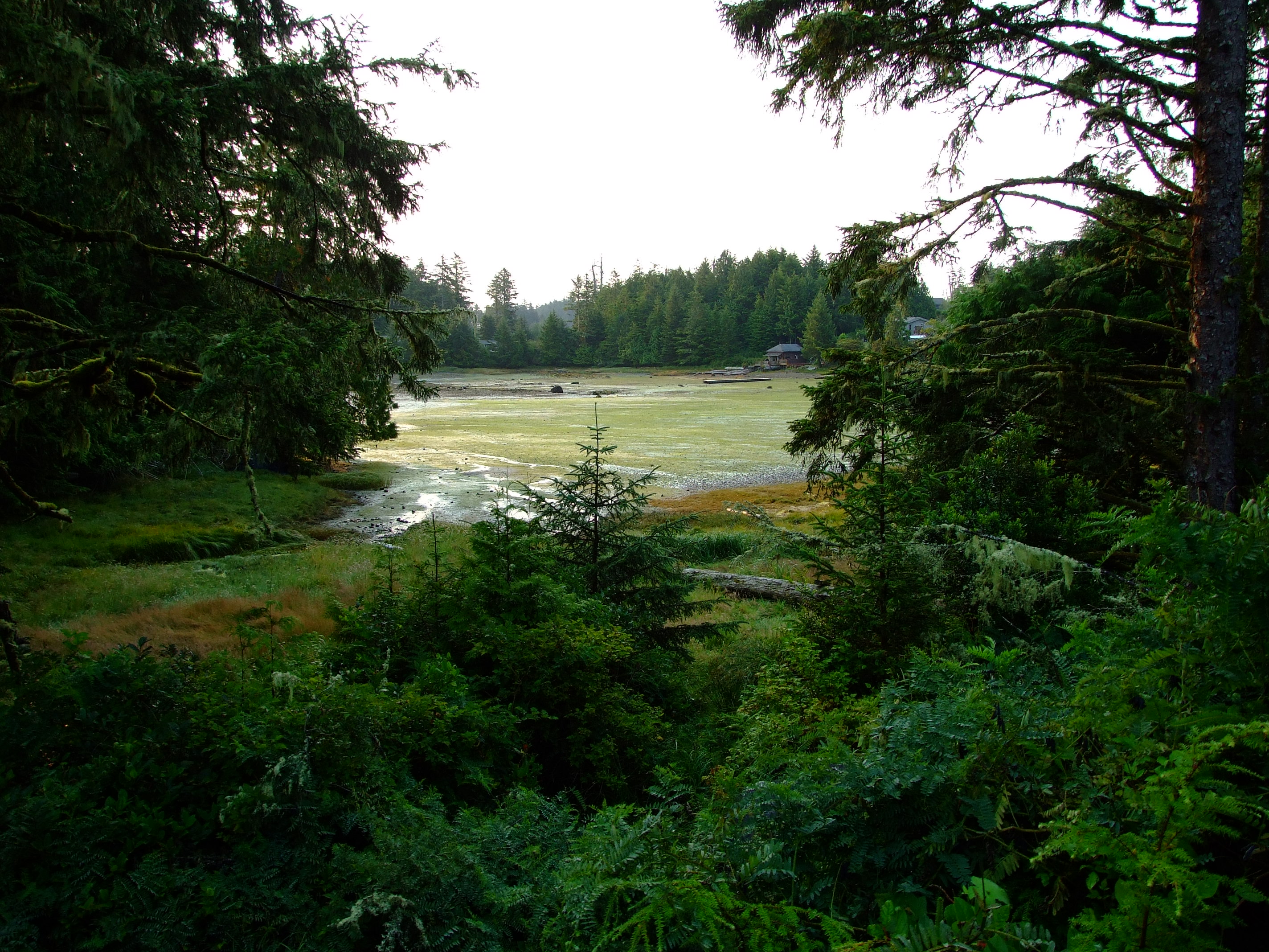
The Lighthouse Loop of Ucluelet’s Wild Pacific Trail

It was just after 08:00AM when I slipped on my walking boots and quietly left the cabin where my wife and daughter were still sleeping.  We were staying in Ucluelet (pronounced “You-clew-let”), on Vancouver Island, British Columbia, or ‘Ukee’ as it’s called locally, having arrived the previous day after a relaxed 447 km (278 mi.) journey from Telegraph Cove, driving down Highway 19 (the Island Highway) along Highway 4 (the Alberni Highway), and through to almost the end of the road on the Ucluth Peninsula.

The peninsula lies about a third of the way up the Pacific-facing western coastline of Vancouver Island, SE of the Long Beach Unit of the Pacific Rim National Park Reserve and NW of the Broken Group Islands and West Coast Trail Units of the park.  It’s about 180 km (112 mi.) by road from Nanaimo to Ucluelet, and from Victoria it’s a drive of nearly 300 km (186 mi.).

We’d already realised what a great accommodation choice we’d made by booking to stay at Cabins West, but its proximity – only 350m/a 5 minute walk – to my destination that morning was an added bonus.

As I left Cabins West I turned right along Boardwalk Boulevard, and left onto Peninsula Road, where, through a narrow gap in the trees to my left, there was a view of Spring Cove.  It is named after Captain William Spring who opened a trading post there in 1869 (after ‘buying’ the land from the indigenous population for a barrel of molasses), although the first European settler in Ucluelet is reported to have built a house here around 9 years earlier.

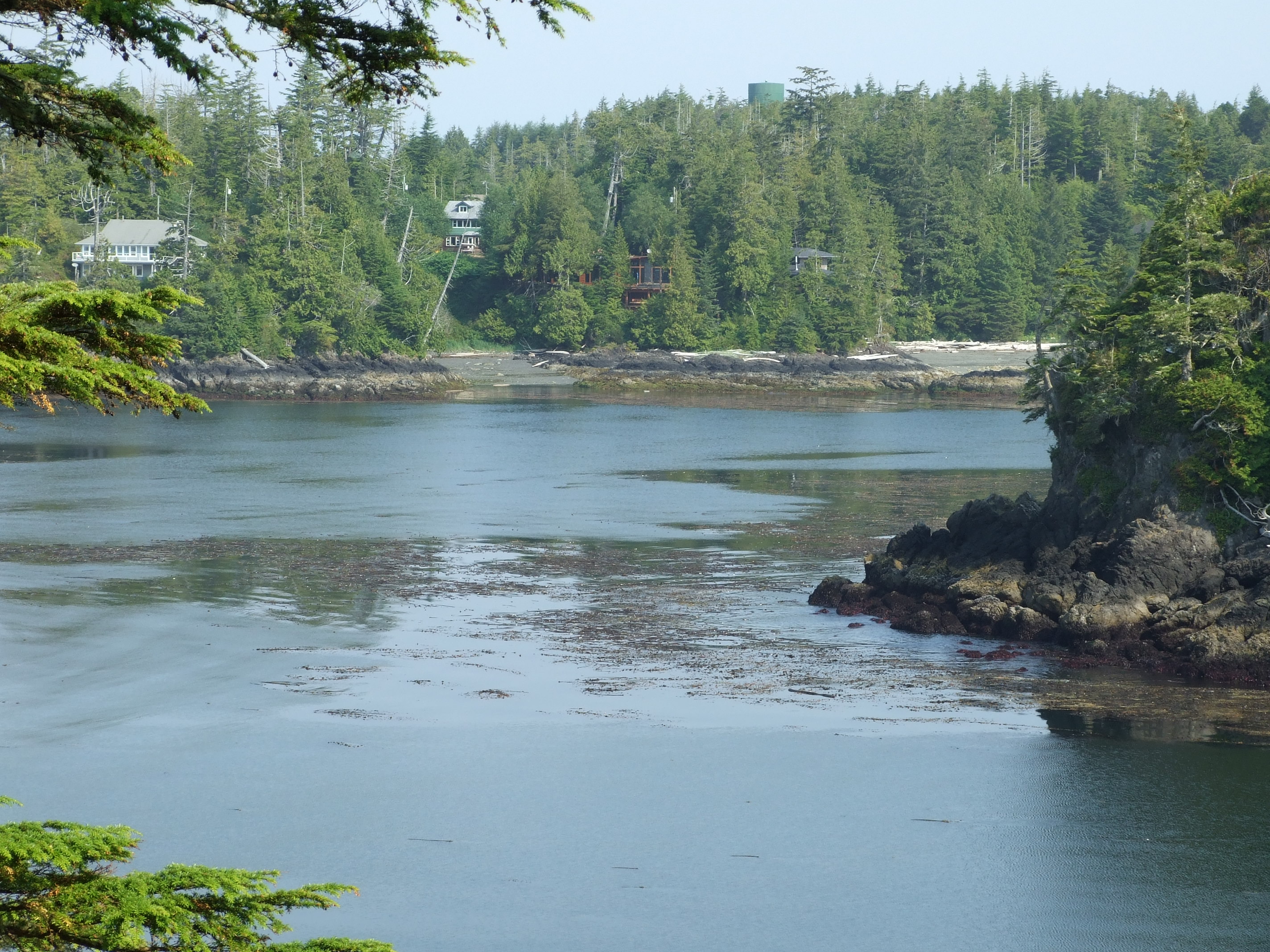
The Beach House and the Shore Cabin of Birds Bay Retreat in Spring Cove can just be seen beyond the branches of the tall tree in the foreground to the right. Obscured by the branches to the left is the old BC Packers site, which might look like a bit of a metallic eyesore in the landscape, but is worth consideration for its intimate connection to the sad story of the Japanese-Canadian fishermen of Ucluelet and their families.

I crossed to the sidewalk on Peninsula Road and continued SSW down the gentle downhill slope to a point where the land was reduced to a strip of only about 170m (560 ft) width between Terrace Beach and Spring Cove.

Terrace Beach, or “Capacuwis” (‘canoe beach landing’) is in the historical territory of the Yuułuʔiłʔatḥ (Yuu-thlu-ilth-aht) First Nation i.e. the Ucluelet First Nation (UFN), who are a part of the 13 member Nuučaan̓uł (Nuu-chah-nulth) First Nations with lands that spread along c.300km of the western Vancouver Island coast from Brooks Peninsula in the north to Point-no-Point in the south.

If you walk along this passage try to imagine that there is no road, and picture First Nations people hauling their canoes from the water to portage between the open sea and the protected cove in an area for which there is archaeological evidence that they have lived for over 4500 years. The name Ucluelet is derived from the Nuu-chah-nulth phrase meaning “safe harbour” or “safe landing place”.

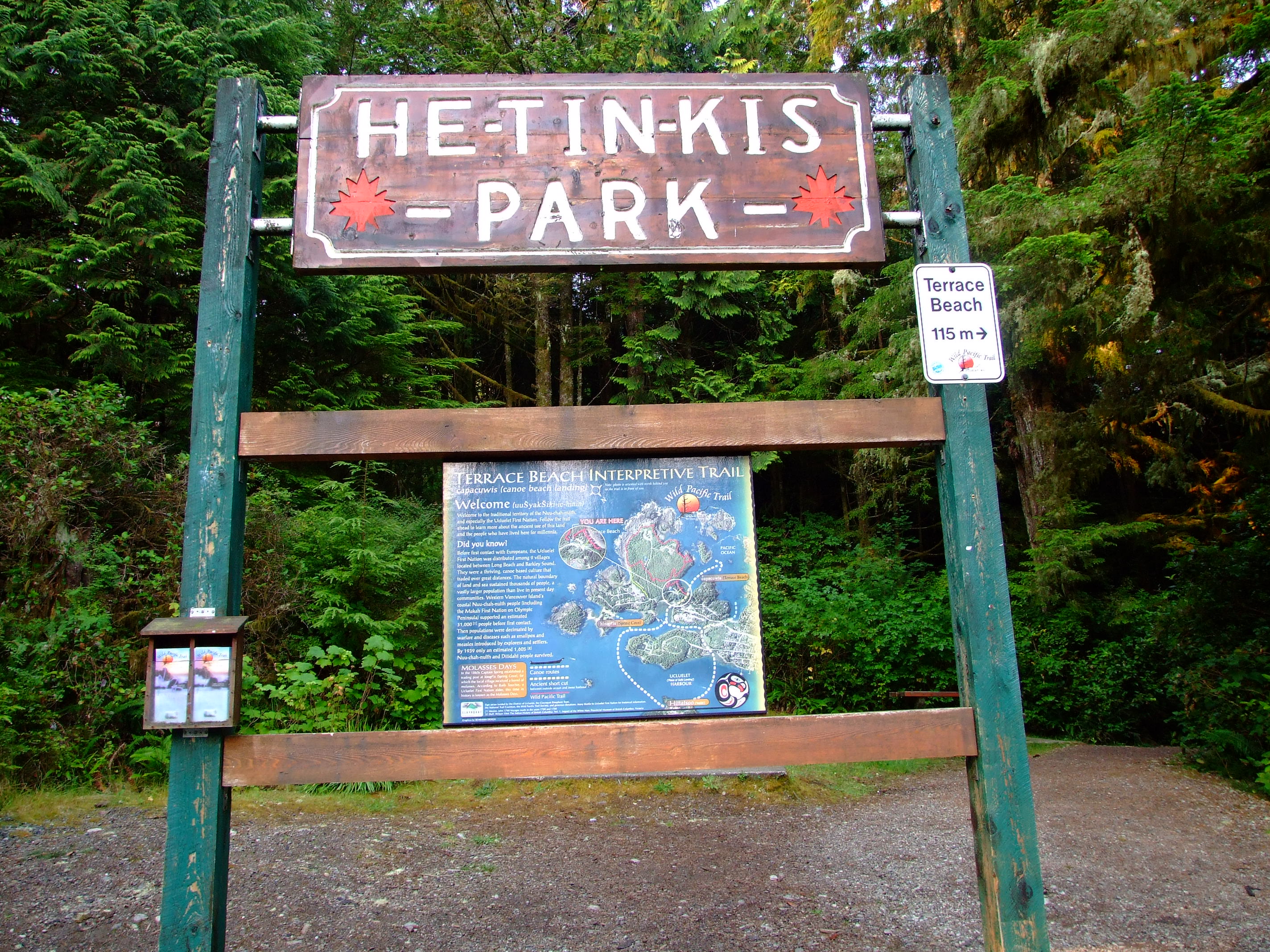
Immediately after passing the Terrace Beach Resort on my right I reached the entrance to He-Tin-Kis (which roughly translates as ‘by the sea’) Park, and the start point of my walk along the Lighthouse Loop of the Wild Pacific Trail.

The He-Tin-Kis Park Terrace Beach project was created in 1971 with boardwalk trails around the wooded slopes forming the southern flank of Terrace Beach. The map panel, which may have been subsequently replaced, was for the Terrace Beach Interpretative Trail (to the right) and noted as follows:

“Before first contact with Europeans, the Ucluelet First Nation was distributed among 9 villages located between Long Beach and Barkley Sound.  They were a thriving, canoe based culture that traded over great distances.  The natural boundary of land and sea sustained thousands of people, a vastly larger population than live in present day communities.  Western Vancouver Island’s Nuu-chah-nulth people [including the Makah First Nation on Olympic Peninsula] supported an estimated 31,000 people before first contact.  Then populations were decimated by warfare and diseases such as smallpox and measles introduced by explorers and settlers.  By 1939 only and estimated 1,605 Nuu-chah-nulth and Ditidaht people survived.”

There was another sign providing some extra details about my chosen route to the left, but a third notice also caught my attention…

It would be another three years before I would have to change my direction of travel on a morning walk due to the proximity of a Black Bear [http://www.geog.uvic.ca/viwilds/iw-bear.html], but having seen one moving at speed across the road and into the scrub during our approach to Ucluelet on Highway 4 the previous day, the reinforced reality of their local presence was enough to remind me of the potential danger.
It would be another three years before I would have to change my direction of travel on a morning walk due to the proximity of a Black Bear (Ursus amaericanus vancouveri), but having seen one moving at speed across the road and into the scrub during our approach to Ucluelet on Highway 4 the previous day, the reinforced reality of their local presence was enough to remind me of the potential danger.
Coming from a country where the last wild bears were exterminated around 1,500 years ago, the prospect of turning a corner and meeting one added to the sense of being somewhere special.  If, like me, you’re not used to bear country you might want to read the .PDF brochure here before you travel.  It’s also worth taking a look at the advice from the same page on cougars and wolves, especially if walking your dog in the area. If you think it couldn’t happen to you, take a look at these Ucluelet news stories from January and July 2015.

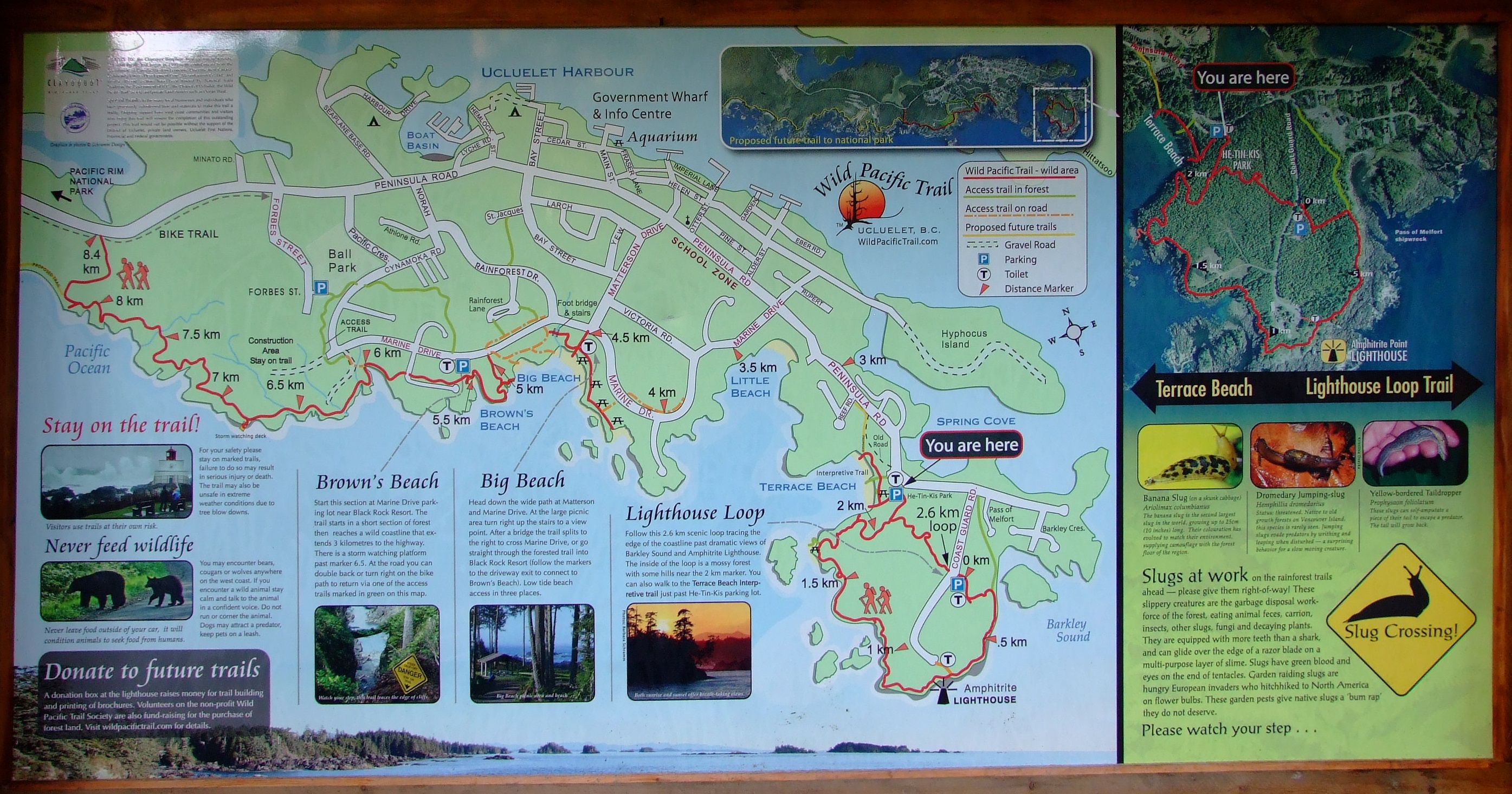
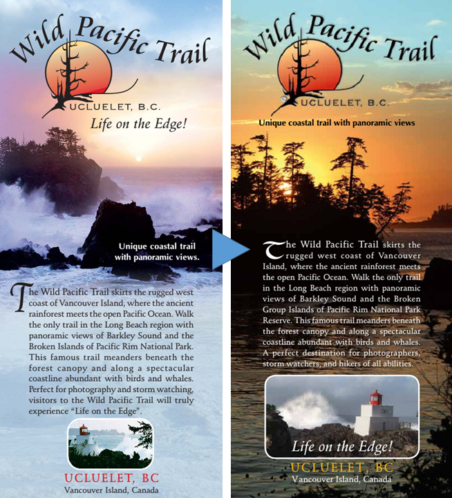
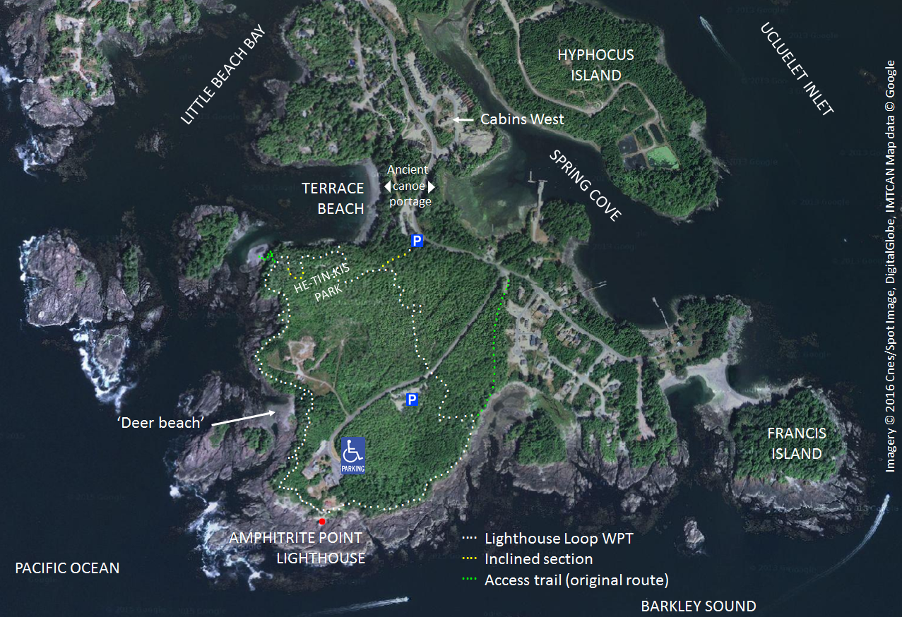
Before starting up the Lighthouse Loop I picked up a copy of the then current 2008 printed map of the Wild Pacific Trail (left above), which is still available online here, but development has been rapid, and I don’t expect that it will be long before the 2013 edition (right above) is upgraded too. You can get the most recent map from the online Wild Pacific Trail website, and there are more links for further information about the trail at the end of the post.
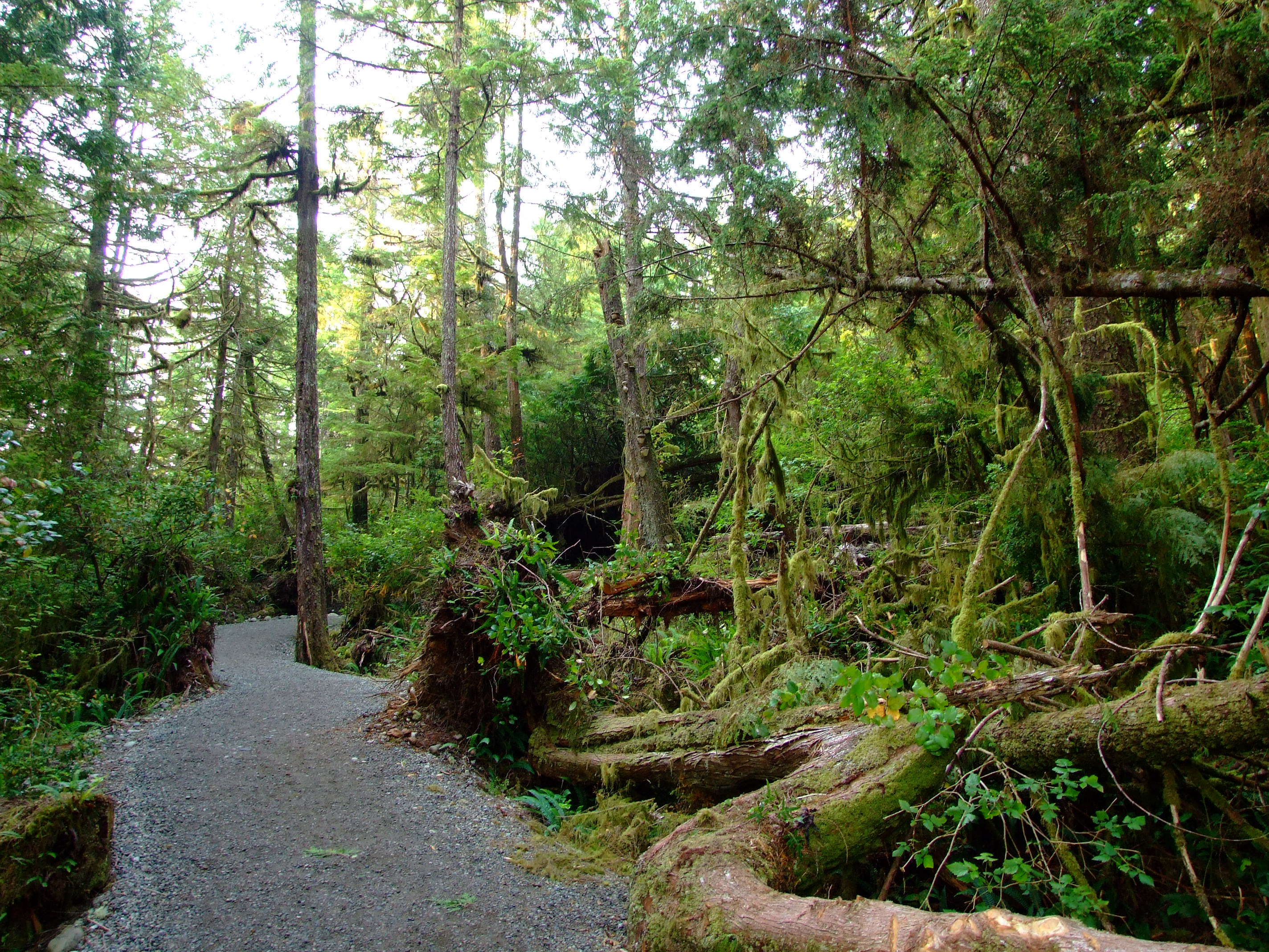
Heading up the hardcore-surfaced trail which replaced the older boardwalk in this section of He-Tin-Kis Park in 2009.

The Lighthouse Loop was the first section of the Wild Pacific Trail to be built, opening in 1999 at a time when it served as an important reminder of the fragility of the Pacific temperate rainforest eco-region and the effects of old growth deforestation on Vancouver Island. The trees along the trail are mainly Sitka Spruce (Picea sitchensis), Western Red Cedar (Thuja plicata) and Hemlock (Conium maculatum) with characteristic drapings of moss, interspersed with ferns and various berry bushes.

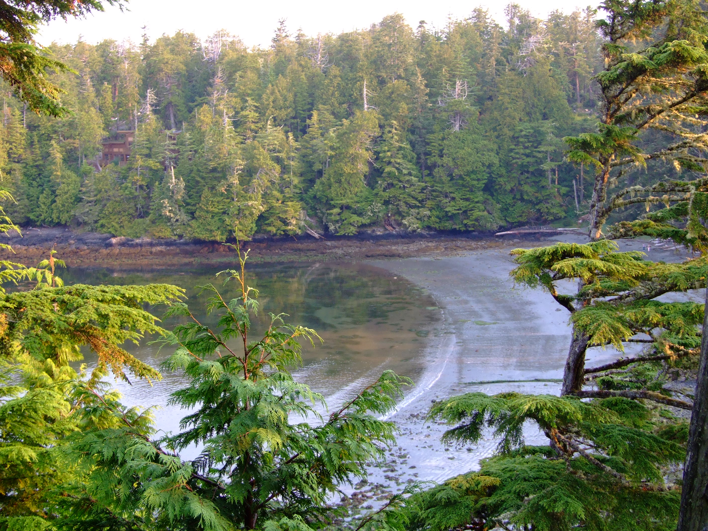
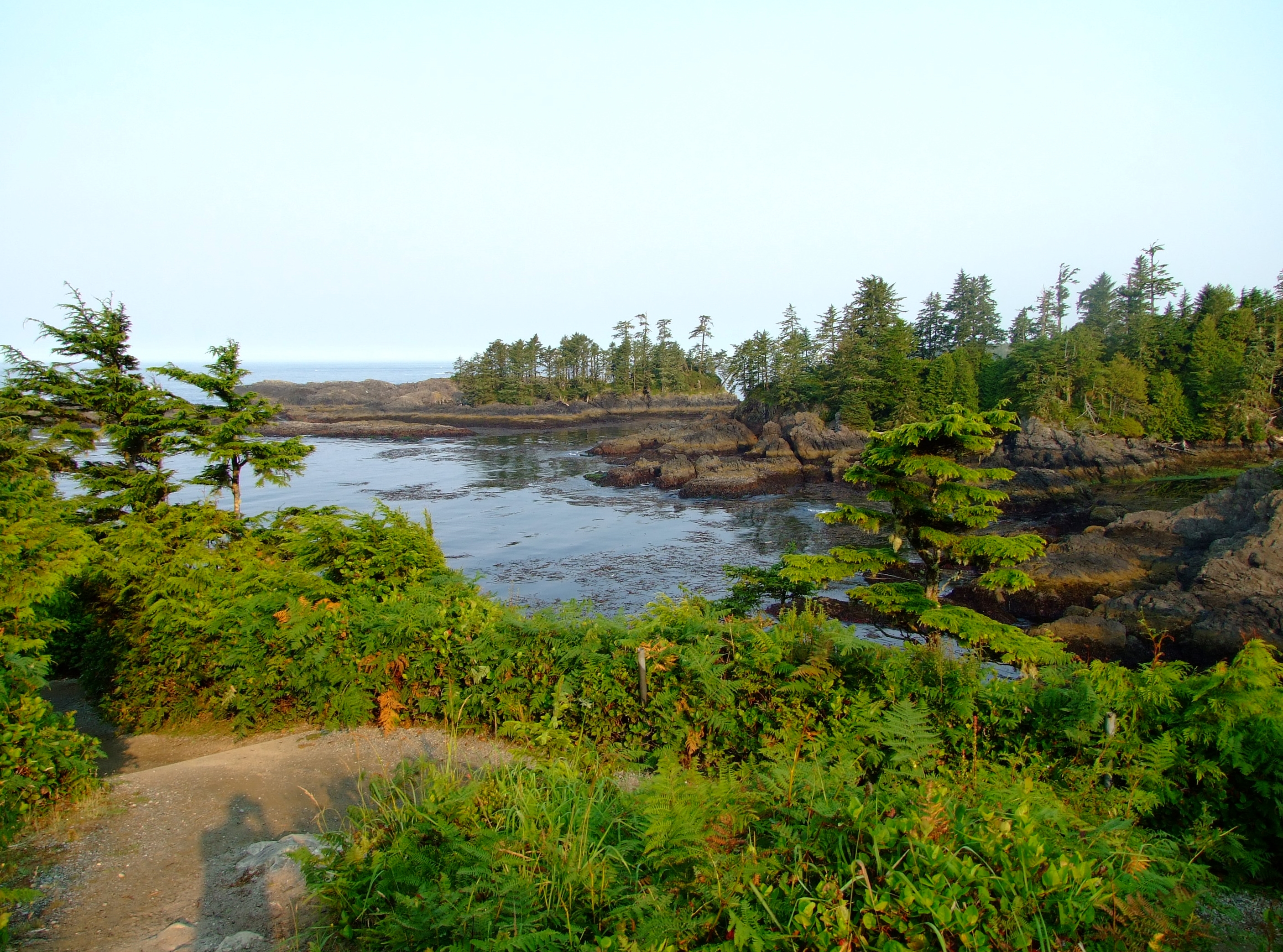
As the path gently climbed, Terrace Beach was revealed in the morning sun to my right.
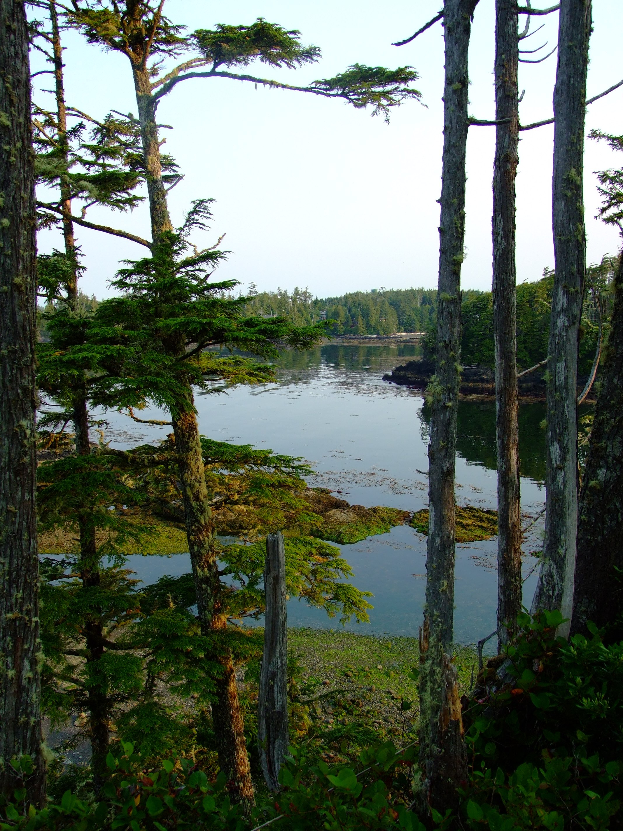
As I approached the most westerly point of the Lighthouse Loop there was a view down to a small spit below, and, looking NW, beyond the entrance to the cove containing Terrace Beach on my right, the shore and buildings on the SE side of Marine Drive near Little Beach.
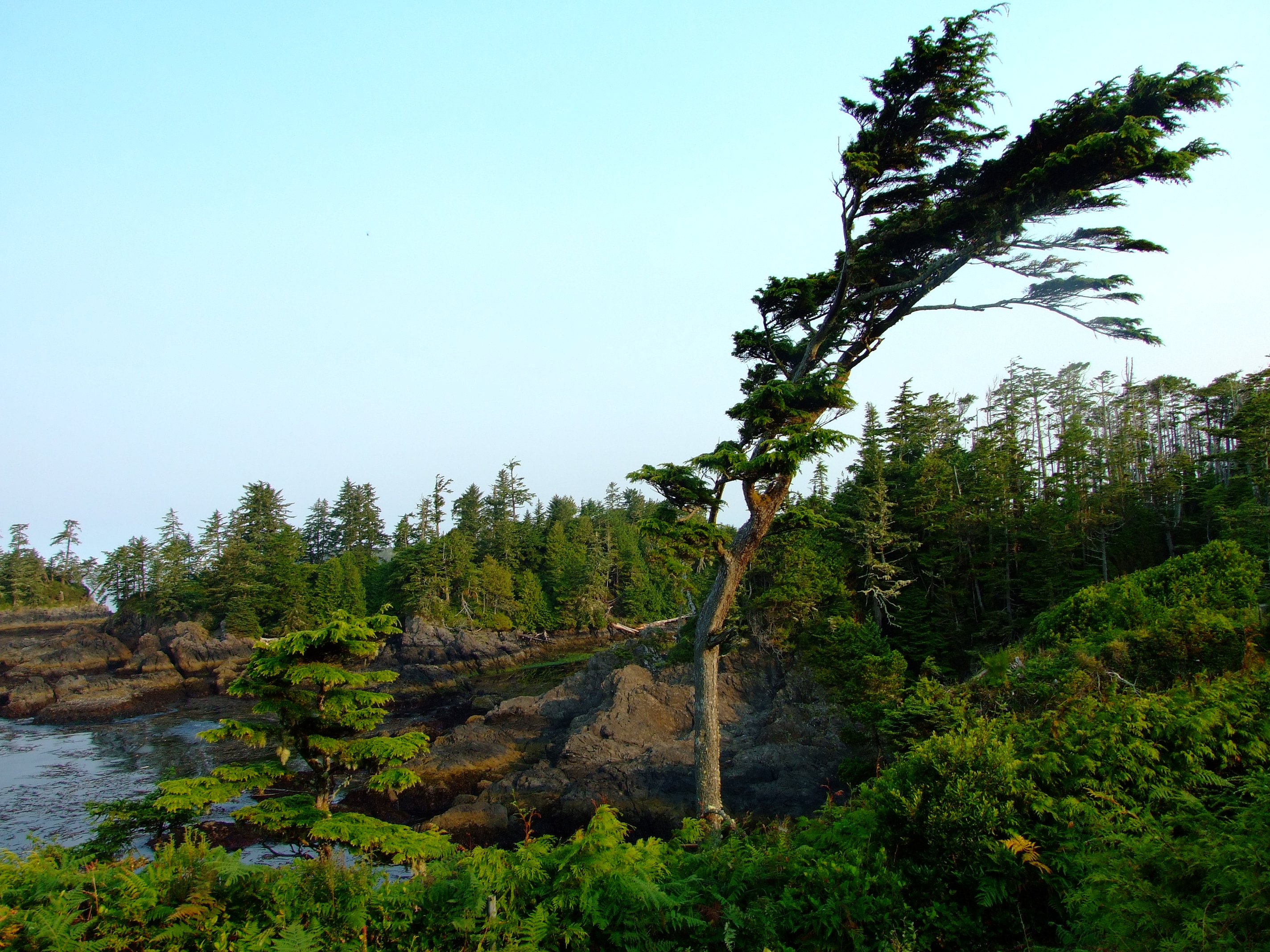
Turning south to follow the western edge of the Lighthouse Loop a number of the trees demonstrated what it sometimes takes to survive the Pacific storms which they face on nature’s front line. The nutrient laden atmosphere which delivers such fecundity to the rainforest can also be the bearer of a ferocity that makes this trail a major attraction to storm watchers, but on this mid-August morning the sea was calm and there were surprisingly few other people on the path.
As I continued walking the canopy was more intermittent along this outer section, enabling me to enjoy the fresh sea air with the sun on my back and a view out across the expanse of the Pacific Ocean.
Descending to the waterside I realised the tide was ebbing.
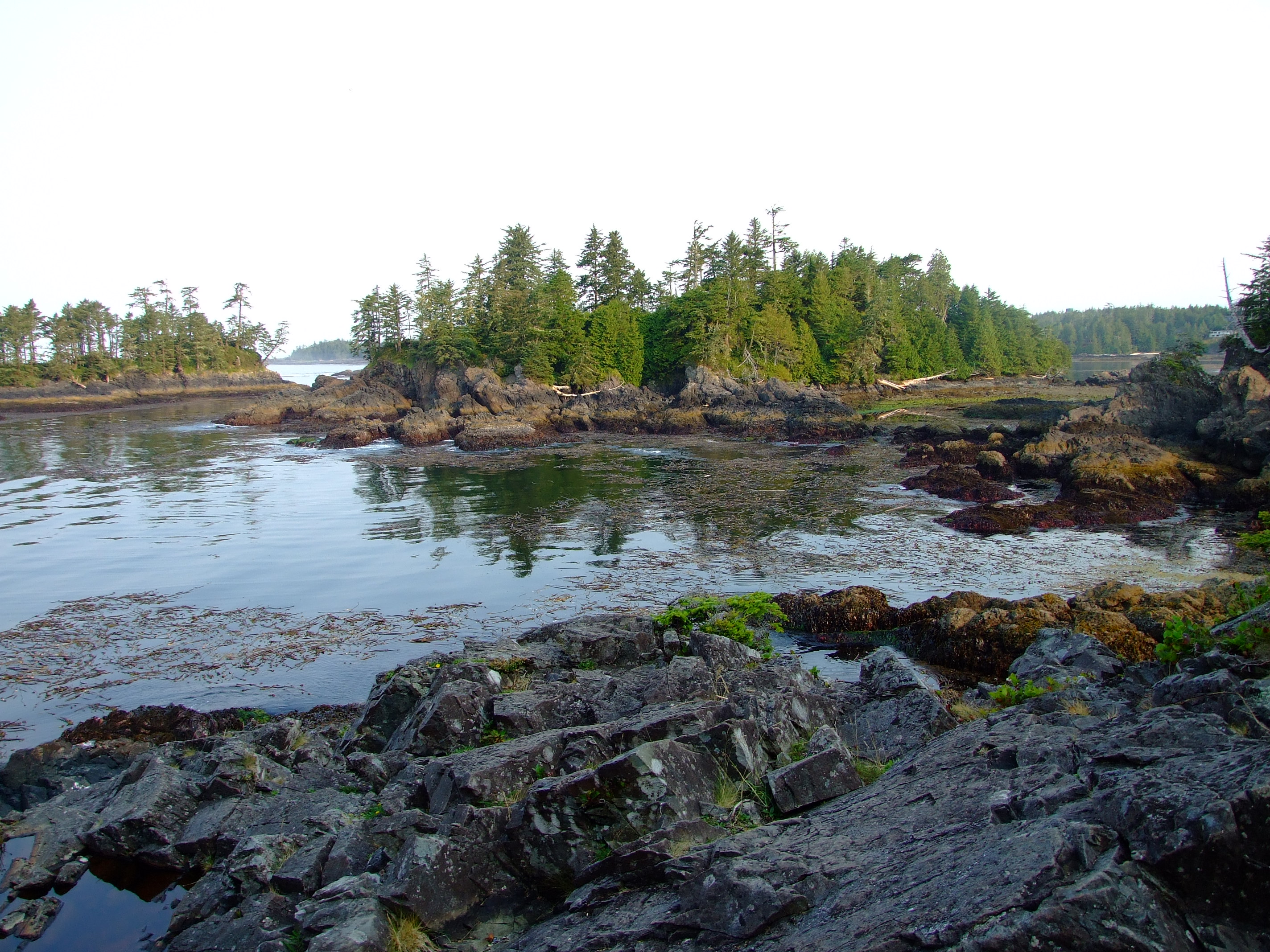
Log littered inlets filled rocky pools inviting further inspection. If you’re here in May keep an eye on the sea as 22,000 Pacific Grey Whales (Eschrichtius robustus) migrate past along the coast at this time. In summer months Orca’s [http://www.geog.uvic.ca/viwilds/iw-orca.html] (Orcinus orca) can be seen closer to the shore.
Log littered inlets filled rocky pools inviting further inspection. If you’re here in May keep an eye on the sea as 22,000 Pacific Grey Whales (Eschrichtius robustus) migrate past along the coast at this time. In summer months Orca’s (Orcinus orca) can be seen closer to the shore.
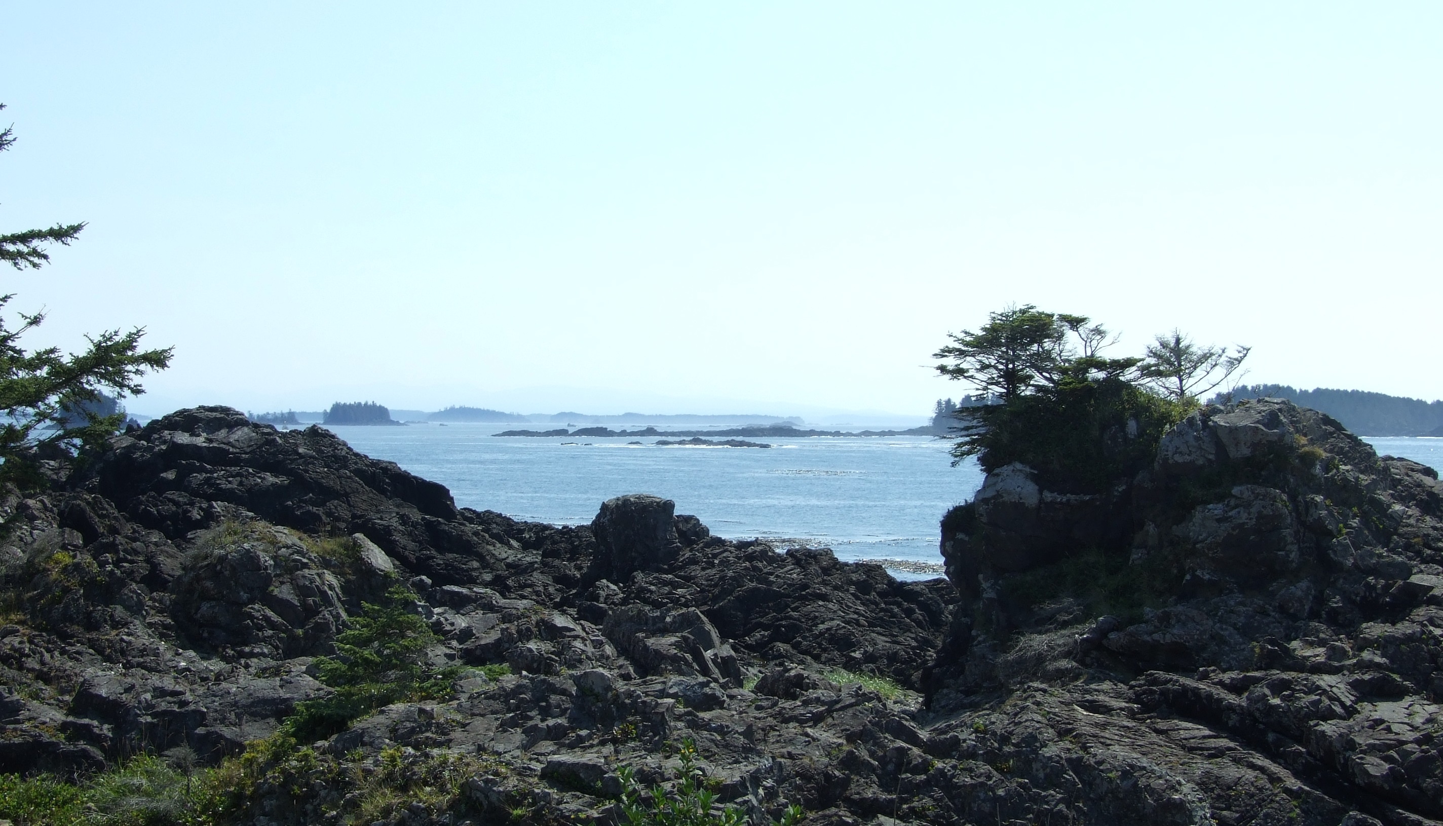
The view to the SE of Amphitrite Point Lighthouse and beyond to the George Fraser Islands at the western edge of Barkley Sound.
As I walked on towards the lighthouse I was early enough and lucky enough to come across a prime specimen of the Banana Slug (Ariolimax columbianis) crossing the trail. The second largest slug in the world, it plays an important role in cleaning up the detritus of the rainforest.
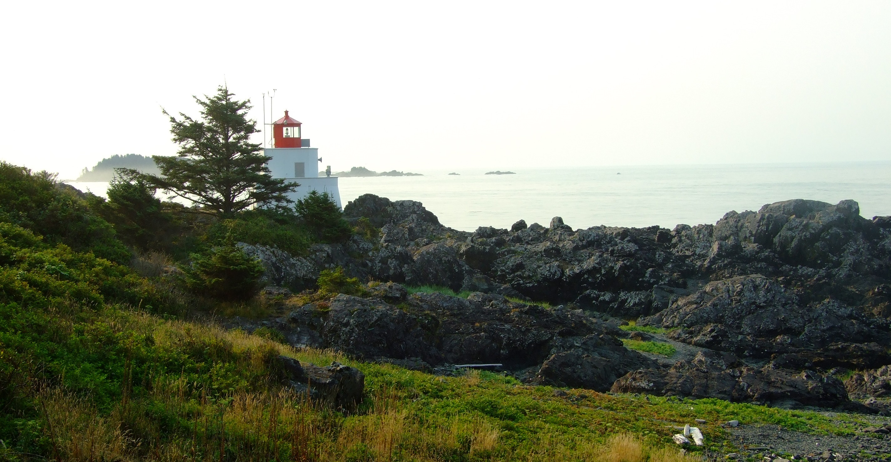
The 1915 Amphitrite Point Lighthouse. For a detailed account of why and how it was built, and the keepers that have looked after it, visit LighthouseFriends.com.
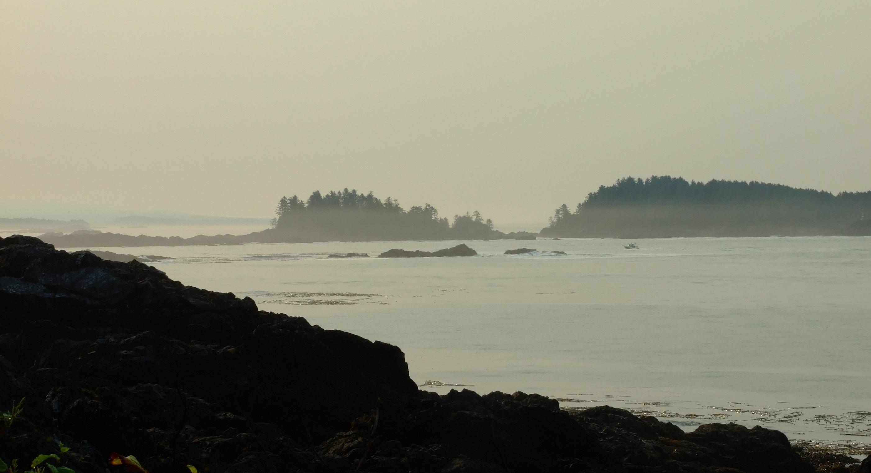
It was still a little misty as I looked out over Barkley Sound and the Graveyard of the Pacific, but the sun was starting to burn it off.

From here I headed a little further along the coastal path and then cut back along the interior forest trail, returning to Cabins West around an hour after setting out.  With everyone now out of bed it was time to do it again, but I had a feeling that this time round the Lighthouse Loop might take a little longer.

By 10:30AM the view towards Little Beach was much brighter than it had been just a couple of hours previously. However, early morning and late evening are the best times to watch for Sea Otters here. Hunted almost to extinction for their fur along the Canadian coast, Sea Otters were absent from Vancouver Island until 1969 when a reintroduction programme began. It has been remarkably successful. The year after our visit the first returning Sea Otter raft in Ucluelet was spotted during the Spring of 2011 in Little Beach’s bay; it comprised 50-70 individuals. Once again, it would be 3 years before we got to see Sea Otters in the wild.
By 10:30AM the view towards Little Beach was much brighter than it had been just a couple of hours previously. However, early morning and late evening are the best times to watch for Sea Otters (Enhydra lutris) here. Hunted almost to extinction for their fur along the Canadian coast, Sea Otters were absent from Vancouver Island until 1969 when a reintroduction programme began. It has been remarkably successful. The year after our visit the first returning Sea Otter raft in Ucluelet was spotted during the Spring of 2011 in Little Beach’s bay; it comprised 50-70 individuals. Once again, it would be 3 years before we got to see Sea Otters in the wild.
The view at the edge of the Pacific was no less impressive on the second time round, but it was better for sharing the experience.

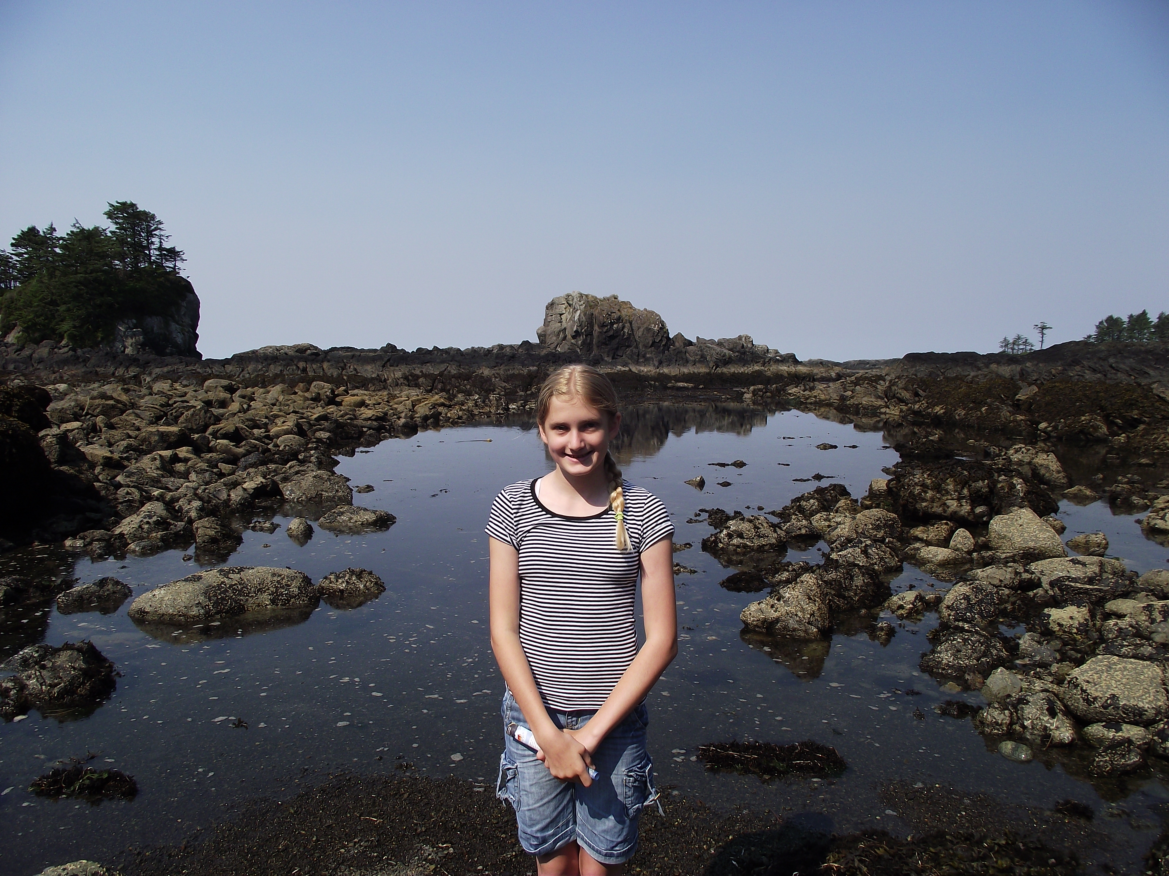
It didn’t take long before we found ourselves down at the exposed rocks and pools of the intertidal zone, which, amazingly, we had all to ourselves. Well almost, but it wasn’t other people that would later join us.

If you don’t know too much about the seashore in this region, download a copy of Parks Canada’s “Exploring The Seashore” brochure.

At low tide levels like this there is a huge expanse to explore more of the rich biodiversity of this region.
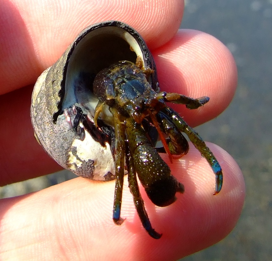
The Blueband Hermit Crab (Pagurus samuelis) is the most common type of hermit crab on the western coast of North America, with Vancouver Island being the northernmost point of its distribution.
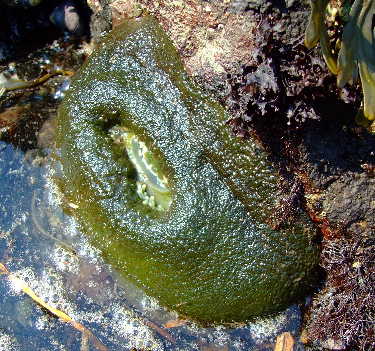
A retracted Giant Green Anemone (Anthopleura xanthogrammica). You can just see the tips of its tentacles waiting for the sea to return, when this venomous carnivore would look like this…

Source: By pfly [CC BY-SA 2.0 (http://creativecommons.org/licenses/by-sa/2.0)], via Wikimedia Commons.
We spent nearly an hour on the ‘beach’, and on the day of our visit we’d been lucky enough to hit a pretty low tide at the right time.  The tide had turned at about 09:30AM, but didn’t reach its full height until 15:45PM, at which point the area we’d walked on was a further 3.11m (10.2”) underwater.  Keeping in mind that this link is for tide times in Ucluelet Harbour (which means there can be some variation with the water levels out on the coast), it’s really worth a little planning to make the most of your visit.

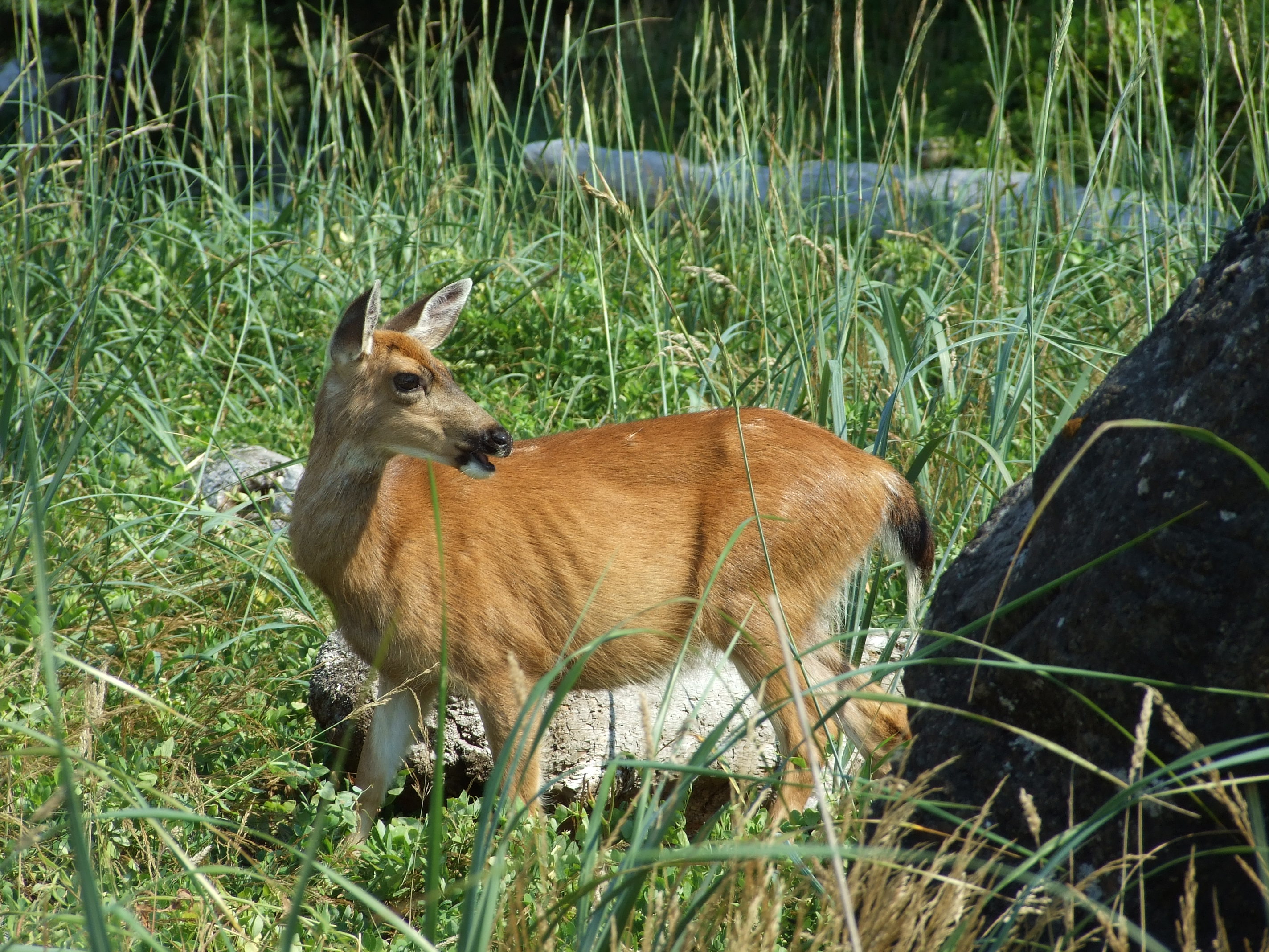
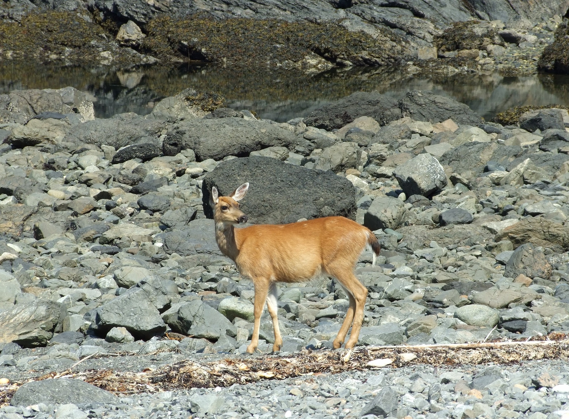
We eventually retreated up the shore (for the shade rather than due to the slowly returning ocean), where, from behind a rock poking above some tall grass, a female Columbian Black-tailed Deer (Odocoileus hemionus columbianus) suddenly emerged.

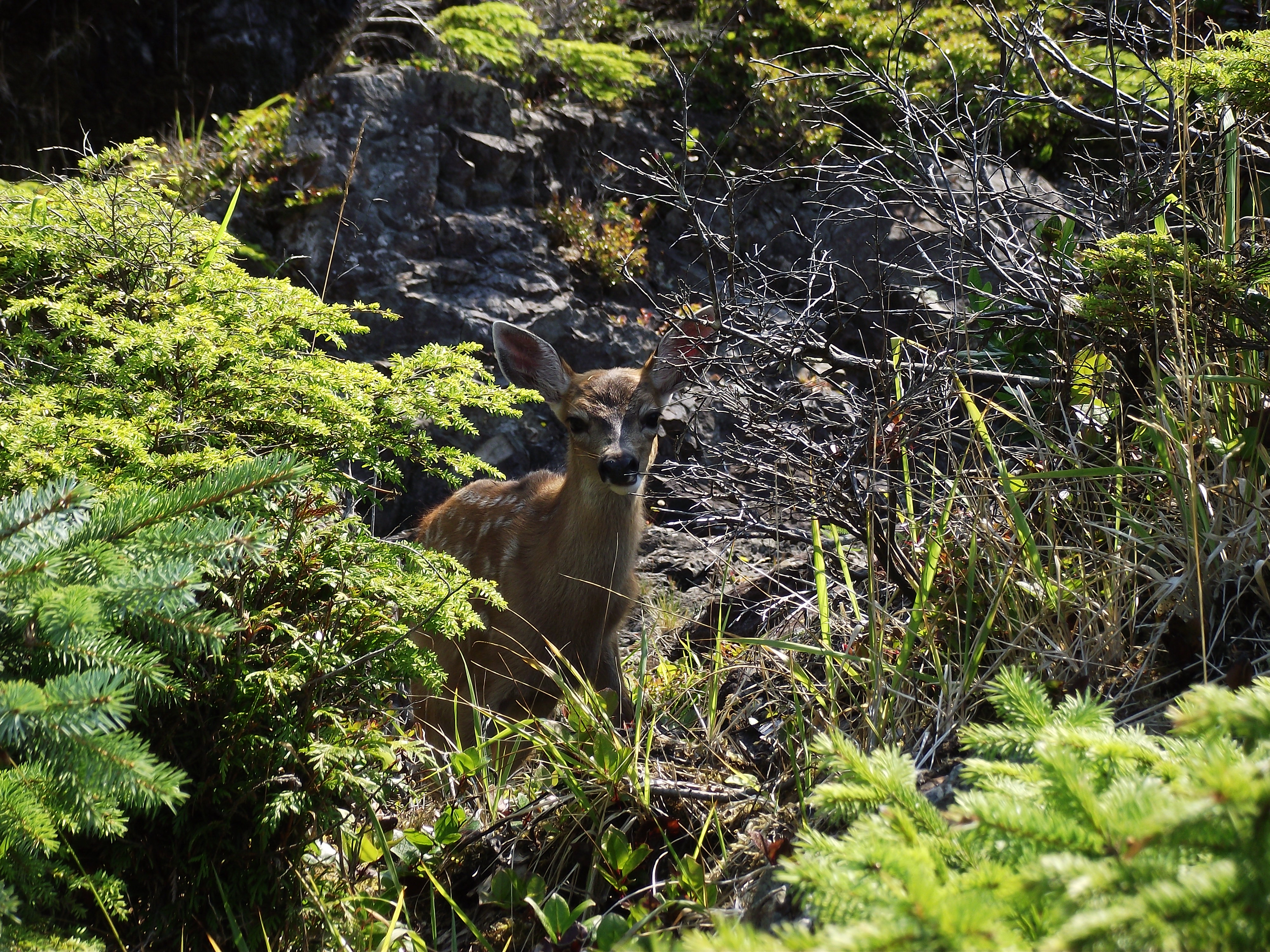
She appeared fairly unconcerned by us as she grazed, but we soon spotted that she wasn’t alone…
This fawn was probably 10-12 weeks old, as birthing occurs in May and early June.

The fawn was alert to our presence, but as we remained fairly quiet and moved slowly, it followed its mother’s lead and got on with eating choice new growth while ignoring us.

Unlike bears, wild deer are not in short supply in the U.K., and if I want to be assured of seeing them I can always just drive into London.  However, the experience of sitting on a rocky beach on the edge of the Pacific Ocean and watching these Black-tails with my wife and daughter provided a deep sense of calm satisfaction with life.

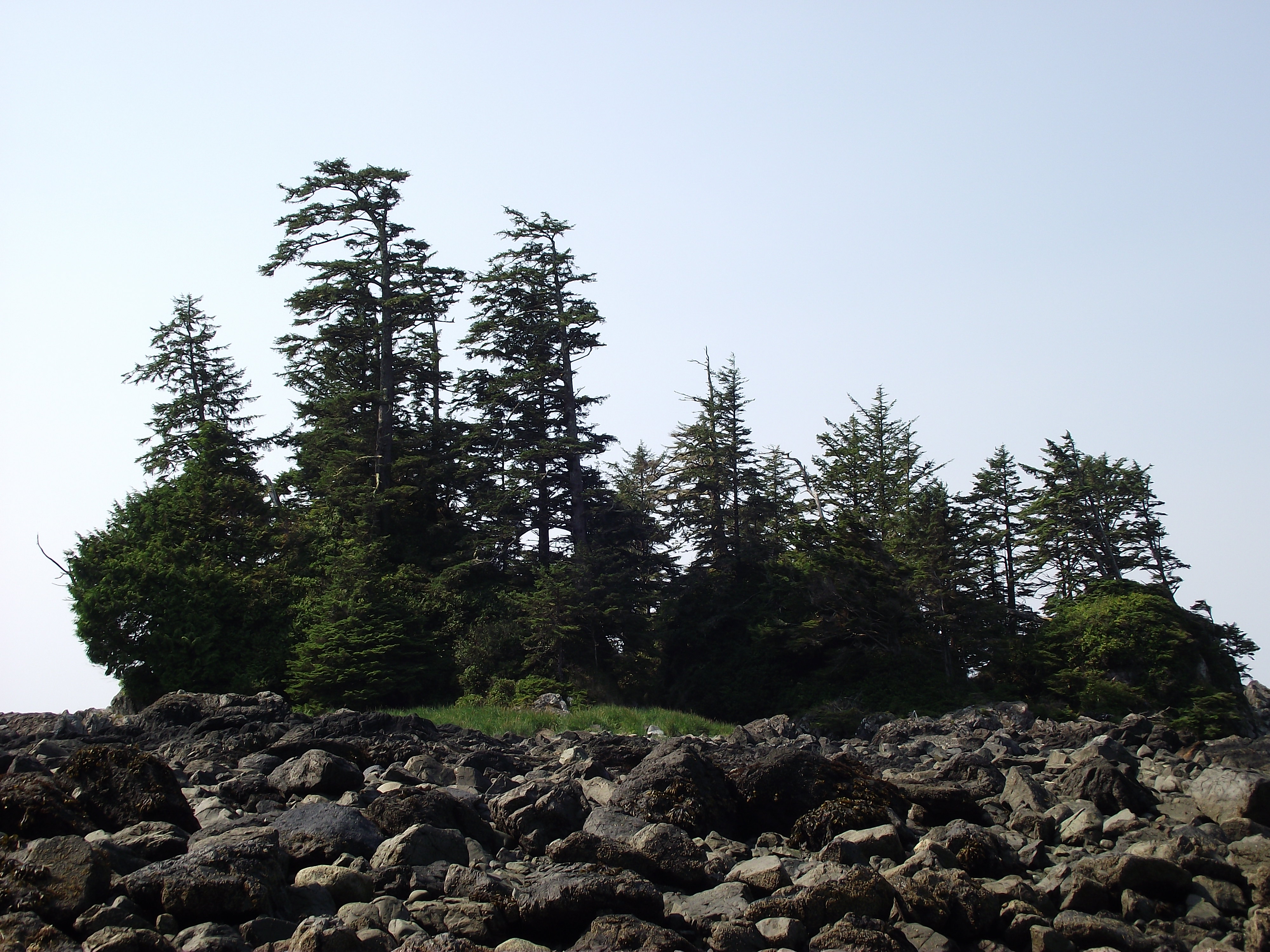
Moving down to the stony shore the doe made an arc between us and the ocean, and, occasionally pausing and checking back to make sure her fawn was following, headed up towards a tree-crowned tidal islet/spur…
We left any exploration of the trees to the deer, who, as creatures of habit, hopefully already knew it to be a good place of refuge and sustenance.
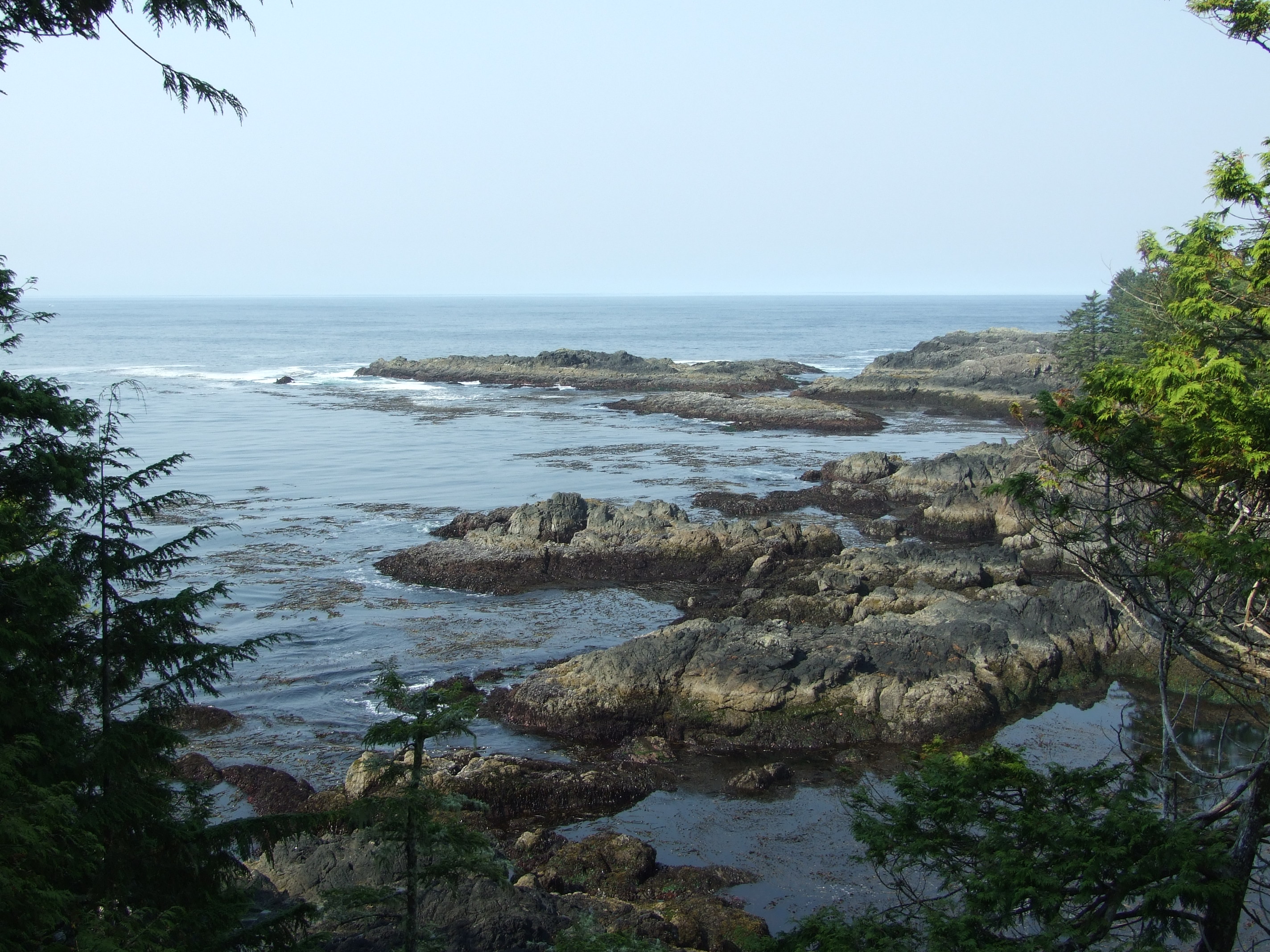
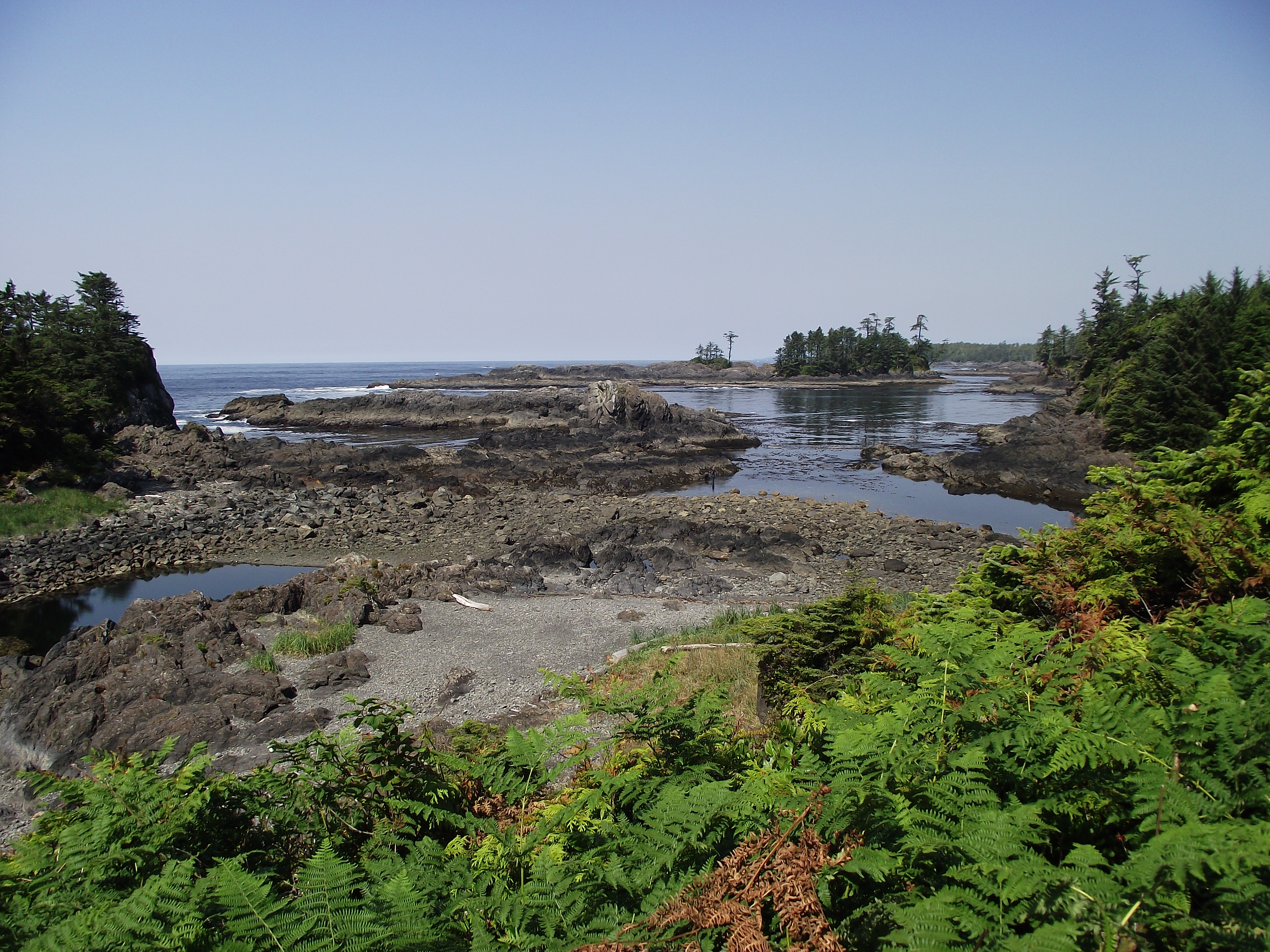
We ascended the track from the shore to the trail path, and were rewarded with another fine panorama of this magnificent coast.
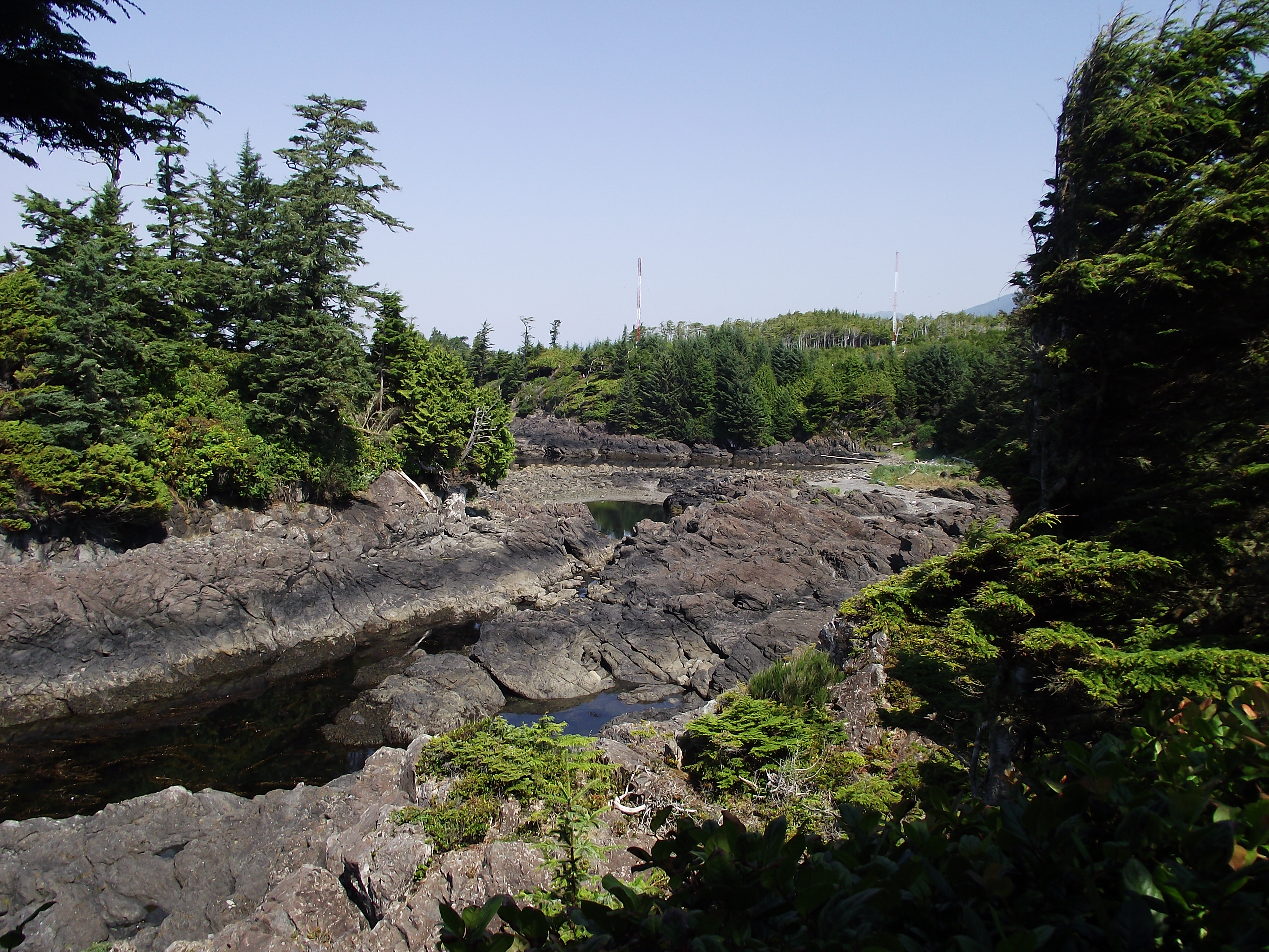
As we walked on we realised just how well protected (and trapped) the deer would be as the tide came in. We also noticed two of the four Coast Guard masts located on the Amphitrite peninsula, and, if you look carefully, that there were now other people enjoying a midday walk around the Wild Pacific Trail.
The Lighthouse Loop of the Wild Pacific Trail provided many fine views and photo opportunities without the need to go rock hopping (or climbing off-path through the forested sections which can hide many deep crevices beneath rotting trunks and vegetation). A c.3m fall from the path cost one visitor a dislocated arm and the need to be extricated by the Ucluelet Volunteer Fire Brigade in October 2015.
Having passed the Amphitrite Lighthouse, our final views of the Pacific from the trail were of some of the hundreds of islands in the 800 km2 (309 mi2) area of Barkley Sound, none of which is bigger than 2 km (1.24 mi.) across.

Once again (at least for me), the Wild Pacific Trail then led back across the centre of the forest, and it didn’t take long before we arrived back at Cabins West.

Lighthouse Loop Wild Pacific Trail

Although it’s now over 5 years since our visit, the morning we spent on the Lighthouse Loop of the Wild Pacific Trail remains as one of those moments when the world raises its game several notches, and you wonder where on earth you will find a challenge to meet such perfection.

I hope that the way that the Wild Pacific Trail has been considerably extended and developed in the intervening period means that we need have little fear of ‘previous comparison disappointment’; a return to Ucluelet is high on my quite short list of ‘really need to get back there ASAP’ places.

If you’re looking for an easily accessible view of “Life On The Edge”, the Lighthouse Loop of the Wild Pacific Trail might be just where you should be heading to.

More online information.

Start with the comprehensive Wild Pacific Trail official website, and spend some time going through all of its pages before you decide what you want to see and have the time to enjoy most.

Before your visit, keep an eye on the latest reports from the Tofino Ucluelet Westerly News.  In August 2015 they reported on the community’s capital injection plans for the Wild Pacific Trail, and in November 2015 they followed up with an article on the “nine new viewing points and a viewing deck on the Lighthouse Loop”.

You can also keep up to date with Wild Pacific Trail news by logging on to their Facebook page.

There’s also a quite good background article on the Wild Pacific Trail here.

The information source for the Terrace Beach Interpretative Trail sign First Nation population estimates is here.