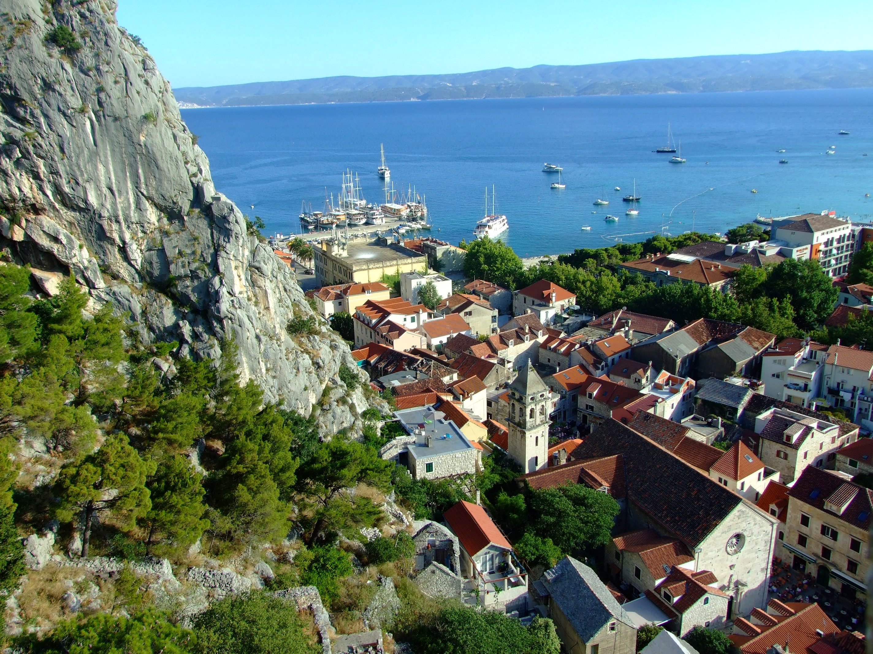
Two views over Omiš – Mila Gojsalić and the Mirabella

In the heat of a Croatian summer it pays to get up and head out as early as possible, which is why, at 07:20AM, we found ourselves in front of the gate of the Utvrda Peovica (Mirabela Fortress) in the Dalmatian Adriatic coastal town of Omiš.  Here we discovered that the locals didn’t share our ideas.

You can get to the entrance of the Mirabela Fortress by following the signs up a short 10-15 min. walk from the square where St. Michael’s Church (Crkva Sv. Mihovila) is located on Knezova Kačića in Omiš old town.]
You can get to the entrance of the Mirabela Fortress by following the signs up a short 10-15 min. walk from the square where St. Michael’s Church (Crkva Sv. Mihovila) is located on Knezova Kačića in Omiš old town.

We briefly returned to our nearby accommodation at Villa Mama before heading out again, this time to where our car was conveniently parked on the western bank of the Cetina River.  At 07:44 AM it was already 27°C (80.6°F), but we didn’t have long with the air conditioning.

Taking Mosorska cesta north out of Omiš along the right bank of the Cetina and up the hairpin bends of the D70 for 4.1 km (2.5 mi.)/about 7 minutes, we then turned right onto the Z6165.  Continuing along this road for a further 1.1 km (0.7 mi.) we passed through a short narrow tunnel (with priority to oncoming traffic) and reached our destination which was marked by a raised viewpoint with an iron fence.
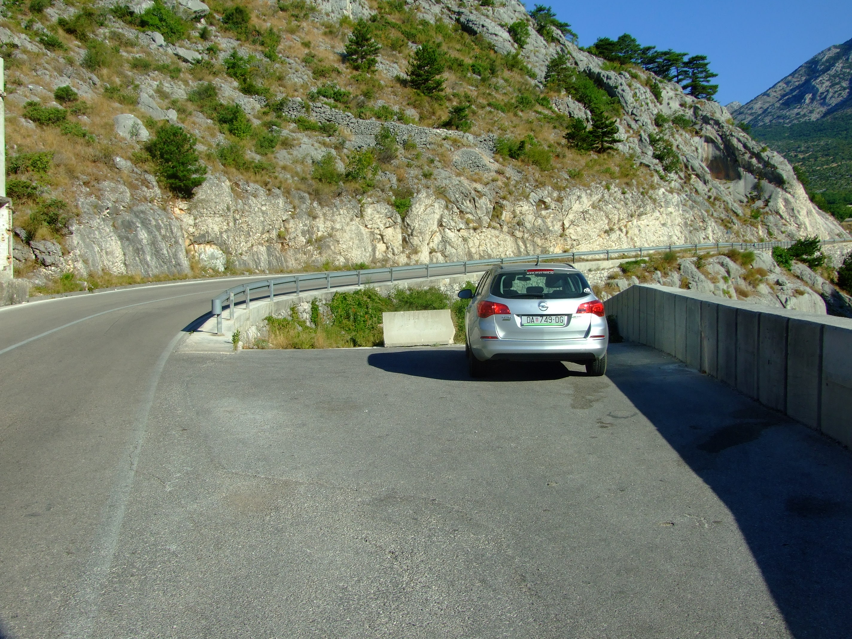
We couldn’t park by the viewpoint (take a look at Google Streetview in warning of the potential consequences of doing so), so we drove another 130m to a point where there’s a blocked off turning to an unfinished road, and plenty of space to pull over and park.
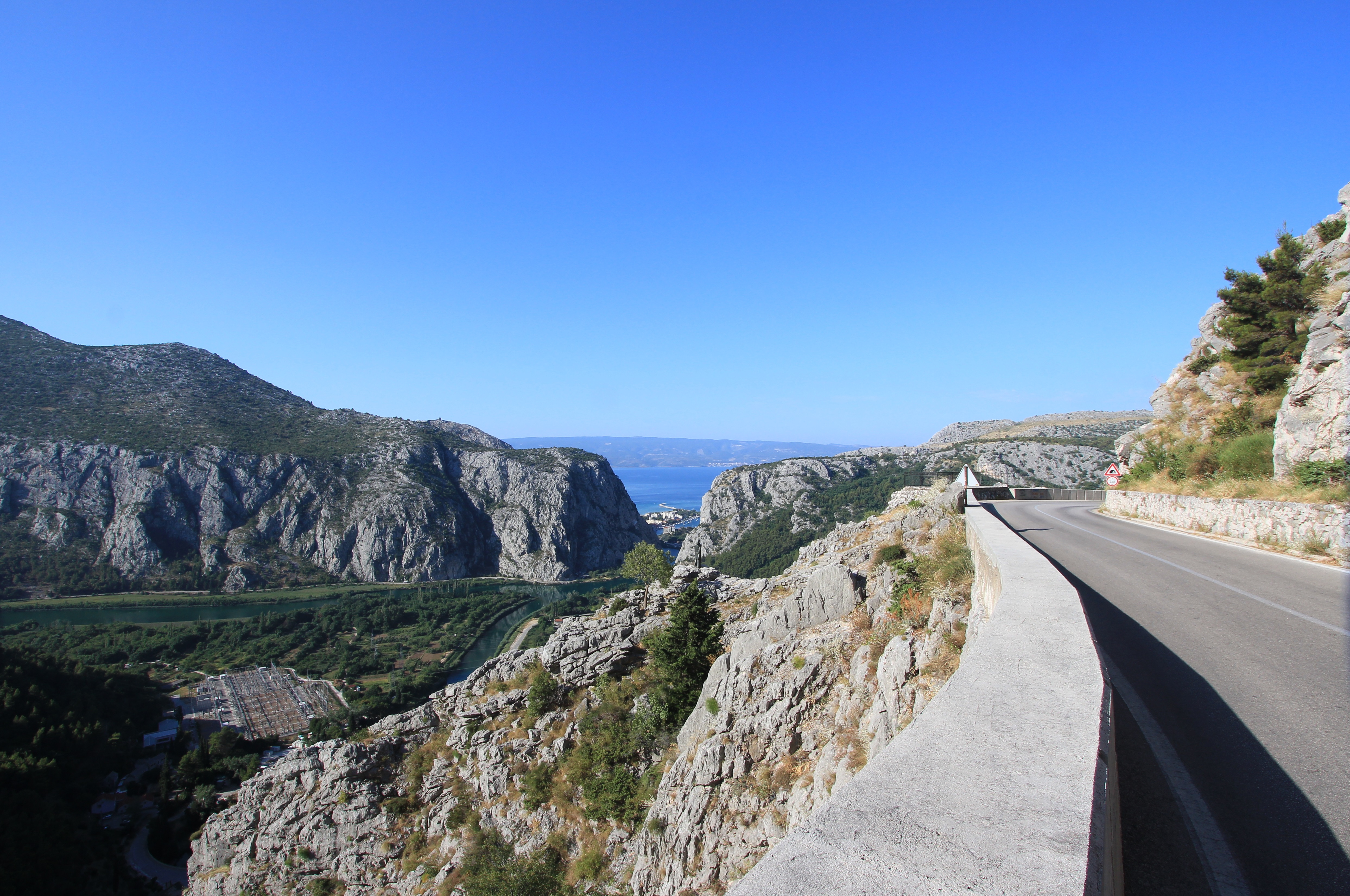
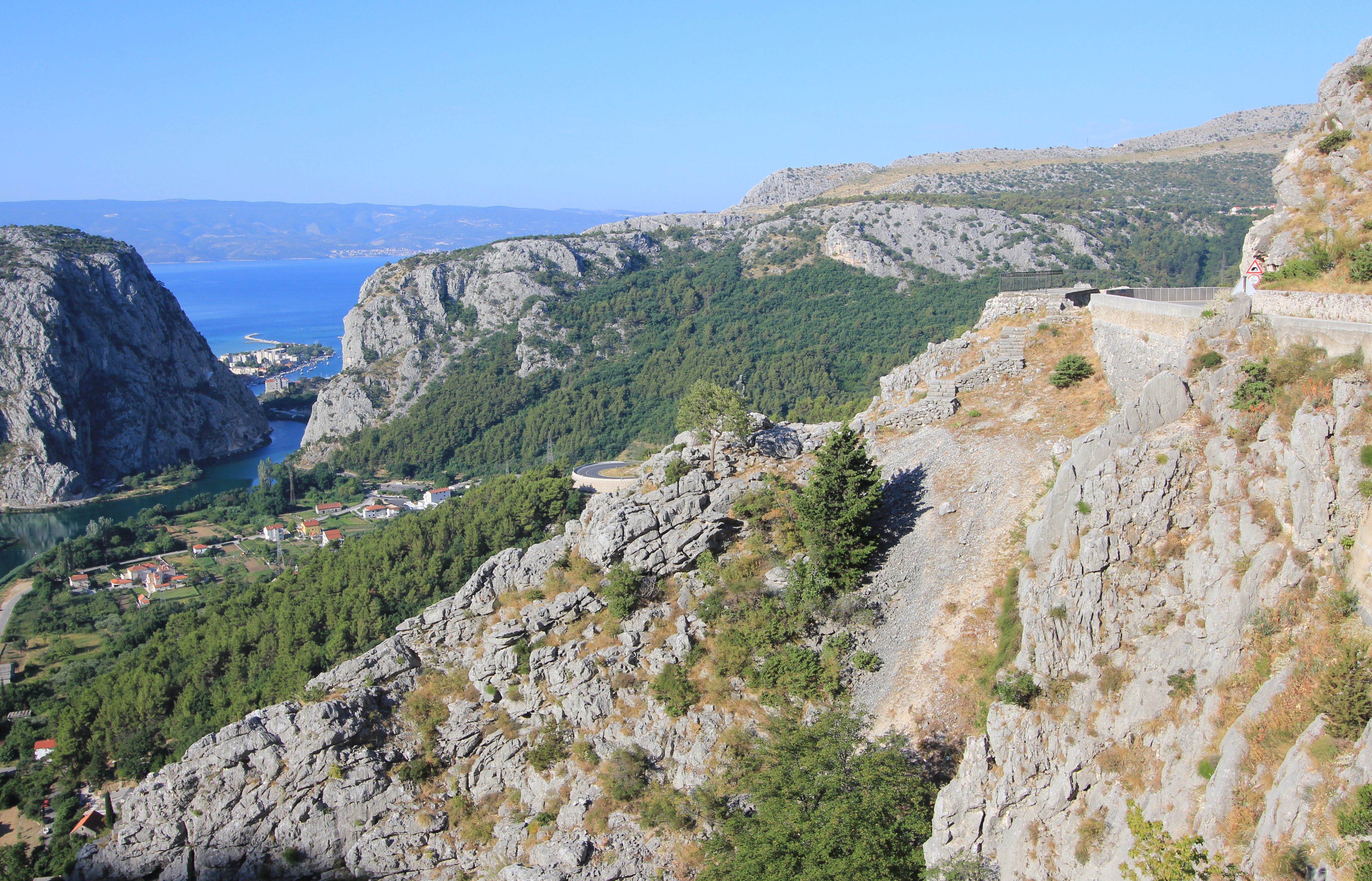
The view over the end of the Cetina valley with a glimpse of Omiš, and beyond to the Brač Channel and the northern edge of the island of Brač. The viewpoint is visible by the road to the right, a couple of bends away.
With little space between the road and the edge barrier we walked carefully, keeping one eye on the view and one eye on the traffic, as we heeded back to the viewpoint.
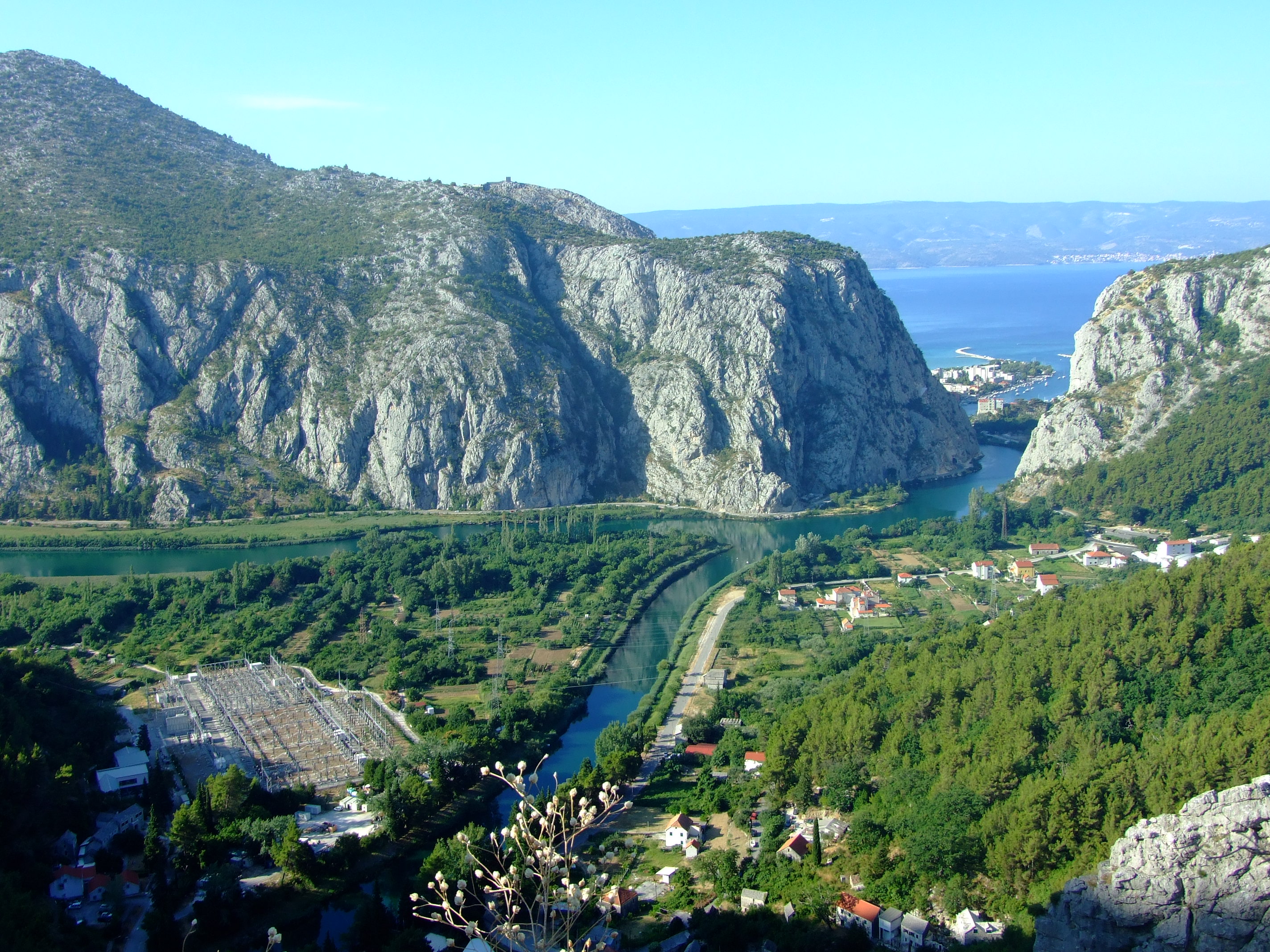
The Cetina River and the Zakučac Hydroelectric Power Plant (HPP) - the largest HPP in Croatia by capacity - are clearly visible from above.
The Cetina River and the Zakučac Hydroelectric Power Plant (HPP) – the largest HPP in Croatia by capacity – are clearly visible from above.
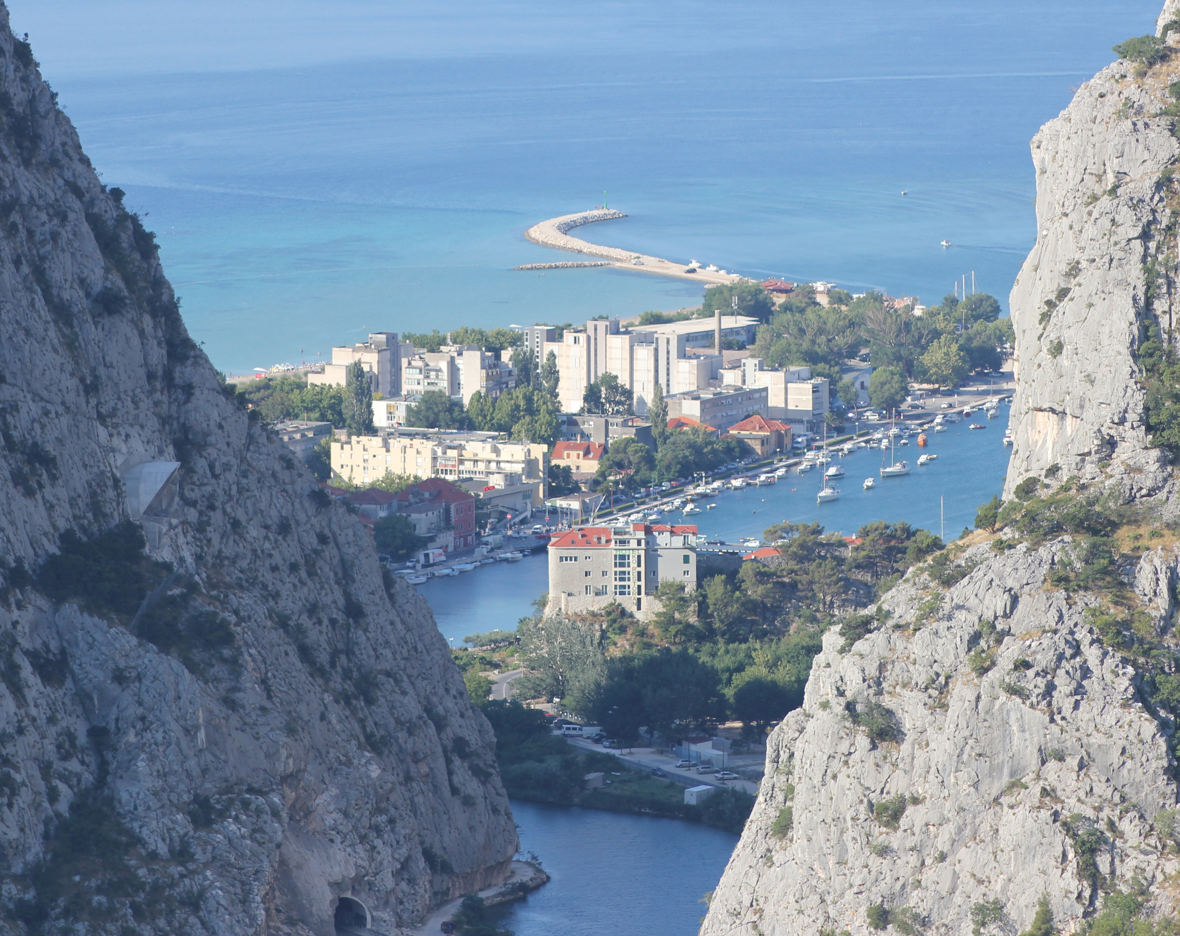
A close up of part of Omiš divided by the Cetina. In the still-shaded rock face to the left you can see the hooded entrance to the tunnel at the Omiš end of the proposed Omiš-Dugi Rat bypass. If it’s ever finished a bridge will have to span this view in future.
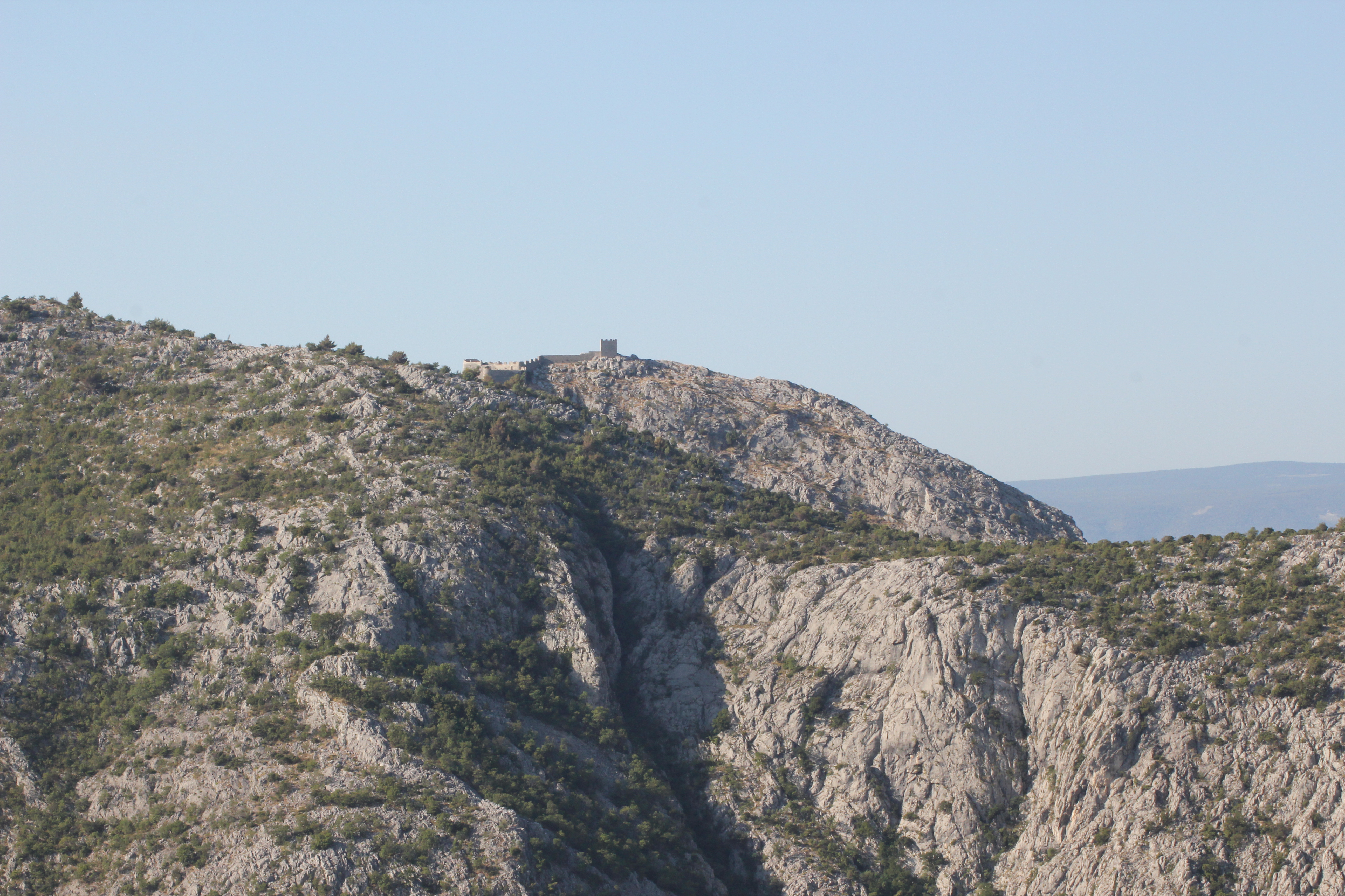
Visible on a ridge of the Omiška Dinara mountain on the other side of the valley is the 15th century Starigrad Fortress (Fortica), but this telephoto view was as close as we would be getting that day…
We’ll save this walk for another time, and not in the height of summer.
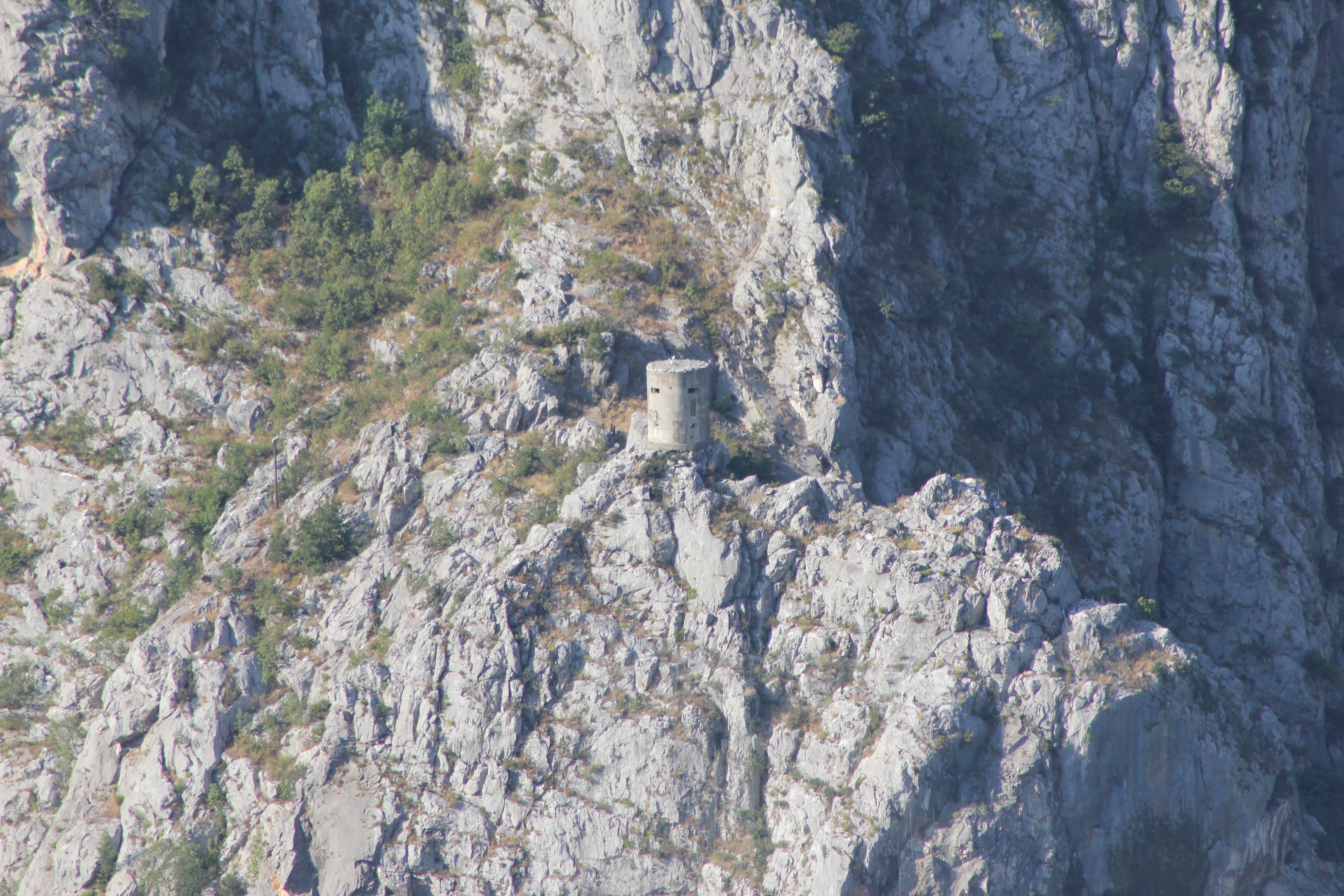
A long way below the Starigrad Fortress and just above the Z6166 as it leaves Omiš and turns east along the left bank of the Cetina is another small defensive tower. It’s just about visible from the road below if you know when to look up, but there is no established footpath to reach it.

Our new destination that morning was very specific, and this video from Crodrone captures the setting of the Mila Gojsalić memorial statue perfectly:

The story of Mila Gojsalić (also spelled “Mile Gojsalića”) is nearly 500 years old, and is set in the context of the tiny semi-autonomous ‘republic’ of Poljica standing against the might of the Ottoman Empire at the height of its power.
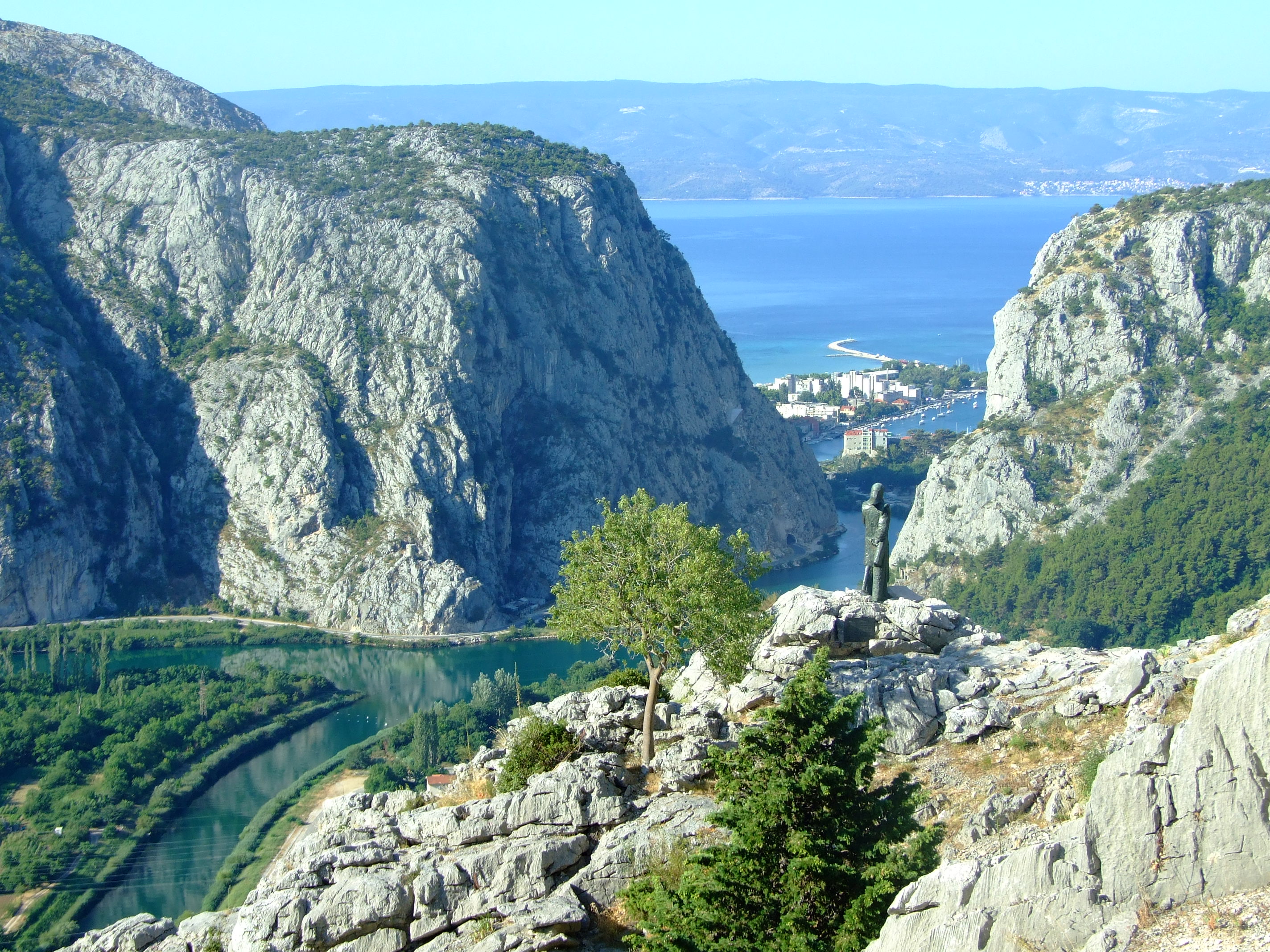
In 1530 the spirit of Poljica burned so brightly in one of its daughters that she is still remembered by name to this day. The statue of Mila Gojsalić by Ivan Meštrović was erected at this point (Lat.-Long: 43.460489, 16.700175. GPS: 43° 27' 37.7604'', N16° 42' 0.6300'' E) in 1967. You can also spot the tower from the previous image in this photo.
In 1530 the spirit of Poljica burned so brightly in one of its daughters that she is still remembered by name to this day. The statue of Mila Gojsalić by Ivan Meštrović was erected at this point (Lat.-Long: 43.460489, 16.700175. GPS: 43° 27′ 37.7604”, N16° 42′ 0.6300” E) in 1967. You can also spot the tower from the previous image in this photo.

The history of Poljica is fascinating in its own right (see the links at the bottom of this post).  For a people to successfully cultivate a viable, ordered living from this harsh landscape is no small feat.  For such a small community to then continuously develop, define (with a series of formal statutes), and effectively defend (both by the political expediency of token suzerainty and armed resistance) a unique form of rural democracy largely on their own terms, for hundreds of years, is nothing less than remarkable.
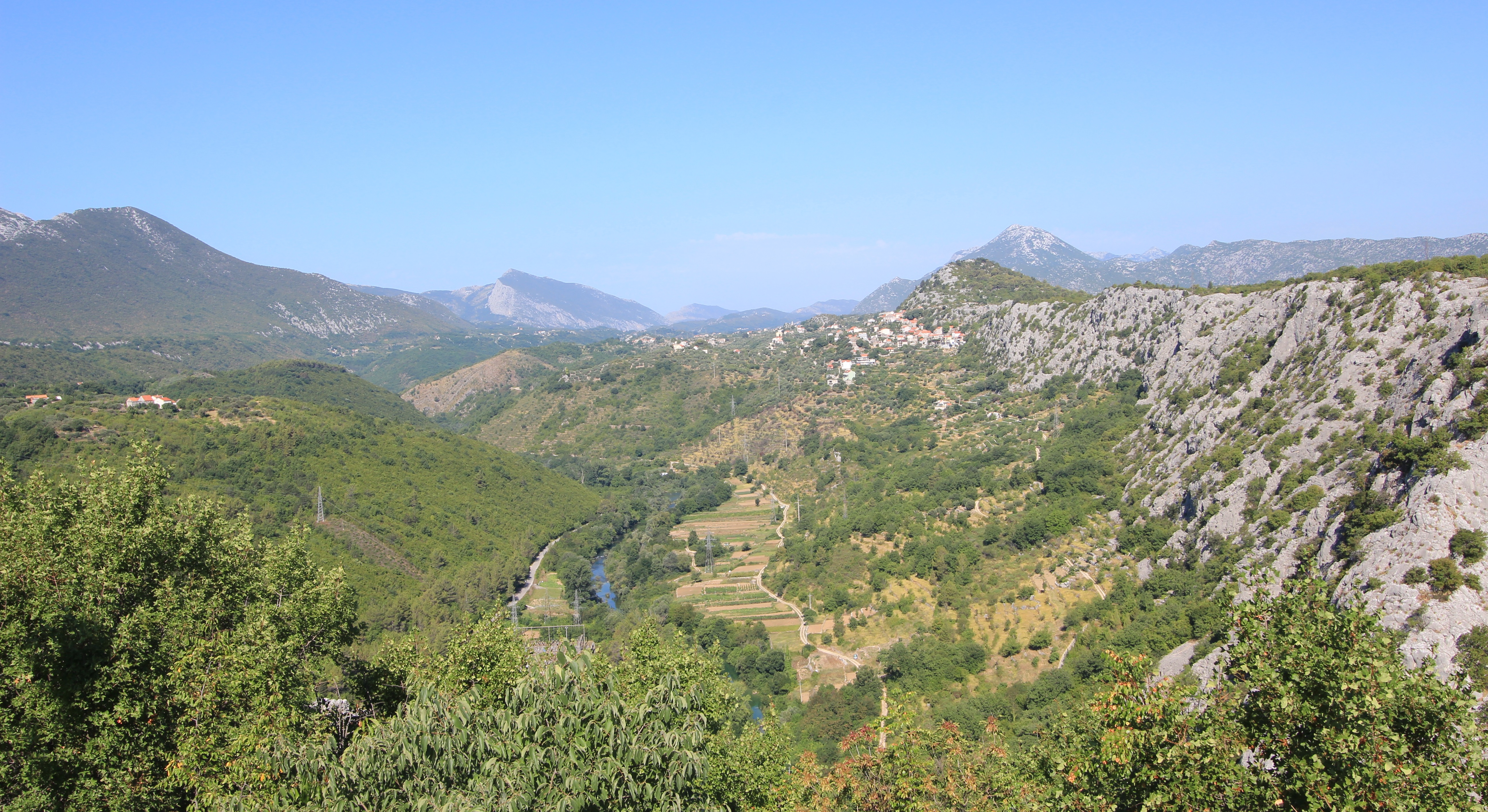
A view of Poljica (pronounced ‘Pol-yee-tsa’) looking NW from Zadvarje. This is the south eastern section of Sredjna (Middle) Poljica along the line of the Cetina Valley as it flows away towards Omiš.

However, in 1530 the future looked bleak.  During the previous century the Ottoman Empire had expanded rapidly into Europe.  In 1463 the Bosnian Kingdom had fallen to the army of Mehmed II in a matter of just a few weeks following the capture and execution of King Tomašević at Jajce, only 105 km (65.2 mi.) NNE of the Poljica village of Kostanje (named for its plentiful Chestnut trees) where Mila is said to have come from.  The Ottomans created the sanjak of Bosnia, their westernmost province, from the central part of the conquered areas of Bosnia, and enlarged it further in 1482 when they took the Duchy of Herzegovina from the House of Kosača.

In 1493 the Ottomans had taken the Imotski fortress, 30 km (18.6 mi.) ENE of Poljica. Raiding further to the west, and less than 150 km (93.2 mi.) NW of Poljica, the Ottoman forces decisively defeated the combined troops of several Croatian nobles at Krbava Field, near Udbina, on the 9th September 1493, but for Poljica the threat of Ottoman expansion became reality when a “major Turkish detachment crossed the river Cetina into Poljica for the first time in 1500, taking one hundred and fifty people prisoner.” [See article by Edo Pivčević linked below]. Given that the population of Poljica at the time was only in the low thousands this would have been an almost unimaginable shock to the community.  By 1502 Venice had ceded the Tvrđave Duare castle at Zadvarje at the south-eastern end of Poljica to the Ottomans and the threat, if not the reality of conflict, was a daily fact of life.
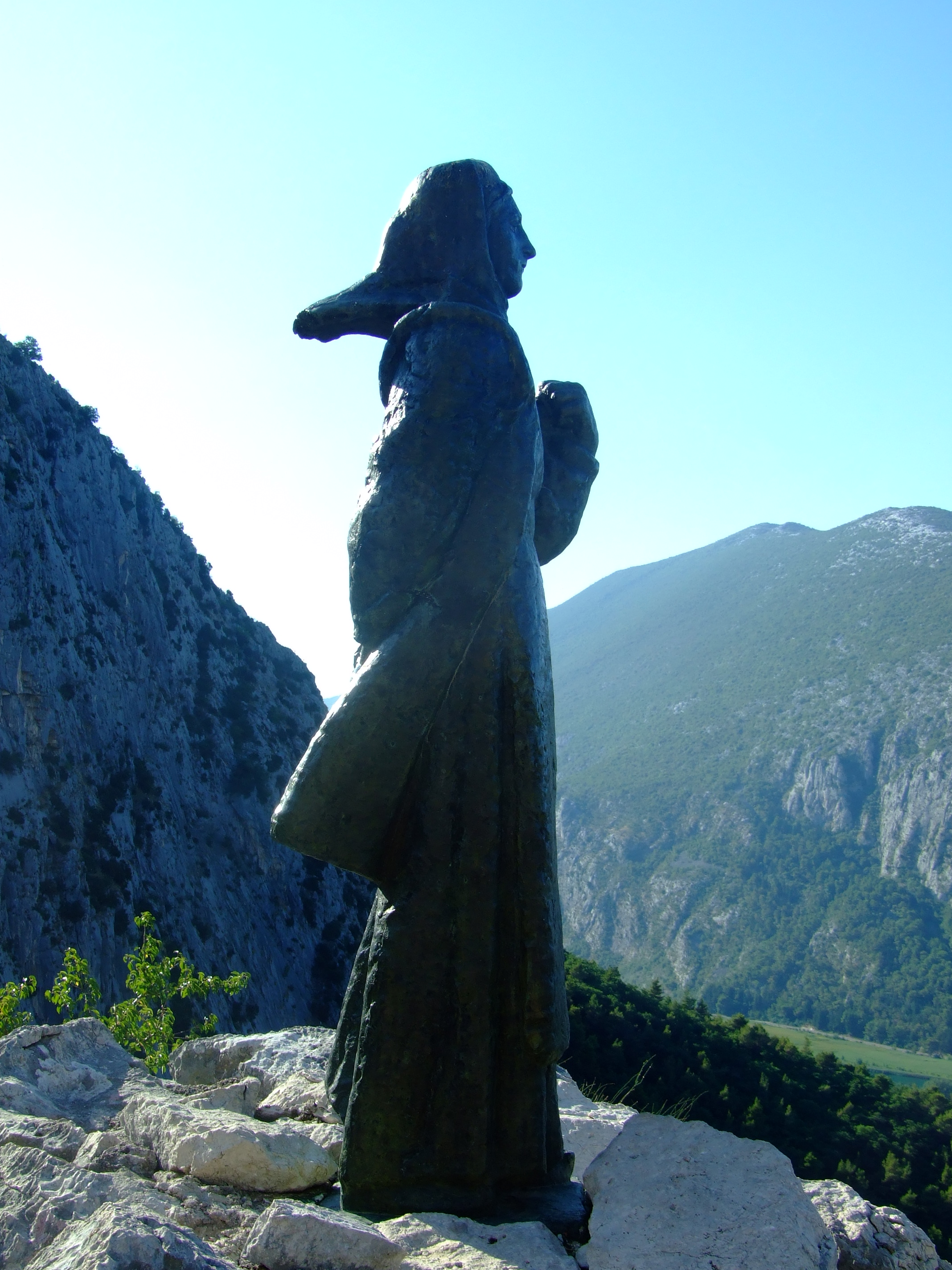
The morning sun rises over the Mila Gojsalić statue.

Ottoman forces finally seized the then political centre of Croatia at Knin in May 1522, with the downstream town of Skradin at the mouth of the Krka River (around 60 km (37.3 mi.) from the northern borders of Poljica) quickly following, but the inhabitants of Poljica had been on the receiving end of Ottoman ambitions for several years by then.  By 1514 they had realised that the political strength of the coastal Venetian Empire would avail them little in defending their lands, and had already transferred their suzerainty to the Ottomans.  It made little difference.

In 1526, and 313 km (195 mi.) NE from Kostanje, the Ottoman Empire, now under the leadership of Suleiman the Magnificent, had continued its northwards advance into Europe and inflicted a significant defeat over the Hungarians and their allies at the Battle of Mohács.  Continuing north the Ottomans took Buda in 1529 before turning NW to lay siege to Vienna.  This might sound to be a fair distance from Poljica but after Mohács the Ottomans started limiting the privileges given to Christians in captured territories unless they were to convert to Islam. With increasing dominance both regionally and locally, Mila would have been all too aware of threat to her community’s way of life from the Ottomans.

In the 1526 Poljica declined to pay the Ottoman tribute on the basis that the Turks had attacked the fortress at Klis, less than 5 km (3.1 mi.) NNE of Poljica, and a strategic gateway to Venetian Split.  Led by Petar Kružić, men from Poljica had joined his Uskok defenders against the Ottoman attempt to seize Klis, but in 1530 the Ottomans turned their attention to Poljica more directly and invaded with an army of 10,000 soldiers. They are said to have burnt and looted their way through the villages of Srinjine, Tugare and Gata, before encamping near the latter settlement.  This would have had particular symbolic significance as it was at the hill of Gradac, near Gata, that the people of Poljica would meet on St. George’s Day each year to choose their own leaders.  The intention to subjugate Poljica could not have been clearer.

The Ottoman force was reportedly led by Herzegovinian Sanjak Ahmed Bey (more usually reported as ‘Ahmed-pasha’ or sometimes ‘Osman-pasha’), but he would meet his match in Mila Gojsalić.

Remembered in popular memory as a notably attractive young lady of the district, accounts vary as to whether Mila Gojsalić was seized by her enemy and taken to Ahmed-pasha’s tent where she was raped (the most oft repeated story), ‘sold’ alongside other women of the district to the invaders and then raped, or whether she used her charms to ‘infiltrate’ the emplacement and seduce the leader of the Turkish forces.

Whatever the circumstances, she is said to have waited until the Ottoman leader was asleep and crept out from his tent, before setting fire to the encampment.  The blast from the ignited powder store is said to have killed him together with many other officers and soldiers.  In some versions of the story the explosion is said to have also claimed Mila, whilst in others she is said to have leapt from a cliff to avoid being captured by her enemies.

The disarray among the Ottoman invaders was such that the people of Poljica were able to strike with decisive force in the darkness and overrun their erstwhile oppressors, many of whom, the story tells, were forced over the edge of the precipice where the Mila Gojsalić memorial statue is located today.
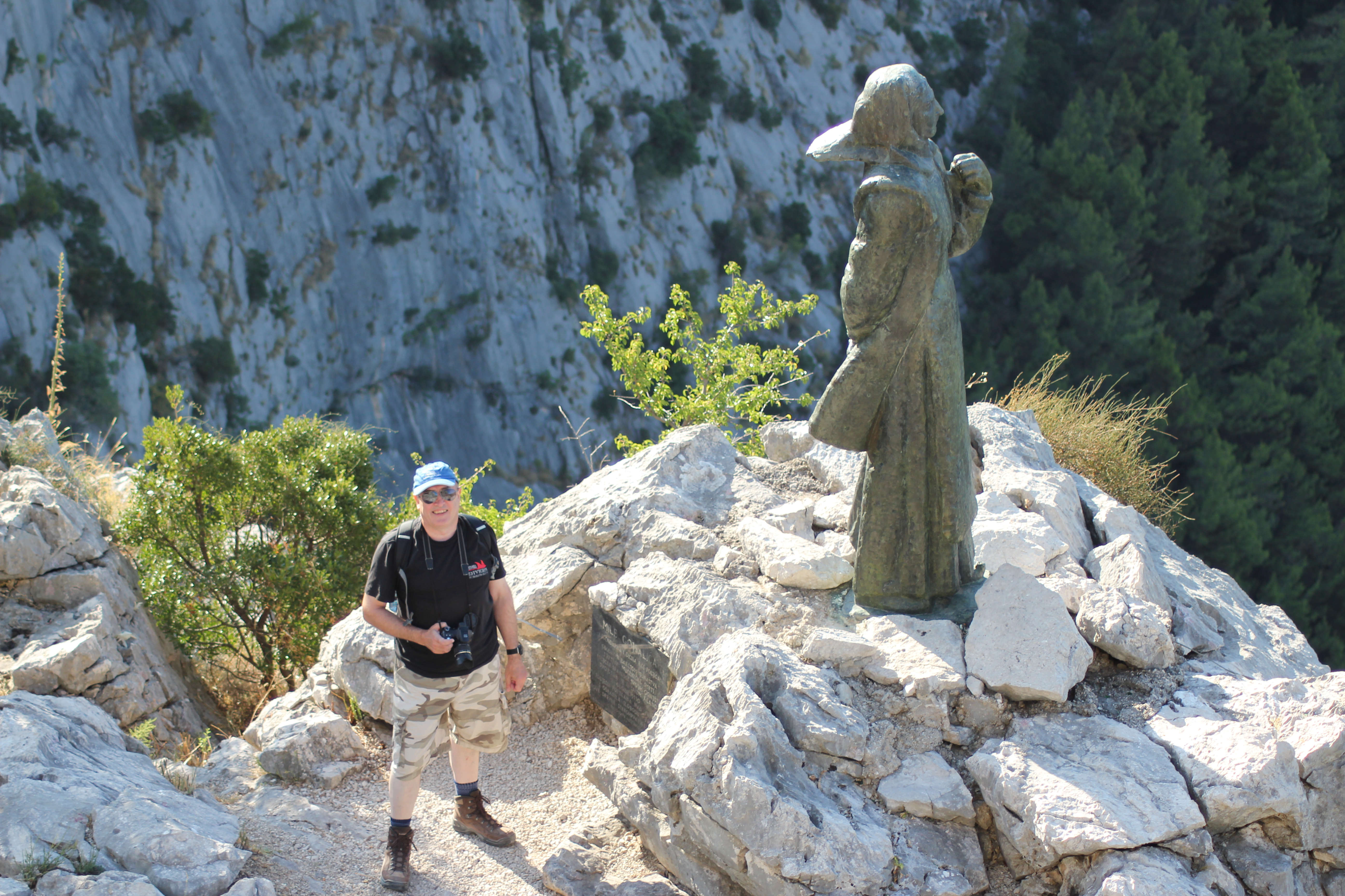
Meeting Mila Gojsalić. There’s no reason not to walk carefully down the steps from the fenced viewpoint, but this is as close as you need to get to the statue. A slip and the drop from the direction of her feet to the right is not survivable.

This was not the end of the fight for Poljica, but Mila was not forgotten by her people, and, in time, she became recognised as a Croatian national folk hero.  In recent years her home village of Kostanje has hosted the “Dani Mile Gojsalić” (Mile Gojsalić Days).  2016 will be the 13th edition and will run from the 14th – 17th July.  You can follow the event (in Croatian) on the organisers’ Facebook page.

Our day continued with a drive on through Kostanje, crossing the valley over the Cetina on the old Pavica Most, and on to Zadvarje.  From here we headed inland to visit the famous sinkholes at Imotski, and returned via a stop at the stecći near Lovrec.

By the early evening we were back in Omiš where we retraced our steps through the now much busier streets to the Utvrda Peovica (Mirabela Fortress).  This time it was open to visitors.
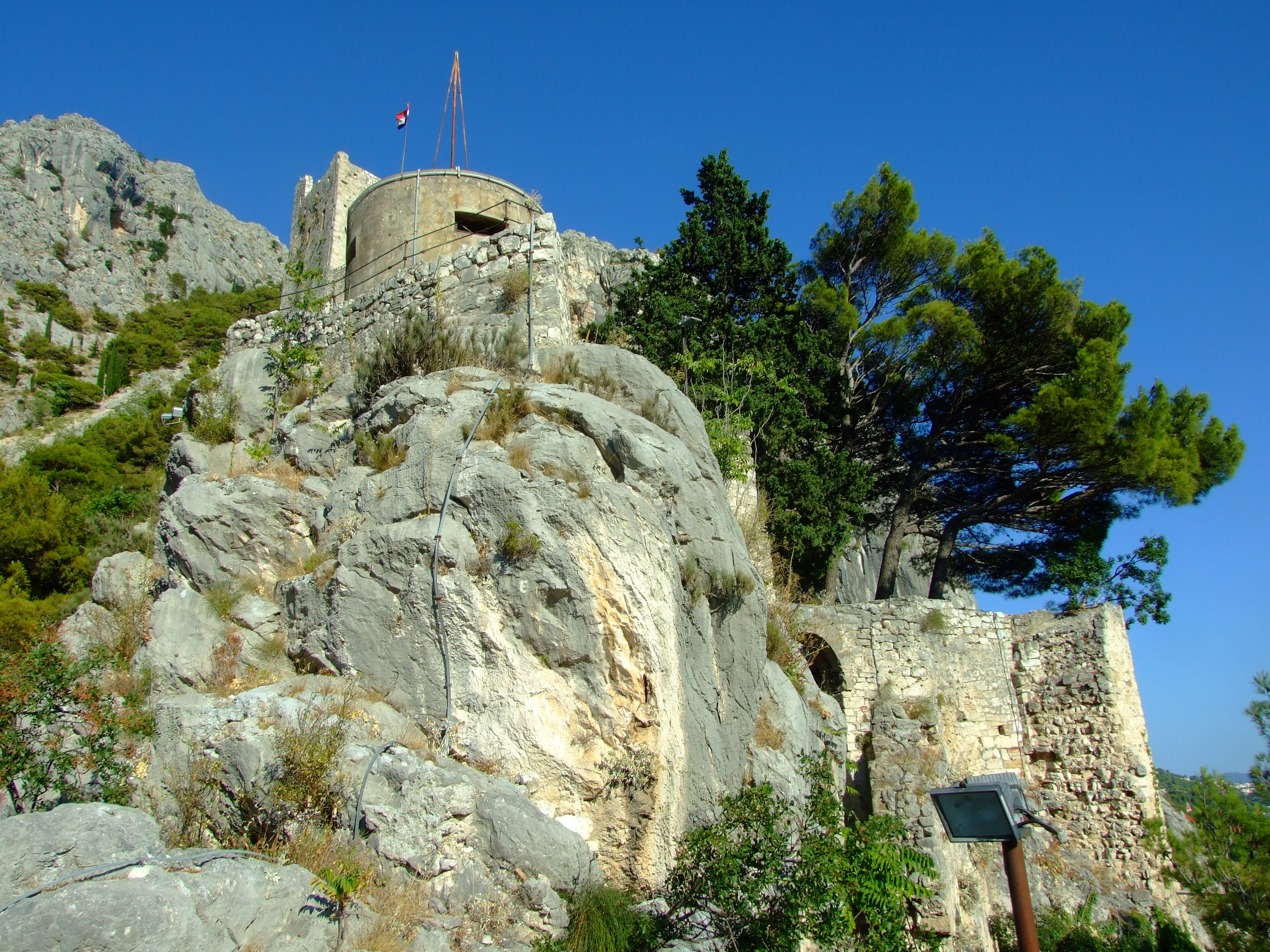
Looking up at the Utvrda Peovica/Mirabela Fortress from its lower levels.

It is believed that work on this redoubt was started early in the 13th century during the period when Omiš was ruled by the Kačić family who are perhaps best known for their tenure during the period when the famed Omiš pirates used the tower as a lookout for passing prey.  Built on six tumbling tiers, the Venetians expanded and refortified the structures after taking over in 1444.
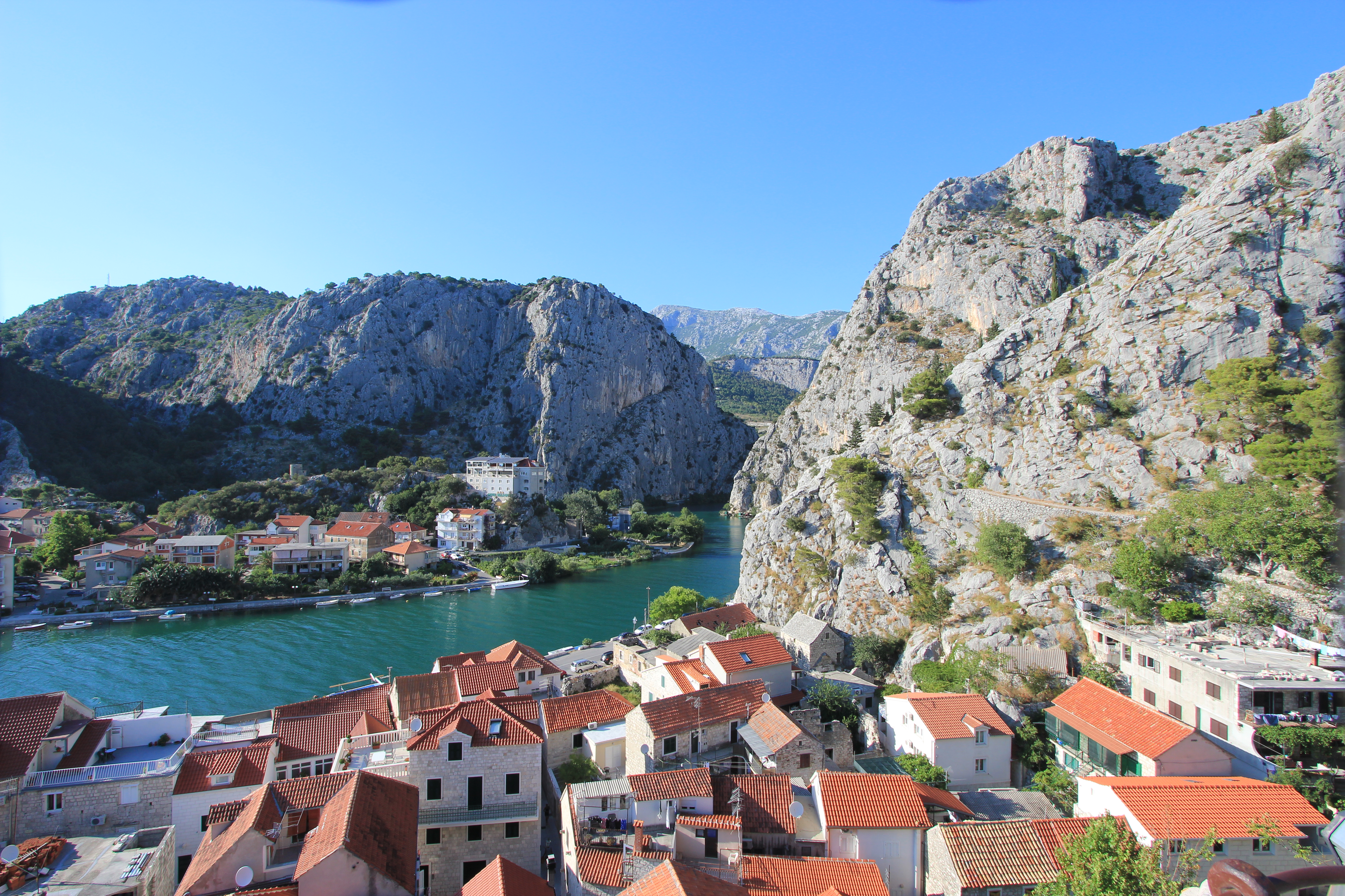
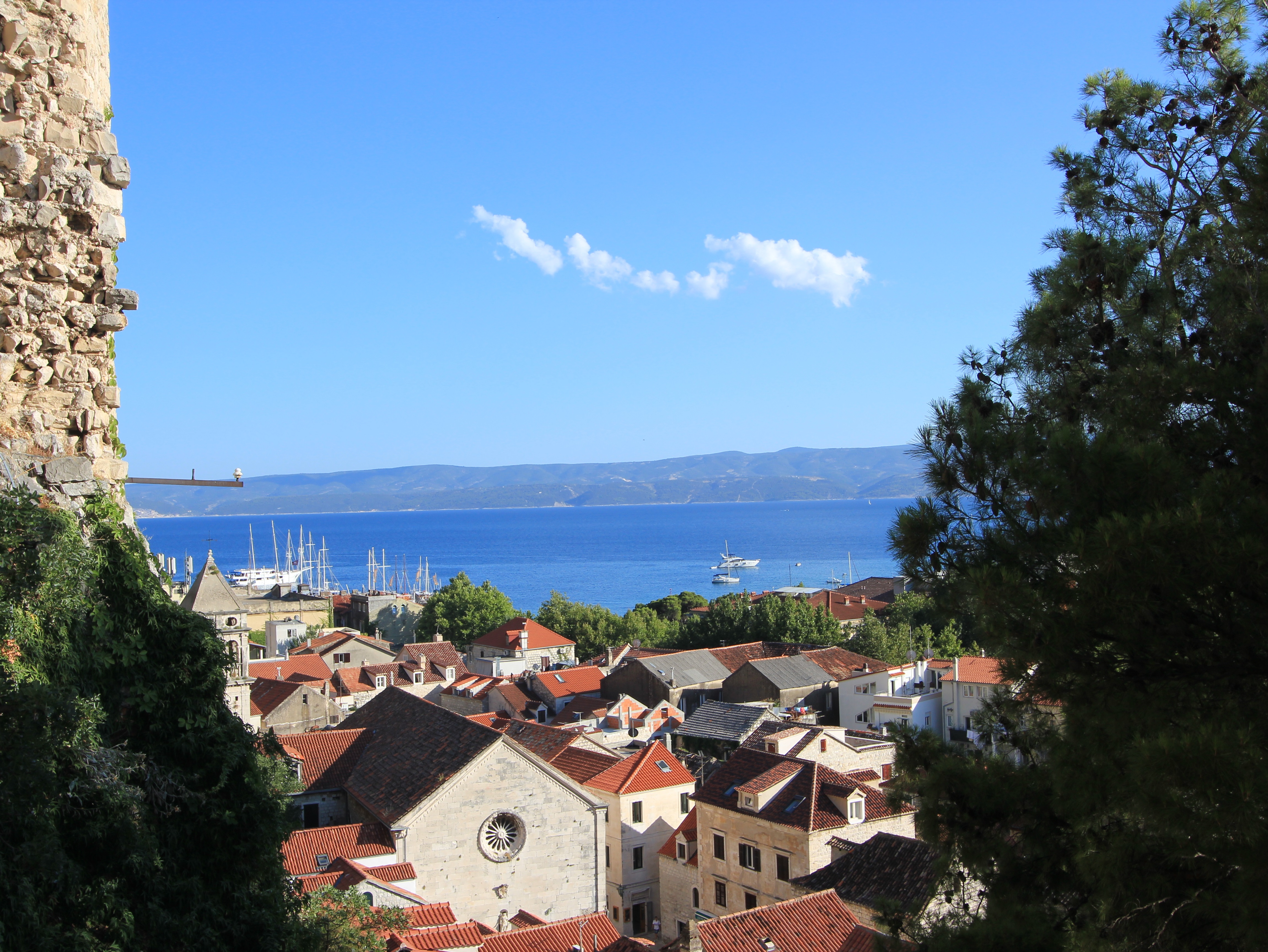
The view looking north-west over the Cetina River from the lower levels of the Utvrda Peovica/Mirabela Fortress.
The view looking south over Omiš old town from the lower levels of the Utvrda Peovica/Mirabela Fortress.
Still looking south over Omiš old town from slightly higher levels of the Utvrda PeovicaMirabela Fortress.

Because of the acoustic dynamics of the Mirabella’s location sound can be amplified without being directionally attributable.  This strange feature was used to advantage by defenders facing an Ottoman attack in 1537.  Shouting loudly, a relatively small number of soldiers were able to convince the invaders that the town contained a large force in wait for them, and, according to legend, the Ottoman troops promptly retreated.
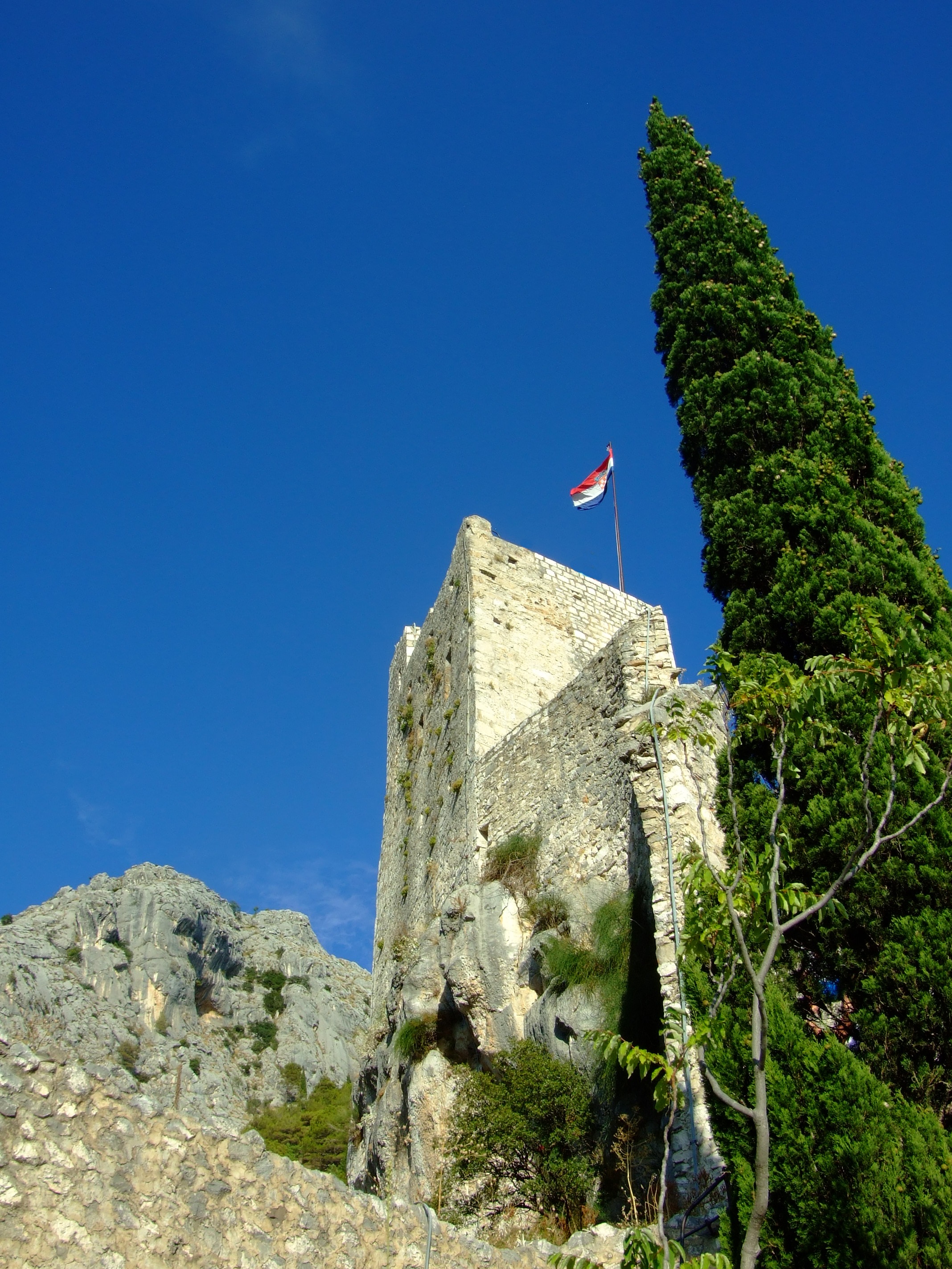
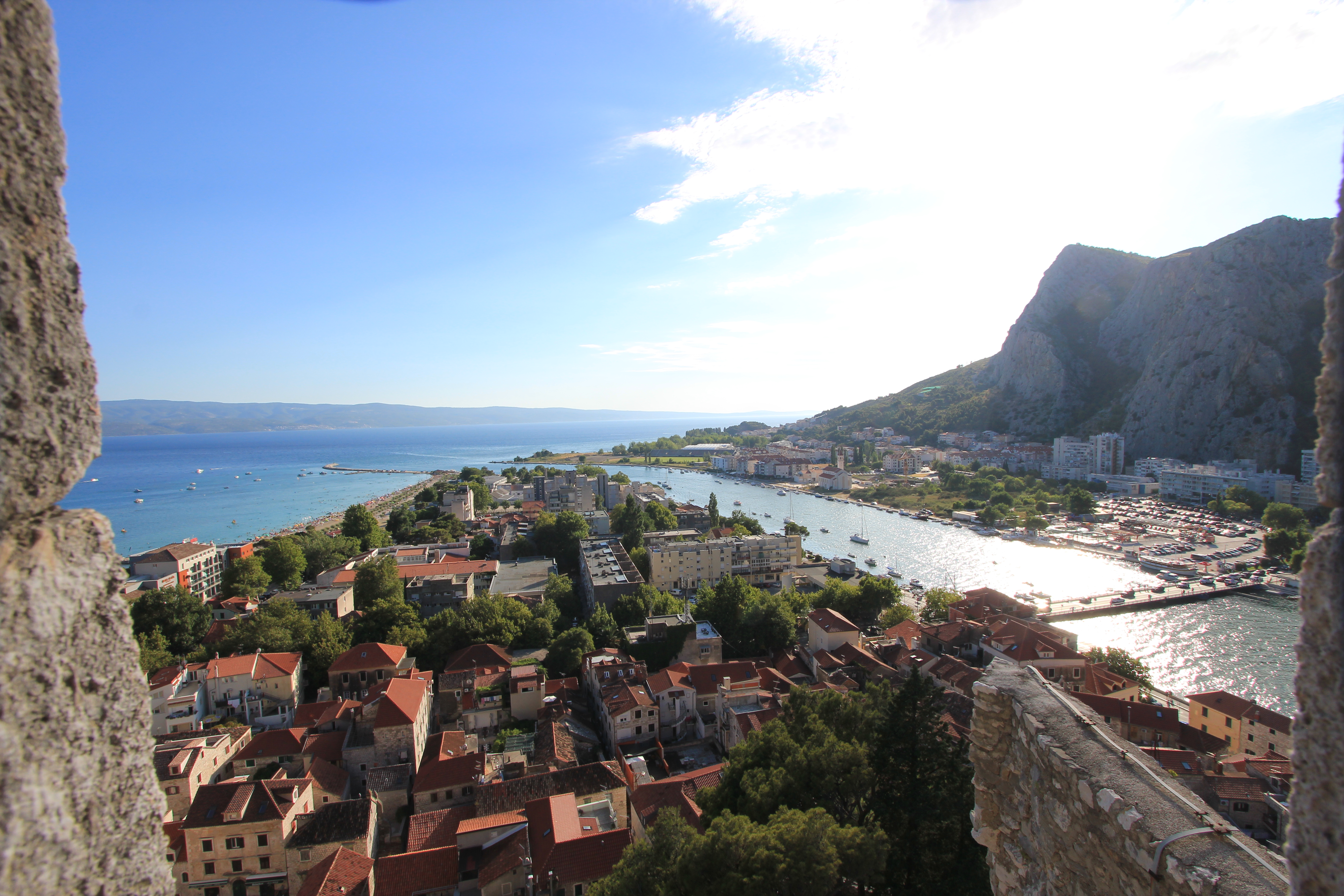
The Romanesque upper castle consists of four floors reached by an internal staircases with a final exit achieved by climbing a short ladder to the open top some 245m (804 ft) above the town. The castle tower you can see today is a comparatively recent restoration, albeit crafted in its original form with its original stones by the local population after it was destroyed by a lightning strike in 1988.
The view looking south-west from the upper levels of the Utvrda Peovica/Mirabela Fortress. To the right is the outflow of the Cetina River and the main road bridge. To the left is the 700m south-east facing stretch of sand called Velika Plaza (Big Beach).

As we were on a road trip vacation tour we only spent a couple of nights and one full day in the Omiš area.  The mid-summer heat was, to say the least, a limiting factor on our exploration of the town and wider region, but I don’t regret that we made the small effort to visit the Mila Gojsalić memorial statue and the Mirabela.  If I were to return with anyone who hadn’t seen these views I wouldn’t hesitate to take them there, and I think that, with more appropriate weather conditions, I would easily be able to spend a minimum of a couple more days exploring the area out on foot.

There is one final consideration that would almost certainly get me to spend a night in Omiš if travelling down the Dalmatian coast.  Its name is the Konoba Joskan.  On the night of our arrival in Omiš we quickly confirmed that many of the choices for eating out in the centre of the old town, and the vicinity of our accommodation, involved a ‘public dining’ experience.

The Konoba Joskan is located up an opening on the north side of Knezova Kačića, and if at first you manage to miss the entrance to this restaurant just keep looking (or asking) until you find it.  Previous vacation research and the idea of a small enclosed and more intimate konoba courtyard had already caught our attention, but we were unprepared for just how good this place would be.

Given that it was the height of the tourist season, we were lucky enough to be reasonably early and get a table in the courtyard (there’s also an inside air conditioned dining area), but that said, we noticed that the lovely staff bent over backwards to fit in later arrivals without a reservation.

The simple two-page menu suggested ‘fresh daily’ (which was confirmed when the day’s fish options were explained), and my wife and I both opted for a fillet steak with sliced fried potatoes and a shared tomato salad in oil and balsamic vinegar, with a couple of beers. It was the best meal we had eaten in Croatia to date.  In fact, it was so good that we went back the next night, after our sight-seeing tour, when we ordered exactly the same meal. It was just as good the second time round, and therefore qualified it as one of the two best meals we had in Croatia.

More online information.
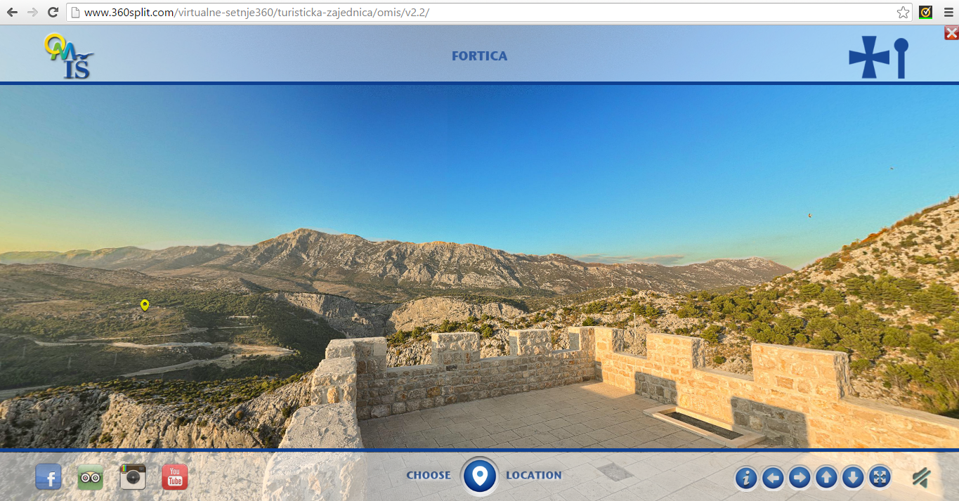
To get a first visual impression of the area from a number of different locations there is an excellent 360° interactive viewer on the Visit Omiš website (available in Croatian, Czech, English, German, Polish and Slovenian).

For the history of Poljica take a look at “The Principality of Poljica From its Medieval Inception to its Fall in 1807” by Edo Pivčević.

The history page from the village of Sitno website provides another brief introduction, as does cuvalo.net which adds a legal commentary and translation of the Poljica Statutes.

There’s also “Split and Poljica – relations through history” by Prof. Mate Kuvačić.  It is in Croatian, but Google translate works reasonably and is worth a read.

Later additions.

Take a look at these views from a beautiful January walk by BBQboy in January 2017.

Avoiding high season crowds in Dubrovnik’s Old City

At the risk of mixing popular memes…

How to beat the crowds in Dubrovnik
…but ONE DOES NOT SIMPLY HAVE TO ENDURE!

The word ‘spectacular’ is somehow insufficient when used to describe the Old City of Dubrovnik, and, in a country rich in ancient architectural splendour and blessed with abundant natural wonders, it is still unsurprising that it is the number one tourist destination in Croatia.  As reported online by CroatiaWeek “In the first 9 months of 2015 an impressive 822,542 tourists visited the famous walled city.  […]  On 2 October 2015 the city recorded its 3,000,000th overnight stay, hitting the number 20 days earlier than last year.”

Most visitors  arrive via international flights (nearly 85% of arrivals come directly from overseas airports rather than domestic Croatian airports), and on 7th August 2015 Dubrovnik airport welcomed it’s millionth traveller of the year (see EX-YU Aviation News, always an interesting source of information on air traffic in the region).

Smaller numbers of people arrive by car, primarily by heading south through Croatia along the Jadranska Magistrala (D8, the Adriatic Highway), and also on national and international ferries to Dubrovnik’s port of Gruž.

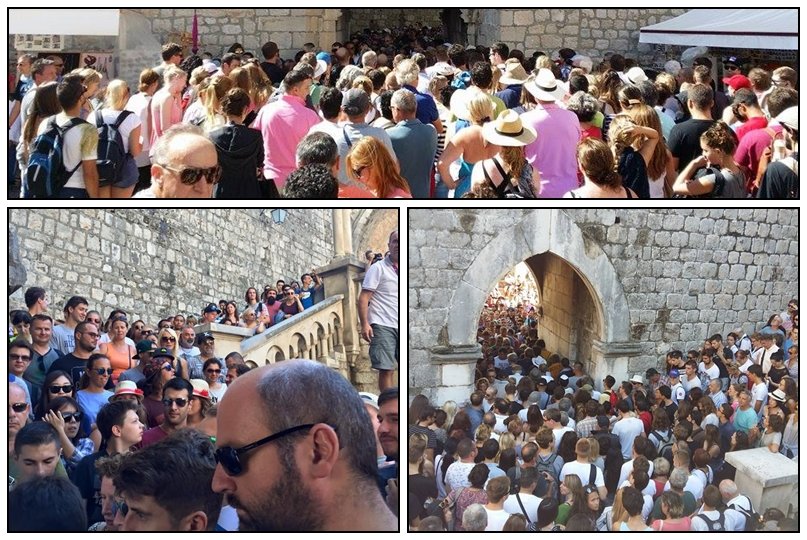
A third group of tourists arrive by cruise ship, and their sudden mass influx can cause considerable congestion.  On the 17 August 2015 pedestrian crowded at the entrances into Dubrovnik’s Old City looked like this:

Dubrovnik crowds at the summer season peak
Source: Dubrovački dnevnik. If you follow the link you’ll find more images and a video, but I think you get the idea.

That’s a lot of people to share your experience of Dubrovnik with, but there are a couple of things you can do if you’re not a fan of crowds.

Firstly, you could just avoid visiting in July and August.  This is the peak of the tourist season which runs from  March until the start of November (although the City Council are trying to promote year-round tourism through such as their Project Winter).

However, for many people, especially those tied to school summers breaks, this is, of course, not possible, and in any case, you might want to be in the city for the annual Dubrovnik Summer Festival which runs from mid-July to nearly the end of August.

The second action to take in order to avoid high season crowds is to plan ahead carefully. Read up on what you really want to see the most,  because there’s plenty of choice in the Old City. There are some links at the bottom of this post to the better online resources I found for Dubrovnik when planning last summer’s vacation in Croatia.

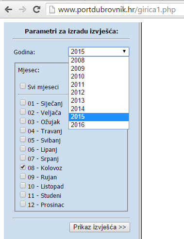
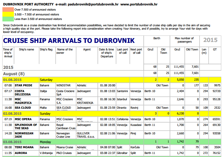
Assuming you still want to visit the Old City during high season, one of the best tools for planning the timing of your visit is provided free of charge by the Dubrovnik Port Authority, which you can access here.

All you have to do is select the year and the month of your visit…

Select_year_and_month_of_visit

…click on “Prikaz izvejšća”, and details of all the cruise ships scheduled in port that month will be revealed (in English).

Scheduled_ cruise_ship_arrival_in_Dubrovnik

The listing is colour-coded for quick reference identification of days when cruise ship visitor numbers are expected to be especially high (red), average (yellow) or lighter than usual (green).  However, if you’re fixed to specific dates it also tells you the hour the ships dock and the time when they depart. From this information you can make a judgement about when will be the best times to avoid the city gates, busier thoroughfares and the walls, as well as when restaurants are likely to be most crowded during the day.

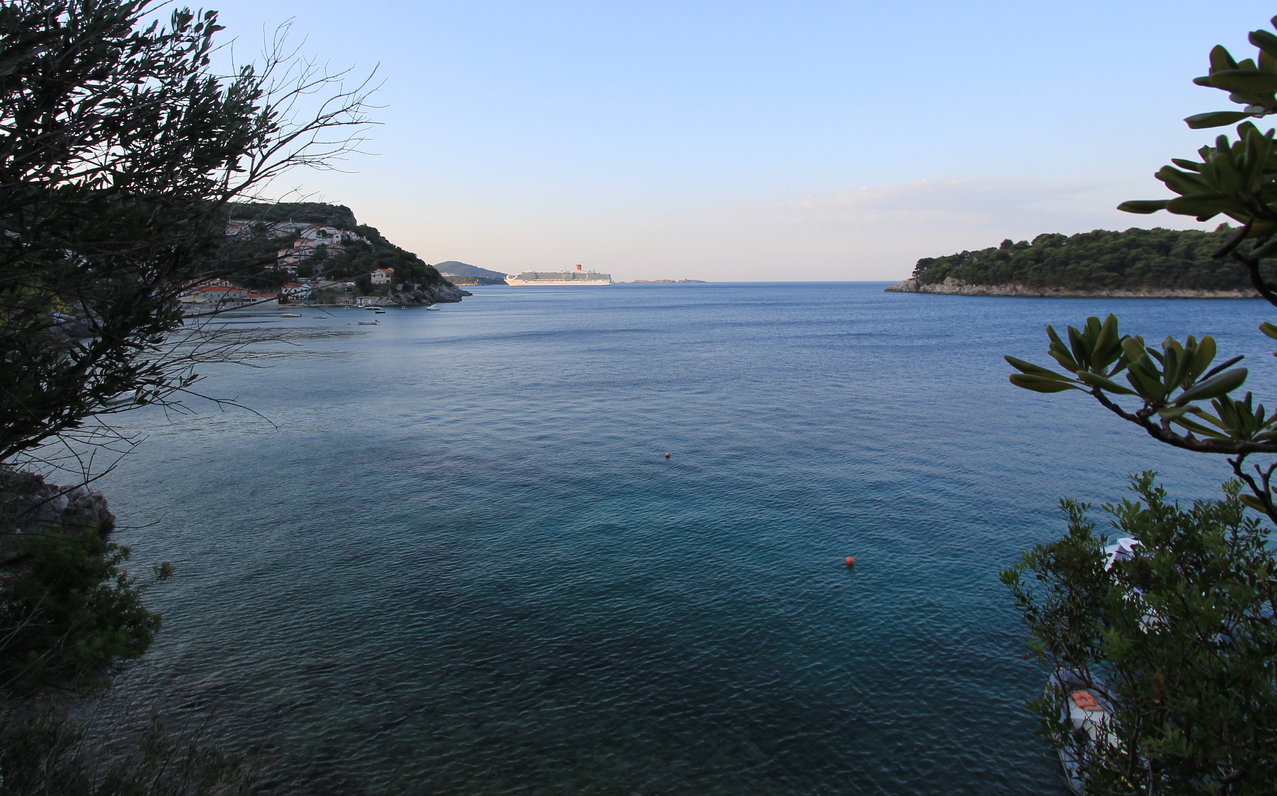
The Costa Deliziosa viewed from Štikovica
The view from Štikovica as the Costa Deliziosa approaches Dubrovnik’s Gruž port at 06:31 AM. Time to… relax and have a coffee before driving down to the Old City.

Keep in mind that whilst the Port Authority has now limited the number of cruise liners able to visit each day, that also means that there is more than enough space for docking at Gruž rather than anchoring off-shore and having to make a more time-consuming transfer to land.  Rapidly disembarking passengers are only a 10 minute courtesy coach/public bus/taxi journey from the Old City.

Most cruise ship passengers will arrive at Pile Gate (it’s generally just the smaller cruise vessels that anchor in front of the Old City harbour, which means passengers are usually counted in tens or the low hundreds rather than by the thousand, and the Ploče Gate is therefore potentially quieter), so it makes sense to know in advance when the throng will be greatest here.

The following set of images demonstrate that it is possible to avoid the worst of the high season’s crowds; they were all taken before 08:00 AM on Saturday 1st August 2015.

We parked in the shade of the reasonably priced underground car park at Ulica Baltazara Bogišić (much less expensive than around the Old City walls and plenty of spaces) and walked the 450m down Zagrebačka ul. to Ul. Srednji Kono where we crossed to Ul. Iza Grada.

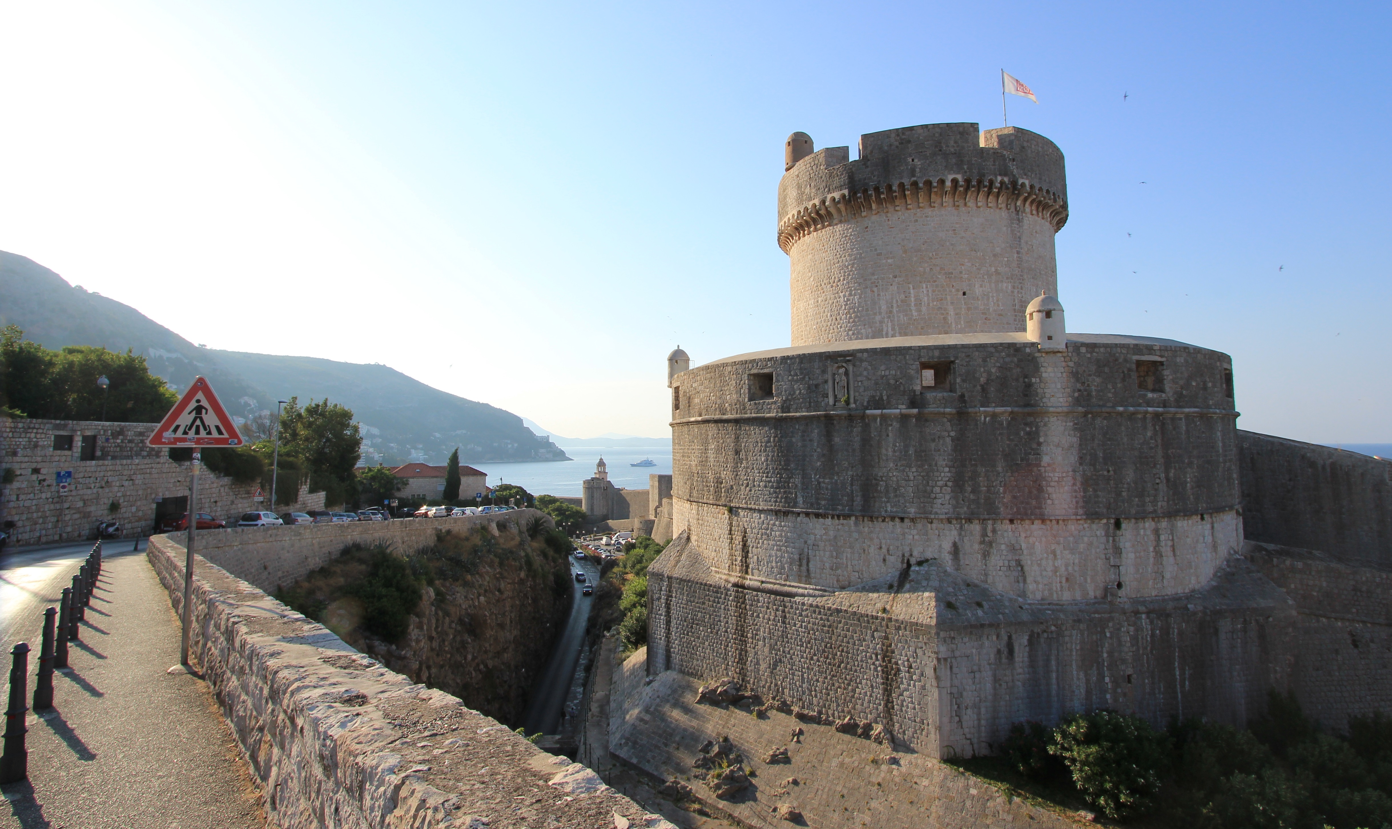
Minčeta Tower, Dubrovnik Old City Walls
Taking in the view of the Minčeta Tower at the top of the northern ramparts from Ul. Iza Grada

From here we continued to stroll a further 500m downhill, past Buža Gate, and round Revelin Fort to the Ploče Gates.

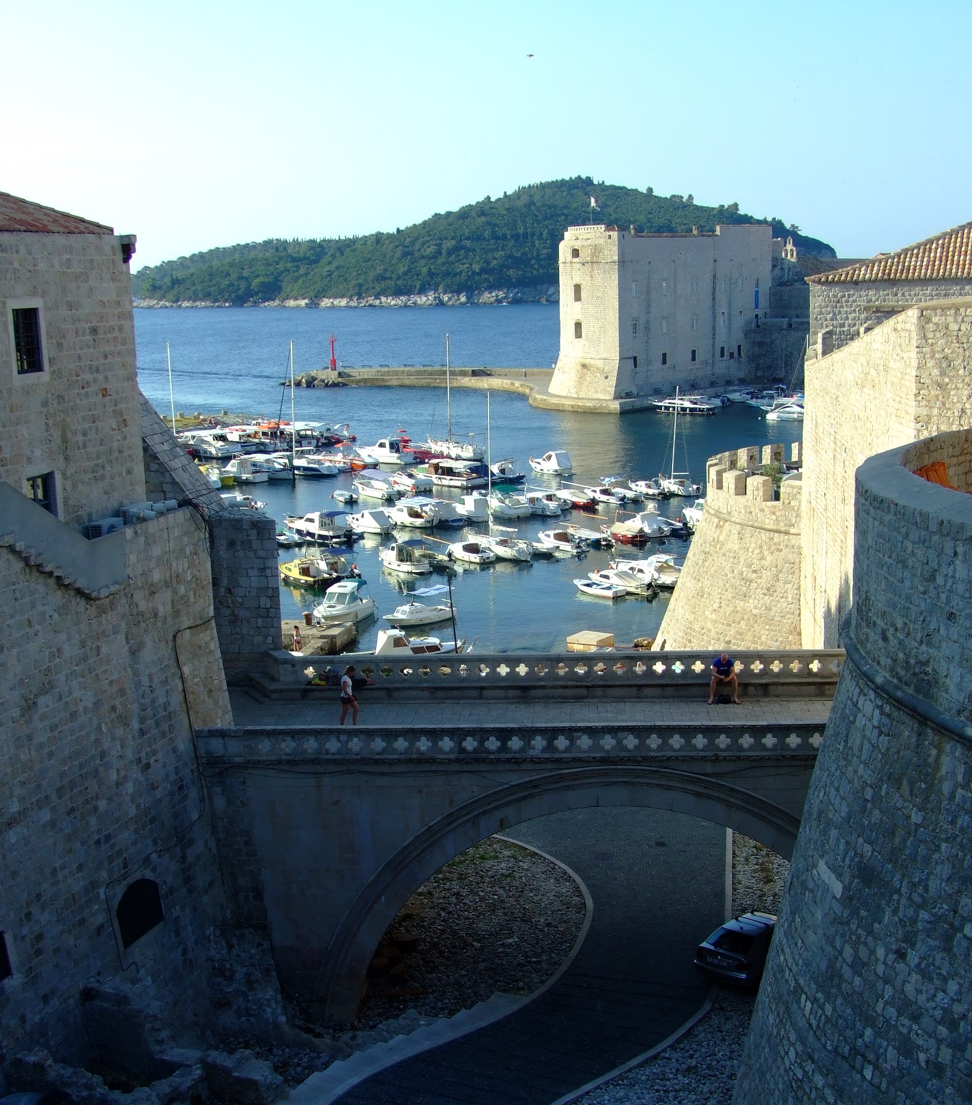
Ploče gates stone bridge Dubrovnik
View of the stone bridge between the Ploče gates and beyond to the Old City harbour and St. John’s Fort.
About 07:30 AM in Dubrovnik
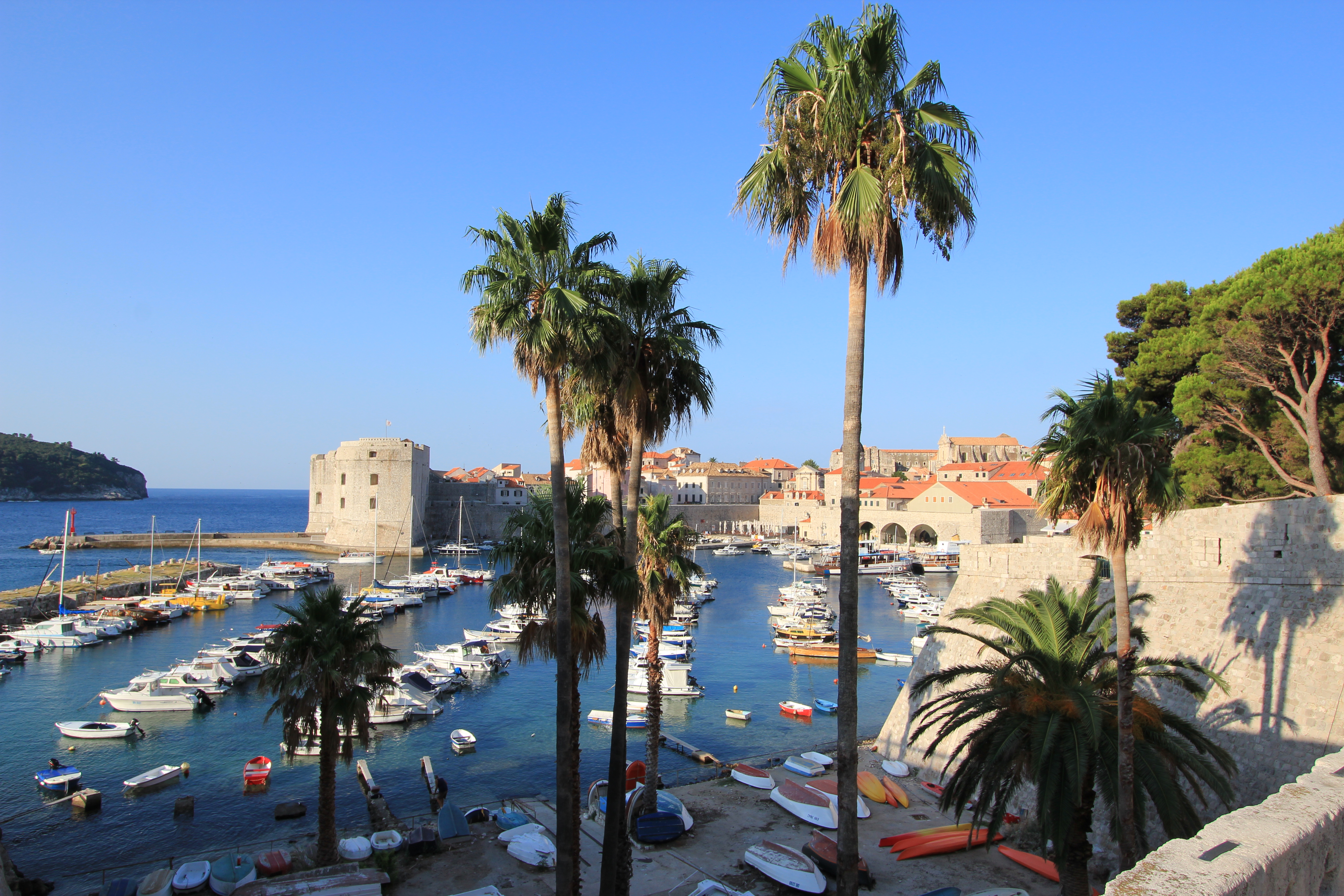
The Old City Harbour from the Revelin Fort moat bridge just before the outer gate at Ploče.
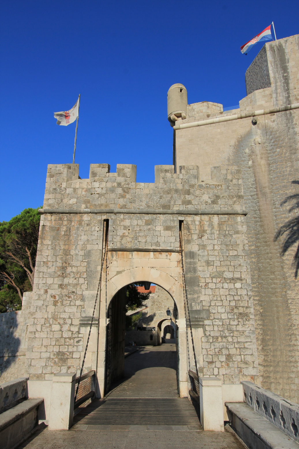
The national flag of Croatia and the Libertas flag of Dubrovnik fly in the morning sun at Ploče Gate
The outer gate at Ploče where a drawbridge was once located.
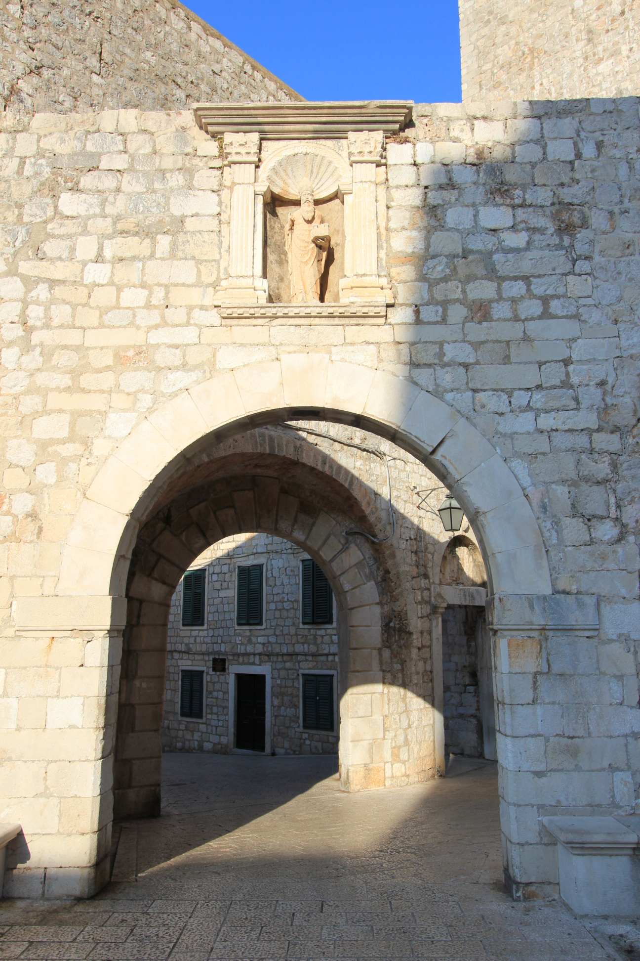
St. Blaise (Sv. Vlaho) looks down over the inner Ploče gate.
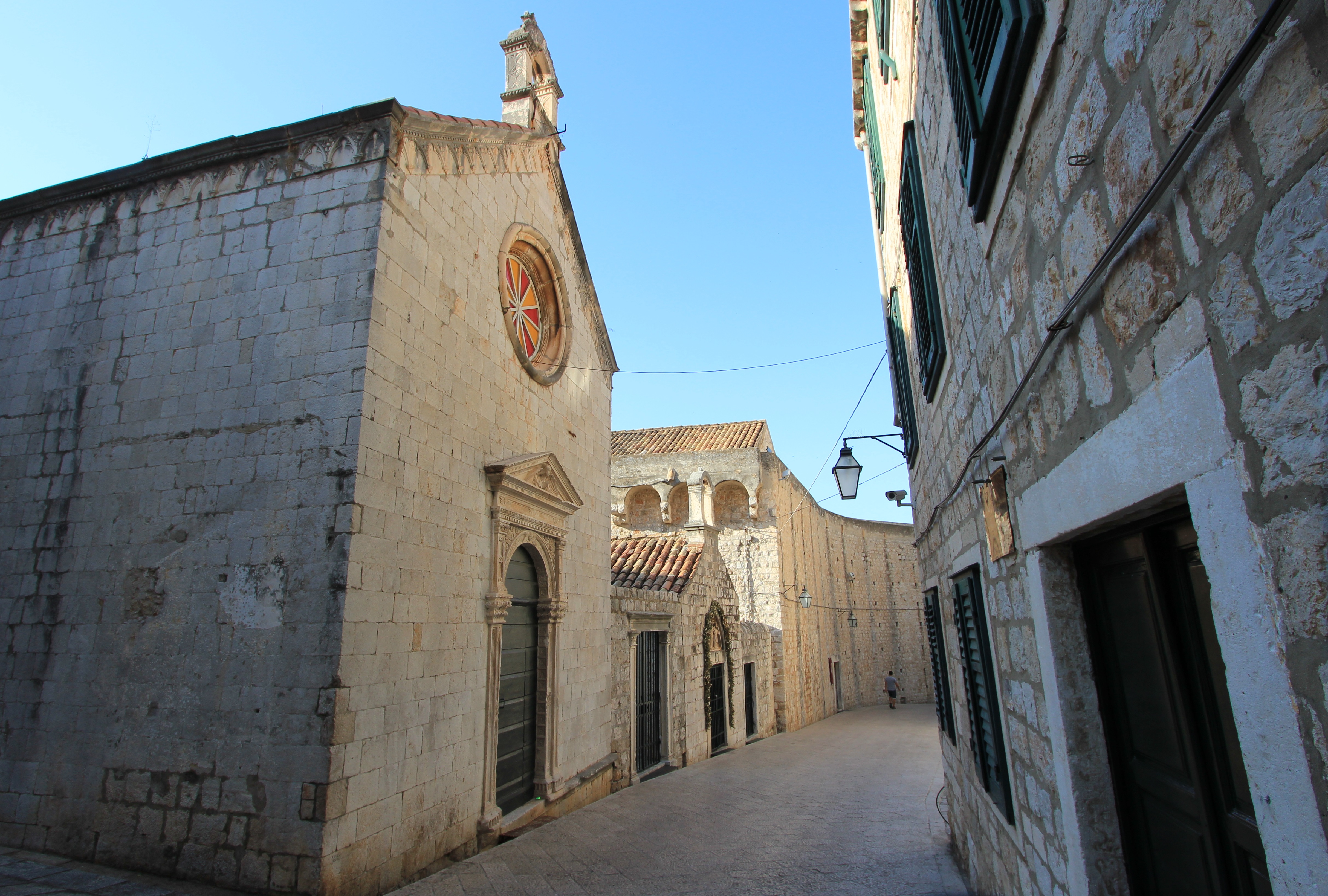
Into the Old City of Dubrovnik. The Chapels of Announcement and of St. Luke on Ul. Svetog Dominika.
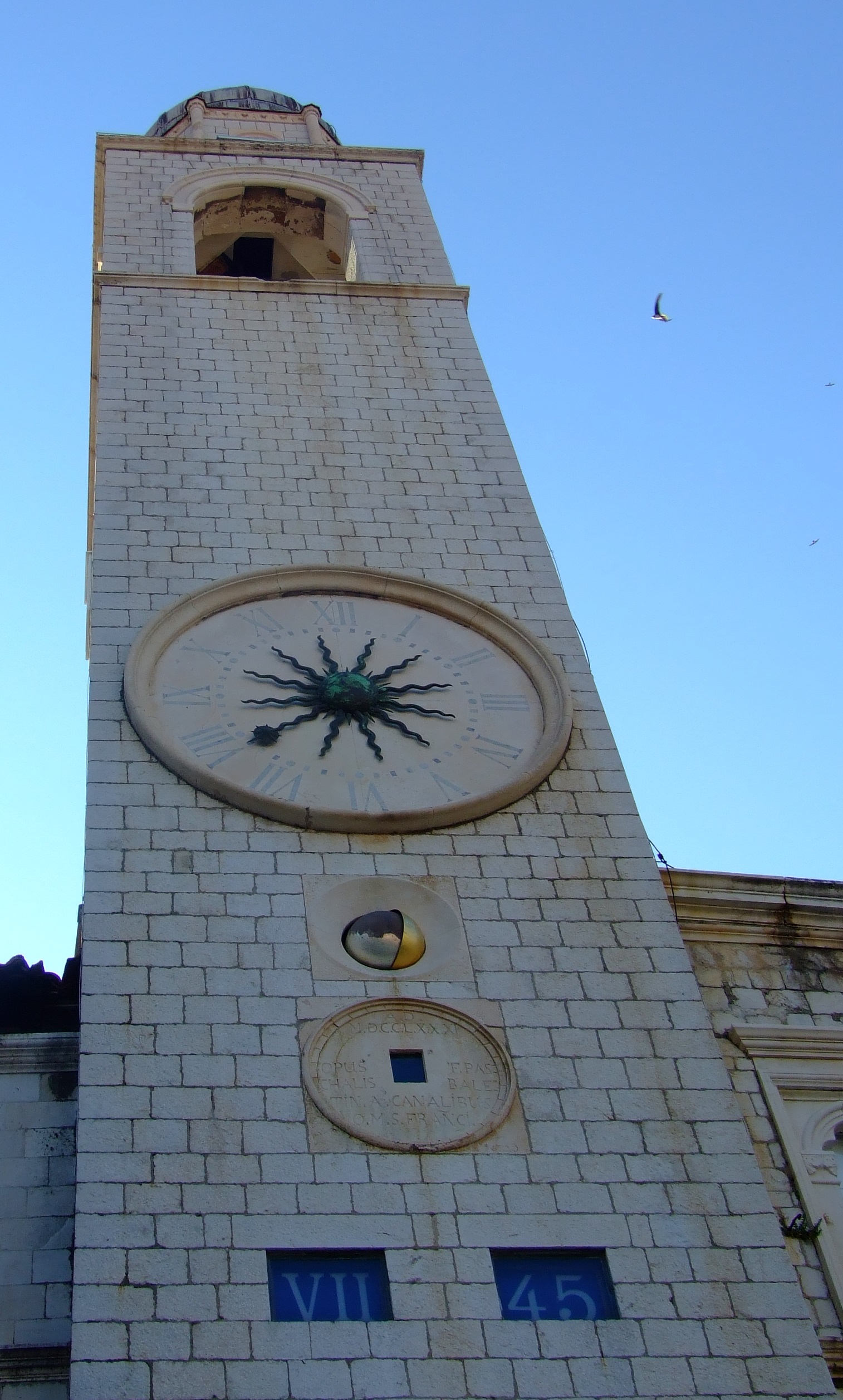
Dubrovnik Old City Clock Tower at 07:45 AM
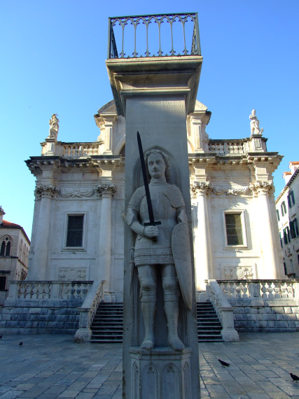
The Orlando statue and column in front of St. Blaise's Church (Crkva Sv. Vlaho).
The Orlando statue and column in front of St. Blaise’s Church (Crkva Sv. Vlaho).
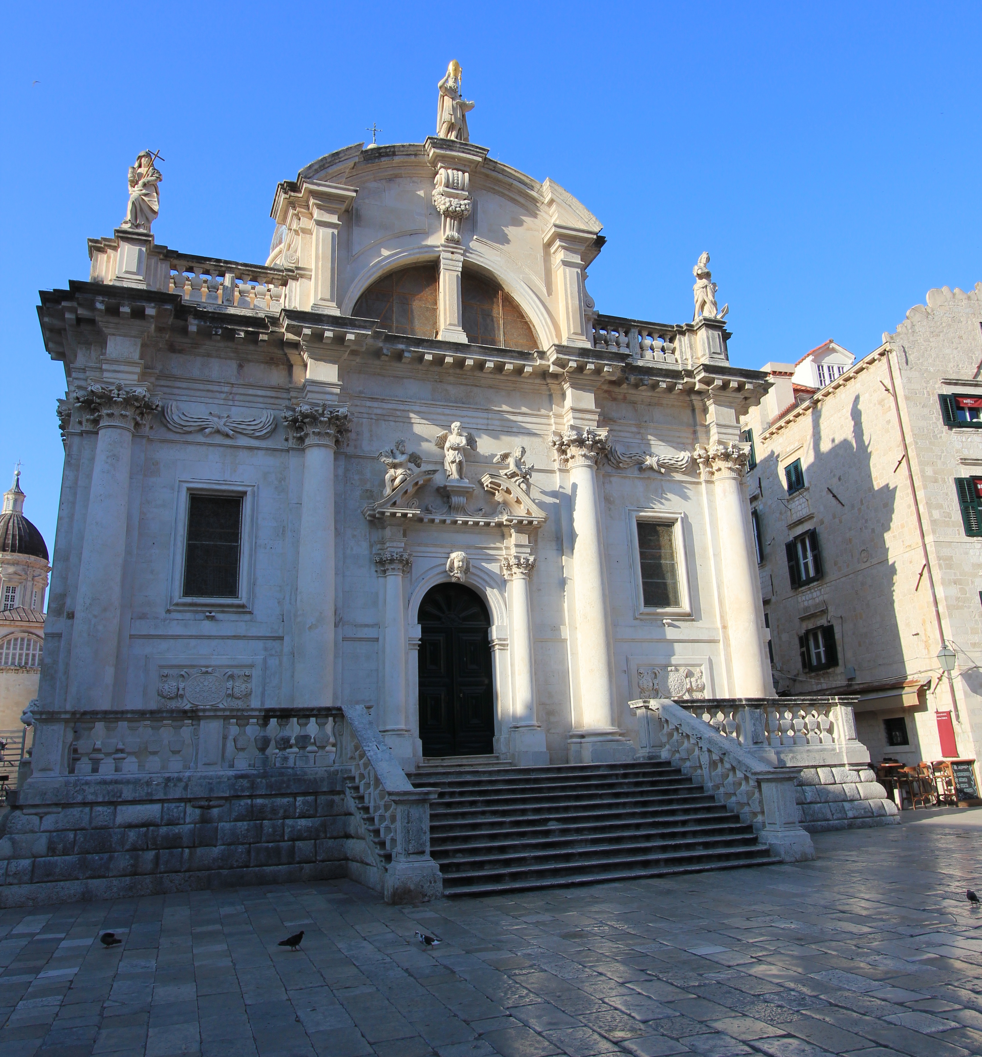
St. Blaise's Church (Crkva Sv. Vlaha)
St. Blaise’s Church (Crkva Sv. Vlaha)
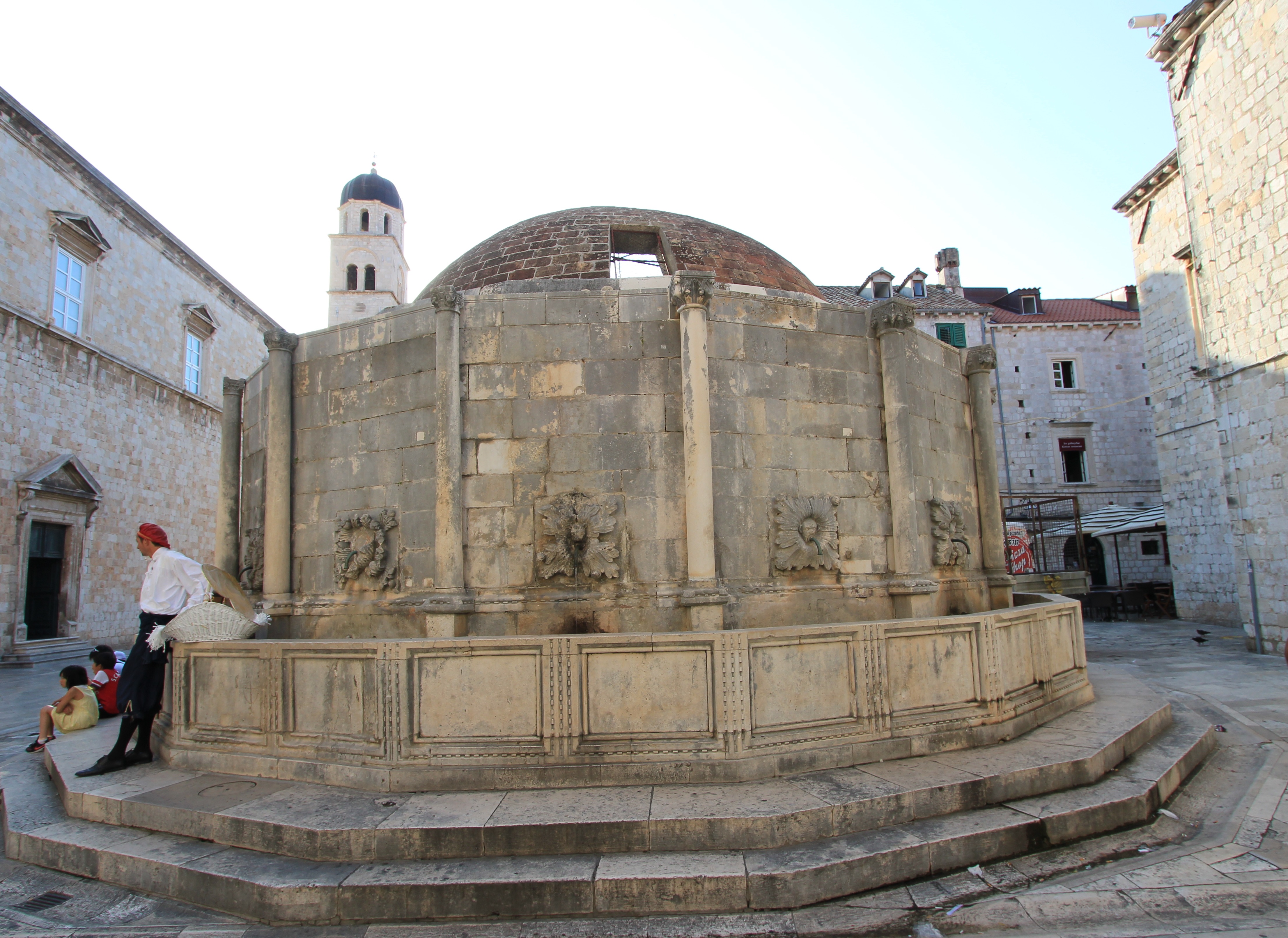
Big Onofrio's Fountain (Velika Onofrijeva Fontana)
Big Onofrio’s Fountain (Velika Onofrijeva Fontana)

If you plan to walk the approximately 2km (1.24 miles) length of Dubrovnik’s city walls – and, if you’re physically able to do so, you really should – a little consideration of timing can also pay dividends. In the heat of the summer going as early as possible (or later in the afternoon) will make for a much more comfortable experience (there’s a reason why paramedics sit in the shade at strategic locations along the route), and once again, an early start can beat the worst of the crowds.

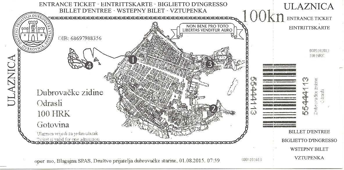
If you choose the early start option there are three entrance points to the main city walls, as can be seen on the ticket below.

Dubrovnik_city_walls_ticket

Most people will scale the heights from the entrance just inside Pile Gate (#1 above), so you might be tempted to enter at the St. John’s Fort  entrance (#2) or the St. Luke’s Fort entrance (#3).  However, this of course means that whatever your pace, you’ll eventually catch up with an increasingly packed congregation of fellow sightseers.

For high season entry I’d recommend starting along the prescribed anticlockwise route at the Pile Gate when it opens (there are different opening times at different times in the year)… and not standing in the queue that will form by the gated entrance steps. You’ll need a ticket to get in (keep it safe and handy as they do occasionally check as you pass other entrances), and these are purchased from a separate office set into the wall just to the left of the Pile Gate exit.   Being at the front of this queue might save you an extra couple of seconds!

Once again, it is possible to avoid high season crowds, even in the middle of summer.  These pictures were all taken before 09:05 AM:

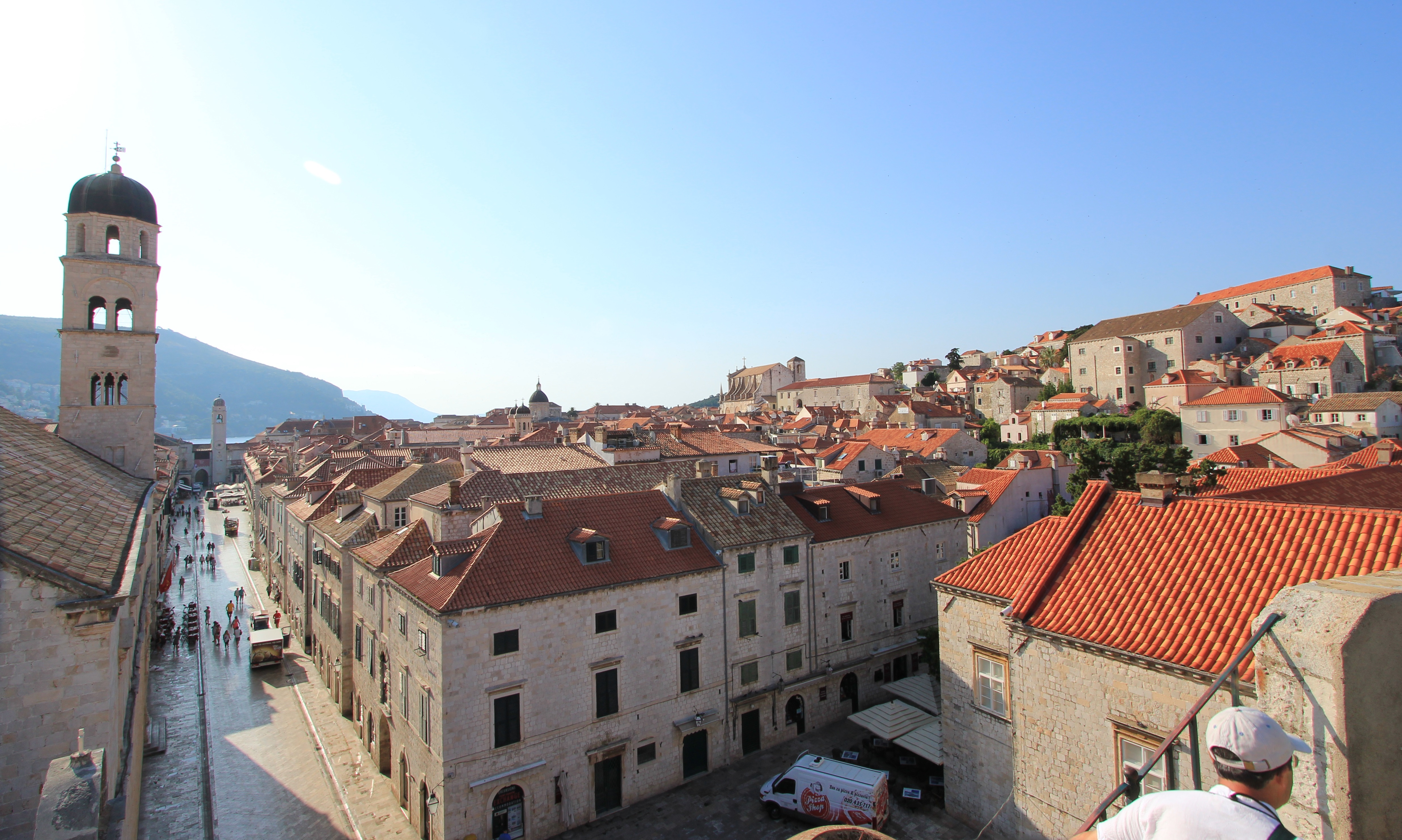
A view down Stradun from the top of the steps up to the Walls near Pile Gate
Dubrovnik Walls in August
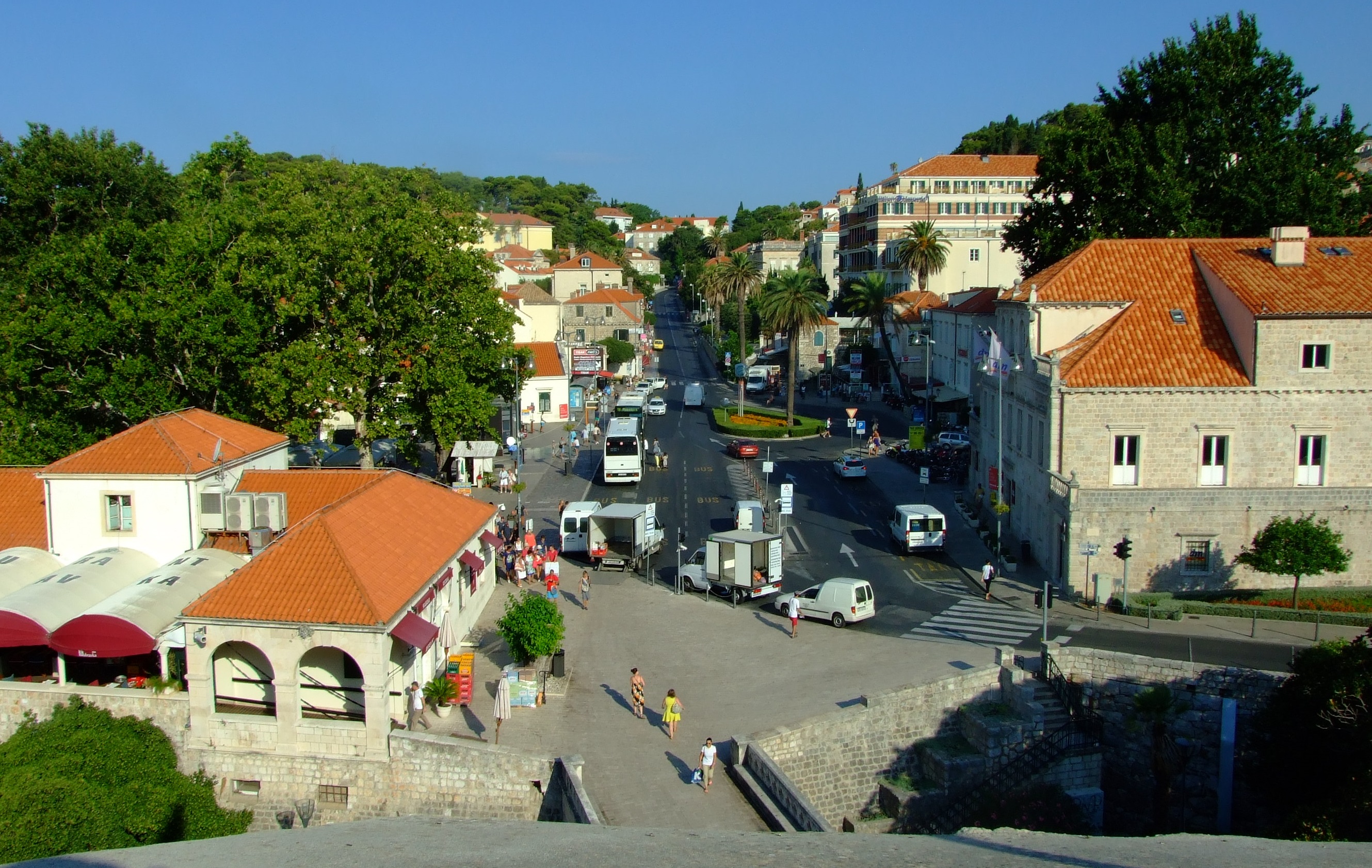
The view looking out from the walls above Pile Gate before the crowds arrive
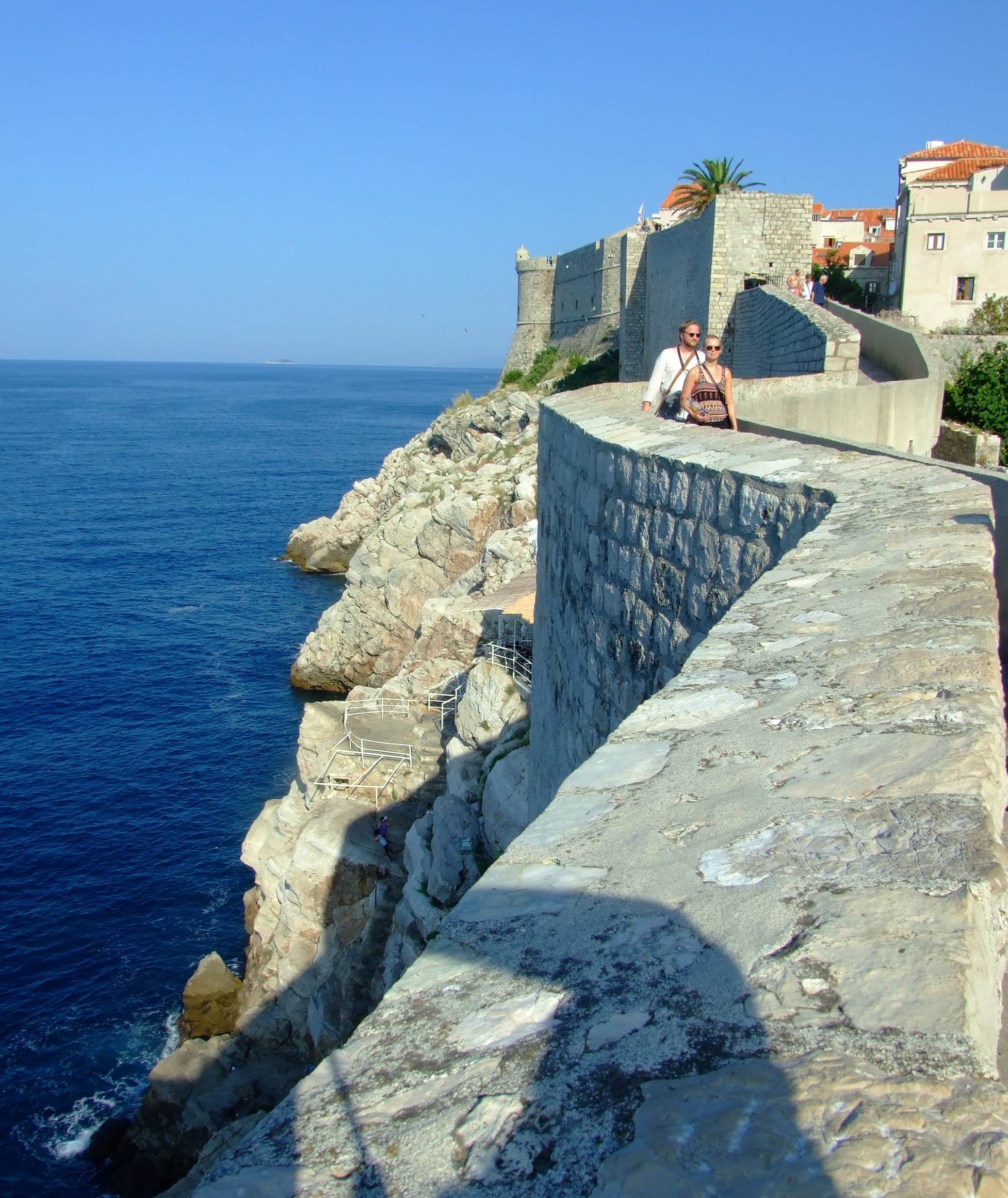
Looking back along the southern seaward walls of Dubrovnik
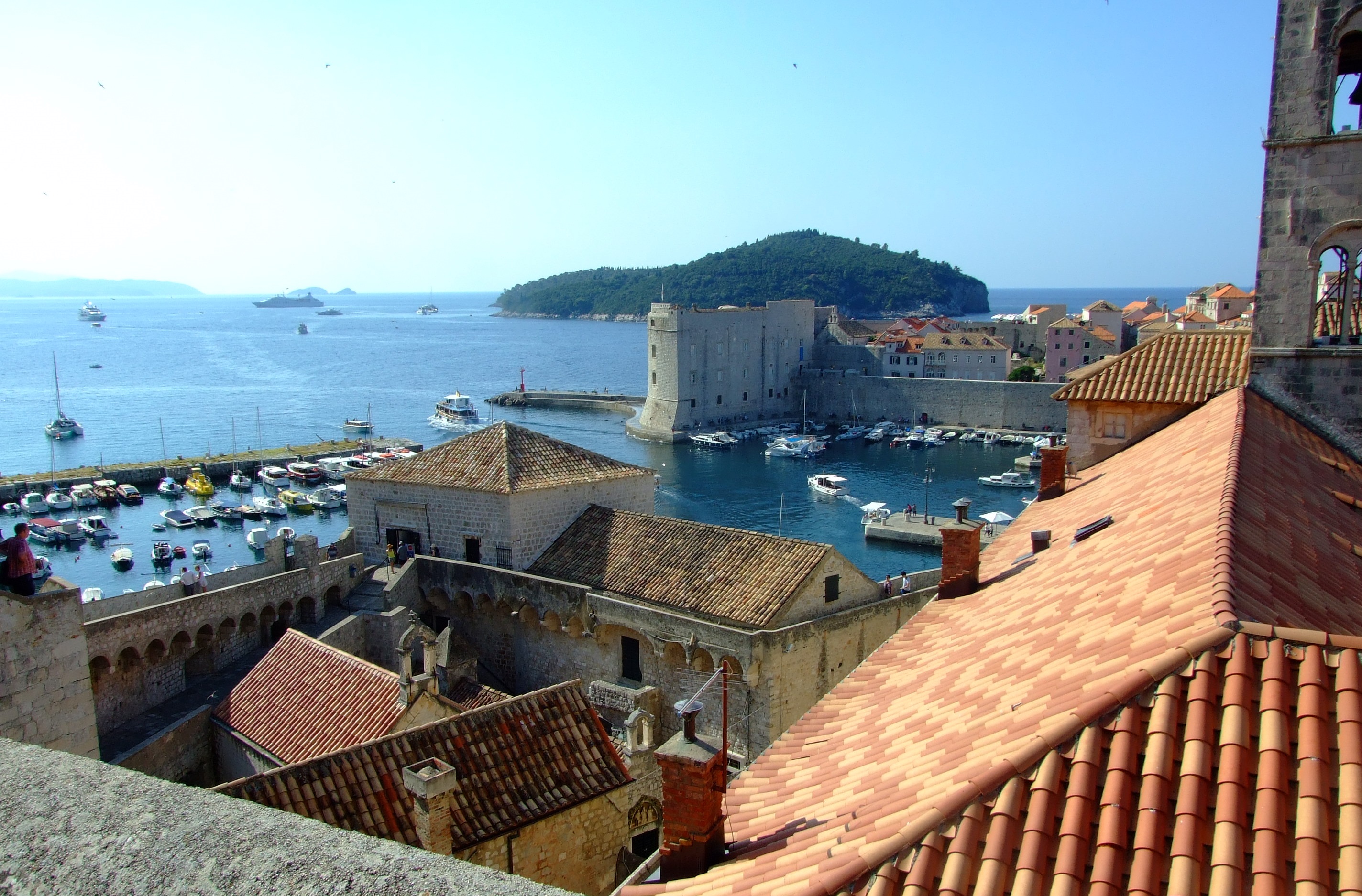
A view from the north walls over St Luke's Gate in the east, and beyond to the Old City harbour, St. John's fort and Lokrum island. Note the Star Pride just below the horizon carrying a scheduled 177 cruise passengers.
A view from the north walls over St Luke’s Gate in the east, and beyond to the Old City harbour, St. John’s fort and Lokrum island. Note the Star Pride just below the horizon carrying a scheduled 177 cruise passengers.

As for the rest of the Old City’s main attractions, it’s going to be pretty difficult to avoid rubbing shoulders with fellow visitors in the high season, particularly during overlapping cruise ship landings.

Side streets away from Stradun (Placa), Ul.Pred Dvorum and the Old City harbour may offer a modicum of respite, but otherwise a)  be patient, and accepting of the fact that there’s a good reason why so many people want to visit this place, and b) have your midday escape options planned.

More online information.

Dubrovnikcity.com – includes an interactive map with icons linking to text pages describing many of the city’s main attractions

Dubrovnik Tourist Board – opening times and ticket prices for the Old City walls plus brief page notes on the forts and other main sites of interest.

Dubrovnik-travel.net – a clear map of the old city making the marked main attractions easy to find.  Beneath the map are links to expandable pages on each of the main attractions.  Hunting around this website also reveals more historical background pages.

Recommended accommodation.

Try the relaxing studios at More Beach House in Štikovica on Zaton Bay.


Stećci in Dalmatia

Lovreć

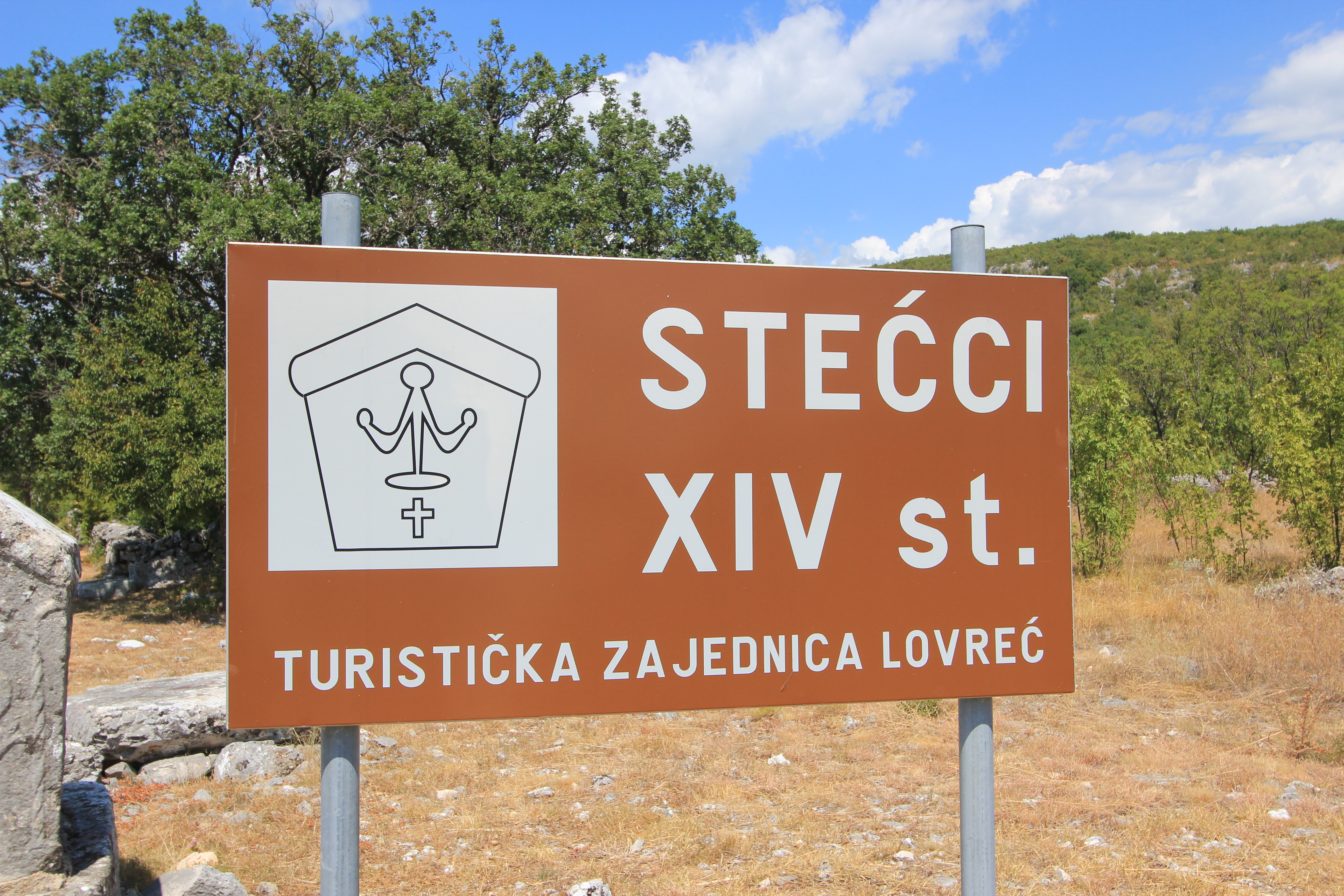
We came across our first Stećci on a baking day in late July when it was almost 40°C (around 100°F), and we’d retreated to the car to enjoy the Dalmatian landscape with the benefit of air-conditioning.  Travelling back from Imotski to Omiš on the D60, we were about 4km (2.5 miles) from Lovreć when we noticed a sign to our right announcing these 14th century monuments.

Ancient monuments Croatia
The Lovreć Stećci can be found alongside the D60 road at 43°28’22″N, 17°01’48″E

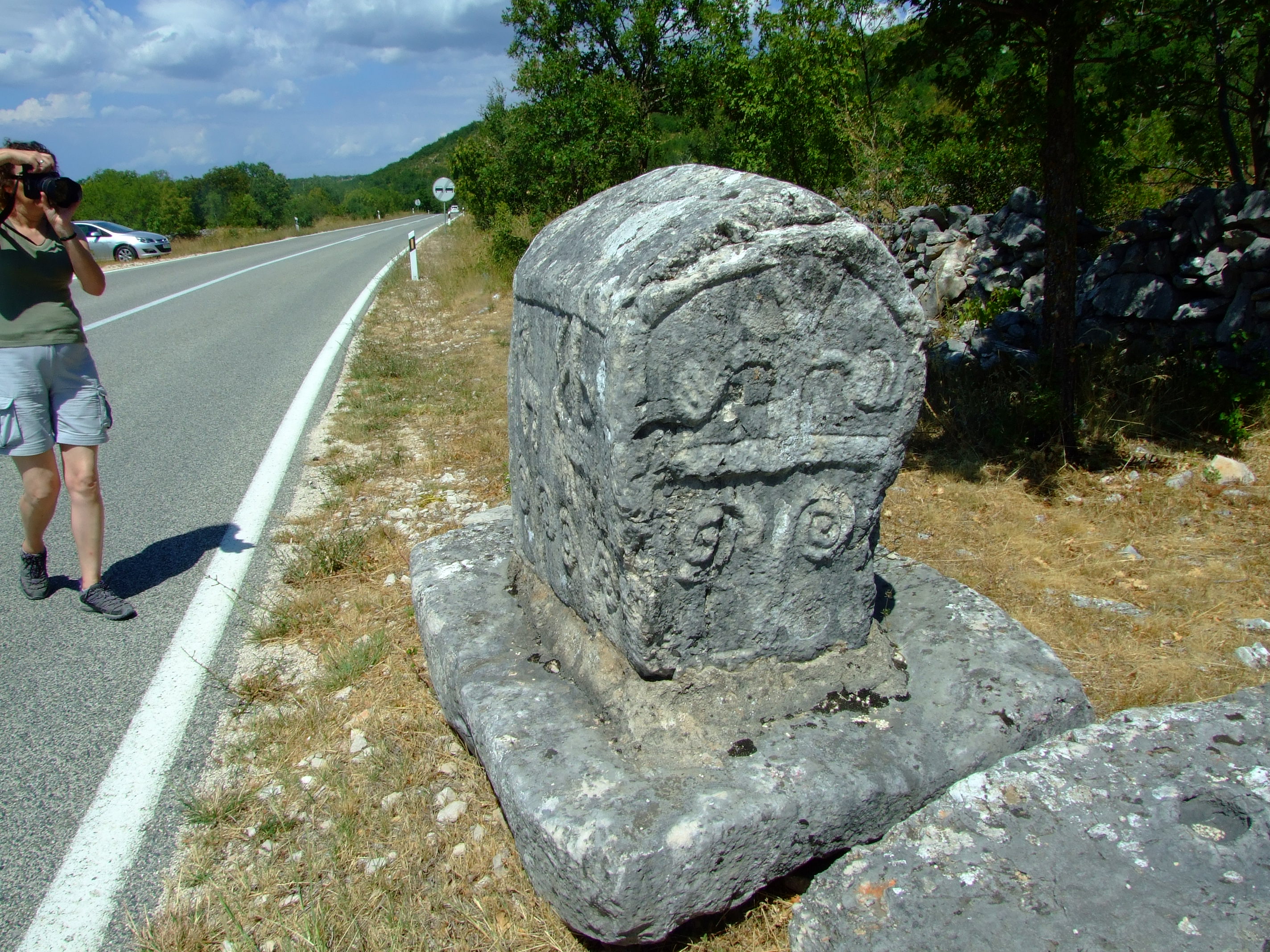
There is no formal parking here, and although fairly quiet this is a fast road, so we reversed onto a piece of hard standing on the opposite side (note the silver car in the image below). As is often surprisingly possible in Croatia, we had the site to ourselves, but what were we looking at?

Unique cultural monuments in Croatia
A Lovreć Stećak – “the standing thing” – with free open access to the public at the time of writing

Stećci is the plural for a Stećak.  They are elaborately sculpted tombstones created between the 12th and 15th centuries, which can only be found in the Balkan countries that claim parts of the former territory of the medieval Bosnian Kingdom.

The medieval Bosnian Kingdom [Source: Optimus Pryme (Own work) [CC BY-SA 3.0 (http://creativecommons.org/licenses/by-sa/3.0)], via Wikimedia Commons]
Today that means that most Stećci (c.60,000) are found in Bosnia-Herzegovina, but where modern borders now extend across the ancient boundaries it is also possible to find Stećci in Croatia (c.4,400), Montenegro (c.3,500) and Serbia (c.4,100). [Note that these figures are derived from UNESCO, and that the given numbers of Stećci outside Bosnia-Herzegovina don’t appear to match the stated total of 10,000.]

They are often engraved with epitaphs in the Bosnian Cyrillic text of the Bosnian Church from the period, and decorated with a variety of motifs that renowned scholar and campaigner Marian Wenzel has firmly identified as being part of a wider Bosnian tradition of artistic accomplishment. “Her work deciphering inscriptions on the tombstones demolished the myth that they were raised by adherents of the allegedly Bogomil Bosnian Church and she demonstrated conclusively that the Stećci were one aspect of a fashion followed by Catholic, Orthodox and Bosnian Church followers alike.” wrote one of her obituarists.

Despite the sometimes frayed relationships between the four countries in which Stećci can be found, in 2009 Bosnia-Herzegovina, Croatia, Montenegro and Serbia jointly nominated them to the UN World Heritage List as a shared cultural heritage.

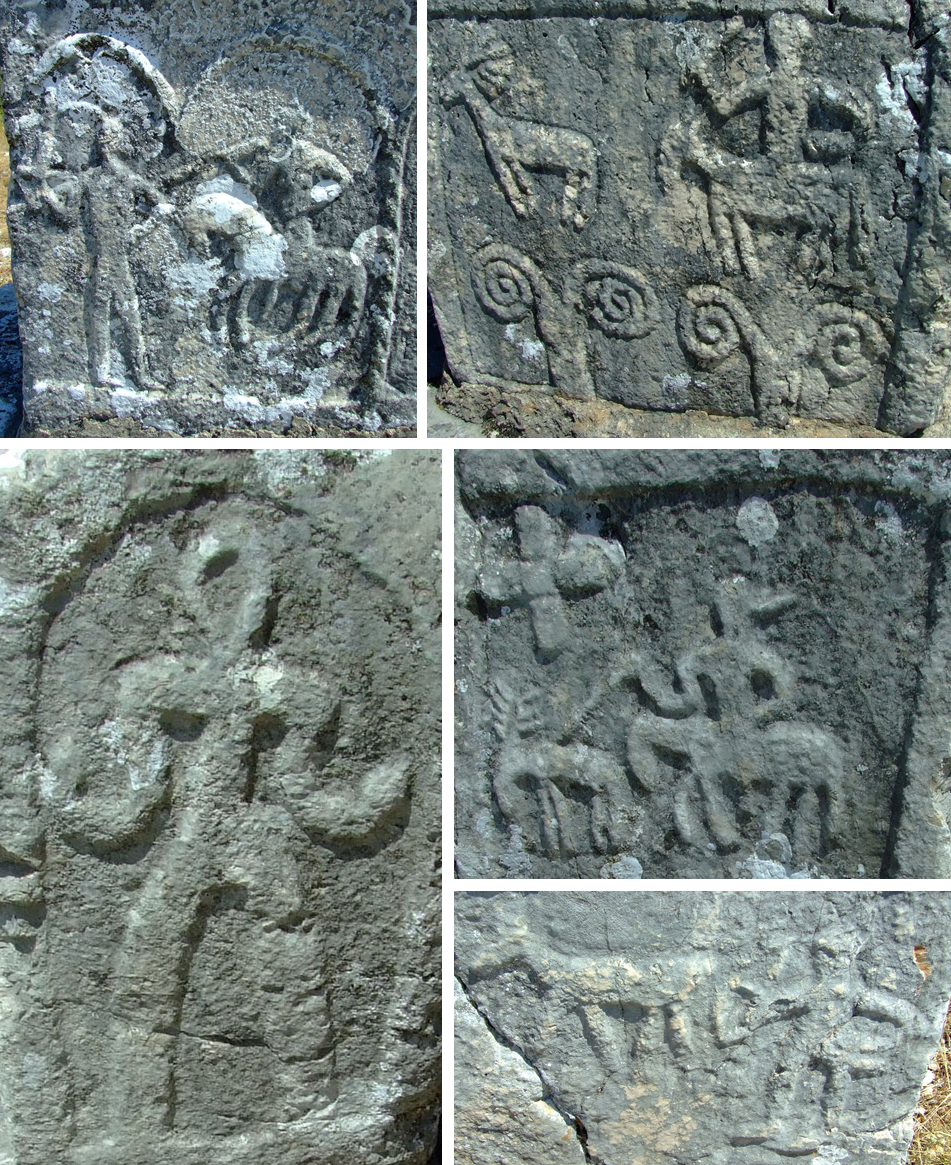
There are two Stećci necropolises in Lovreć municipality.  The one we visited is called Kamenjak, and comprises 13 ridge topped tombstones (or “sljemenjak”  in reference to the distinctive ‘gabled’ design), 14 chests and 2 plates.  The carvings are mostly quite distinct, even after so many years of exposure to the elements, with religious/symbolic single and double spiral motifs, and scenes from everyday life, most strikingly of deer hunting and horseback pursuit, and possibly human conflict.

C.14th Stećci motifis at Lovreć, Croatia
Human figures on the Lovreć Stećci

As an insight into a unique regional, historical cultural phenomena, the Lovreć Stećci are well worth stopping for before time, traffic pollution and neglect diminish the opportunity.  Inspired by our first experience of these funeral monuments, we went searching for more Stećci a few days later.

Brotnice

Whilst staying near Dubrovnik we took a drive down to Konavle municipality, and heading left off the main highway (D8, the Jadranska Magistrala), turned up into the hills approaching the mountainous border with Bosnia-Herzegovina.  Only a few minutes away from the coastal tourist strip of Župa Dubrovacka and Cavtat, the comparative isolation of this area belies the fact that you are travelling in one of the wealthiest regions of present day Croatia.  The rugged landscape reveals pockets of agriculturally based old wealth, and has a fascinating history that includes Roman settlement and attempts to hold back the Ottoman empire, (but we’ll save that for a future post).  On our day out we went to find the Brotnice Stećci.

Hunting Stećci near Brotnice
The road to Brotnice, Konavle, Croatia

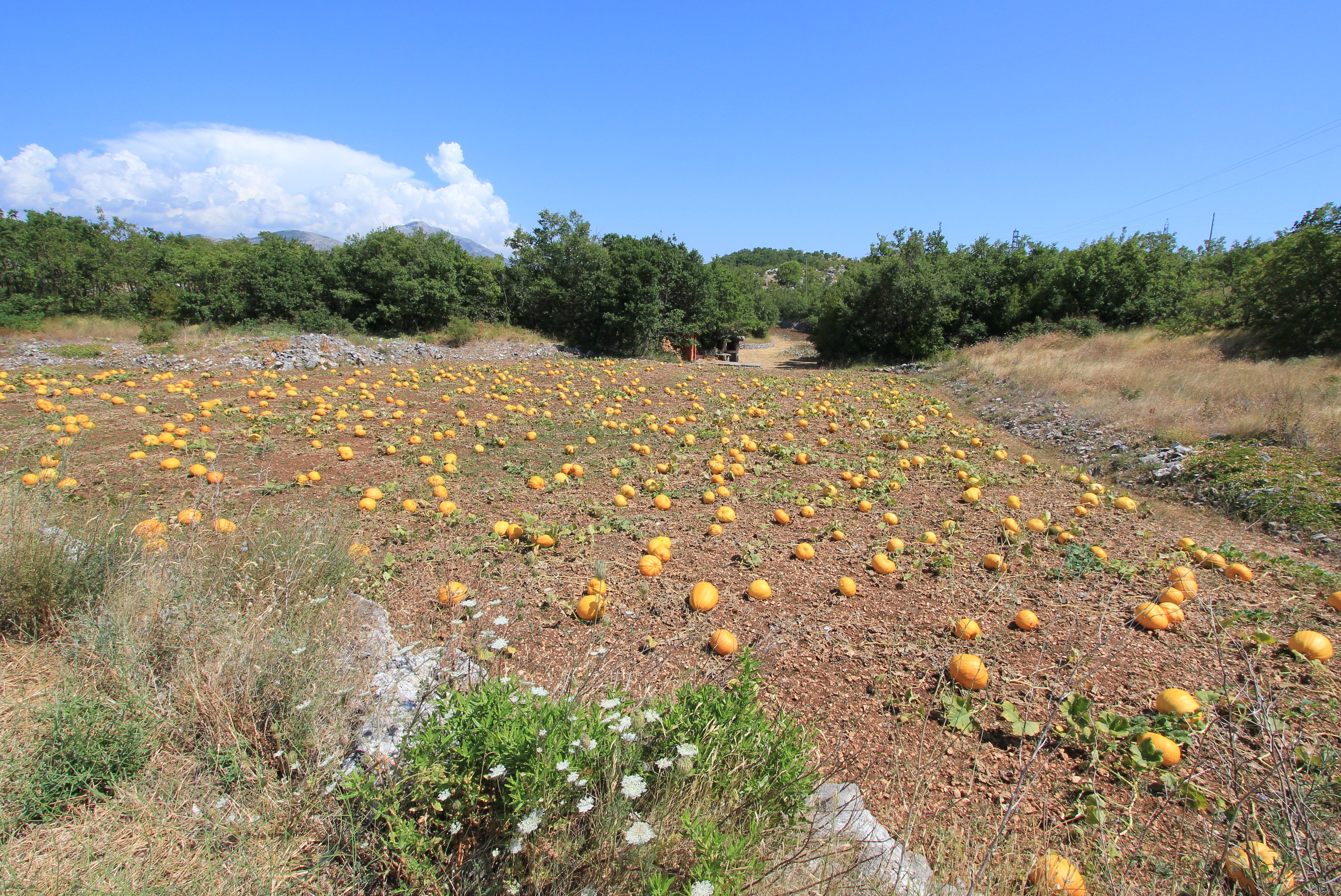
As you can see above, the road is well surfaced. Many of Croatia’s roads are excellent, and here we drove along newly asphalted sections and the parked road laying machinery that was extending the metalled surface inland, almost reaching our destination. The winding route led us past fields of pumpkins and groves of olives, but meeting any other traffic was an almost non-existent event.

Pumpkin fields near Brotnice, Konavle, Croatia
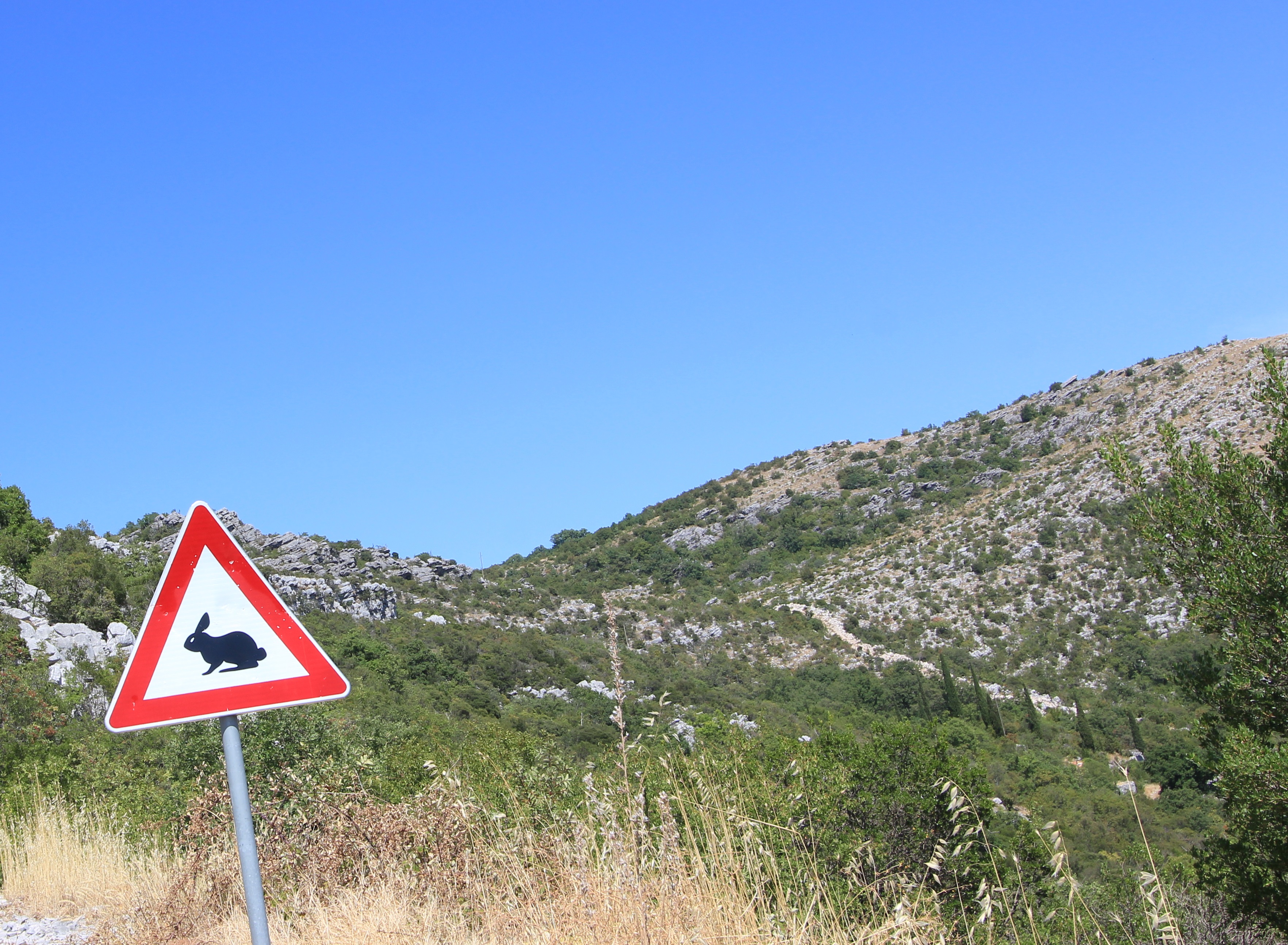
Beware of Killer Rabbits and huge blue skies near Brotnice, Konavle, Croatia

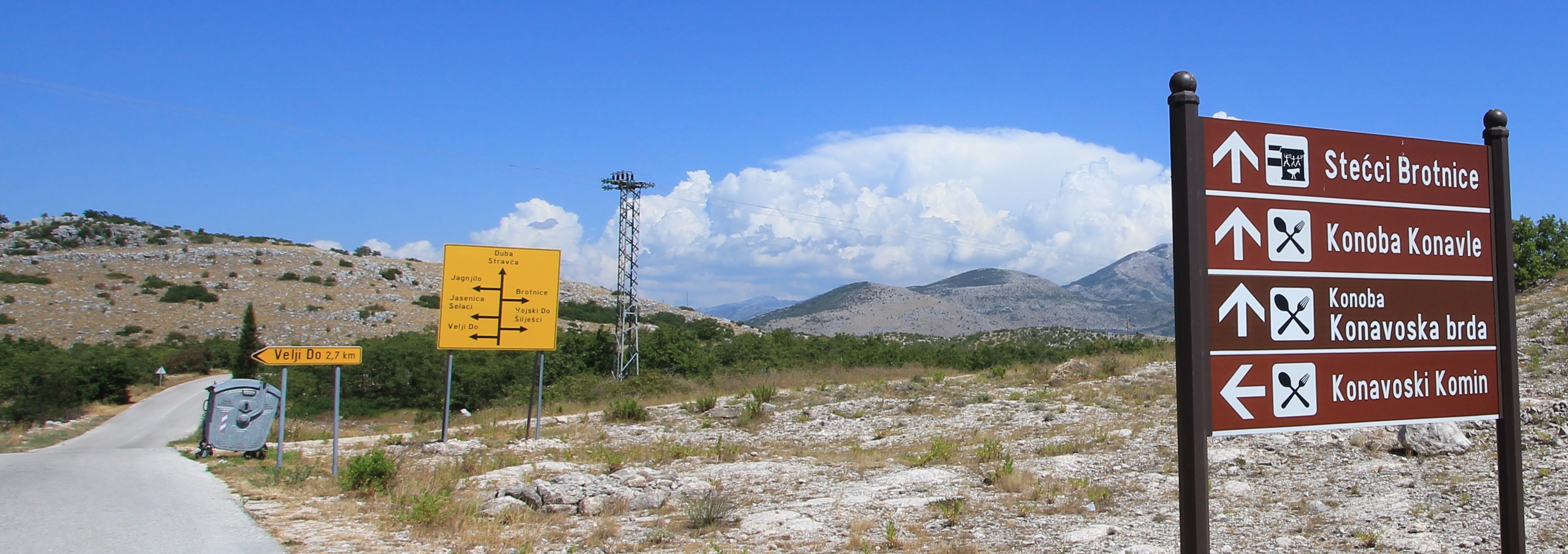
The signposting helped to get us to the vicinity of our quest (although I’m still not sure about the purpose of the rabbit ‘warning’ sign), and we eventually ended up down an unpaved track in a farmyard where a local resident re-directed us to our destination, He also noted that we should drive all the way as the final section of track would be crawling with “poisonous snakes”. Of Croatia’s 15 species of snake only 3 are venomous, and of these only the Horn-nosed Viper (“Poskok” in Croatian) is of potentially serious concern, but I digress as, despite liking snakes, we didn’t see one.

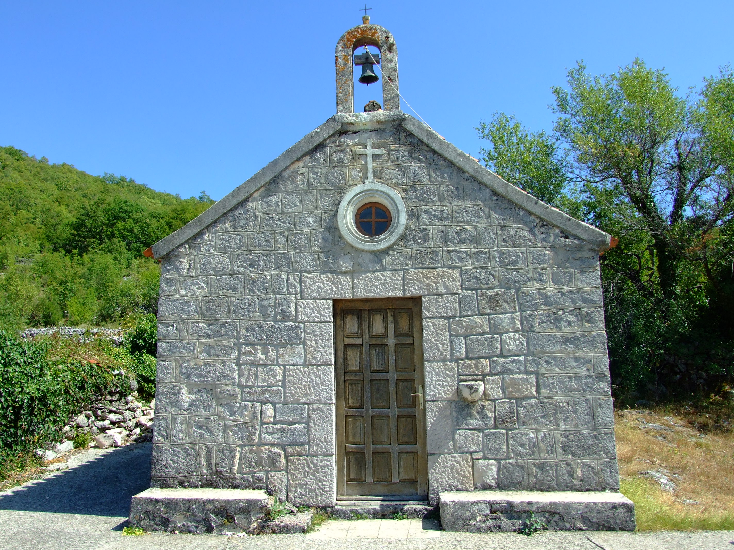
The front of the 16th century St. Luke's church (Crkva Sv. Luka)
The front of the 16th century St. Luke’s church (Crkva Sv. Luka)

At 42°35’32″N, 18°17’58″E we found the small church of Sv. Luka.  There’s plenty of free parking space here, and the chances are that you will have the place to yourself. At the entrance to the church yard you are greeted by a modern monolith with a slowly de-laminating text that reminds you that they don’t make them like they used to!

The 'Tombstone Path' sign at the entrance to St. Luke's
The ‘Tombstone Path’ sign at the entrance to St. Luke’s

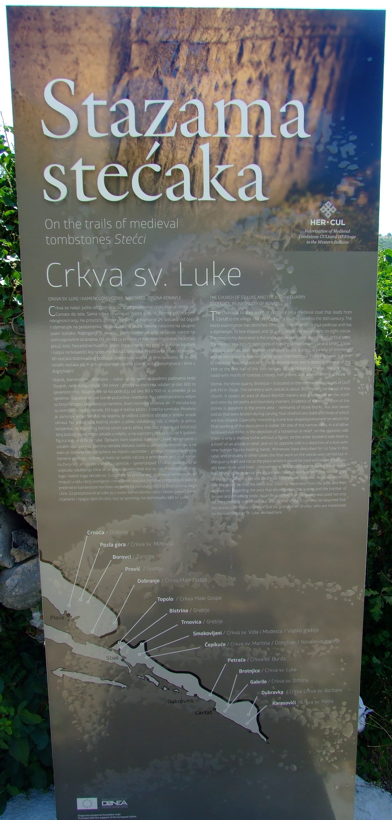
As part of the ‘Tombstone Path’ (“Stazama stećaka”) of southern Dalmatia it provides the locations of other Stećci in the area, and contains the following description of the site:

THE CHURCH OF ST. LUKE AND THE VOZNIK QUARRY, BROTNJICE, MUNICIPALITY OF KONAVLE

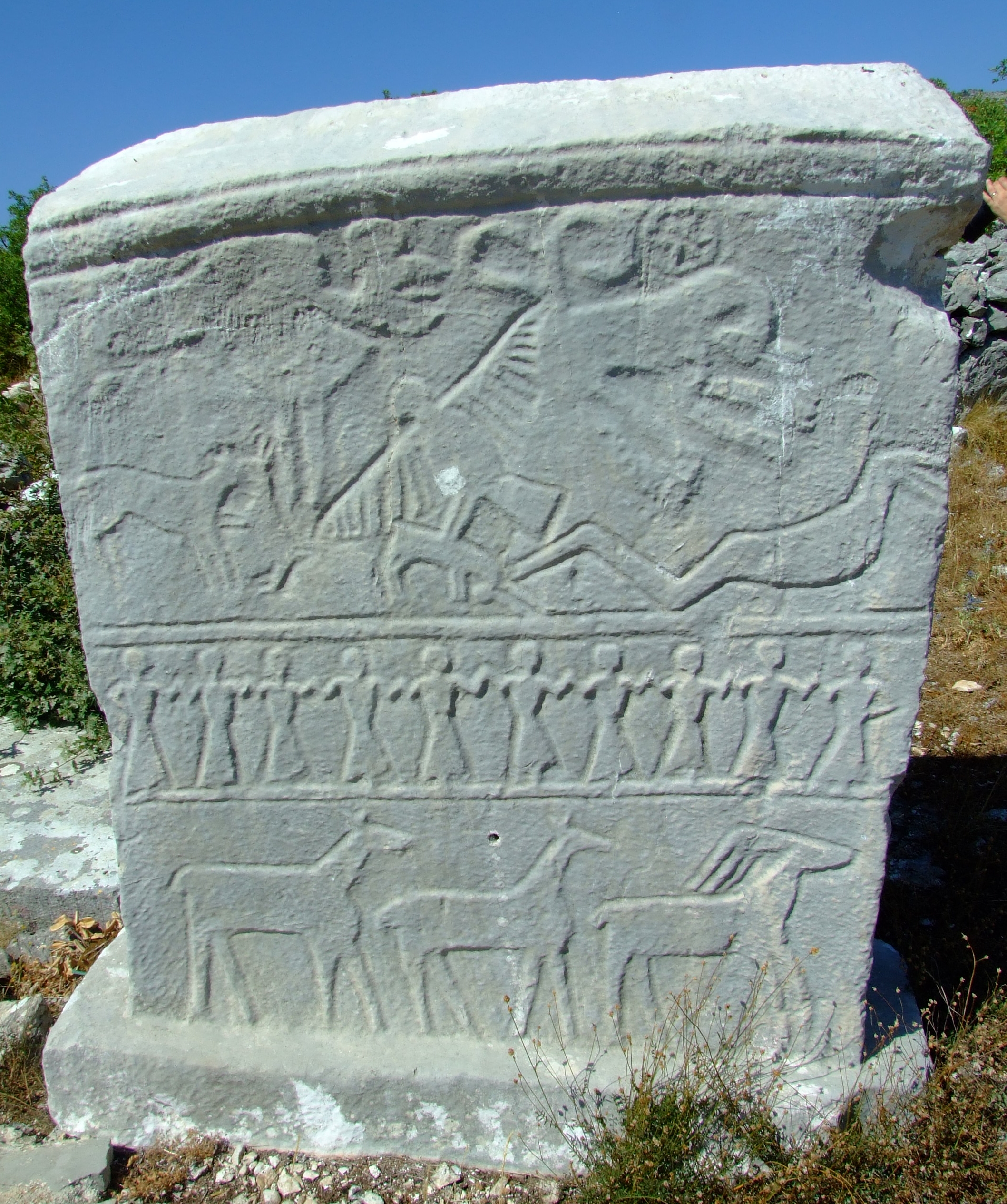
The church is located south of Brotnjice on a medieval road that leads from Cavtat to the village. The church itself is roughly dated to the 16th century.  The latest examination has identified 29 stećak, one of which is on  pedestal and has a sljemenjak, 10 box-shaped and 18 slabs.  We found decorations on eight stećak. The most richly decorated is the single stećak with decorations on all vertical sides. The decorations include depictions of hunting (a man on a horse and birds) a kolo, fantastic animals, deer, womem in unusual poses, a cross, a variety of trimmings and an inscription in Bosnian Cyrillic script that mentions Ratko Utješinok.  It is one of the most beautiful stećak in the Dubrovnik area and is dated to the end of the 14th or first half of the 15th century.  Of the remaining stećak five are decorated with motifs of rosettes, crosses, half-moons and women in long dresses.

Voznik, the stone quarry, Brotjnice – is located on the northwestern slopes of Osojnik Hill in Osoje.  The cemetery with stećak is about 300 meters northeast of the church.  It covers an area of about 80×100 meters and is bordered on the north and west by old paths and boundary markers.  Evidence of the exploitation of the stones is apparent in the entire area – remnants of stone blocks, but also seven stećak that were broken during carving, four of which are slabs and three of which are box-shaped,  Especially interesting is one box-shaped monument on which the final working of the decoration is visible. On one of the narrow sides, in a shallow hollowed-out niche, is the depiction of a horseman in relief; on the opposite side there is only a shallow niche without a figure; on the wider (Eastern) side there is a motif of and arcade in relief; and on its opposite side is a depiction of a kolo with nine human figures holding hands. Witnesses have described for us how in this case, and probably in other cases, the final work on the  stećak was carried out in the quarry itself and not at the place where it would have been used and where it had usually been done until then – the cemetery.  It is apparent that during the preparation of the stone pedestal great care was taken in working with the natural grain of the stone which is set in a southeast northwest direction.  Recesses were cut into the stone so that the block could be separated from the base and then worked on. Regarding the area that encompasses the quarry and the number of broken and remaining stećci, it can be assumed that the quarry was used not only for the cemetery in Brotnjice, but also further afield.  It can also be assumed that the stonecutter Ratko Utješinok and his grandfather Druško, who are mentioned on the sljemenjak at St. Luke, worked here.

The sljemenjak at Sv. Luka

More online information.

The Rural Dubrovnik Neretva website has more on other places to find Stećci in southern Dalmatia, and a 5′ 35″ video which is worth a look.