“Dad’s brought us to the wrong place again” sighed my daughter to her mother after we had pulled up in a car park at the side of the North Douglas Highway, and I had ‘wandered off’ to “ask for directions”. We had only been driving for 10 minutes from where we’d been staying during the first stop in a 3 week tour of Alaska.
The day had started by ‘reminding’ my daughter of the previous day’s tour guide commentary reference to the Alaskan Gold Rush during a boat trip out of Juneau to Tracy Arm Fjord, and my advice to her to dress warmly in layers for a visit to an “old mine” today.
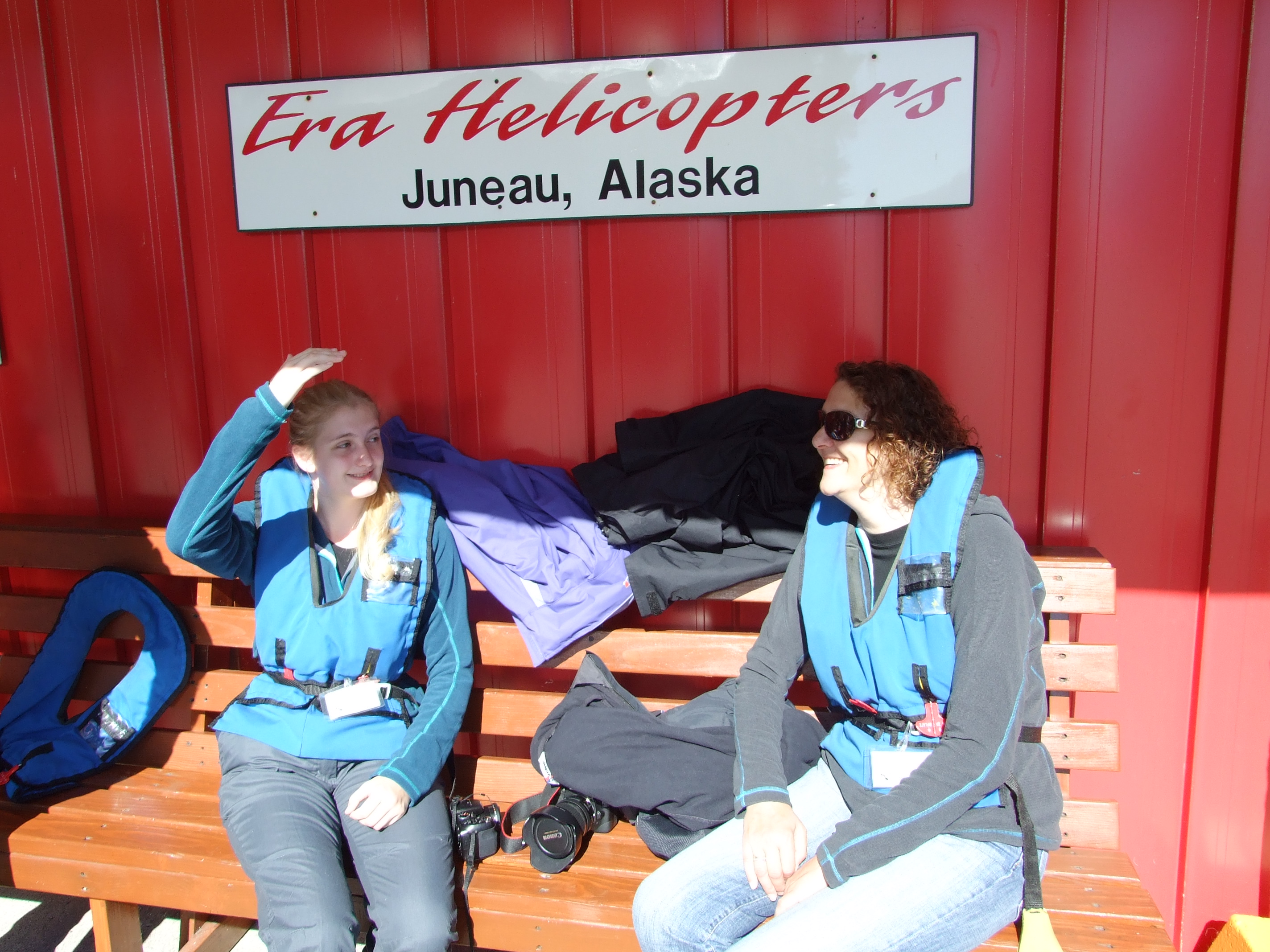
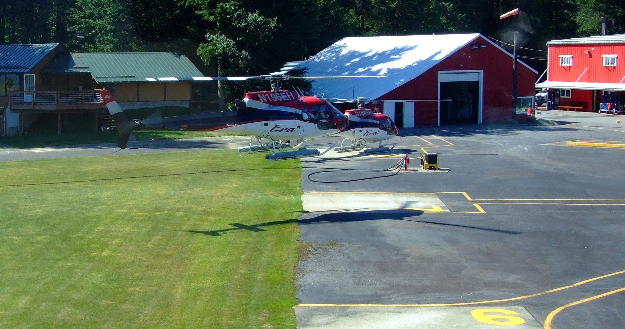
It soon became apparent to my daughter that I had lied (my wife knew, of course) when I returned to the car and escorted everyone to the Era Helicopters’ Juneau base for check in, a safety briefing, and fitting with lifejackets (mandatory for flights over water) and glacier boots (ask for at least one size larger than your regular shoe size).
It was the last day of July, three months since I had booked the Juneau Glacier Dog Sled Adventure as a vacation surprise, and the weather gods were with us. In a year of extreme variations across the state of Alaska Juneau experienced a July with an average temperature of 57.6°F (14.2°C), less than 1°F (°C) warmer than the normal mean of 56.9°F (13.8°C). However, during the middle and end of the month there was an upward spike, with the highest temperature for July recorded on the 29th, at 81°F (27.2°C). It was a ‘sucker summer’ up in the 49th.
The sunglasses and shielding of eyes were needed before we got anywhere near the ice, but even on a dull day make sure you pack a decent pair of shades for this trip i.e. 100% protection from both UVA and UVB. Polarised lens are also a good idea; if you’ve paid all that money you might as well be able to see your destination as well as possible. For the relatively short time you’re up there you probably won’t need glacier glasses, but you’ll notice all the camp crew wearing them.
On the subject of UV, don’t forget the reflection of UV from snow can be >80% (compared to snow-free ground which typically reflects only 2-4 percent of UV and surfaces of water bodies which reflect about 5-8 percent), and that you will be at moderate altitude with greater UV levels anyway. We coated up with Riemann P20 sun block before we left. Don’t forget that because of the reflection baseball cap peaks won’t save you, and that even the underside of your chin or nose are at risk of exposure.
Despite the warm weather down at sea level we still dressed in lined hiking trousers (or jeans in my wife’s case), layered up with long sleeved cotton T-shirts under fleeces, and carried our windproof/waterproof overjackets. Hiking boots/shoes with thick hiking socks were donned, hats and gloves stowed in pockets, and we were ready to go…
Before I continue with the tale of our day out with Era Helicopters, I’m going to get the logistical and financial details out of the way.
For 2016 flights for this trip are currently listed to run from the early afternoon of Monday 9th May until the late afternoon of Tuesday 9th August. Flights run 7 days per week in this period (with the exception of 12th, 15th, and 21st May), with between 3 and 8 flight departure times per day being offered for the Juneau Glacier Dog Sled Adventure. There are over 700 departure slots with starts as early as 7:15AM and as late as 5:15PM. However, at the time of writing, a couple of slots are already sold out and a few only have limited available seats remaining. If you’re going to only be in Juneau for a very specific timeframe get booking now; this may be the one trip of your vacation that you don’t want to miss. We might have just been lucky, as we had no problem when we selected our choice of a specific day and time for our flight, but if I was heading out for next summer I’d be booking now.
In 2016 booking directly with Era will cost you $555.00 per person if you weigh 239lbs (108.4kg) or less, and $655.00 if you weigh 240lbs (108.9kg) or more. Note that the full amount of your booking total will not be charged to your credit card until thirty days prior to your travel date, but, if making reservations within thirty days of your selected date, your card will be charged immediately.
You will need to declare your weight on booking, and if you are just scraping under the threshold it’s worth skipping a couple of meals before you arrive as “Due to [the] length of [the] tour and passenger loads, all passengers will be required to “weigh in” at the heliport. Passengers weighing in excess of 240 lbs. will be subject to a $100.00 surcharge to ensure adequate seating space.” Enough to pay for a blowout meal afterwards!
At the check-in you’ll also need to sign a waiver, and any medical conditions must be disclosed, but don’t worry because this is purely in your interests; Era are, as you’ll read below, a seriously reputable company when it comes to flight safety.
There are no carry-on bags permitted (although cameras are OK), and loose items will be stored securely at the heliport. The list of prohibited items includes drones, iPads, iPad minis, tablets, Go-Pro/selfie sticks and umbrellas.
There’s a minimum number of 4 passengers per flight. We had our family of 3 and 2 additional guests + the pilot, which is the maximum passenger seating in the AStar helicopters (see more below) used for this tour.
The vast majority of passengers come from cruise ships, and are collected from the Juneau dock terminal by personnel from Era’s ground staff operation. It’s only a 5.3 mile (8.5km) journey. If, like us, you drive yourself to the heliport, don’t expect a discount, and, more importantly, don’t be late.
If you book this trip through your cruise provider you can probably expect to pay a premium, but firstly, make sure you are actually getting the trip you want as there are several alternatives in the Juneau area (more on these below). Some examples of cruise ship companies offering this specific tour and their pricing are as follows.
- Carnival Cruise Line call the Era trip the “Four Glacier Helicopter & Dogsled Adventure” (not to be confused with the “Dog Sledding on Mendenhall Glacier via Helicopter” shore excursion). Listed at only $549.99 per person, and with their guarantee to offer the best price for this trip – “Find a better price for any excursion we offer and we will refund you 110% of the price difference!” – that’s a whole $5.01 saving over direct booking. Unless you are over 240lbs. Carnival note that “guests weighing over 250 lbs [and this figure should probably be checked if you happily maintain your weight at 245lbs] will be required to purchase 2 seats (1½ tickets) on this excursion. You may acquire the second ½ ticket/seat […] after making your initial online purchase.” If half a ticket comes in at around $275 I think the $100 Era additional charge looks quite attractive by comparison.
- Celebrity Cruises offer the Era package as a “Dog Sledding Adventure By Helicopter”. They charge $589.75 per person, and state that “Guests weighing 240 lbs or more will be assessed a weight surcharge” (but not how much this is).
- Princess Cruise Line go with “Dog Sled Adventure by Helicopter” and charge $599.95 per person. They also note that “Prices are based on the amount Princess typically charges for each excursion, but your price may vary by voyage date and departure time. Weight surcharge ($130) may apply on this flight. Due to weight and balance limitations, as well as passenger safety and comfort, the helicopter companies have advised that guests weighing 240lbs or more (fully clothed) will be assessed the weight surcharge to reserve adequate space on board the helicopter. Guests weighing 240lbs or more should reserve an extra surcharge ticket and, once on board, go to the Tour Office to have the ticket charge adjusted down to the surcharge amount.”
- Disney also go with the name “Dog Sled Adventure by Helicopter” and charge $619 (ages 10 and up), or $479 (ages 2 to 9). For two parents travelling with 3 children under 10 this booking rate would save $100 over direct booking with Era. This figure drops to $24 if they only have 2 young children, and with only 1 child they would need to think about borrowing an extra child, having another child themselves and delaying the cruise until that child was 2 years old (the minimum age for this experience), or just accepting they’re going to take an overall hit of $24. Or they could book direct with Era (especially if their children are over 10 years old). Disney also refer to the ‘half-seat’ surcharge.
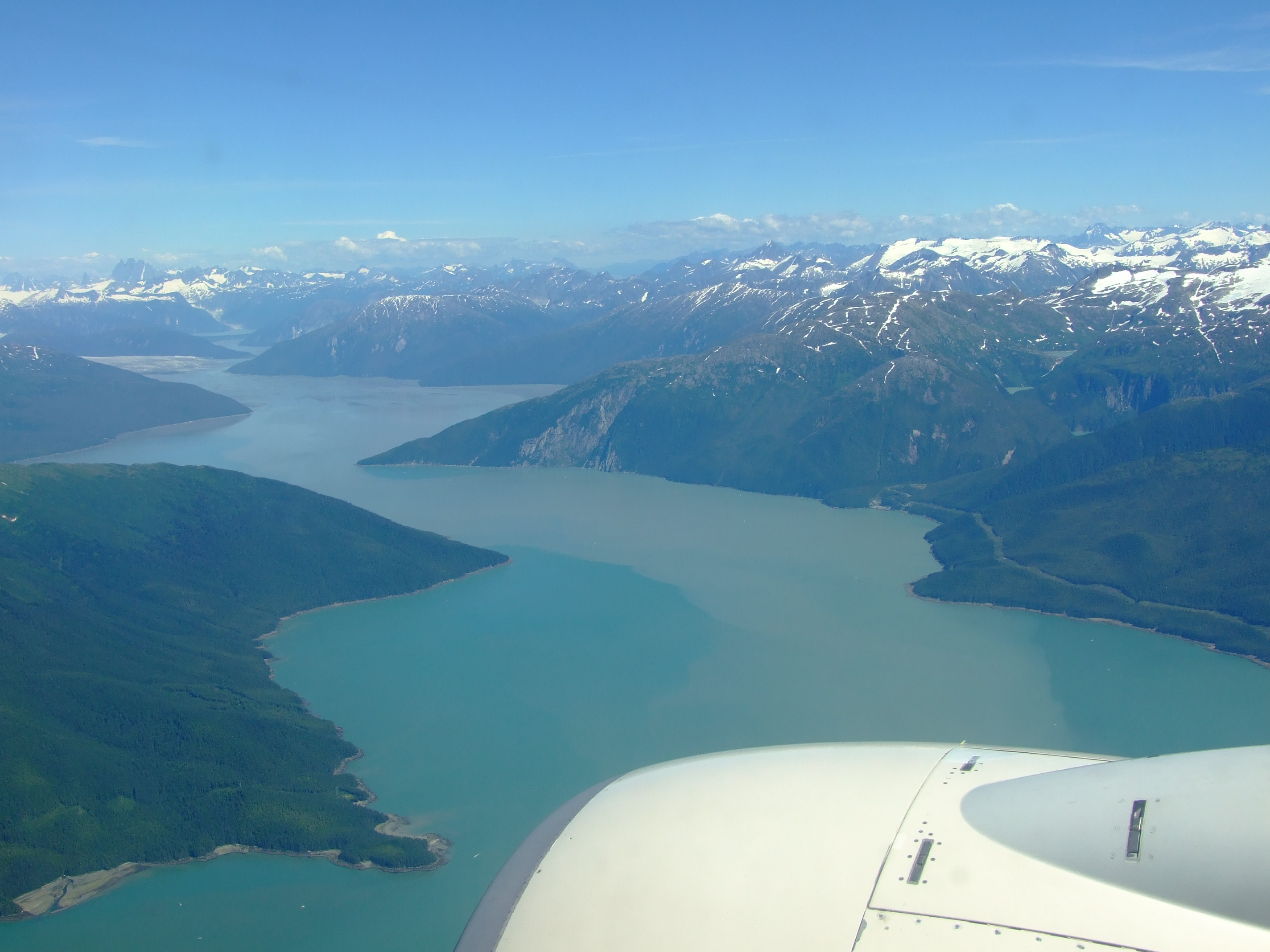
If you’ve travelled into Juneau by air rather than by water you may have already had a sneak preview of at least part of the day’s destination. If you’re a) flying in from the south from Seattle, b) doing so in fairly good weather, and c) sitting in a window seat on the right of the aircraft, you’ll probably be admiring the mountainous coastline and several glaciers for much of your descent.
About 10 minutes before you land at Juneau international airport (JNU) you’ll pass Port Snettisham as you fly along Stephens Passage…
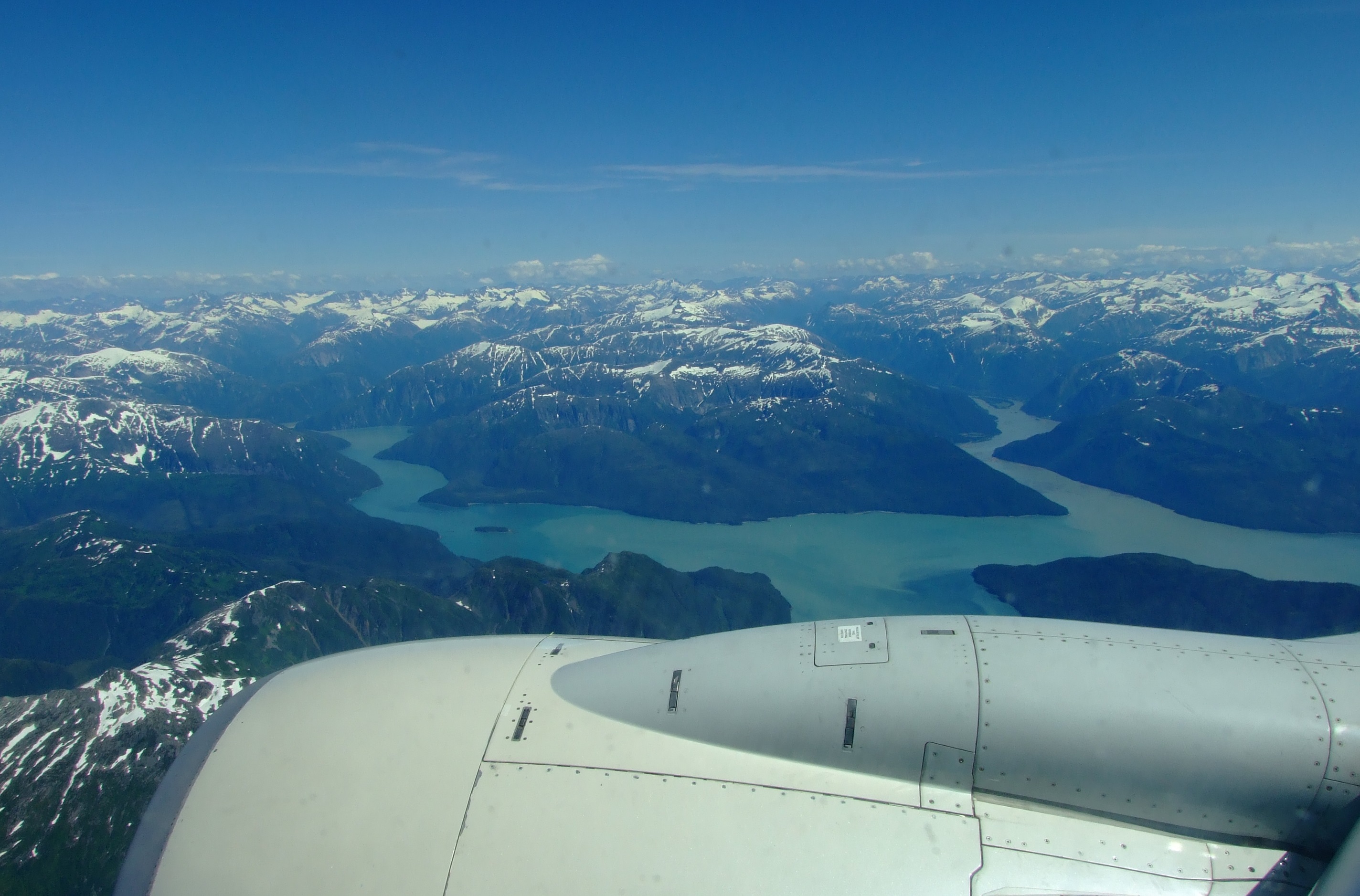
Around 4 minutes further on you’ll pass Taku Inlet with its amazing water colour variations and spiked promontories.
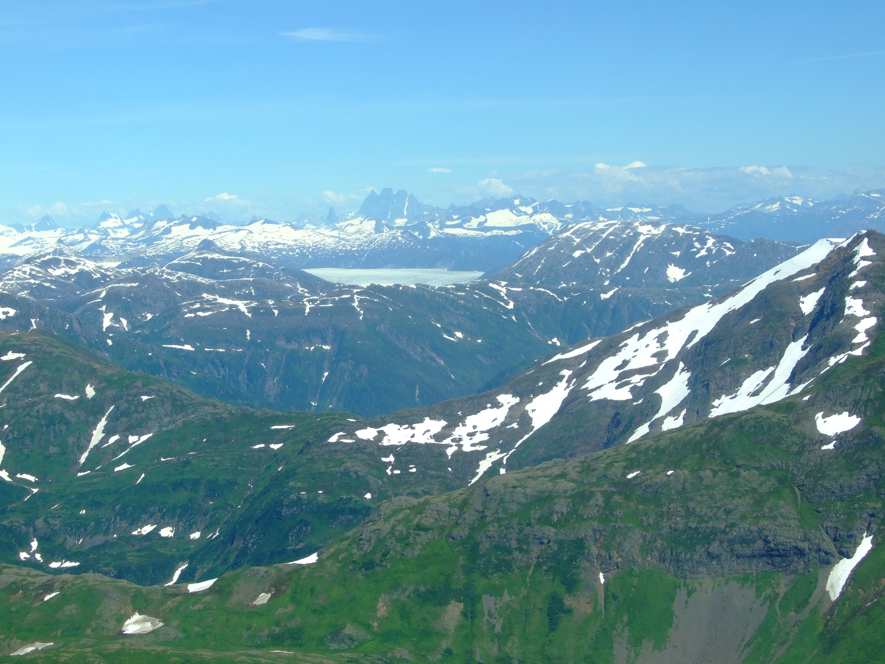
As you start to pass the mainland 5 minutes before landing there is a further brief chance to see the Taku Glacier:
Returning to the world of rotary aircraft, there’s an interesting article on Era’s roots and development over the years, and the company’s place in the Alaskan landscape here. With regard to Era Helicopters today, you’ll be flying with one of the top four international offshore oil and gas industry helicopter operators in the world. They also operate in the contract Search and Rescue (SAR) and air medical markets, so you can be assured that passenger safety is a critical priority for them.
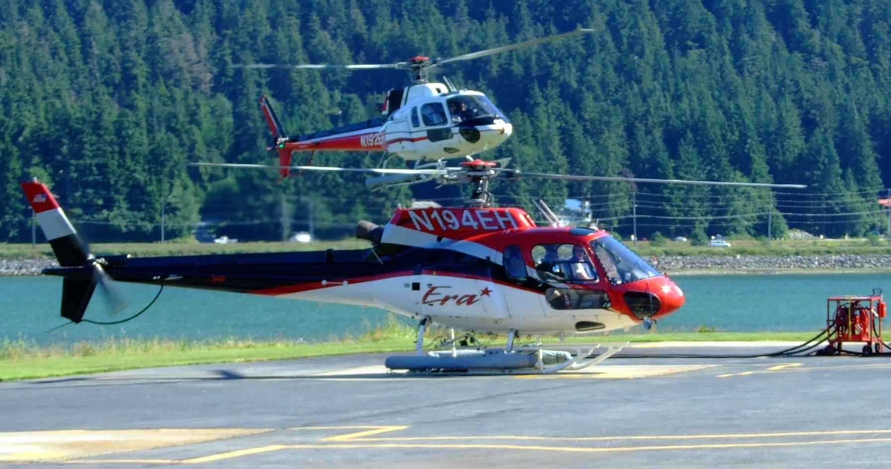
The helicopter type used for Era’s flightseeing operations is the Airbus Helicopters AS350 (known as the AStar AS350 in the U.S.). It has a strong pedigree of use in inhospitable terrain, including such as decades of service with the Brazilian Navy for Antarctic environmental monitoring., and is also used by the other three helicopter excursion companies in Juneau (see further details towards the end of this post).
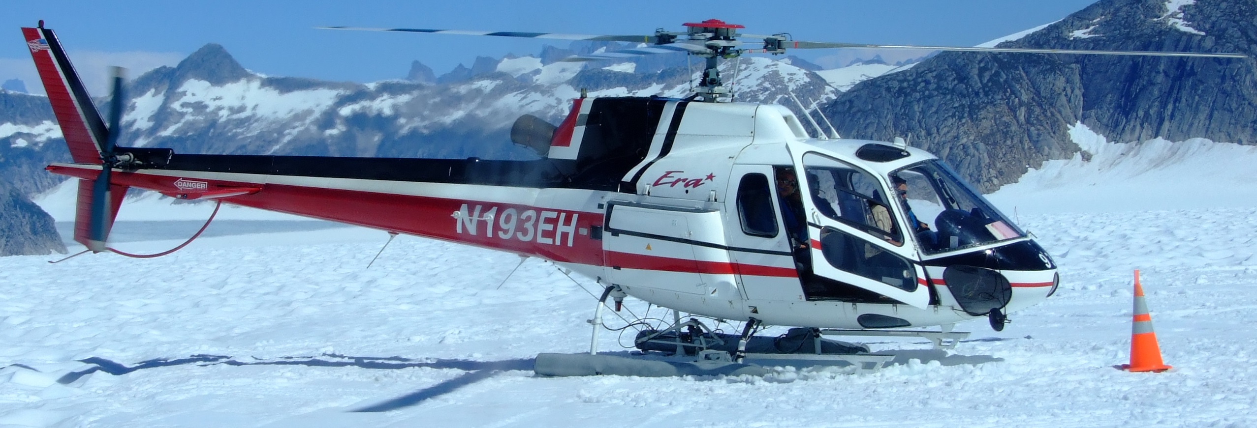
In the AS350 B2 configuration for 5 passengers the pilot sits on the right, slightly forward of the two front seat passengers next to him, and there are three passenger seats behind.
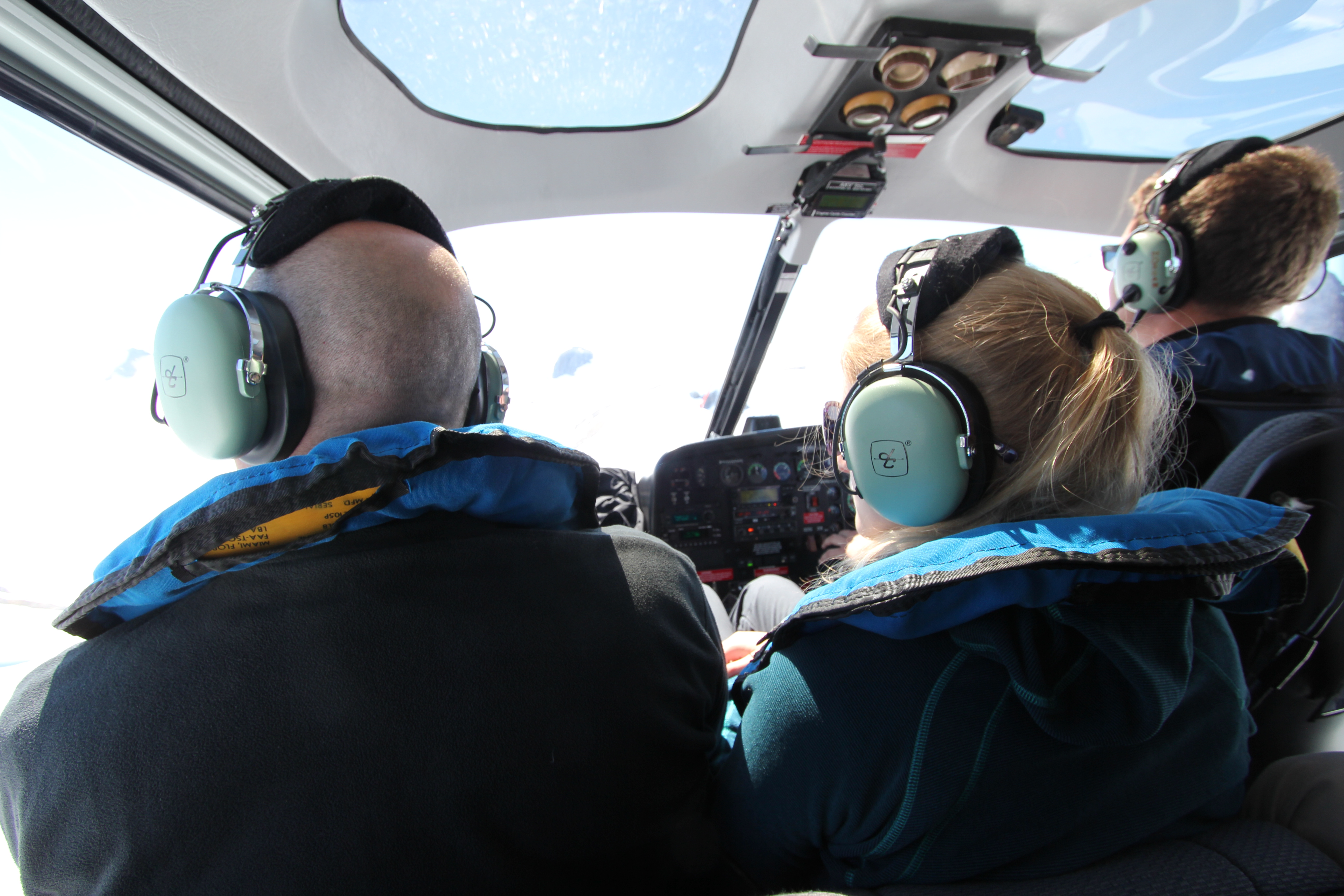
Visibility is pretty good in the AS350, but keep in mind that at certain angles there may be slight reflections from the windows so keep on snapping those extra shots…
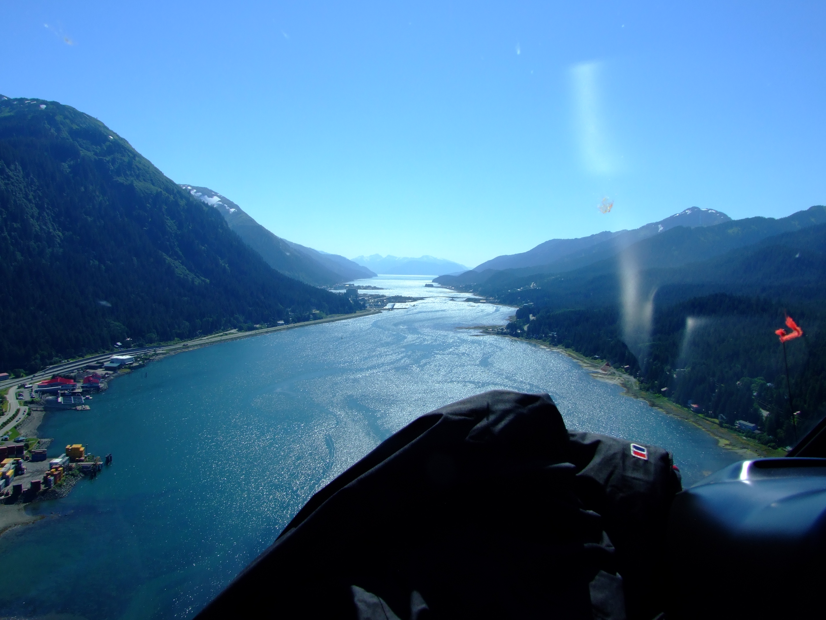
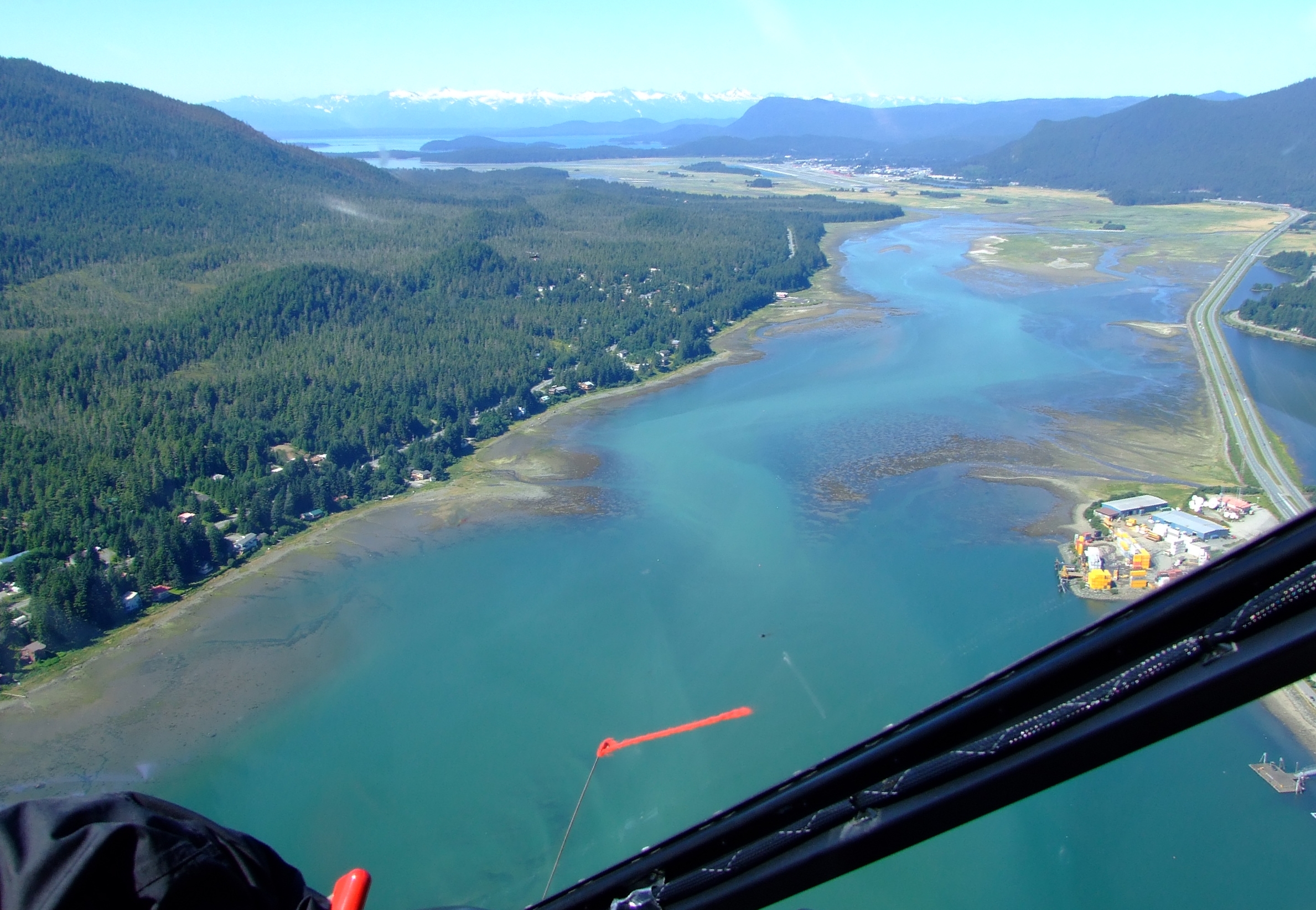
Our Juneau Glacier Dog Sled Adventure started with a journey heading south down the Gastineau Channel, as per the image above. If you’ve already had time to explore the area this provides a fascinating new perspective. If you only have one day in town it still provides a unique view of the state capital of Alaska (and if you book your trip times wisely you’ll have the chance to squeeze in more opportunities around this tour).
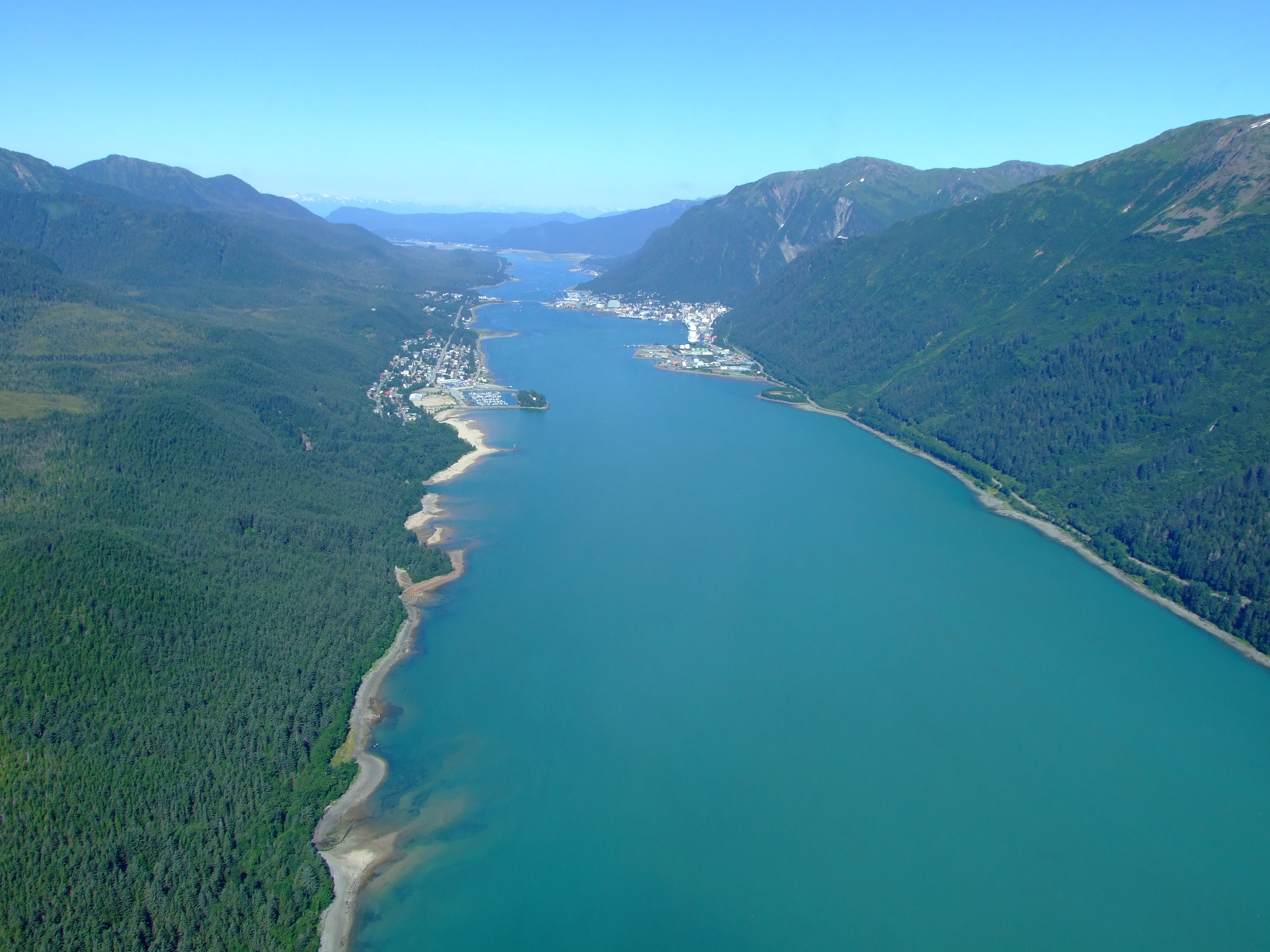
Looking back at the view of Juneau (on the right) and Douglas (on the left) from the other end looked like this:
From here we flipped right towards the mainland and climbed up to a hover above Sheep Creek in front of the north-west faces of Hawthorne Peak (4210 ft/1283m), Middle Peak (3722 ft/1134m), and West Peak (3620 ft/1103m):
Turning north-east, we flew up over the ridge to our left which descends from Mt. Roberts (behind us in the above image), following the line of the Sheep Fork between the Hawthorne and Powerline Ridges to its confluence with Carlson Creek, before cresting the rock and snowfields of Annex Ridge to the south-west of Annex Peak (4,170 ft /1,271m). Here we got a closer view of the Taku glacier ahead on the same line of sight as when we’d flown into Juneau a few days earlier:
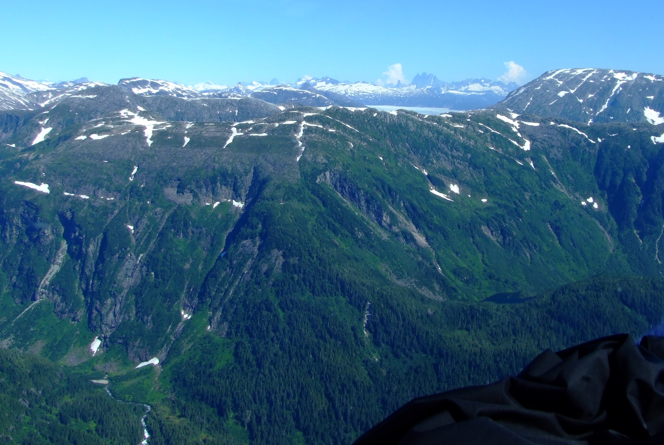
Dropping down into the steep sided valley we flew over the mirror smooth surface of Glory Lake as the enormity of the Taku Glacier ahead began to hit home, but, as we exited over the end of the lake, Norris Glacier suddenly appeared on the left:
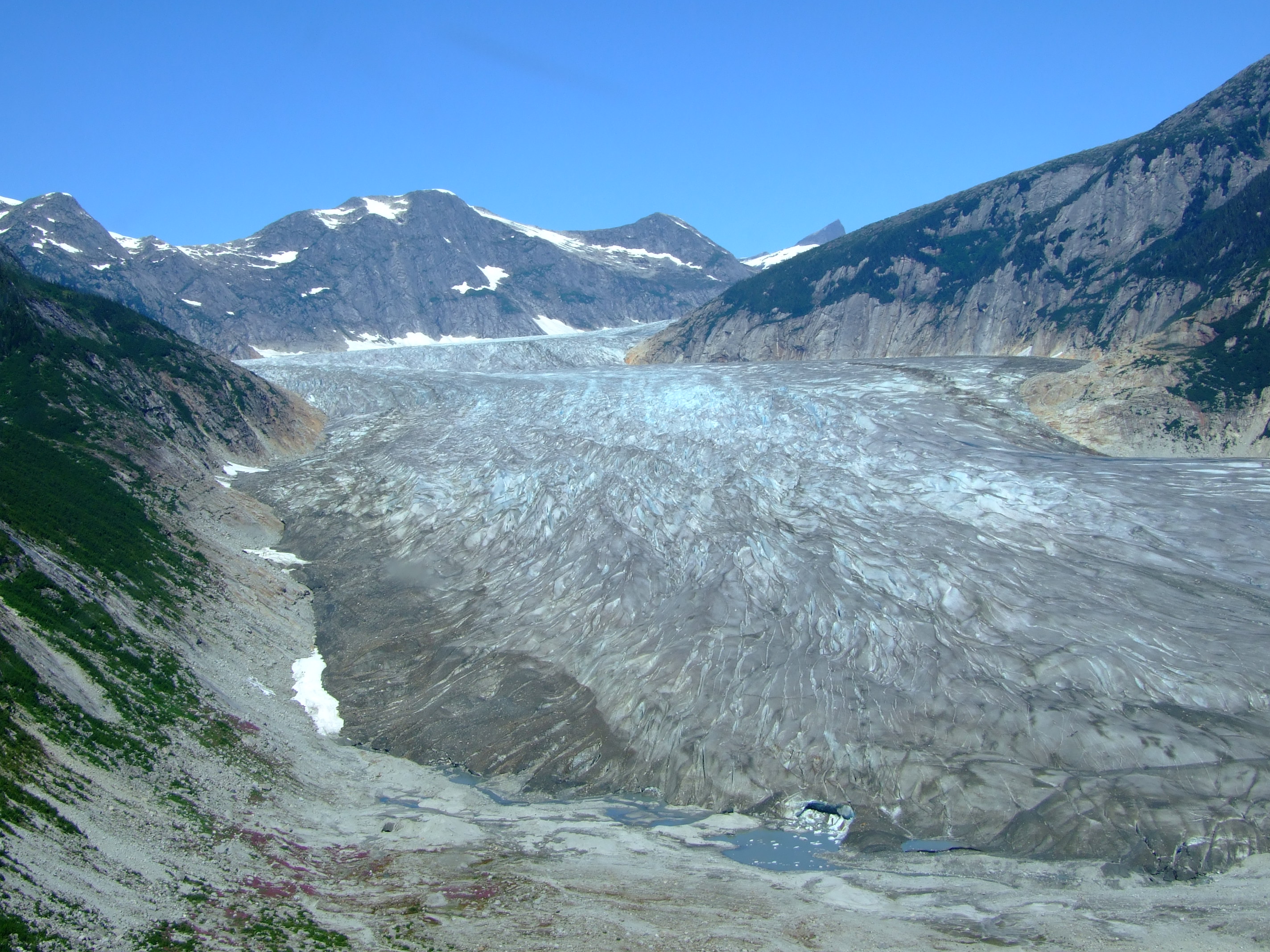
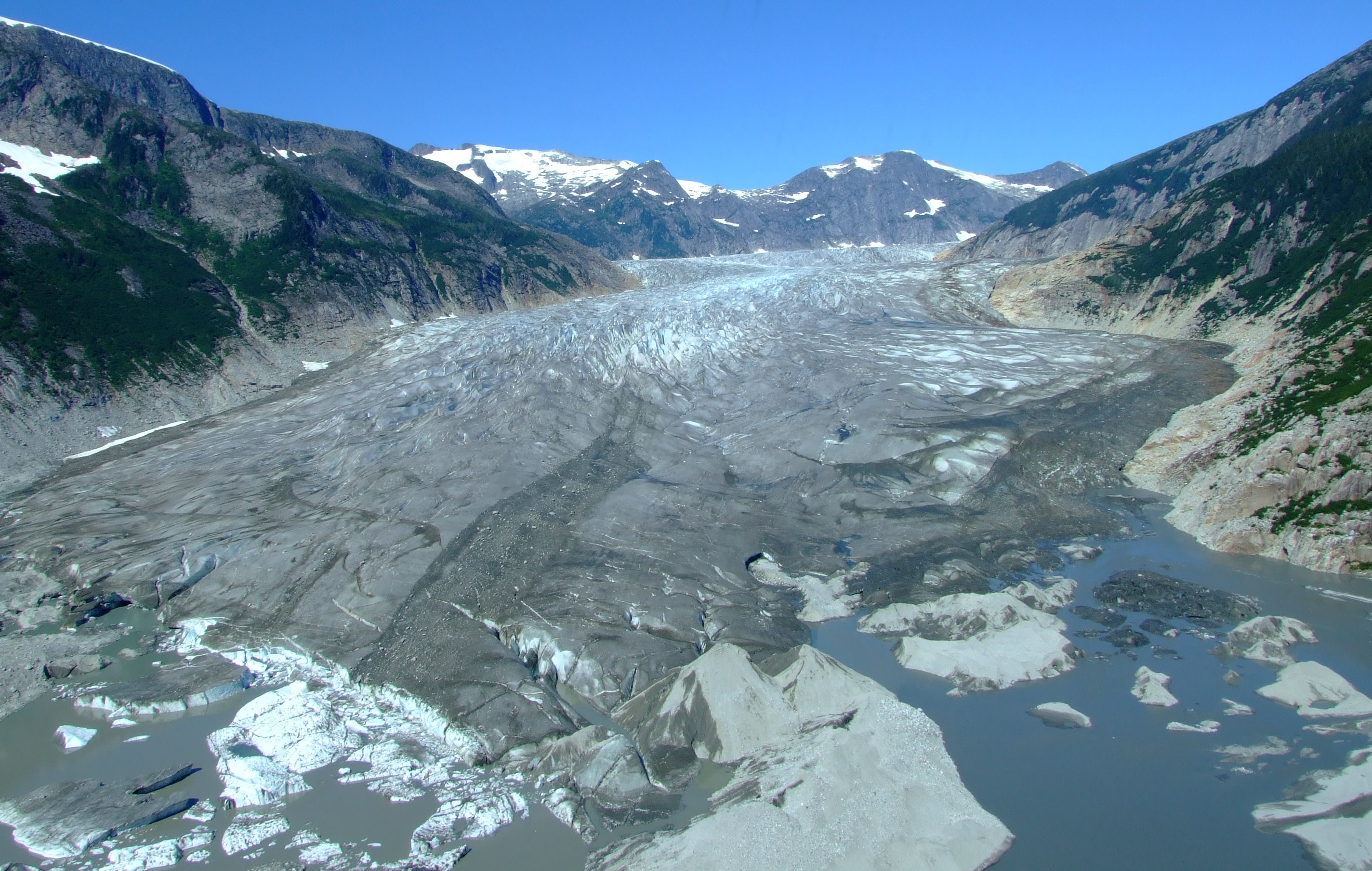
Our pilot then took us down across Norris Lake towards the Taku Glacier:
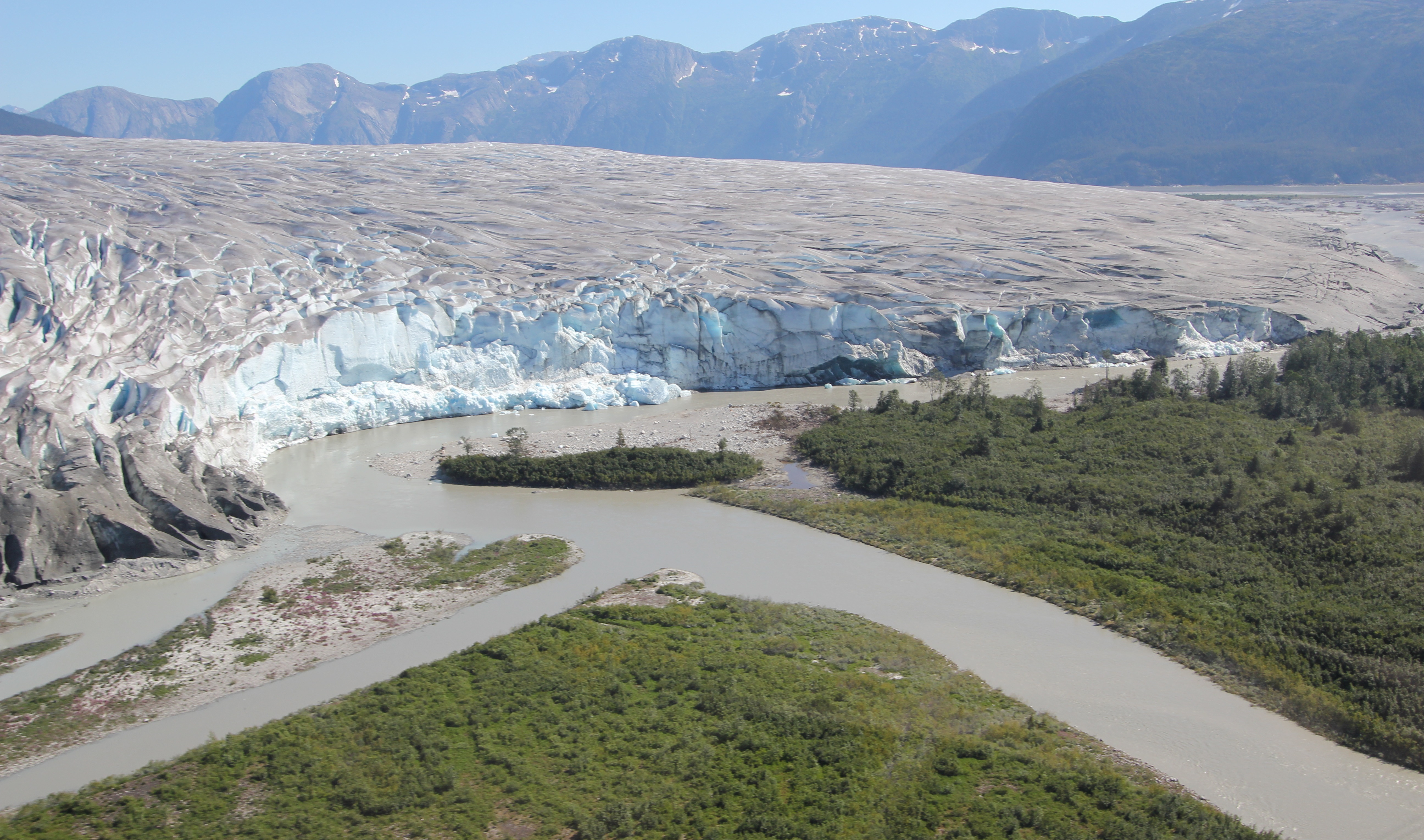
The Taku Glacier (now well over the 1995 calculation of 831 km2 (321 square miles) in size) is the primary outlet of the Juneau Icefield which covers an area of over 1,500 square miles (3885 km2), and stretches nearly 100 miles north to south and 45 miles east to west.
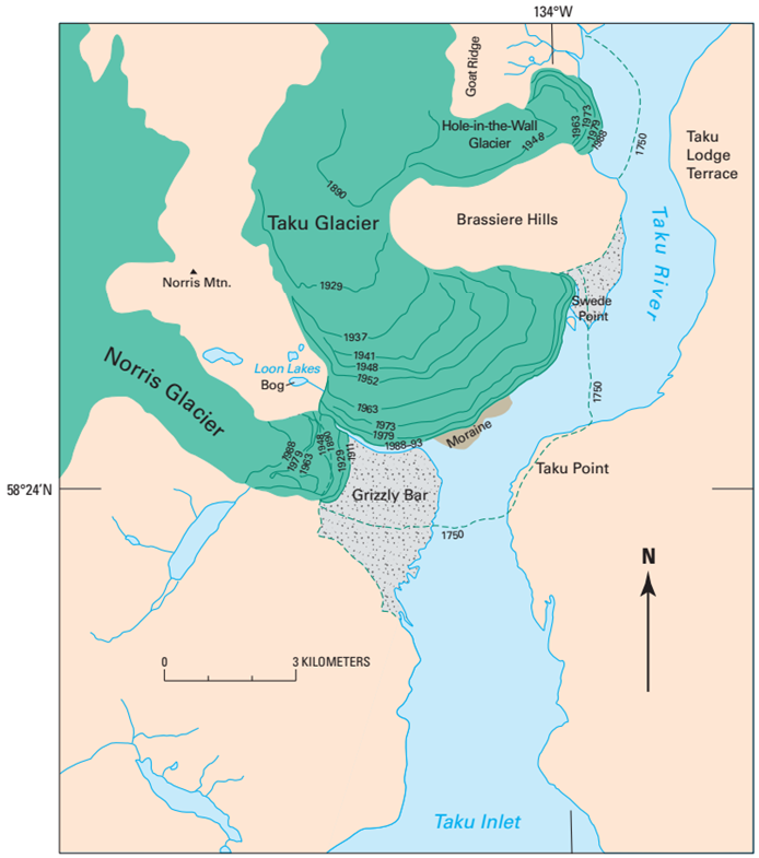
During the variably dated ‘Little Ice Age’ it is believed that the Taku Glacier extended out across the Taku Inlet creating an ice dam that caused the formation of a lake backed up into Canada (although others disagree about this). It has been noted that when Vancouver first visited the inlet in 1794 the Taku Glacier “was in an enlarged state, blocking the headward end of Taku inlet […]. He mentioned that ‘the basin’ was about 13 miles from the mouth of the inlet, indicating that the ice-front was not far from Taku Point. This agrees with the local Thlingit accounts of an ice barrier which prevented access to the interior valley of the Taku River ‘before the White Men came’.” This was contested in 1996 by Arne Friedmann who wrote “A detailed investigation of Taku Point showed, that the Taku Glacier ice front did not reach the eastern shores of Taku Inlet and the Taku River was not ice blocked. No large ice dammed lake reaching into Canada was formed in the 18th century.” Later still, the 1980 USGS Professional Paper 1386-K notes “As recently as about 1750, Taku Glacier was more than 3.5 km beyond its late 20th century position. At that time, it dammed Taku River at Taku Point. A large ice-dammed lake extended northeast into Canada.”
Today the size of this ice river, flowing 36 miles (58km) from the north, and approximately 5¾ miles (9.25 km) long around the front of its terminus, is still awe inspiring.
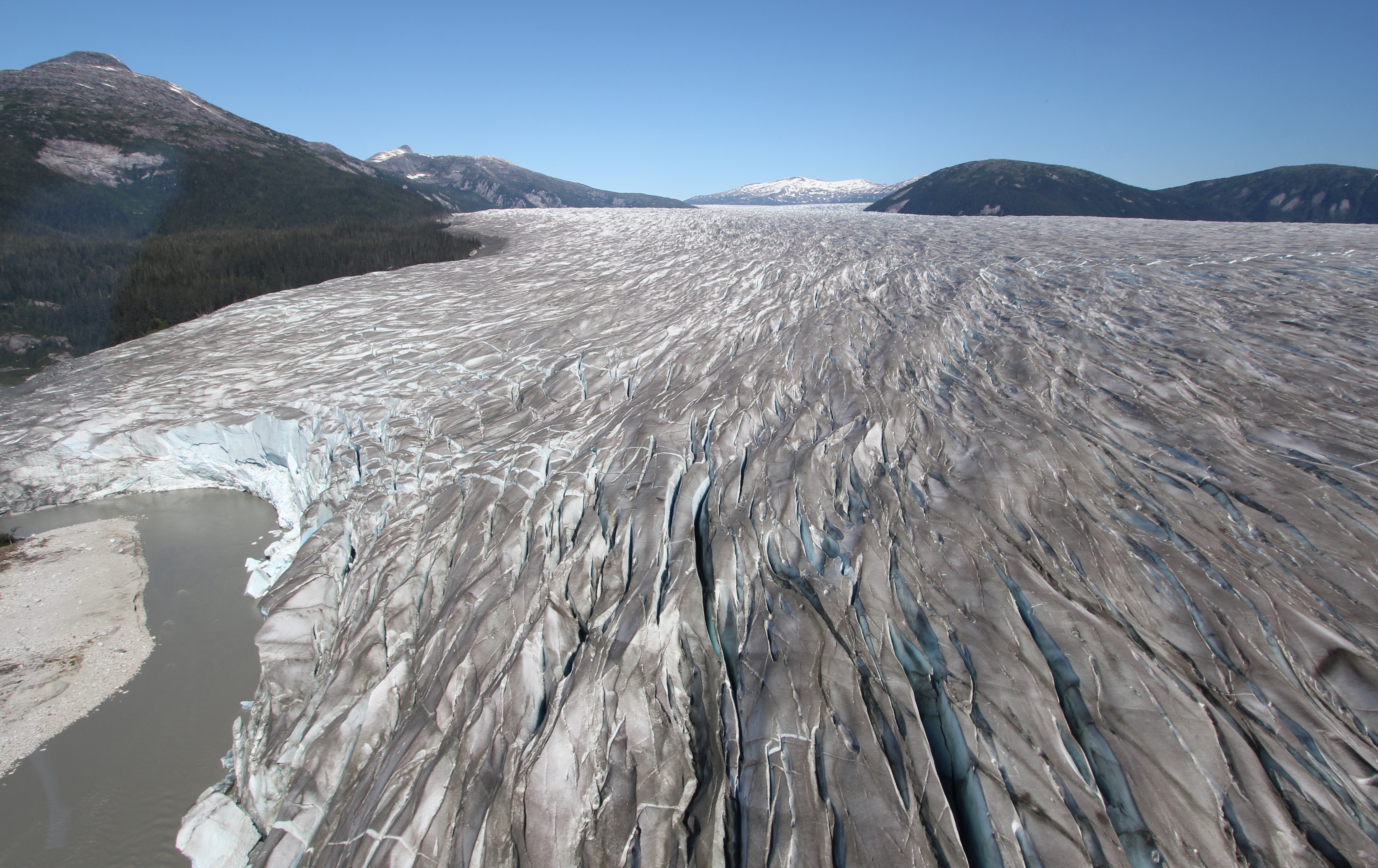
This Era trip maintains a tradition of tourists visiting the Taku Glacier that is over 100 years old. For the 1896 edition of “Appletons’ guide-book to Alaska and the northwest coast” (the full title is a tad longer, but it’s still available as a reprint-to-order) author Eliza Ruhamah Scidmore wrote
“It is one of the show places on the Alaska coast, and is regularly visited by excursion steamers. The Taku Glacier was christened the Schulze Glacier in 1883, in honour of Paul Schulze, of Tacoma, and in 1891 was renamed the Foster Glacier, in honour of the then Secretary of the Treasury; but locally to geologists, tourists and navigators it remains Taku. The native Name is Sitth Klunu Gutta, “the spirits’ home.” It is Sitth too Yehk’s, the ice spirit’s, very palace of delight, and the fabled man-faced seals with their human hands live and frolic in its clear blue grottoes and crystal dells. The ice-stream, a mile in width, fills its canons from wall to wall, and is squarely broken front rises from 100 to 200 ft. above the water. It is one of the purest and cleanest glaciers, without medial or apparent lateral moraines, and deeply fissured and crevassed for the 5 miles of its course which is visible from the water. Because of its purity, ships prefer to fill their ice-boxes in this basin, and the process of lassoing the icebergs and hoisting them on board is an interesting feature in ship life.”
From our helicopter seats in 2013 the view of Taku Glacier was no less than amazing, but there was a lot more of it to be seen than in 1896. Extending its length by 4.8 miles (7.3km) between 1890 and 1990, the tidewater Taku Glacier stopped calving into Taku Inlet in 1948 (elsewhere stated as 1953) which allowed it to advance across its own outwash delta.
The amount of sediment deposited into the Taku Inlet by the glacier had eventually stopped steamships and their descendants from getting up to a viewing position, and later prevented even lighter keeled craft from making a reliable viewing journey; these days you need either an airboat, a hovercraft or a kayak to get to the glacier by water (see the airboat trip reference link at the end of this post).
Taku Glacier maintained an extremely positive mass balance between 1948 and 1988, but since then a slightly negative mass balance has been recorded, and between 1990 and 2000 its advance effectively halted, although the terminus height continued to rise at an average rate of 1.4m per year. In the summer of 2001 the Taku Glacier started advancing again at a rate of between 10-30m per year, and it has often been cited by comparison with other significant Juneau Icefield glaciers as being the only one which was still expanding. However, as reported in the Juneau Empire in September 2015, the advance of Taku glacier has stagnated since 2013. No longer constrained by mountainous sides, the broad bulbous terminus means that the glacier has more area to expand across with less mass to drive forward movement.
Eventually, Taku Glacier will withdraw, underlying silt will be washed out, and a mighty 50km fjord will be created in place of the deepest and thickest alpine temperate glacier known on the planet (the Juneau Icefield Research Program (JIRP) which has studied the Taku Glacier since 1946, recorded a maximum measured depth of 4855 ft (1480m)).
With a glacier of this size, that will not be happening anytime soon, and it will remain as a spectacular site to visit for decades. However, whilst no one appears quite sure as to whether the ‘advance’ stage of a tidal glacier’s lifecycle is currently ending for the Taku Glacier, I’m glad we were there to see it at its possible maximal extent for the foreseeable future.
Our view of the Norris Glacier terminus was returned in this shot…
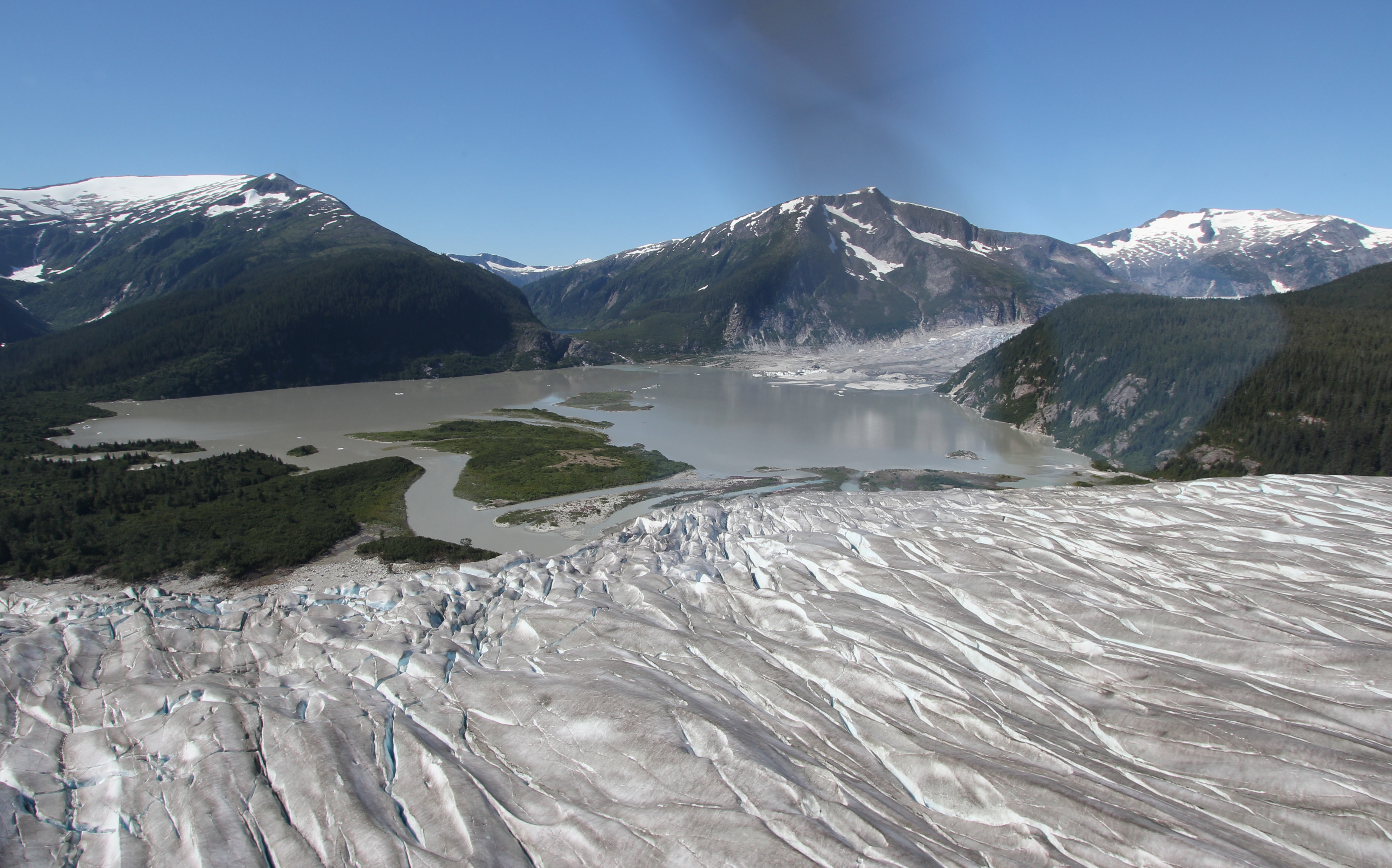
Norris Glacier began its retreat prior to 1890, but when it reached its fullest extent in 1911, it still stretched out around the spur descending from Norris Mountain (to the centre right in the above image), across what is now a lake, and onto the northwest shore of Grizzly Bar (the low lying tree clad land in the centre left of this image). As late as 1929 there was still no proglacial lake. Today Norris Glacier has retreated to the extent that it barely scrapes over the rock edge of the lake. For more on the retreat of Norris Glacier see the links at the bottom of this post.
Rather than returning over Norris Lake we hopped up and straight over the Loon Lakes and Oona Lake on the spur of Norris Mountain to view the Dead Branch of Norris Glacier which floats on its own melt water during the summer:
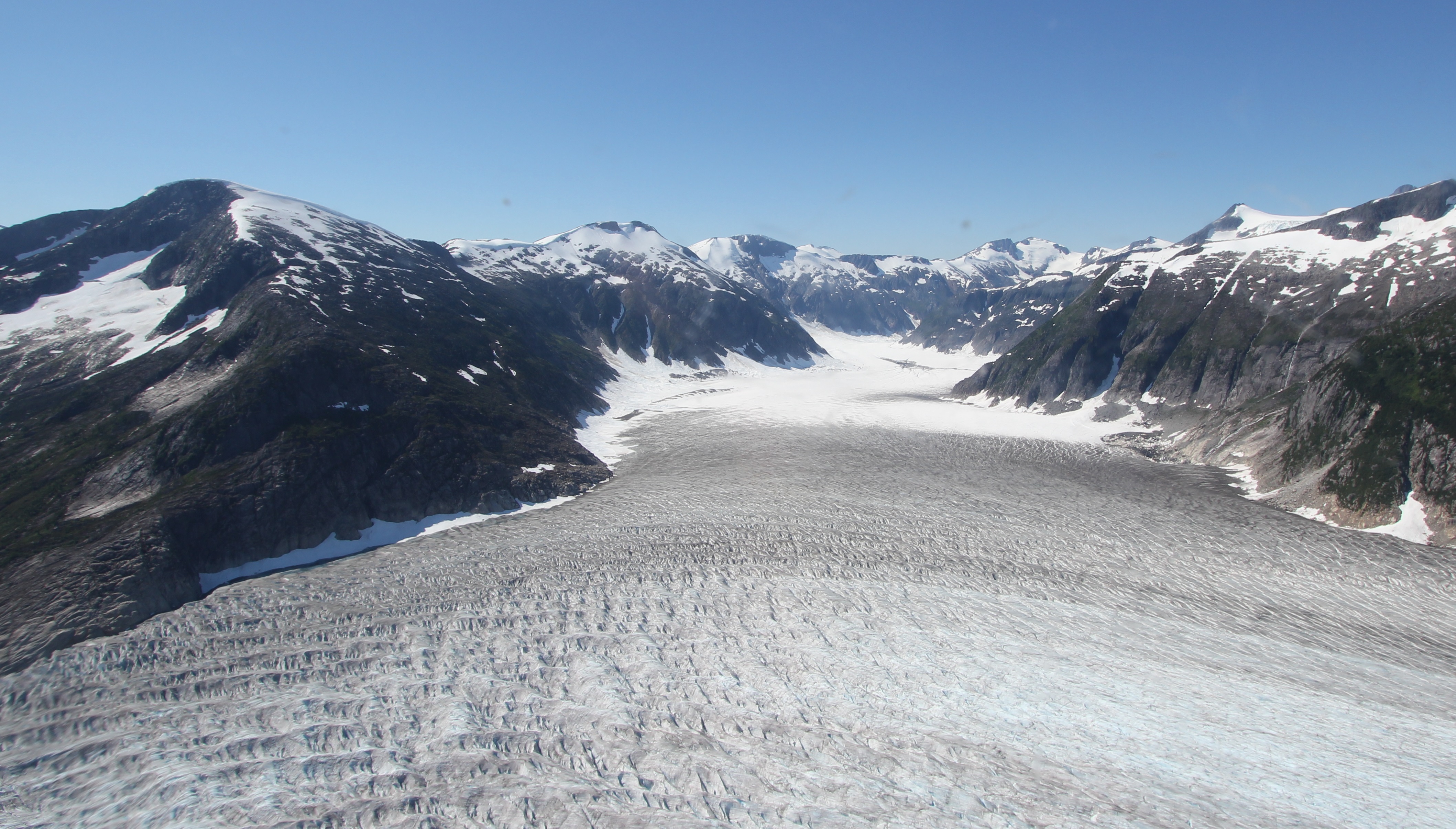
Turning left into the Middle Branch of Norris Glacier which lies between the Dead Branch and Death Valley, we descended towards our drop off at the Alaska Heli-mush sledding camp:

From take-off at the heliport to set-down at the camp had only taken around 18 minutes, but it had felt like a much longer trip with all that we’d had to see and take in.
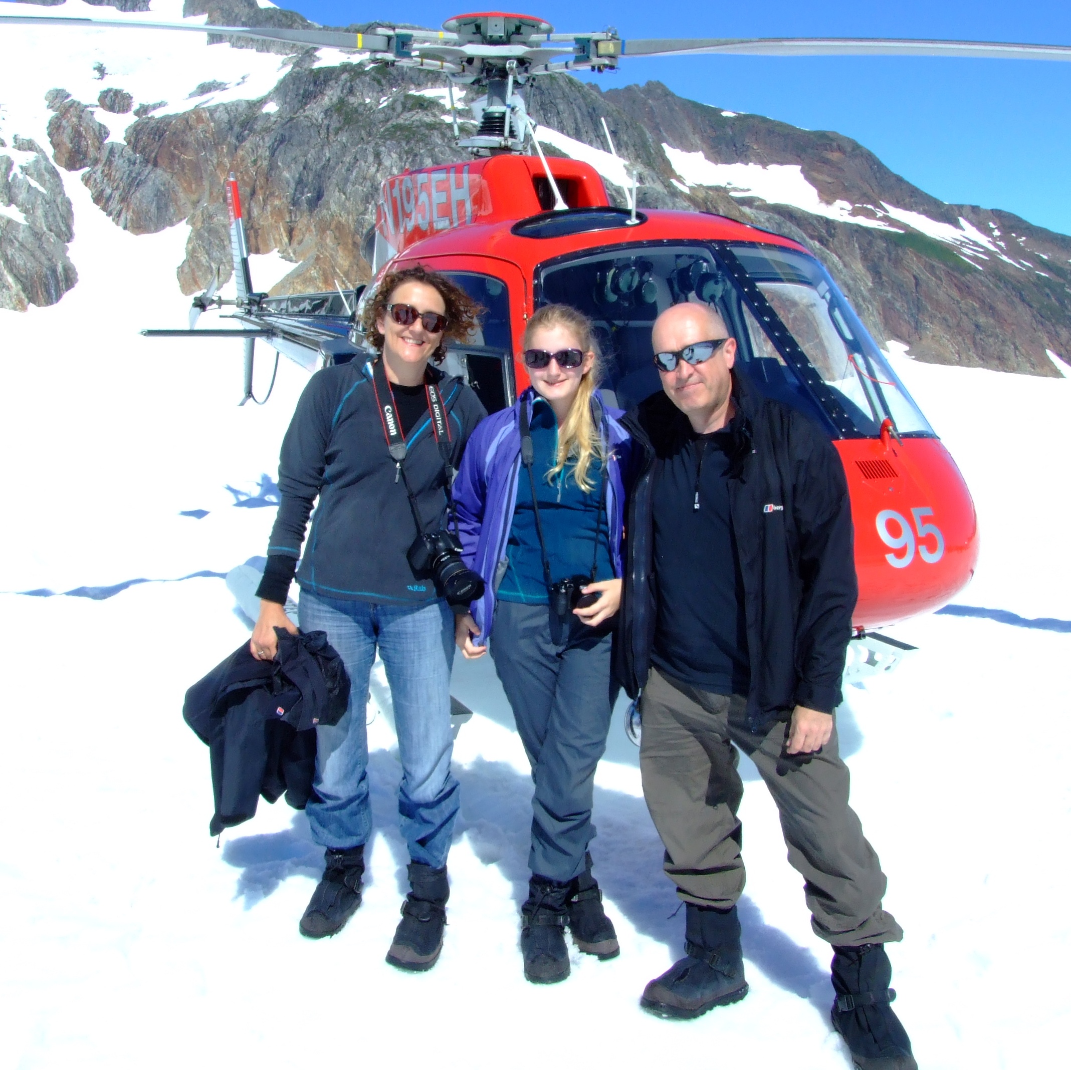
Leaving our lifejackets in the helicopter, the obligatory family arrival photo was taken (through the fade of memory, I think we were offered to purchase a print on our return to base, which we declined in favour of the image below which the base crew took with our own cameras):
We were then introduced to our guide, who kindly took another family photo for us, explained a little about the rigging, ran through the procedures for controlling a dog sled, and we were nearly ready for the off.
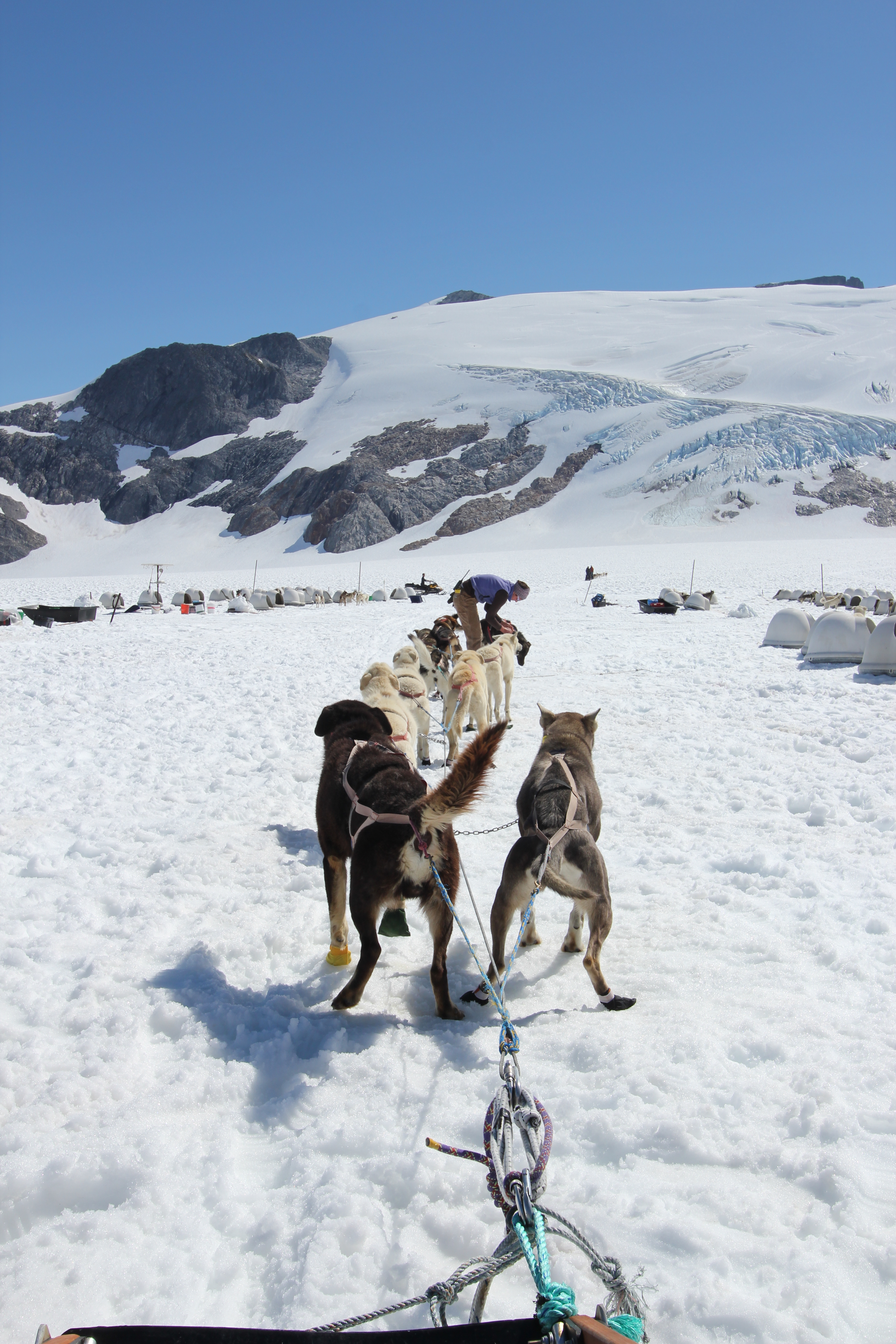
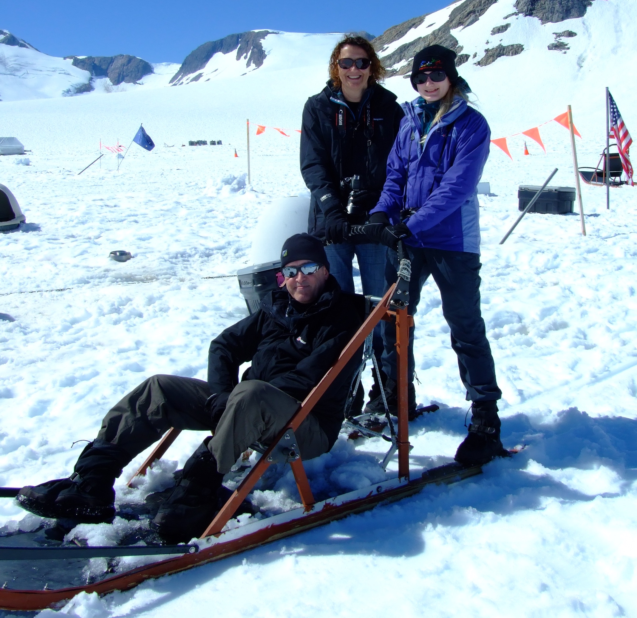
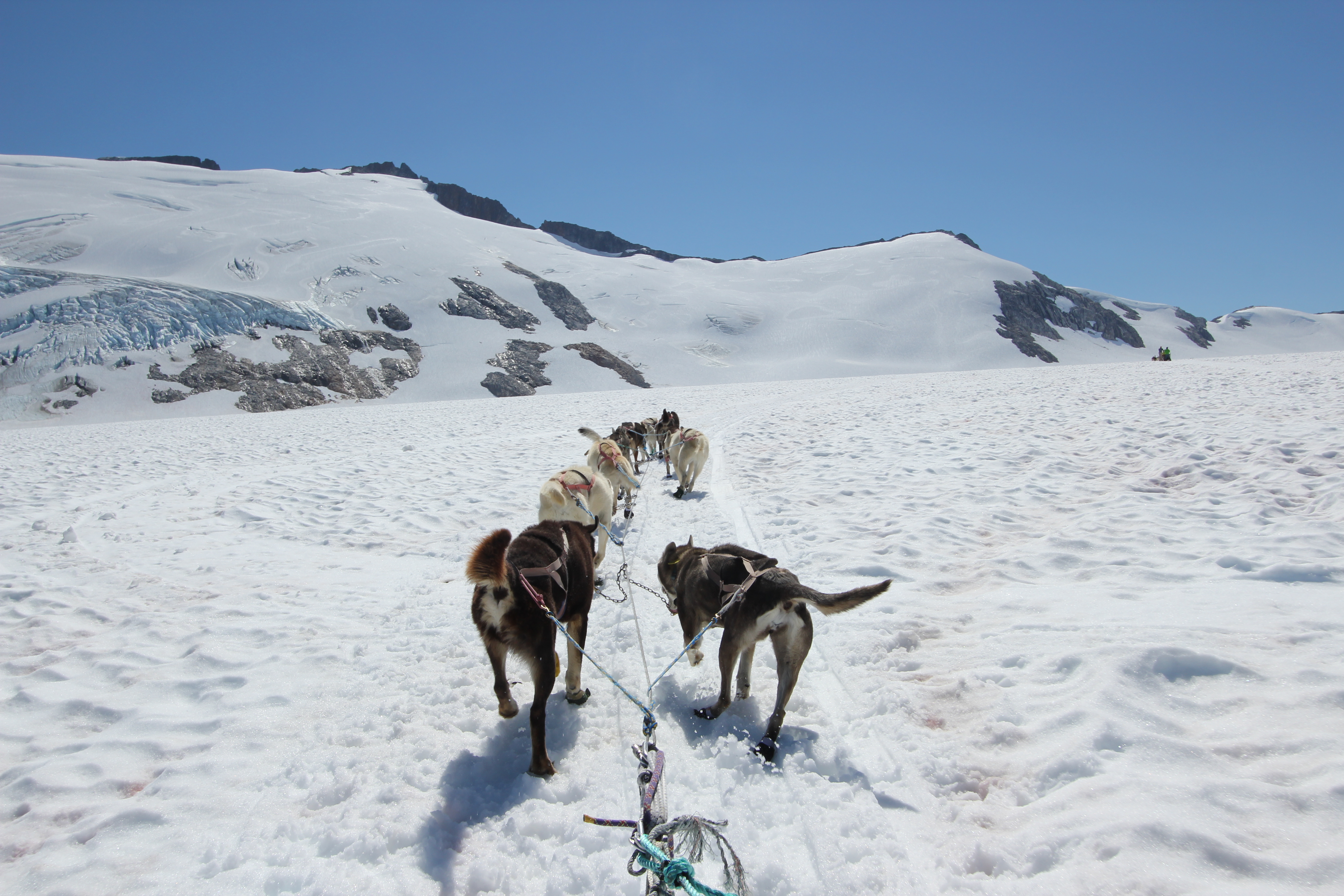
The nine dogs were to pull all four of us, with my wife at the front of a two-seater touring sled and our guide driving on the runners, whilst my daughter stood on the runners and I sat in the bucket seat of the lighter sled (as pictured above) coupled a few meters behind. Although it was less about personally mushing a dog team and more about being towed around, the feeling of almost silently speeding across the bleakly beautiful landscape (and in my daughters’ case, also learning how to lean/steer the sled) genuinely made it a memorable experience to have shared together.
The Middle Fork is more than large enough to host several groups of helicopter passengers sledding at the same time, and it took around 20 minutes to complete a large clockwise circuit out across the snow before returning to camp.
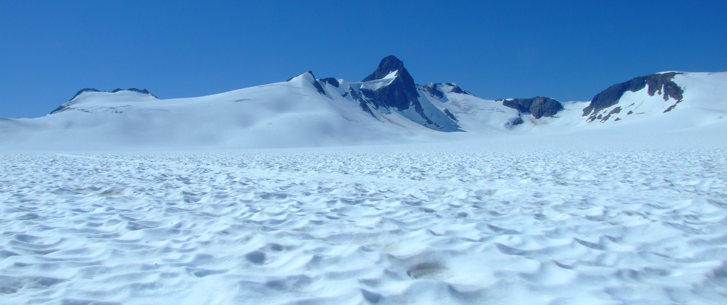
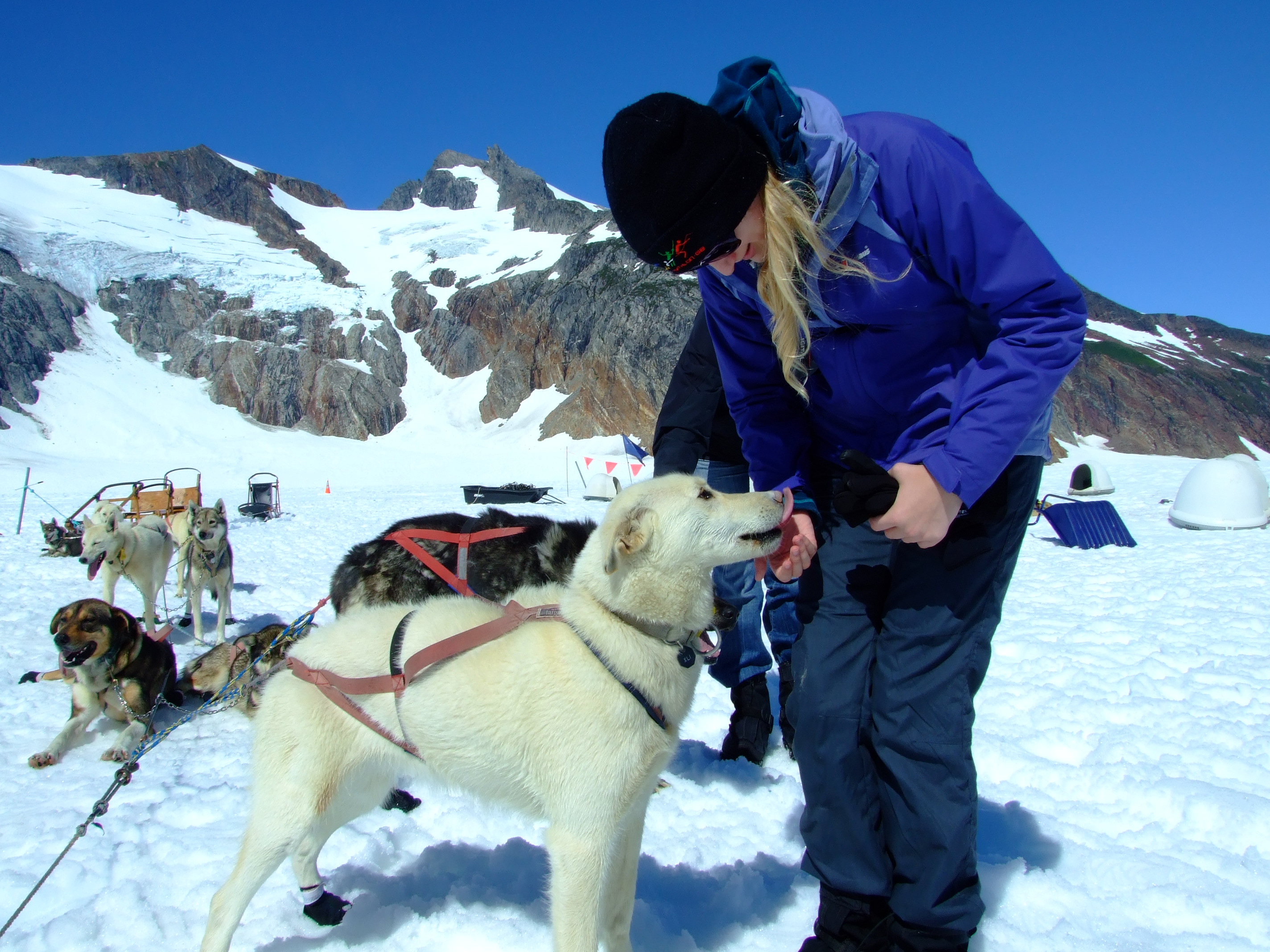
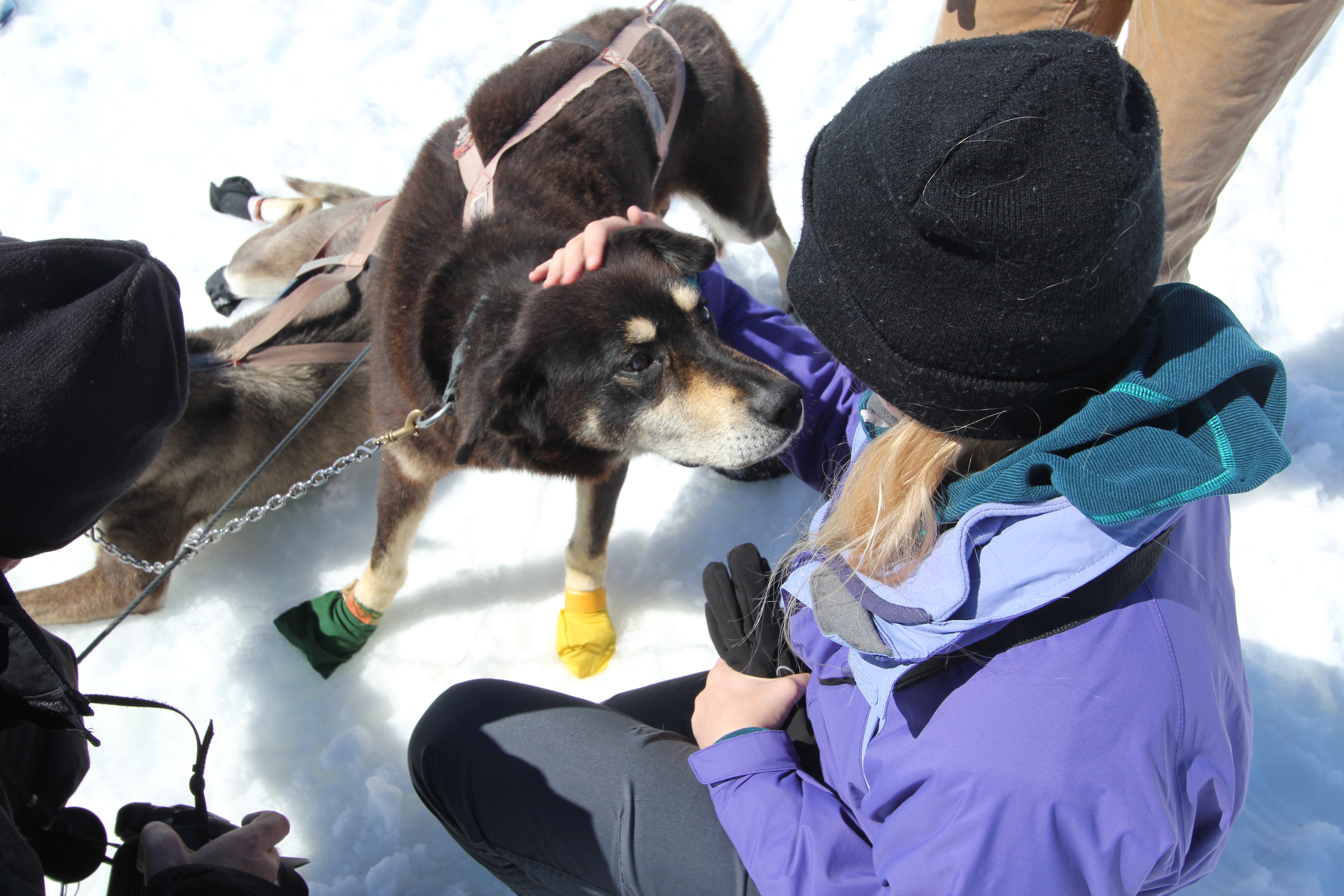
After the sled ride there was a chance to meet some of the dogs up close:
1 hr 10 minutes after landing at the camp we returned to the skies…
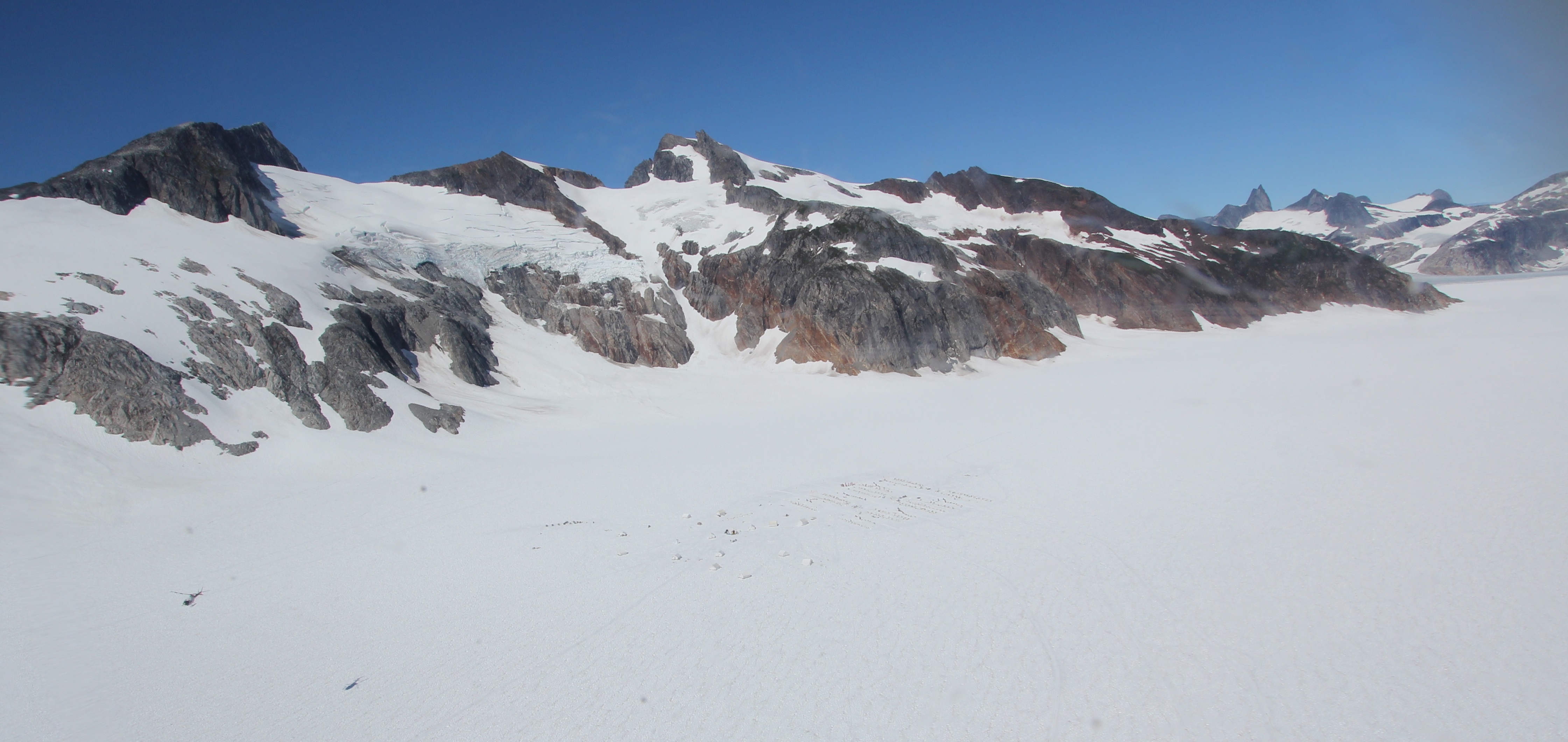
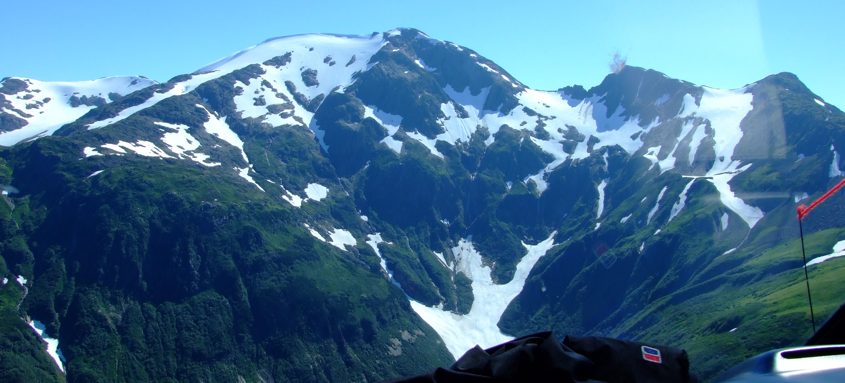
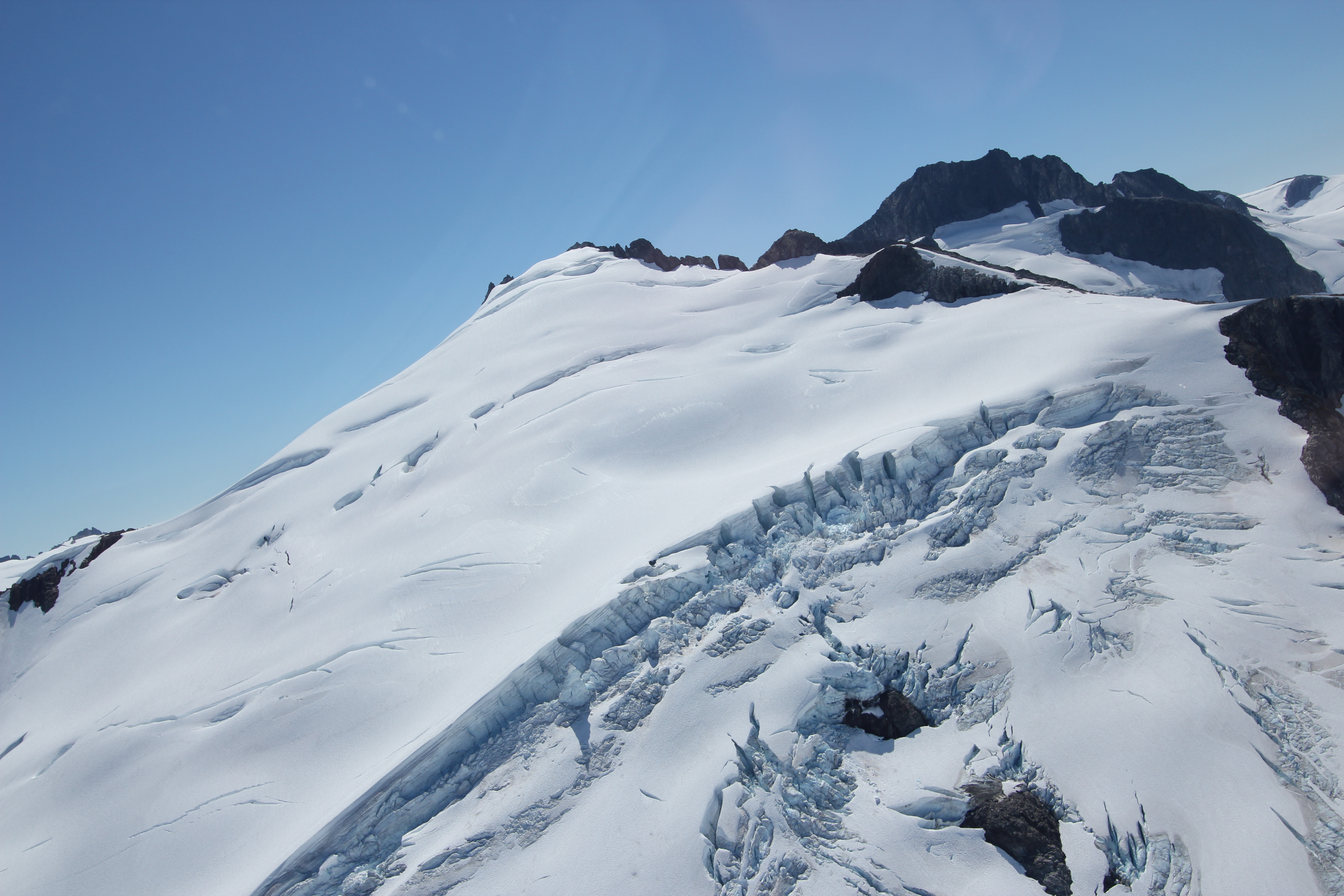
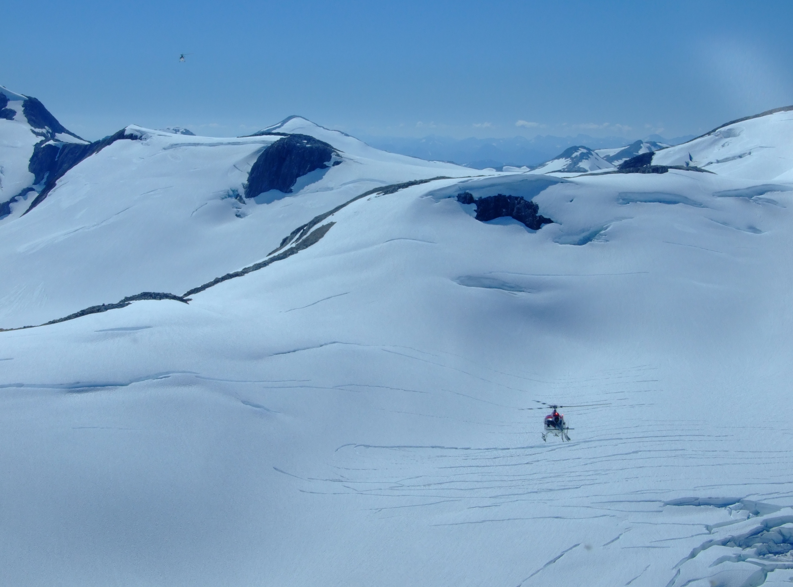
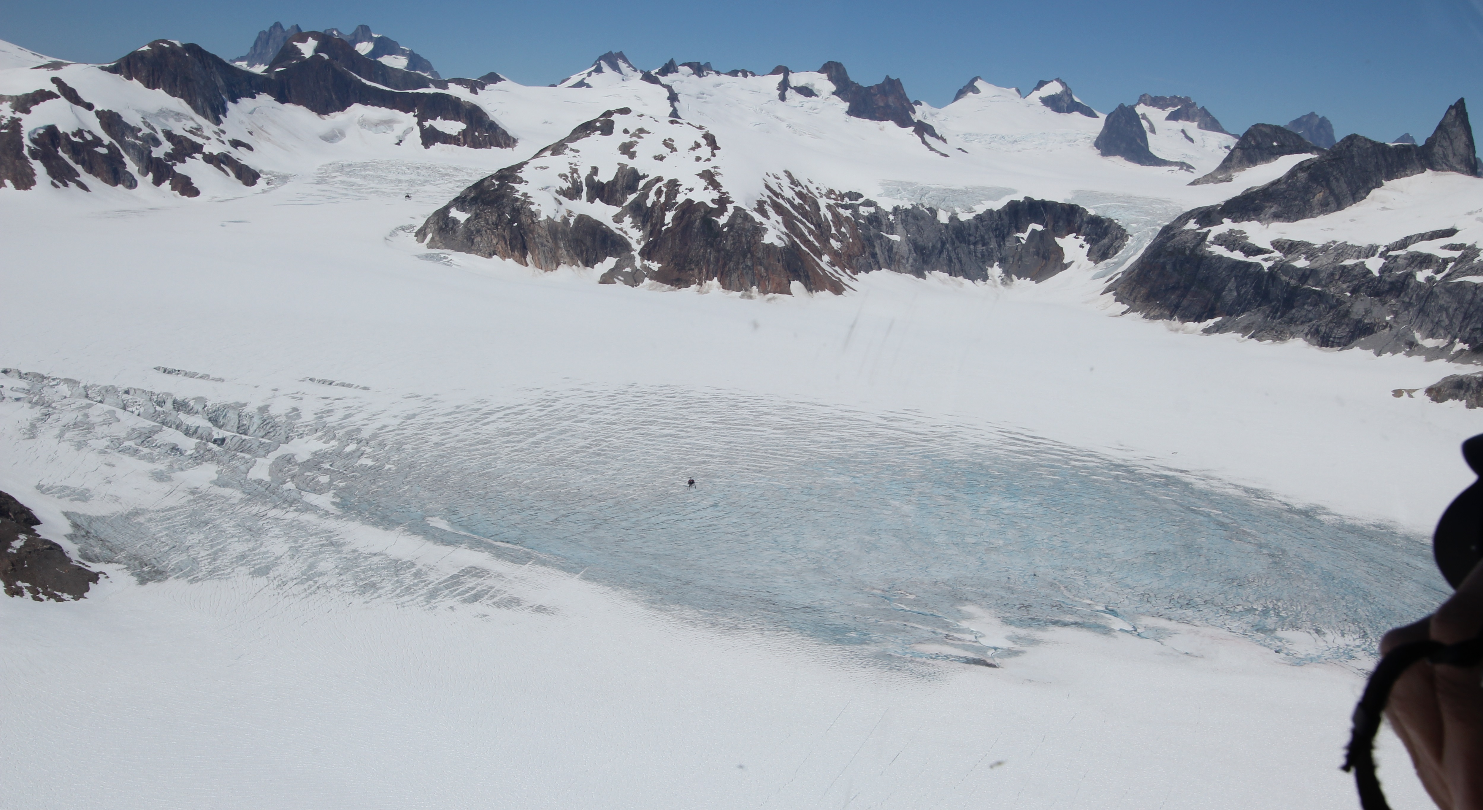
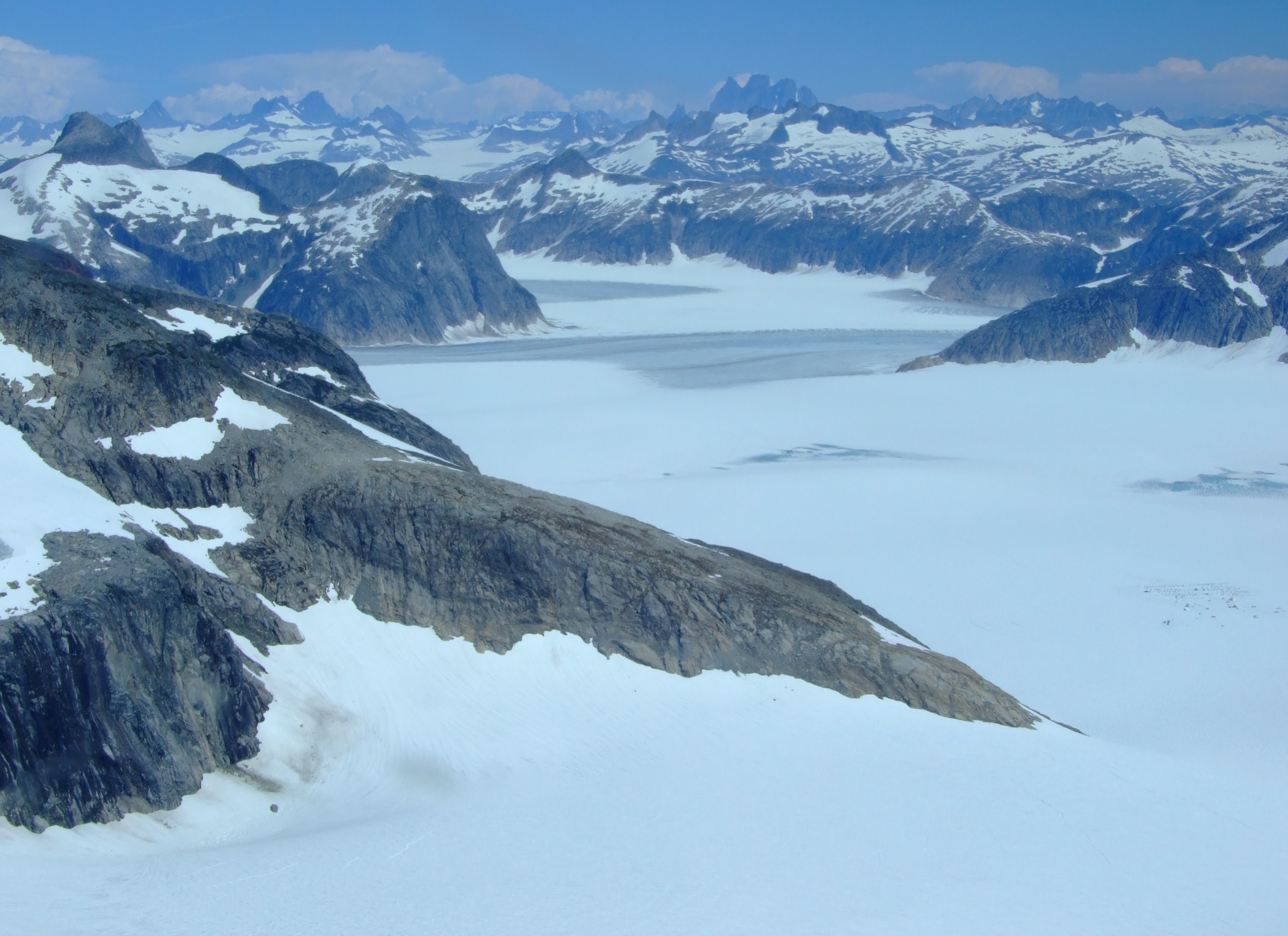
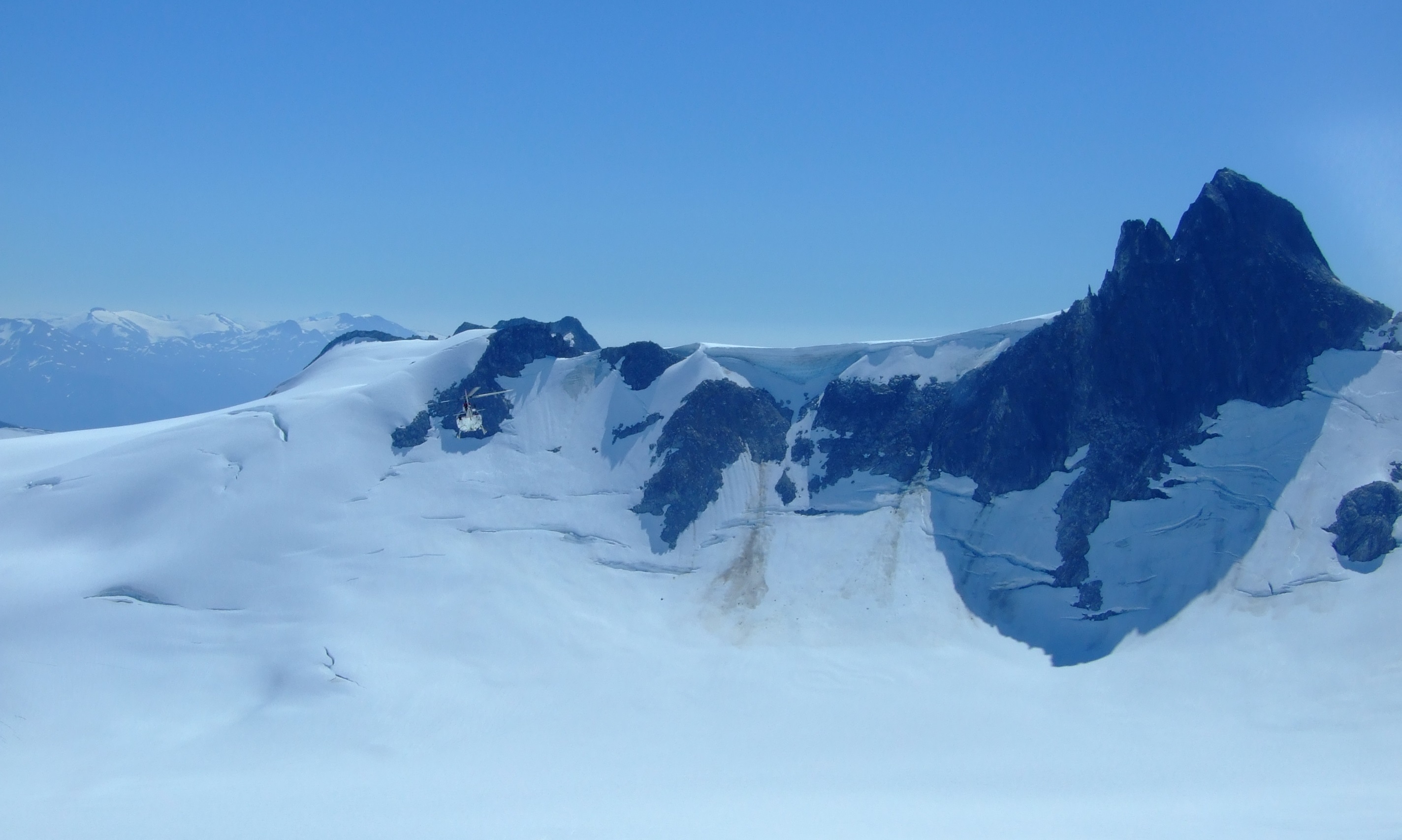
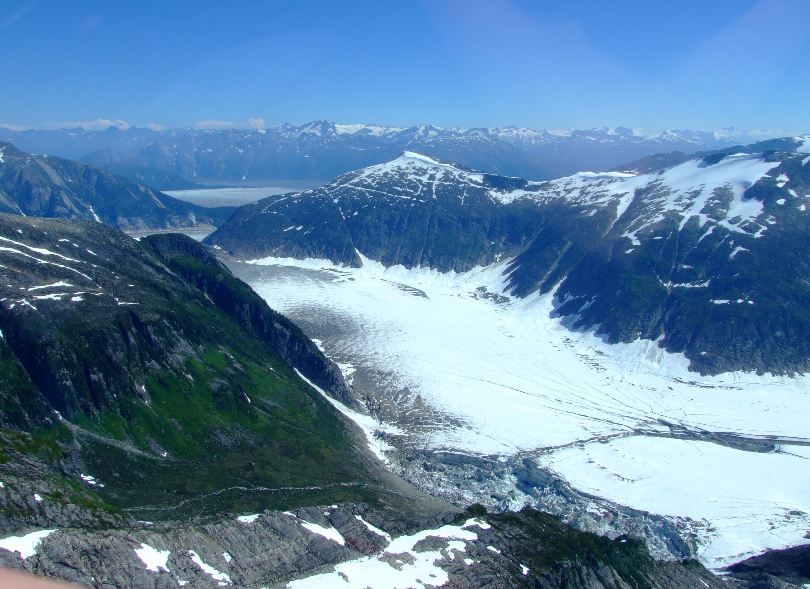
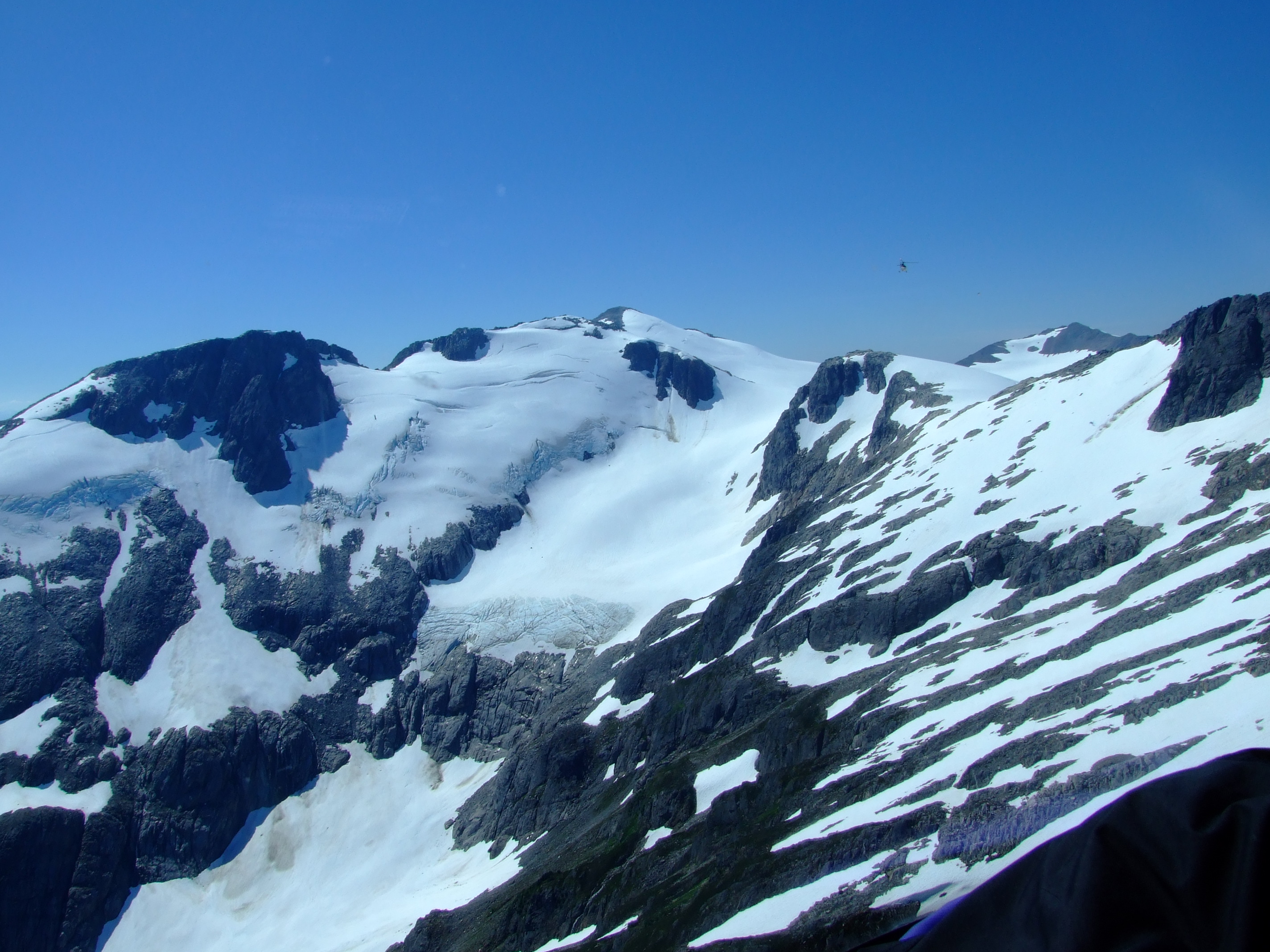
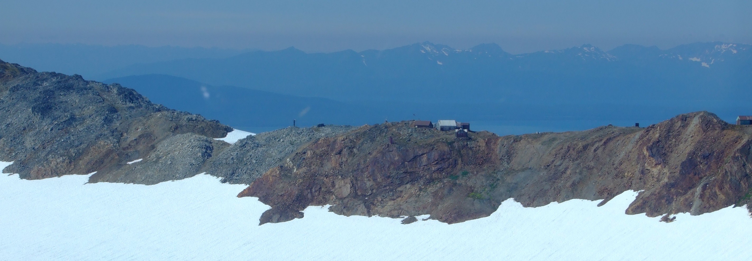
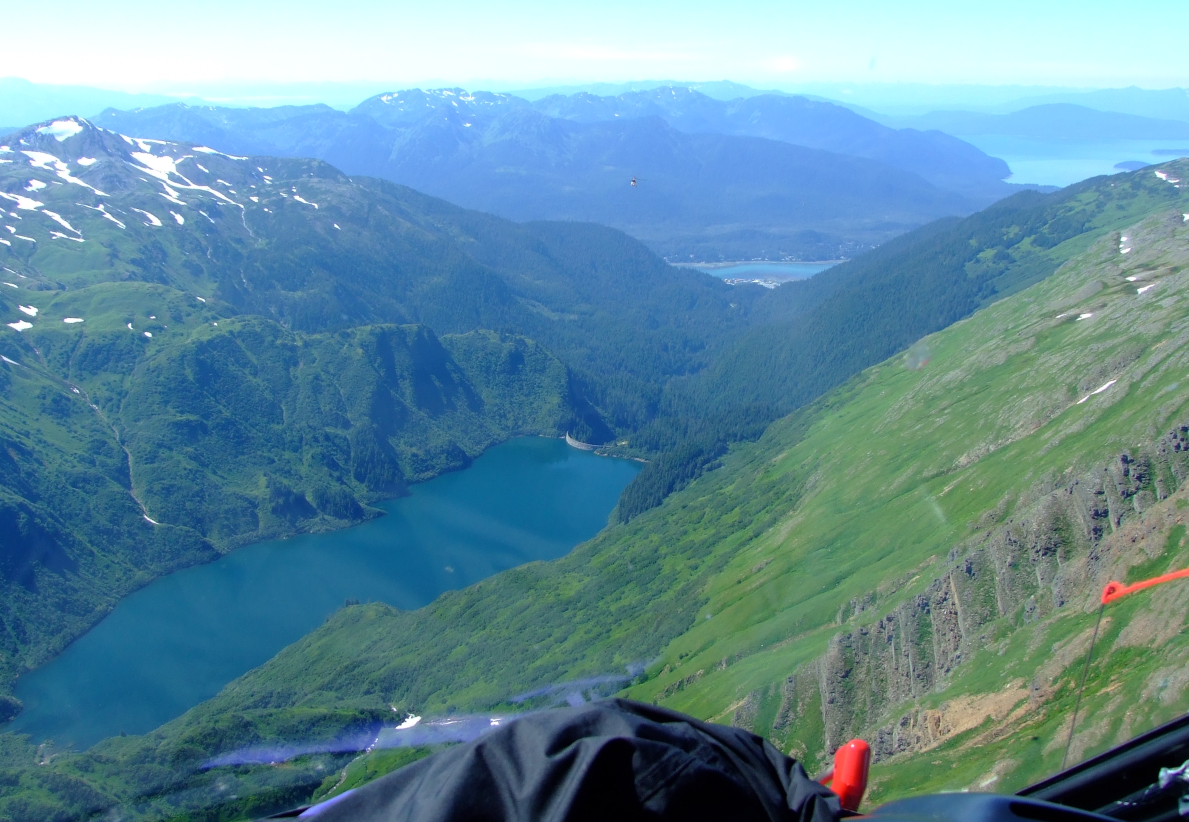
Bearing in mind that I’d never been to Alaska before, and had very little prior knowledge of the geography of the Juneau Icefield i.e. had no idea where we were going, the following photos are included purely to give you an idea of what you might see on the way back to Juneau (the route will vary according to the prevailing weather, but we were lucky enough to see all of this during our flight). I’d be very happy to see advice in the comments section to better identify specific locations, name peaks, etc.

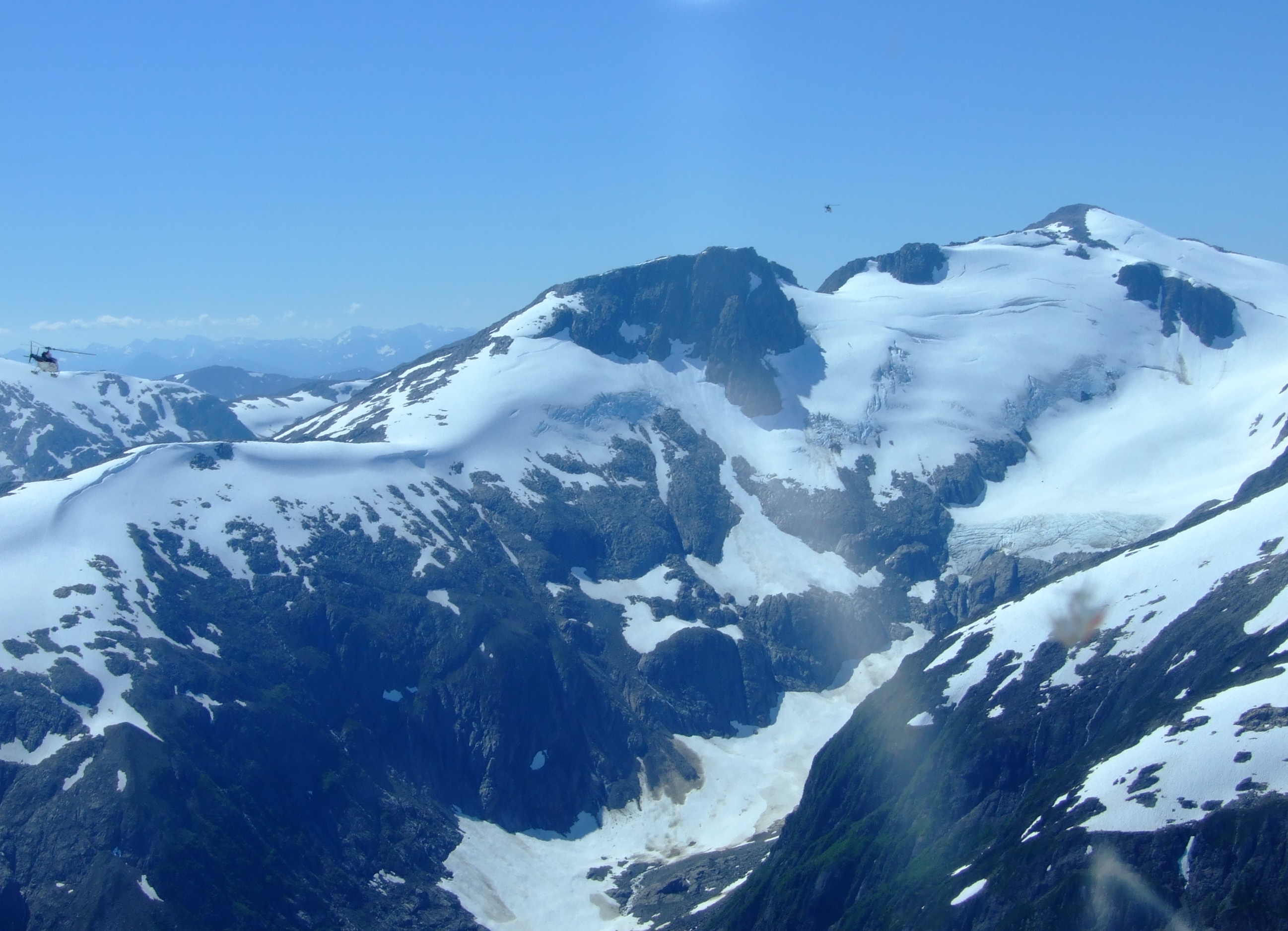
We took a route that headed north-west across Death Valley towards Echo Pass and Amherst Peak, climbing and dropping with the landscape, and then followed an anti-clockwise arc around the upper end of the valley and down towards Nugget Mountain. The two Era helicopters in front added some perspective to the raw landscape – you might be able to spot them in some of the other photos if you enlarge the images enough – and later gave me some clues about the direction of our travel over the Juneau Icefield.

The question you might still have at this point is whether a 1 hr 35minute trip is worth $555.00 per person. The answer is simple and emphatic. Yes. Would I do it again? Not necessarily.
I wouldn’t want to have missed sharing any of this trip with my family, but the experience also brought the realisation of just how much there is to see around Juneau. A helicopter flight is the perfect (and in some instances the only practical) way to access so much of the Juneau Icefield, and I’d have no hesitation in flying with Era Helicopters again, but I might also look around for a different excursion next time.
Alternative trips
Era Helicopters also offer
- An Extended Juneau Glacier Dog Sledding Tour where you get 2.5 hrs at the Alaska Heli-mush camp (and a longer sled ride experience). It is currently booking from 10 May to 2 September 2016 (not every day), departing at 11:15AM only. Booking directly with Era will cost you $735.00 per person if you weigh 239lbs (108.4kg) or less, and $835.00 if you weigh 240lbs (108.9kg) or more.
- The Juneau Pinnacle Experience with “up to 65 minutes of flight time and 2 unique landing locations (15-20 minutes each).” It is currently booking from 30 April to 12 August 2016 (not every day), departing at 10:00AM only (most dates). It looks as though there’s just one helicopter currently scheduled to run this service, so advanced booking would be sensible if you want to ensure a seat on a specific date. Booking directly with Era will cost you $650.00 per person if you weigh 239lbs (108.4kg) or less, and $750.00 if you weigh 240lbs (108.9kg) or more.
- Taku Glacier Adventure in Juneau with approximately 30-35 minutes flight time (depending upon flight route due to weather) and 15-20 minutes on the glacier (Norris Glacier is an alternative). There are only two currently listed dates for 2016 and they are both sold out, but it would be worth checking back to see if they add more dates later.
There are a number of other providers of helicopter-based tourist excursions from Juneau.
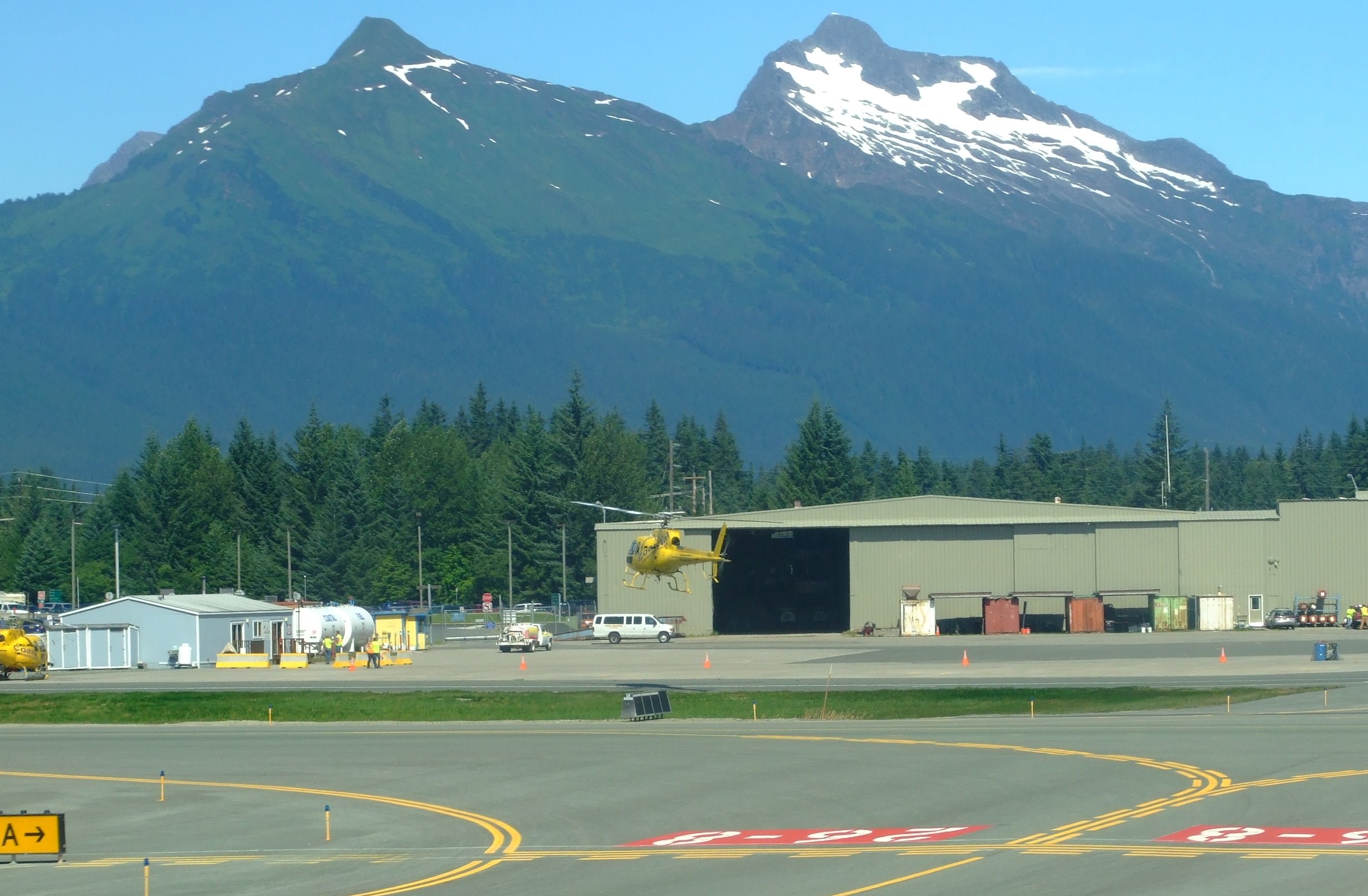
Coastal Helicopters fly out of Juneau International Airport:
They offer a range of trips including
- A 1 hr Icefield Excursion for $290 to walk on either Herbert, Taku, Lemon or Norris Glacier.
- A 1.5 hr Dog Sled Tour for $510 on Herbert Glacier. There’s also a 2 hr extended version of this trip with an additional landing elsewhere on Herbert Glacier for $580
- A 2 hr Taku Glacier Adventure by Air, Water, & Ice for $560 using a combination of a helicopter and an airboat to visit Taku Glacier.
NorthStar Trekking fly out of JNU and offer three options on the same model (pricing appears to be on application or check your cruise shore excursions listings) with a c.30 min. helicopter ride out to either Mendenhall, Taku, Norris, Herbert, Gilkey, Battle or Thiel Glaciers, followed by ice field trekking:
- Helicopter Glacier Walk About. An easy graded 1 hr of trekking.
- Helicopter Glacier Trek. A more physically demanding 2 hr/2 mile glacier trek.
- Extended Helicopter Glacier Trek. 3 hrs of trekking and climbing on a glacier. There’s a great series of shots to accompany an account of this trip taken in 2015 here.
Temsco Helicopters fly out of JNU to offer several options for tourists (pricing again appears to be on application or check your cruise shore excursions listings) including
- A 55 min. Mendenhall Glacier Tour (includes a 20-25 minute landing/guided walk, and flight out to Mendenhall Towers). In 2015 Fodors listed the Temsco flightseeing trip to Mendenhall Glacier as #8 of 22 of the World’s Most Amazing Helicopter Rides.
- A 1 hr 20 min. “Pilot’s Choice” Glacier Explorer Tourto a variety of locations includes two stops totalling 30 mins. on the ground.
- A 1 hr 30 min. Dog Sled Tour: Juneau on Mendenhall Glacier. 30 min. flight time and 55-60 min. at the dog camp (20-25 min. of dog sledding).
More online information.
Words to learn before you go. A Glossary of Glacier Terminology from the USGS. There are also lots of great pictures, many of which, unsurprisingly, come from Alaska.
Alaska Heli-mush: the people behind the dog sled camp on the Era tour.
The Crevasse Zone contains lots of interesting information and images of the Juneau Icefield.
From Icefield to Ocean neatly summarizes the importance of Alaska’s coastal glaciers in an award-winning poster.
A report paper on the Juneau Icefield Mass Balance Program 1946–2011 featuring the Lemon Creek and Taku glaciers.
The Juneau Icefield Research Project (JIRP), which also contains some great images in the blog.
Interesting posts on the retreat of the Norris glacier and the Dead Branch of the Norris Glacier from the Glacierchange blog “From A Glaciers Perspective” by glaciologist Professor Mauri Pelto. Use the search function for other related posts.
The USDA Forest Service website for the Tongass National Forest.
For topographical maps use the USGS Map Locator and Downloader service (also great for the rest of the USA). Norris Glacier mostly falls into the AK Juneau B-1 area. Download the multi-layered .PDF files for later reference, but keep in mind the most recent version is from 1997.
The 2008 USGS Satellite Image Atlas of Glaciers of the World, Alaska can be downloaded as a complete document or just as a partial document (04_1386K_coastmts.pdf). Pages K104-K109 covers the main glaciers seen on this trip.
